
Wet weather to bring half a month’s worth of rain to Sydney
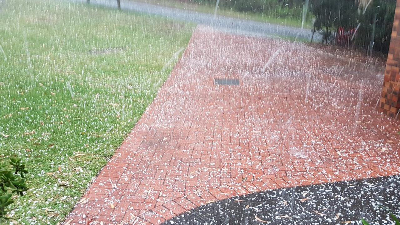
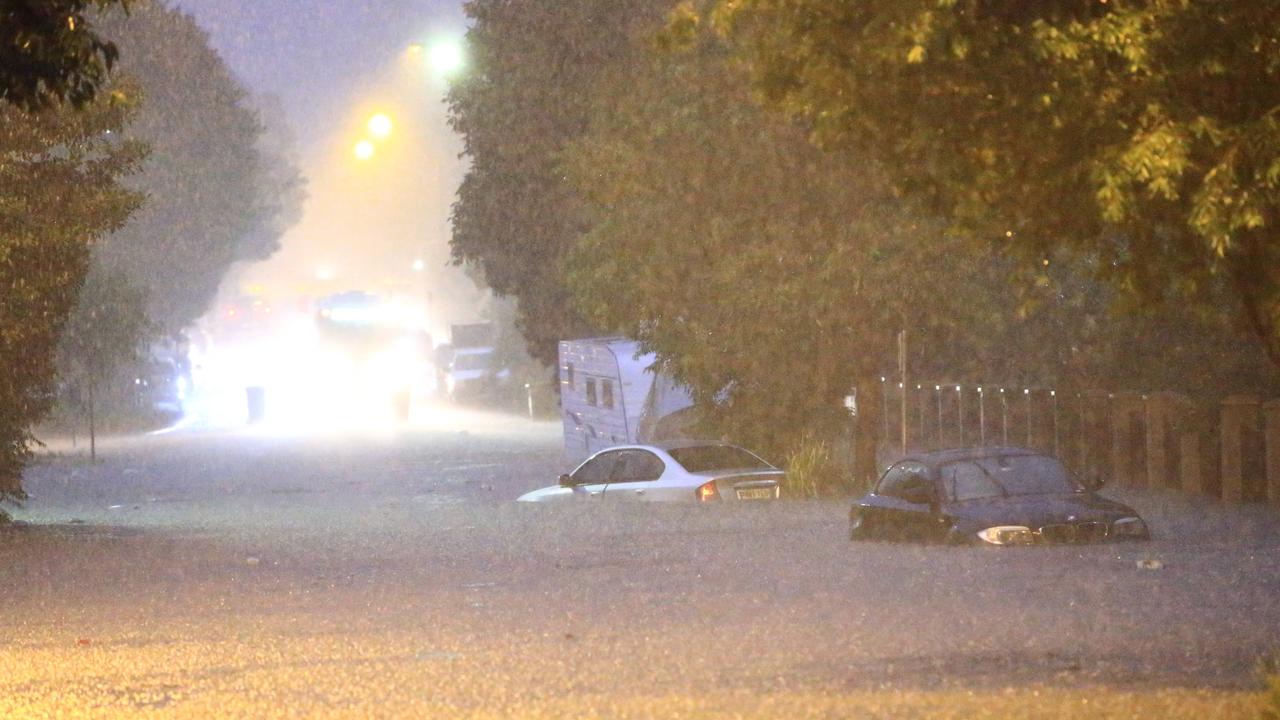
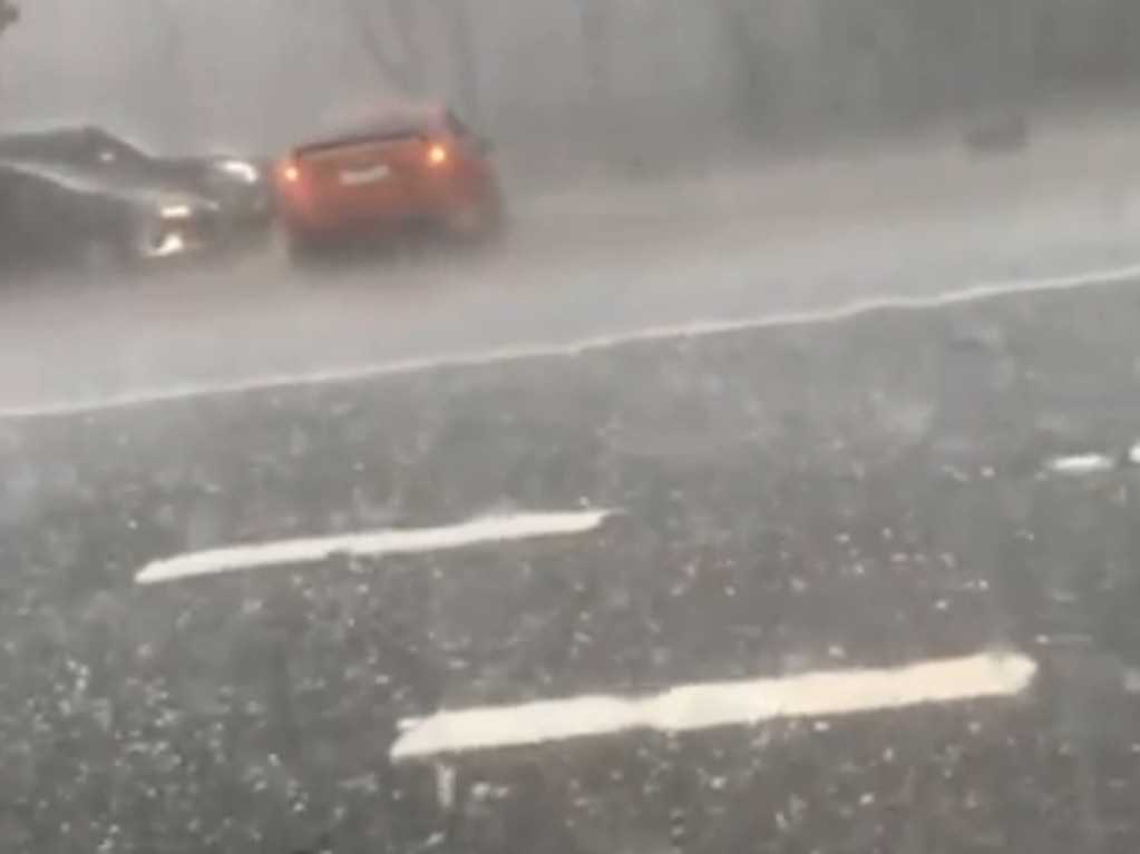
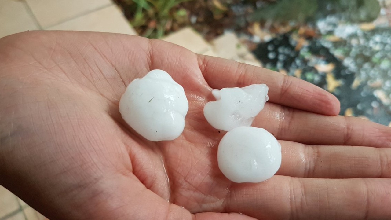
A massive hailstorm wreaked havoc across NSW yesterday, with flash floods and golf ball-sized hailstones pummelling cars and homes.
Efforts have begun to clear water, remove branches and debris and restore power to battered Sydney homes after dangerous thunderstorms bore down on the city overnight.
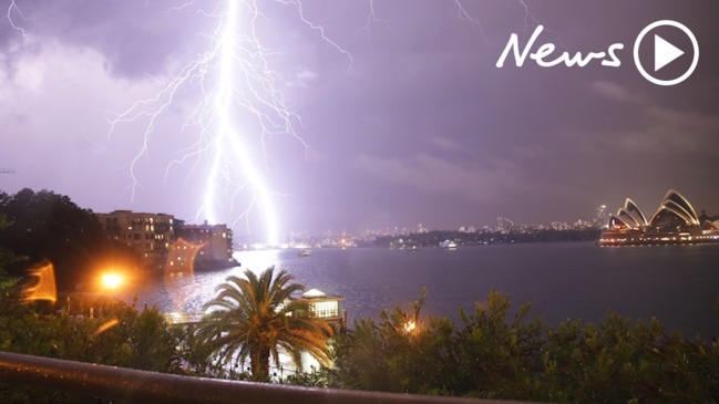
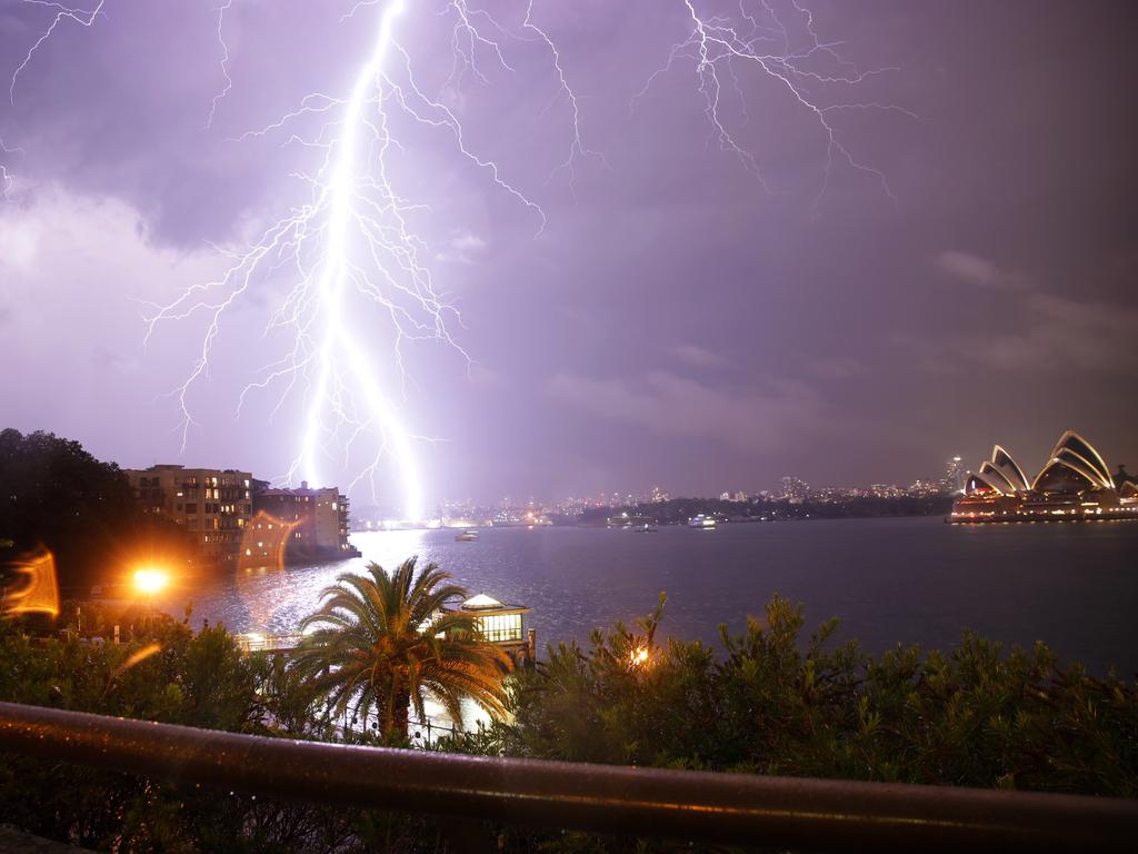
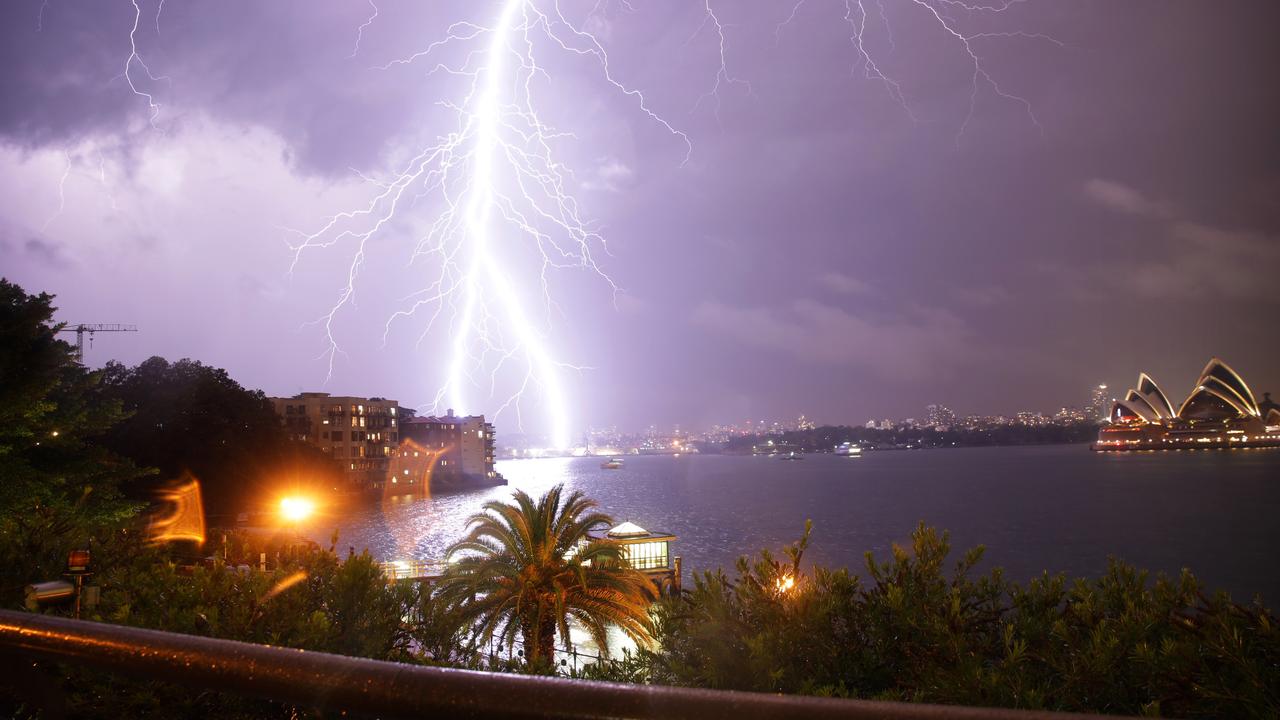
Parts of New South Wales were smashed by a furious storm cell on Thursday, bringing strong winds, giant hail and heavy rainfall.
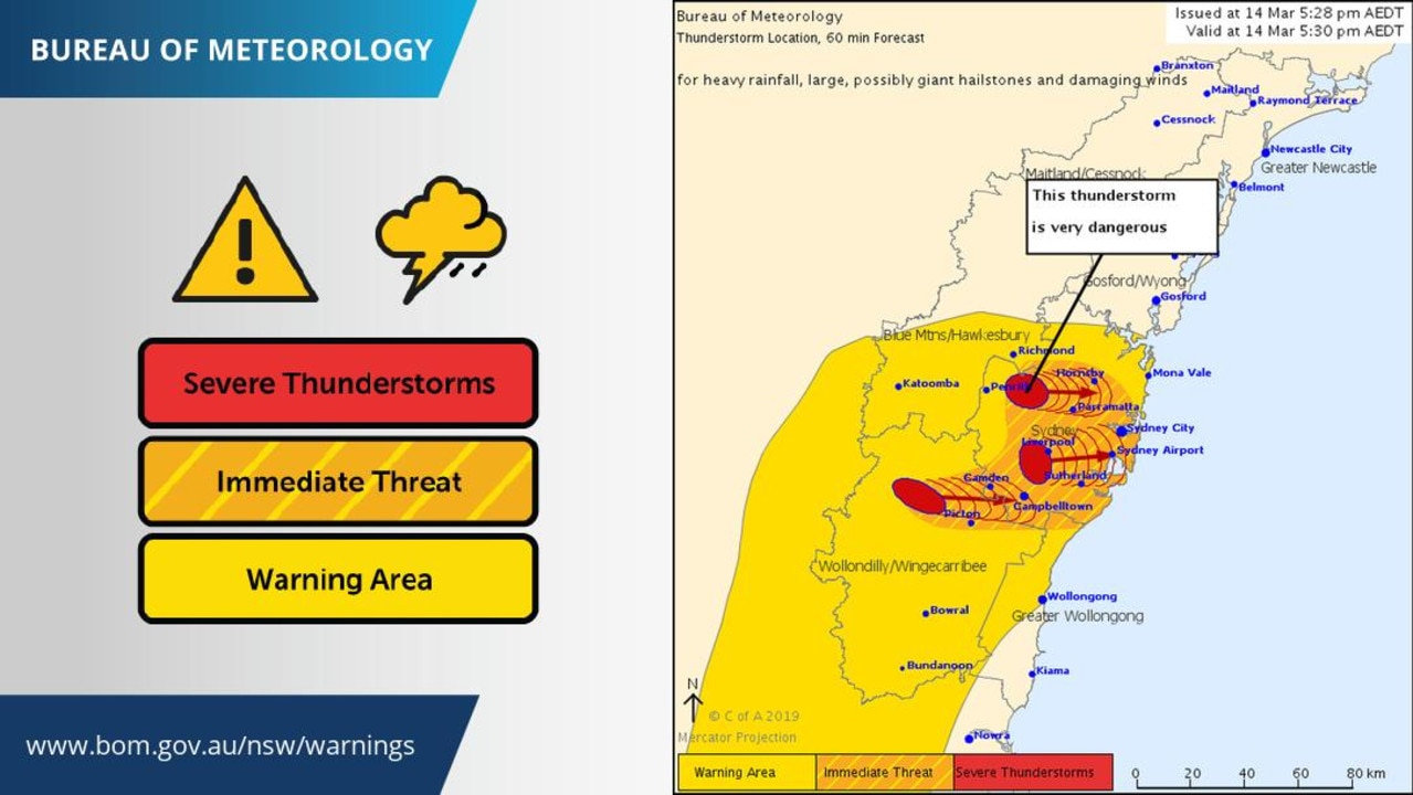
A severe thunderstorm warning was issued for Sydney and the Illawarra district, as well as the greater Gosford, Wyong and Newcastle areas, before being cancelled around 2am on Friday.
The Bureau of Meteorology (BoM) still urged people to take care, with storms likely to develop again Friday afternoon.
The storm wreaked destruction in Sydney before moving north through Gosford, Wyong and Cessnock towards Newcastle in the early hours of Friday.
Parts of the northern beaches were without power on Thursday night as the fierce thunderstorm swept through. AusGrid said electricity had been cut to thousands of homes, mainly on Sydney’s north shore and the northern beaches.
By 11pm, 26,000 customers were still without power. AusGrid said emergency crews were working to restore power as quickly as possible.
WEST PYMBLE: 2 of 3 northbound lanes of Lane Cove Rd are closed at De Burghs Bridge due to flooding. Exercise caution and allow extra travel time.
— Live Traffic Sydney (@LiveTrafficSyd) March 14, 2019
The State Emergency Service has fielded hundreds of calls for assistance and said people should move cars under cover.
Authorities say roads, the rail network and Sydney Airport have also been impacted. Passengers at Sydney Airport were experiencing delays of up to about 90 minutes at the airport and 20 flights have been cancelled due to weather.
#sydneystorms this was just the beginning of it. I had to run because my driveway was getting flooded #sydneyweather pic.twitter.com/IZty6rIHBp
— S. Shah (@SamiyaSamar) March 14, 2019
Insane weather on the highway. Hail, lightening, cars stopped on the road #weather #sydneyweather pic.twitter.com/J7NUkM71i8
— Kumi Taguchi | ç”°å£ä¹…実 (@kumitaguchi) March 14, 2019
The Federal Government gave permission for some flights to leave Sydney Airport post the 11pm curfew, but many planes were stuck on the tarmac without a take-off slot, because so many planes still needed to land. At midnight, some were being turned back to the terminal.

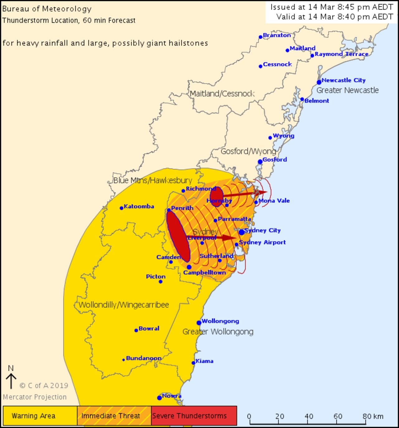
“Very Heavy Rainfall across Sydney’s northern beaches. A large slow moving storm has produced 93mm of rainfall in the 60min to 9:50pm at Mona Vale Golf Club,” the Bureau tweeted.
“Heavy rainfall that may lead to flash flooding and large, possibly giant hailstones are likely,” it said.
Earlier in the evening as thunderstorms hit Wollongong, the SES rescued a person from a vehicle stuck in floodwaters in the region at about 6.30pm. They were not injured.
Total jobs across the state have reached over 350, locations with the greatest impact include Blacktown, Goulburn, Liverpool & The Hills. The type of jobs coming in are trees down, damaged & leaking roofs. Plan for what you would do during #SydneyStorms https://t.co/blJCjm6Rqu https://t.co/yM46P0DCAQ
— NSW SES (@NSWSES) March 14, 2019
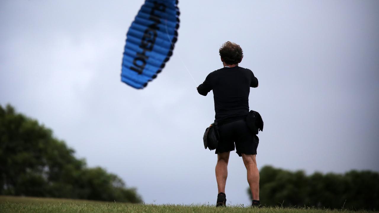
Australia’s east coast is bracing for a blast of wild weather over coming days, with forecasters expecting the worst of it to hit Sydney tonight.
“The situation is still quite uncertain at the moment and the level of rain depends on if the trough stays offshore or comes closer to the coast,” Bureau of Meteorology forecaster Zhi-weng Chua told news.com.au.
Anywhere between 20mm to 60mm of rain is expected to be dumped on Sydney, with heavy rain forecast for Wollongong and the Central Coast as well.
By early Thursday evening, areas west of Sydney had already been inundated, with Camden receiving 20mm of rain.
Showers could persist until Monday.
“The situation is still looking to be quite unstable so showers could remain over the next few days, with Sunday potentially being very wet,” Mr Chua said.
Thunderstorms could also be in store for much of eastern NSW, with residents told to keep an eye out for storm warnings.
Temperatures will hover around the mid-20s for the next few days.
Very dangerous #thunderstorms to affect Campbelltown, Leppington, Minto, Holsworthy, Liverpool & Macquarie Fields shortly. Numerous other areasalso under severe #warnings including Penrose State Forest, Menangle, Bundanoon & west of Berrima. Full warnings https://t.co/j0Ax8130U4 pic.twitter.com/sN2KNknbdD
— Bureau of Meteorology, New South Wales (@BOM_NSW) March 14, 2019
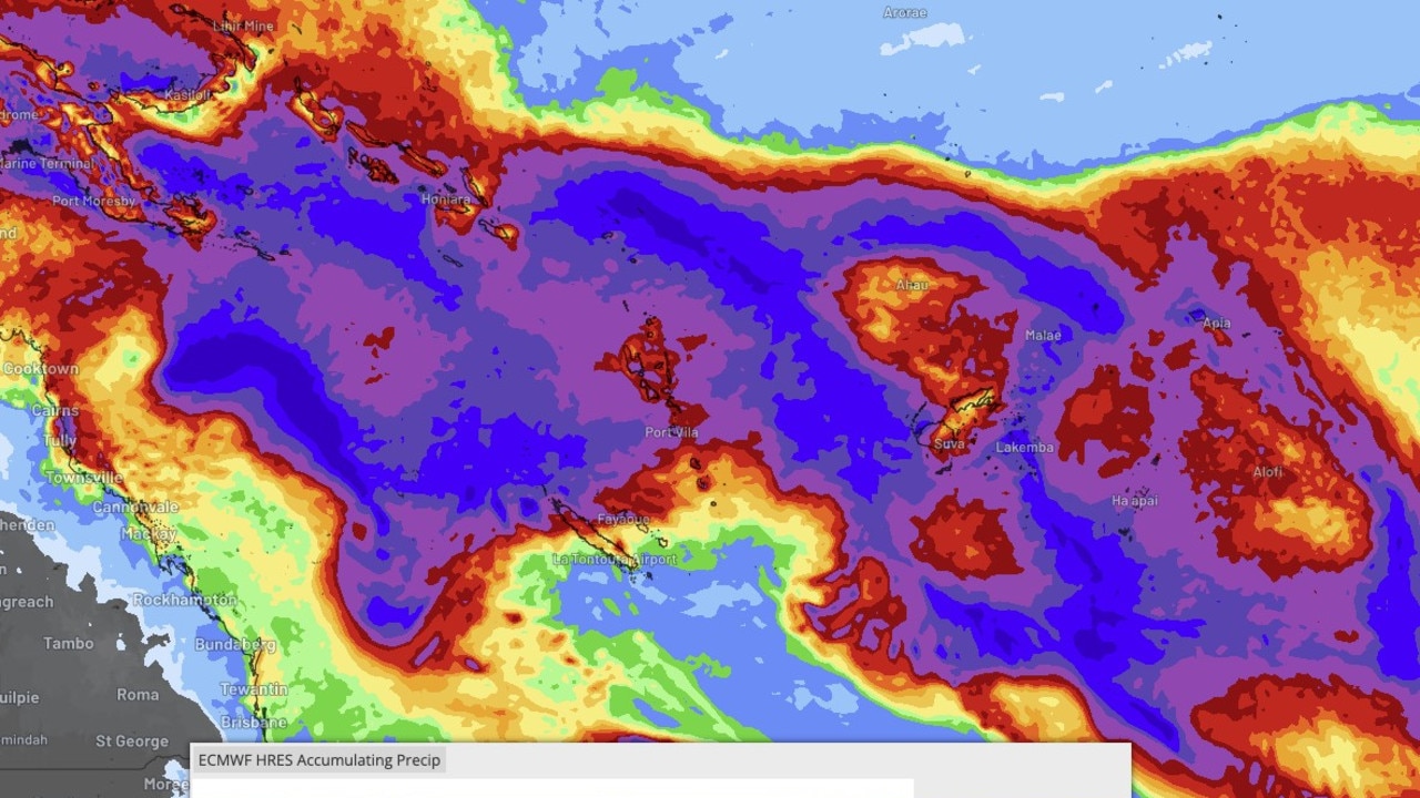
WET WEATHER FOR NSW AND QLD
Parts of Queensland are also in for some wet weather leading up to the weekend, as a severe heatwave centred on the state’s southeast starts to weaken.
Brisbane is bracing for heavy rain and a thunderstorms, with the likelihood increasing as we move into the weekend.
Showers from NSW could link up with storms in Queensland, dumping buckets of rain across both states.
Forecasters say up to 60mm of rain could drench Sydney, with the city not seeing that much rain since last November.
Wollongong could see around 65mm of rain over the next few days and around 45mm could fall in Newcastle.
ACT
The weather will cool down slightly as the weekend approaches, with the temperature hovering around the mid 20s until Monday.
VIC & TAS
Melbourne’s weather warms up just in time for the weekend, jumping up to 28C on Saturday.
Temperatures for Hobart will remain in the low 20s for Friday, before increasing to 24C on the weekend.
WA & SA
There is a lot of hot, sunny weather in store for Perth over the coming days, with temperatures staying around 31C on Friday and increasing to 33C on Sunday.
Adelaide residents will see the temperature climbing as they get closer to the weekend as well.
There will be a maximum of 28C for Friday, with temperatures of 32 and 33 expected for the weekend.
NT
Darwin will likely see some wet and stormy weather as the week continues.
Storms and showers are on the cards for Friday, with the possibility of wet weather continuing into the middle of next week.

Cyclone less than 24hrs away from Aus
A tropical low sitting off the east coast of Australia is less than 24 hours from forming into a category 2 tropical cyclone – and could make its way towards millions.
Read more

‘Extreme’ danger warning as temps soar
Millions of Aussies bracing for blistering temperatures this weekend, with the extreme conditions sparking several warnings.
Read more

PM’s $500m pledge for local jobs
The Prime Minister has announced a crucial investment package during a pre-election speech, but not before he took a few healthy swipes at the opposition.
Read more