
Weather Australia: One dead in Qld as violent storms worsen
Wild storms pummelling Australia’s east coast have turned deadly, with one person dead in Queensland and at least 10 others missing.
A person has died and at least 10 are missing as wild storms continue to lash Australia’s east coast, with fears the worst of the weather may be yet to come.
The body of a woman, believed to be in her 60s, has been found dead in the Sunshine Coast hinterland after her car was swept away by flood waters.
The woman’s body was found inside her car at Belli Park on Wednesday morning.
“I have just been advised that a 60-year-old person has been found deceased after their vehicle was submerged in water just after 8am this morning,” Premier Annastacia Palaszczuk told parliament.
At least 10 other people are believed to be missing.
“This is indeed a tragedy during this particular period of time. Please, I can’t stress this enough. Don’t take any risks, avoid unnecessary travel and stay well away from floodwater,” Ms Palaszczuk said.
Ms Palaszczuk said some areas throughout the Sunshine Coast and Brisbane have been hit with up to 400mm of rain with little warning.
“The QFES has received more than 100 requests already for assistance to respond to flooding properties and vehicles, mostly in the Sunshine Coast, Gympie and Noosa local council areas,” she said.
“Swiftwater rescue crews reported 27 incidents overnight. Some rescues are ongoing to during due to challenging and dangerous conditions.”
Stream more news on the environment with Flash. 25+ news channels in 1 place. New to Flash? Try 14 days free now >
A severe weather warning is in place in Queensland for the Wide Bay, Burnett, Darling Downs, and Granite Belt forecast districts.
Flash flood warnings are in place for the Gold Coast, Toowoomba, Brisbane, Maroochydore, Gympie, Caboolture, Coolangatta and Ipswich.
Six-hourly rainfall totals between 100 and 200mm are likely, with locally intense rainfall rates of 250 to 300mm possible.
Residents have been told to be on high alert, with NSW Incident Alerts warning “significant flash and riverine flooding is likely” if these heavy rainfalls eventuate.
Sunshine Coast local Esther Attewell told The Courier Mail the rain had been “insane”, describing the weather in Cooroy as like being “under a raging Niagara Falls” overnight.
“It’s just gonna be a bomb site outside in the morning,” she said.
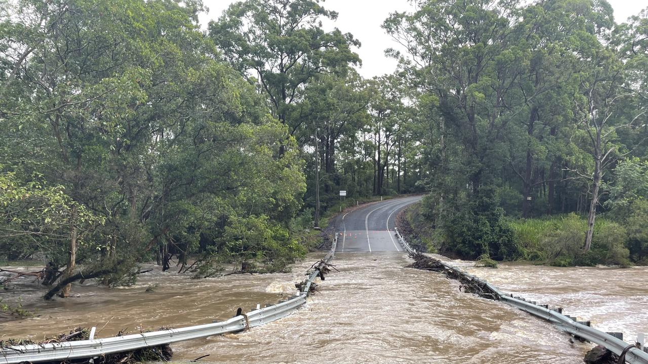
Police have urged motorists to stay off the roads, warning roads, bridges and waterways can quickly become “deadly to cross” in severe weather events.
“We’ve unfortunately seen people driving in the floodwaters once again. And as part of that we’ve not only had to rescue people from vehicles but also unfortunately seeing the death of at least one lady overnight,” Queensland Police Superintendent Craig Hawkins said.
“Other incidents that we’ve had to attend to are inundated homes where people have had to be evacuated. Similarly caravans, caravaners have been required to be rescued, including vehicles that have been washed away.”
Areas cop ‘month’s worth of rain’ in hours
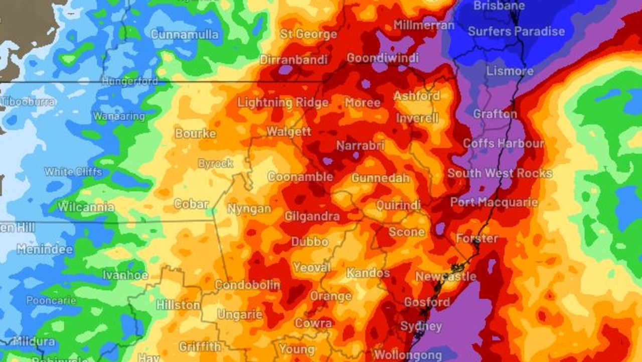
A severe weather warning is also in place for the NSW Northern Rivers, with a slow-moving surface trough likely to produce periods of heavy to intense rainfall from later today and into Thursday.
“Coastal NSW has seen severe thunderstorms and areas of heavy rainfall over the past two days and that trend is set to continue over the next week, with accumulative totals presenting a flash and riverine flood risk,” NSW Incident Alerts said.
Heavy rainfall which may lead to flash flooding could develop north of Ballina, with six-hourly rainfall totals of 150 to 200mm likely, the Bureau of Meteorology (BOM) has warned.
Areas impacted may include Tweed Heads, Murwillumbah, Mullumbimby, Byron Bay, Kyogle and Brunswick Heads.
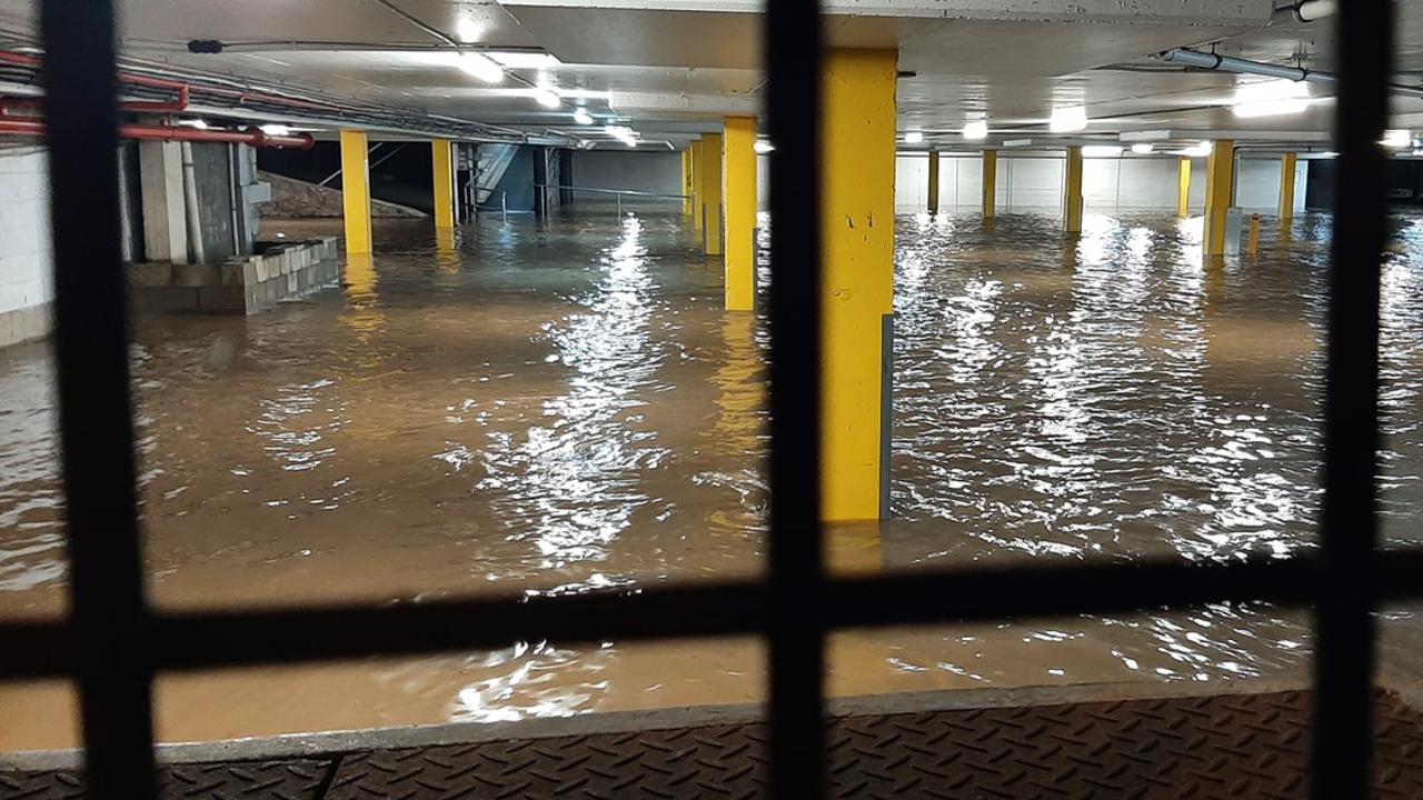
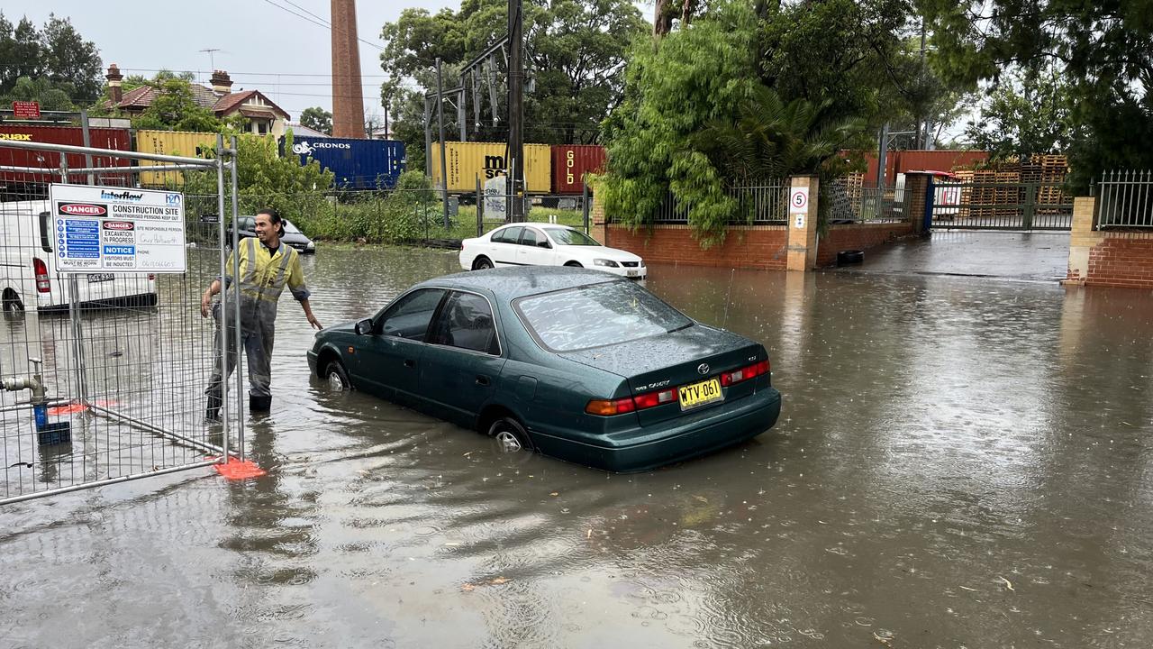
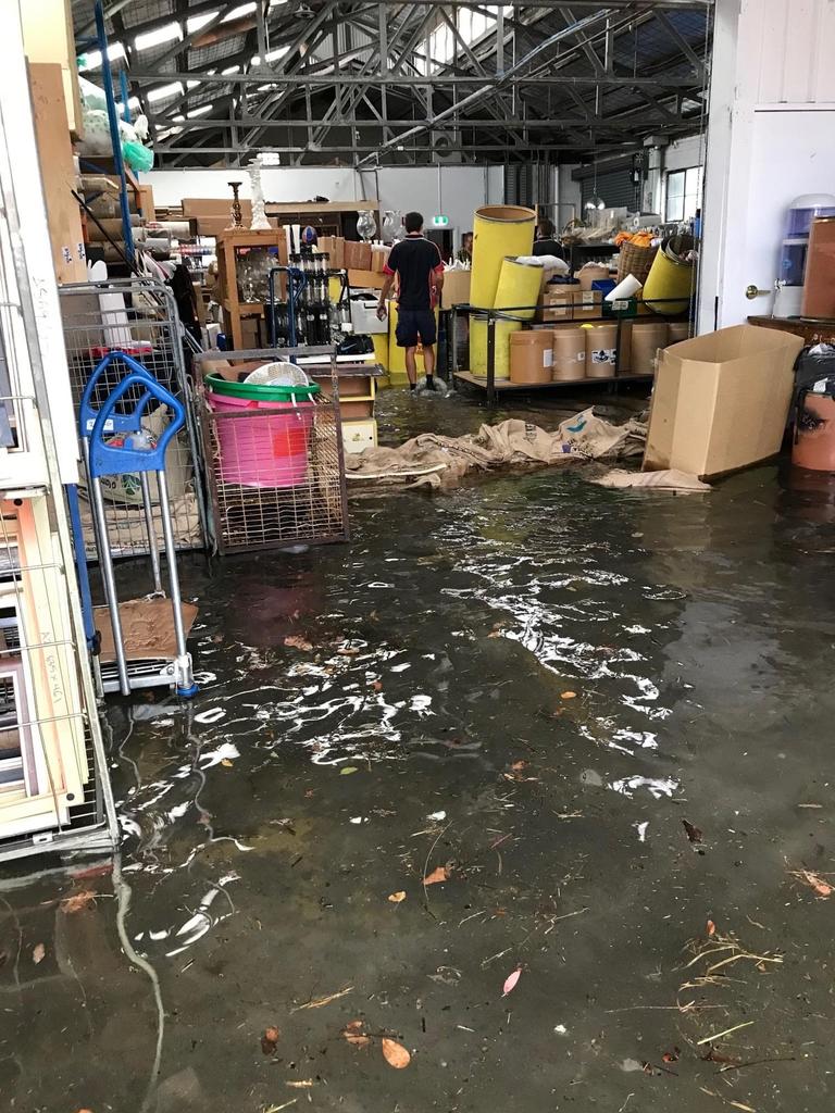
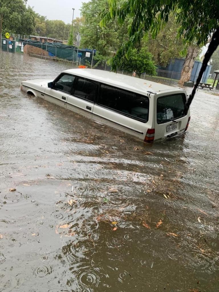
The wild weather has already had severe impacts on some areas, with Sydney’s Inner West was hit particularly hard by Tuesday’s downpour.
Marrickville copped a month’s worth of rain in just two hours, with 140mm of rain falling over 24 hours.
Pictures have emerged showing the streets filled with water, forcing residents to abandon their partially submerged cars.
Authorities and residents are facing massive clean up efforts today, with SES crews responding to multiple calls for help yesterday.
Most gauges across Sydney reached the 100mm mark in the early hours of the morning, with the city seeing its heaviest downpour in a year.
Those hoping to be able to spend the last few days of summer at the beach will be sorely disappointed, with the wild weather to continue for the rest of the week and into the next.
Sky News Meteorologist, Alison Osborne, said the “humid, moisture-laden, easterly flow” that is feeding these showers and storms will continue across NSW and parts of Queensland today, with areas north of the Northern Rivers to be the worst hit.
“The wet, humid and stormy weather isn’t going anywhere, with heavy rain today focusing very much over northern NSW and southeastern Queensland. Torrential rainfall, intense flash flooding, and riverine flooding all at risk there,” she said.
“For the rest of the week, daily storms will continue inland through outback NSW and Queensland.
“The week will end with yet another frontal system tapping into that moisture, moving through the southeast to the mainland. That will then generate further storm activity over the NSW coast and ranges.”
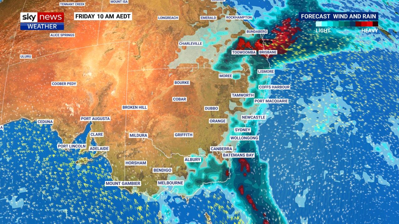
Weather forecast around Australia
It will come as no surprise that NSW is in for some wet, humid weather over the next few days, with Sydney expected to reach a top of 28C on today and tomorrow.
The heavy rain will continue, with the possibility of thunderstorms throughout the day and into the evening.
The weather outlook is a lot sunnier for much of Victoria today, with Melbourne expected to hit 32C, with only a slight chance of a shower and thunderstorm into the evening.
Thursday however is looking a bit more gloomy and humid, with a top of 27C and a chance of showers throughout the day and into the evening.
Wild stormy weather in on the cards for Queensland, with a near 100 per cent chance of showers for Brisbane and heavy localised rainfalls.
The city is expected to hit 24C today and Thursday, with the rain and possible storms continuing for the rest of the week.
Over 300 mm in the last 6 hours near #Gympie!! Heavy to intense rainfall continues across parts of #SEQld. Flood warnings are now current for the #MaryRiver and parts of the #SunshineCoast. Keep up to date at https://t.co/gTs6lxE2c8 and listen to the Emergency Services @QldFESpic.twitter.com/uWyYrWEouU
— Bureau of Meteorology, Queensland (@BOM_Qld) February 22, 2022
Western Australian residents will avoid the rain over the coming days, with temperatures set to hit 35C and 36C today and tomorrow in Perth.
The days will be mostly sunny for the rest of the week, with gusty winds possible on Thursday.
South Australia will be mostly sunny as well, with Adelaide seeing top temperatures of 32C and 31C today and Thursday.
That warm weather is expected to stick around for the week and into the weekend,
Tasmanians are in for a warm day today, with Hobart expected to hit a top of 28C on Wednesday, before dropping down to 23C on Thursday.
The weather will be mostly sunny today, with cloud coverage and a chance of showers moving in for the rest of the week.
The ACT will cop wet weather for the rest of the week, with showers expected to continue into the weekend for Canberra.
Temperatures are expected to hit 26C and 28C today and tomorrow, before dropping down slightly to 23C on Saturday.
Storms and a lot of rain are on the cards for the Northern Territory this week, with top temperatures in Darwin expected to stick around 31C today and tomorrow.
A high chance of showers, thunderstorms and gusty winds are forecast for the area for the rest of the week and into the weekend.

Reason housing crisis could get worse
Australians are already facing a shortfall of more than 640,000 affordable homes. There’s one reason that might get even worse.
Read more

Severe frost alert for Aussie farmers
Farmers are being urged to keep their livestock warm as a freezing start to winter puts animals at risk.
Read more

Aussie-first hydrogen servo opens
Australia’s first publicly accessible hydrogen service station has opened, in a huge move towards decarbonising commercial vehicles.
Read more