
Warning of ‘life threatening’ floods as monsoonal rains drench Queensland
Half a metre of rain has fallen in just 24 hours in parts of Queensland as schools shut amid dire warnings scores of rivers could burst banks.
The Bureau of Meteorology has warned of “life threatening” floods as a monster monsoon drenches Queensland.
The annual monsoon was weeks late arriving, but now it’s here it’s not wasting time with some parts of the state seeing half a metre of rain in matter of hours yesterday.
Now the weather bureau has said scores of rivers could flood as the rain shows little sign of abating.
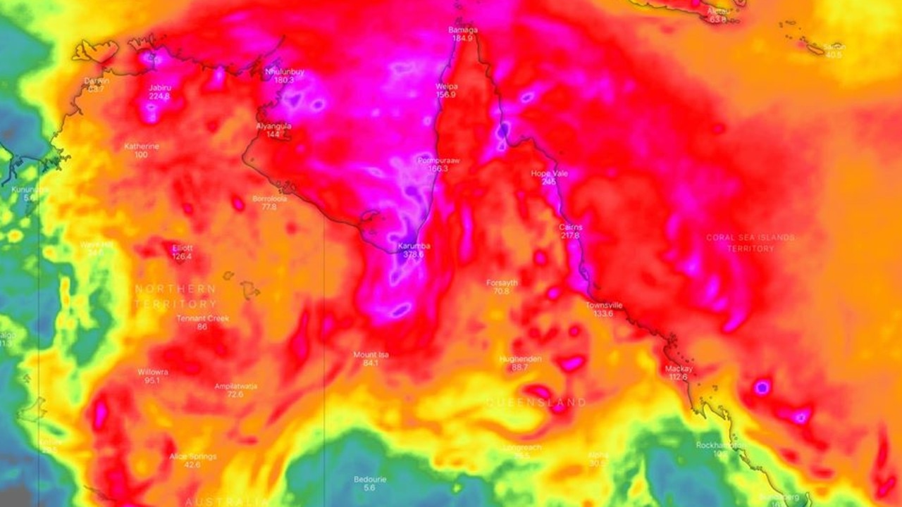
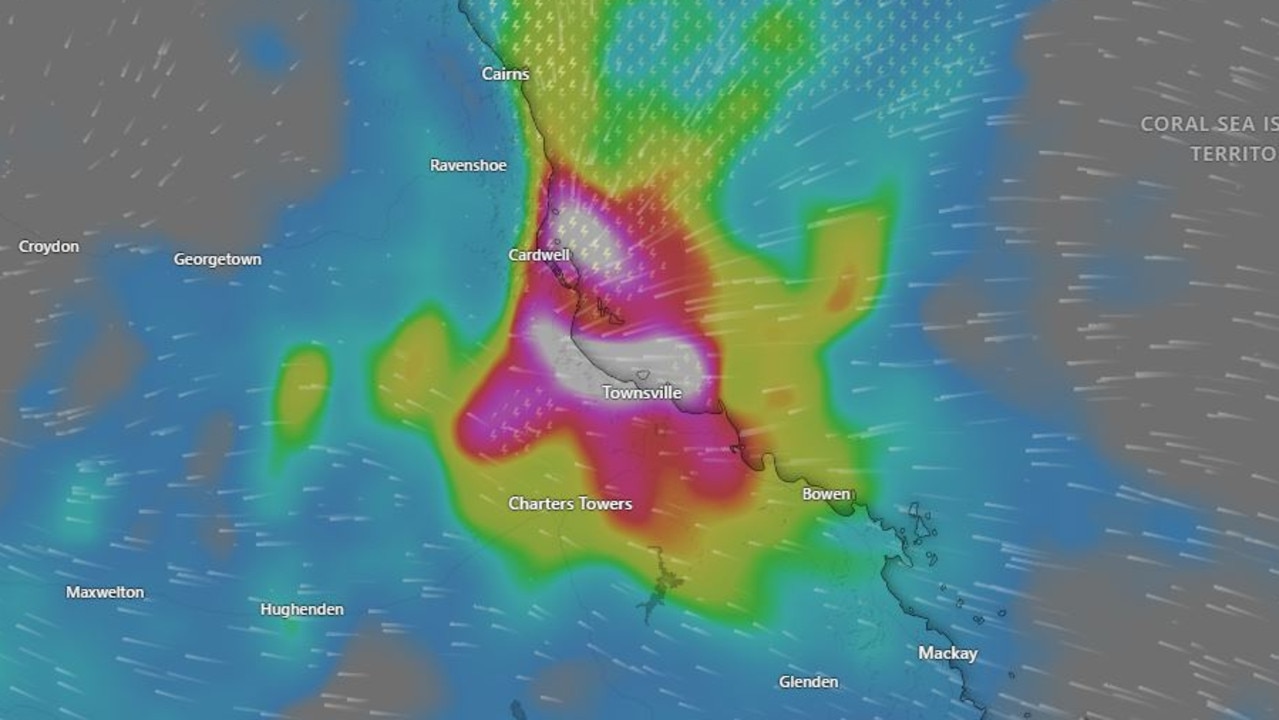
Yesterday, more than 100mm of rain fell on Townsville and Gregory Downs, south of Burketown. Rita Island, close to Ayr and south of Townsville, recorded a massive 529mm of rain in the 24 hours to 9am, the BOM said. That’s more than three month’s the area’s average January rain in one day.
“We’re seeing a drenching in northern Queensland,” said Sky News Weather channel meteorologist Tom Saunders today.
“We have a monsoonal low close to the Gulf of Carpentaria; it’s near stationary and is driving this very humid north westerly that’s pumping in the moisture.
“The heaviest falls are in north east Queensland and the Queensland tropical coast.”
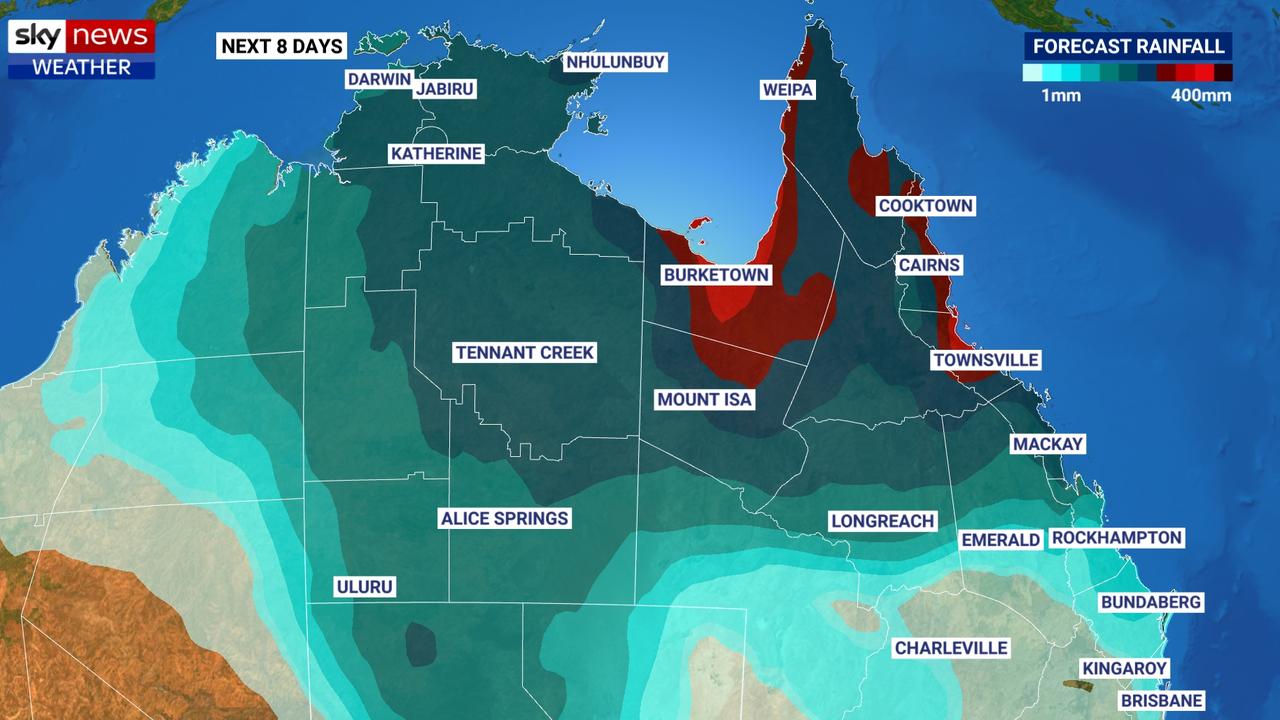
Mr Saunders said the deluge could continue in northern Queensland until Friday with hundreds of millimetres of rain yet to fall on top of the hundreds of millimetres that have already soaked the region.
‘LIFE THREATENING’
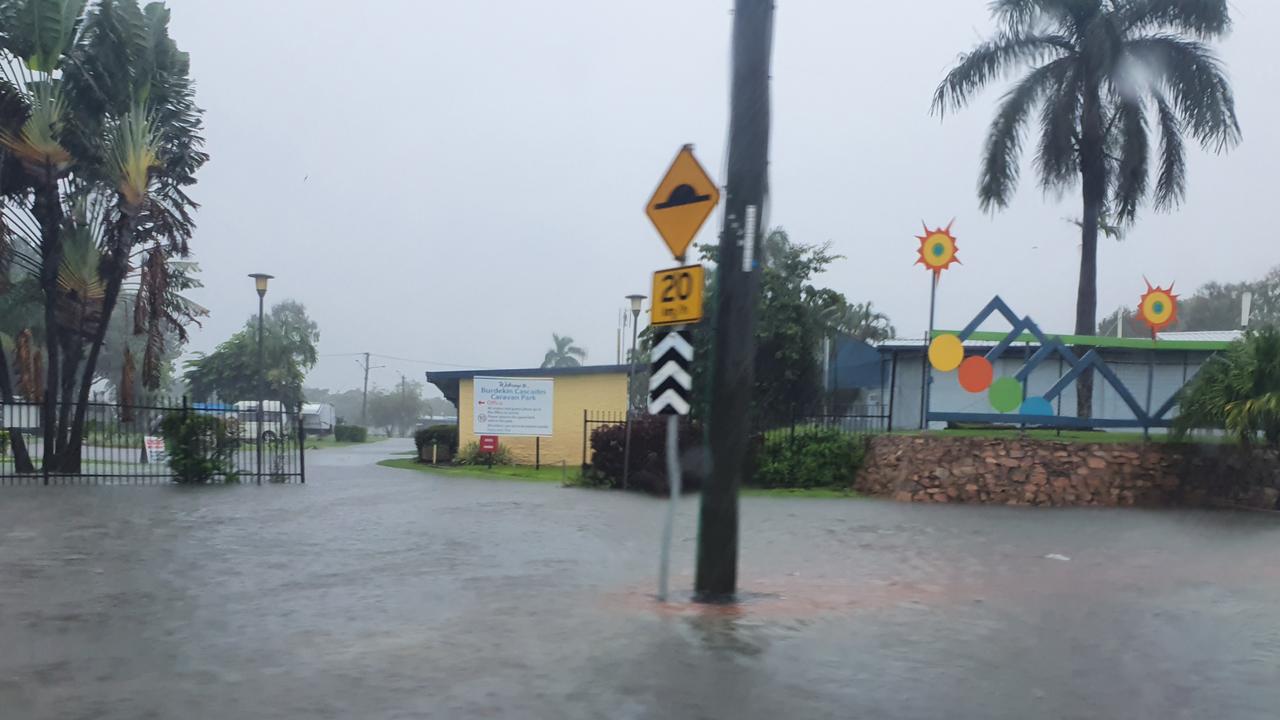
The BOM has issued a severe weather warning for heavy rain and flash flooding across the Gulf Country and a severe thunderstorm warning, also with flash flooding, for the Herbert and Lower Burdekin region close to Ayr.
“Severe thunderstorms are likely to produce intense rainfall that may lead to dangerous and life-threatening flash flooding,” said the weather bureau in a statement.
The biggest risk of death, as ever, is motorists unwisely driving through swollen creeks and rivers.
“If it’s flooded, forget it,” is the BOM’s advice.
There are currently flood warnings or watches in place for 16 rivers across the state.
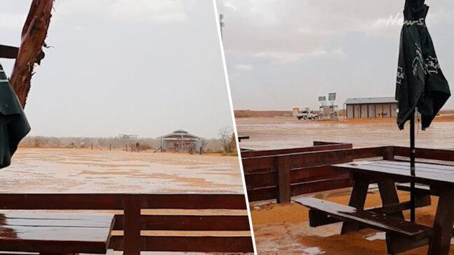
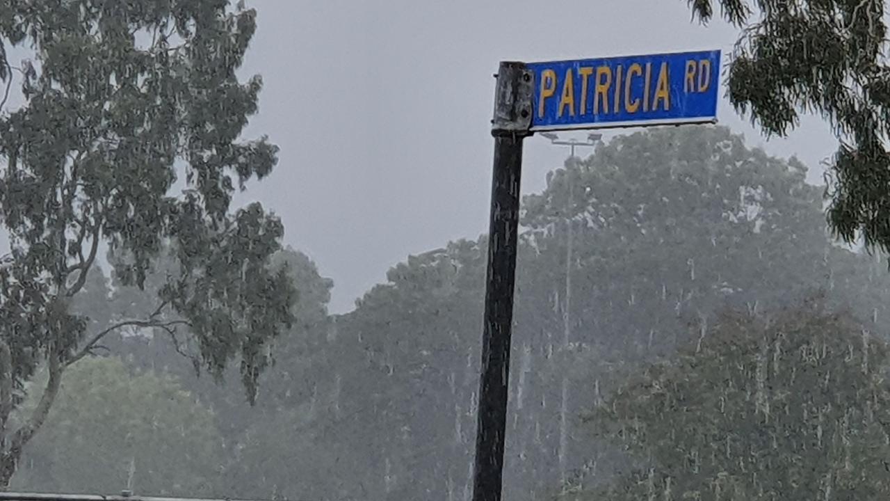
The heavy downpours have prompted the closures of a number of schools in the Burdekin on what was meant to be the first day back of the new school year, the Townsville Bulletin reported.
Some incredible rainfall totals recorded over the last 24 hrs. Intense rainfall recording over 500mm around Ayr, south east of Townsville, which itself received between 100-150mm.
— Bureau of Meteorology, Queensland (@BOM_Qld) January 27, 2020
Elsewhere, Normanton (Glenore Weir 193mm) and Hughendon (Woodbine 130mm) https://t.co/GN6vJCCaaJ pic.twitter.com/40G5Br0uPs
Home Hill State School, Home Hill State High School, Airville State School, Jarvisfield State School, Kalamia State School, Brandon State School and Osborne State School announced they would be closed today, citing safety concerns.
Townsville Mayor Jenny Hill warned residents to be cautious but said that, at this stage, the downpours didn’t seem to be as damaging as those last February that caused major flooding and around $1 billion worth of damage.
“At the moment it’s acting like a typical wet season where we see downpours with significant breaks in between,” she told AAP.
“Last year we didn’t have those breaks, it just kept raining and raining and raining. So far it’s pretty much been business as usual.”
Isolated heavy falls in catchments upstream have flooded the Paroo River – in the state’s southwest – with bridges cut at Eulo.
The river is expected to reach a moderate flood level by midweek. Paroo Shire Council Deputy Mayor Suzette Beresford said the rain was very welcome after six years of drought.
“It’s been patchy, with some properties receiving a bit more than others,” she told AAP.
“As long as it keeps coming,” she added.
Brisbane may see a few spots of rain today but nothing like further north in Queensland. Highs of between 31-34C this week.
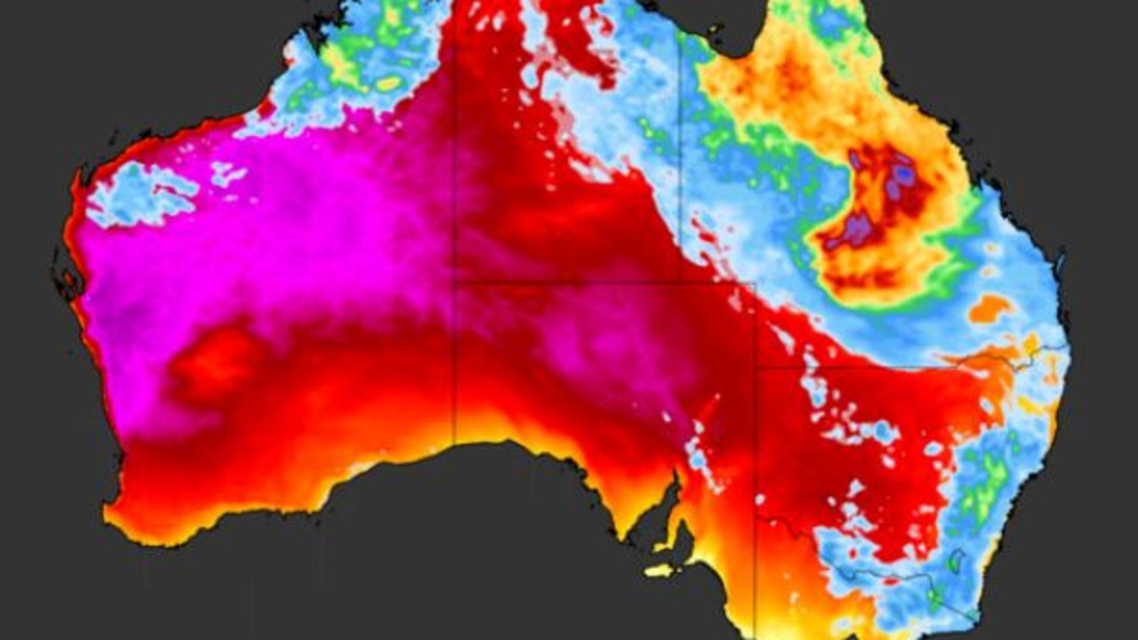
The rains in Queensland could eventually bring some relief to the southern states that are set to swelter through a severe heatwave at the back end of this week.
It looks like the rain band could do something of a vast spiral, heading west from the Queensland coast, then south, across Victoria and potentially back up to the east coast again.
That could bring some downfalls to South Australia, Victoria and possibly into New South Wales.
Western parts of South Australia could see some of the best rain for years, forecasters have said.
Average January rainfall in Ceduna is a mere 8mm. But Friday and Saturday could see between 8mm and 20mm of moisture on both days.
Extreme heatwave warning for Aussies
A very hot air mass is sloshing around the country, causing temperatures to reach the mid-to-high 40s over several states.
Devastating floods claim another life
Another person has died in flooding that is devastating large parts of the North Queensland coast, in scenes of “incredible devastation”.
‘Hoodwinked’: China is conning the world
An Australian economist says China is conning the world on an important global issue.