
WA Coast braces for potential category four cyclone
Tens of thousands homes are at risk and supermarket shelves have been stripped bare as Aussies brace for a “severe cyclone impact”.

A tropical low could become one of the strongest cyclones to hit mainland Australia since 2017, with it expected to affect tens of thousands of homes.
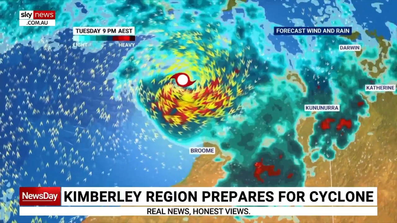
The Bureau of Meteorology (BOM) expects a tropical low off the Kimberley coast to become Cyclone Ilsa as soon as today, with gales and heavy rainfall forecast for the Kimberley coastal fringe.
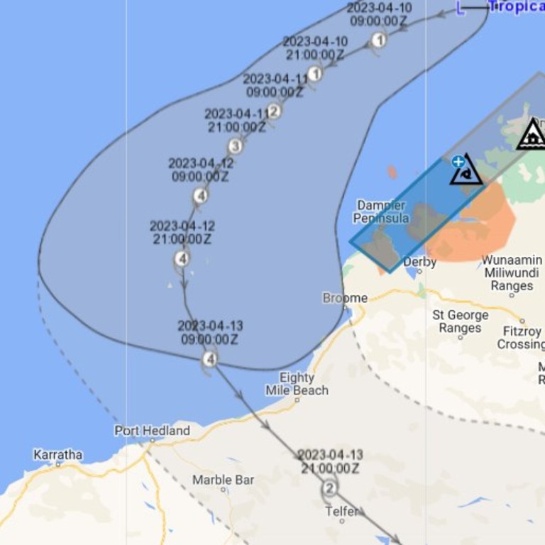
The warning zone includes Kuri Bay to Beagle Bay in Western Australia.
Currently, the low it sitting 650km northeast of Broome, and 460km northeast of Cape Leveque, with sustained winds near the centre of 55km/h and wind gusts of up to 85km/h.
However, by Wednesday it’s expected the system will have developed into a severe tropical cyclone, with a “severe impact” expected along the coast between Port Hedland and Broome on Thursday or Friday.
WA Tropical Cyclone Warning for Kuri Bay to Beagle Bay, not including Derby.. #cyclone#TC#alert#ewnalerts#australia#WAhttps://t.co/td9wCZ7NpKpic.twitter.com/OjyUpeiCNg
— Early Warning Network Alerts (@EWNAlerts) April 9, 2023
Gales with wind gusts of up to 90km/h and heavy rainfall are expected between Kuri Bay and Beagle Bay, particularly if the low moves closer to the coast.
Squally thunderstorms with heavy falls are also forecast over the north of the Kimberley region today and Tuesday.
Abnormally high tides are possible along the Kimberley coast between Kalumburu and Kuri Bay today and Tuesday, with some locations experiencing tides close to the year’s highest astronomical tide.
On Monday morning, The Bureau said winds near the system’s core could reach 250km/h.
“Those kinds of winds are likely to see widespread property damage,” Senior meteorologist Dean Narramore told ABC TV.
“Bring down trees, power lines, power outages and hundreds of millimetres of rainfall is likely to wash out roads.
“Possible isolation and stranding of communities, residents and travellers — so yeah, some really terrible conditions up there when it does cross later this week.”
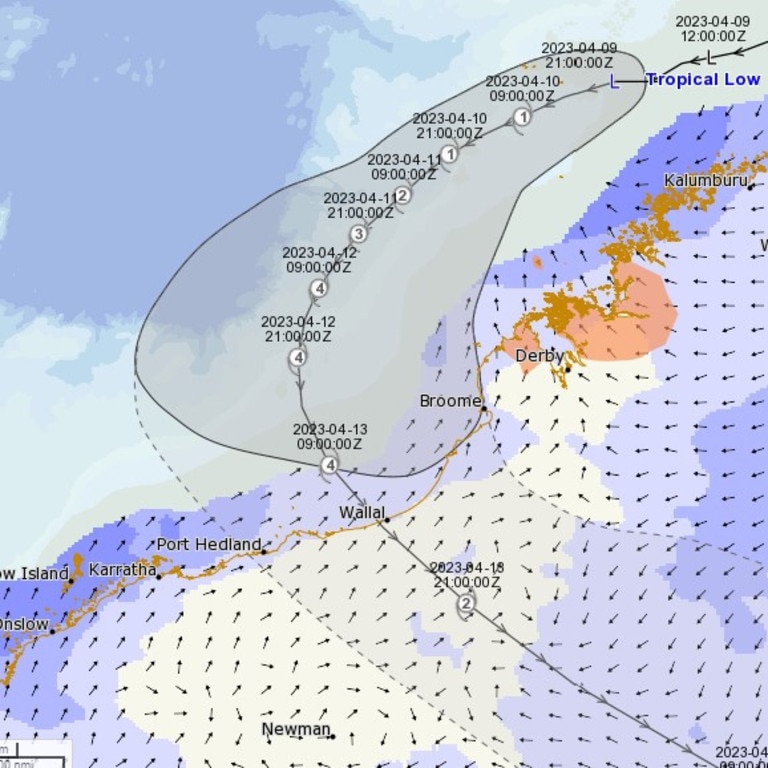
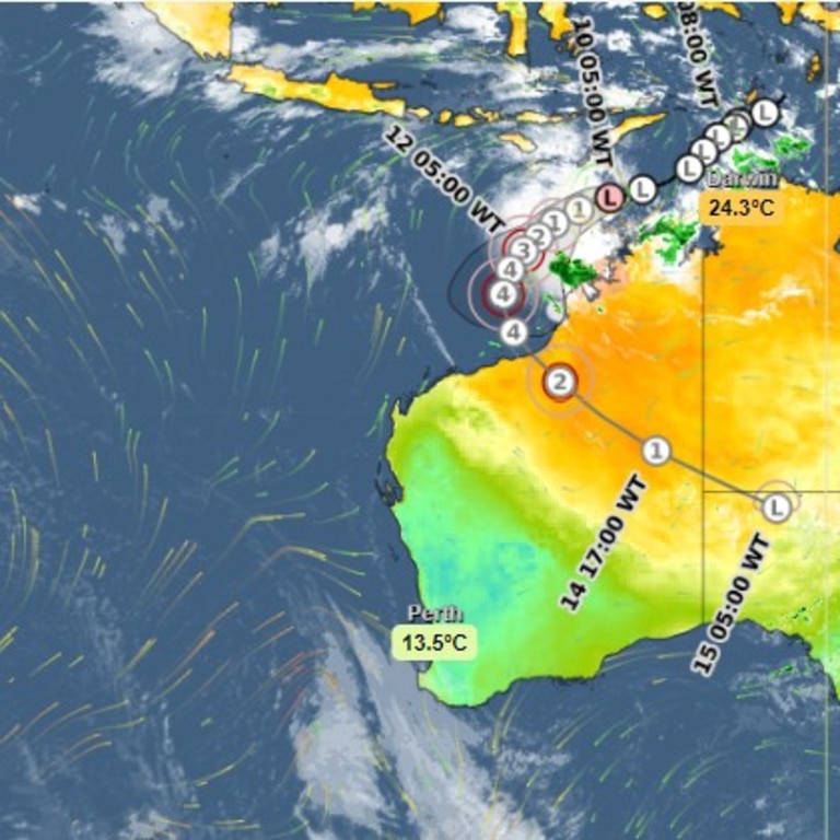
At the time of publication, BOM is yet to make a call on when or where it will make landfall though its last expected positioning, west of Broome on Thursday morning, has the system at a category four and swinging south towards the coast.
However, independent and international forecasters have done their best to fill in the gaps.
The most recent outlook from popular social media forecasters, Perth Weather Live, included four models.
WA Tropical Cyclone Warning for Kuri Bay to Beagle Bay, not including Derby.. #cyclone#TC#alert#ewnalerts#australia#WAhttps://t.co/td9wCZ7NpKpic.twitter.com/OjyUpeiCNg
— Early Warning Network Alerts (@EWNAlerts) April 9, 2023
“Those between Broome and Karratha need to be on alert and preparing properties for a significant system making landfall around Thursday,” they told their 207,000 followers.
All four models had the system making landfall on the Coast between Broome and Port Hedland late on Thursday or early Friday morning, though modelling showed the system could impact close to both.
Port Headland has a population of over 14,300 and is home to significant iron ore mining and shipping operations. Broome, home to 14,660, is one of WA’s top tourist destinations.
Weatherzone expects the system to gain strength as it swings back to the WA coast.
“About half of the main global forecast models expect this system to reach tropical cyclone strength by Monday, and all have it developed into a tropical cyclone by Tuesday,” the forecaster said.
“About half of the models also predict this system will become a category three severe tropical cyclone, or higher, mid-to-late next week.”
There are already social media reports of people stripping shop shelves in Port Hedland.
WA Incident Alerts posted a picture from a follower of empty shelves at a local supermarket.
West Australians, however, were understanding.
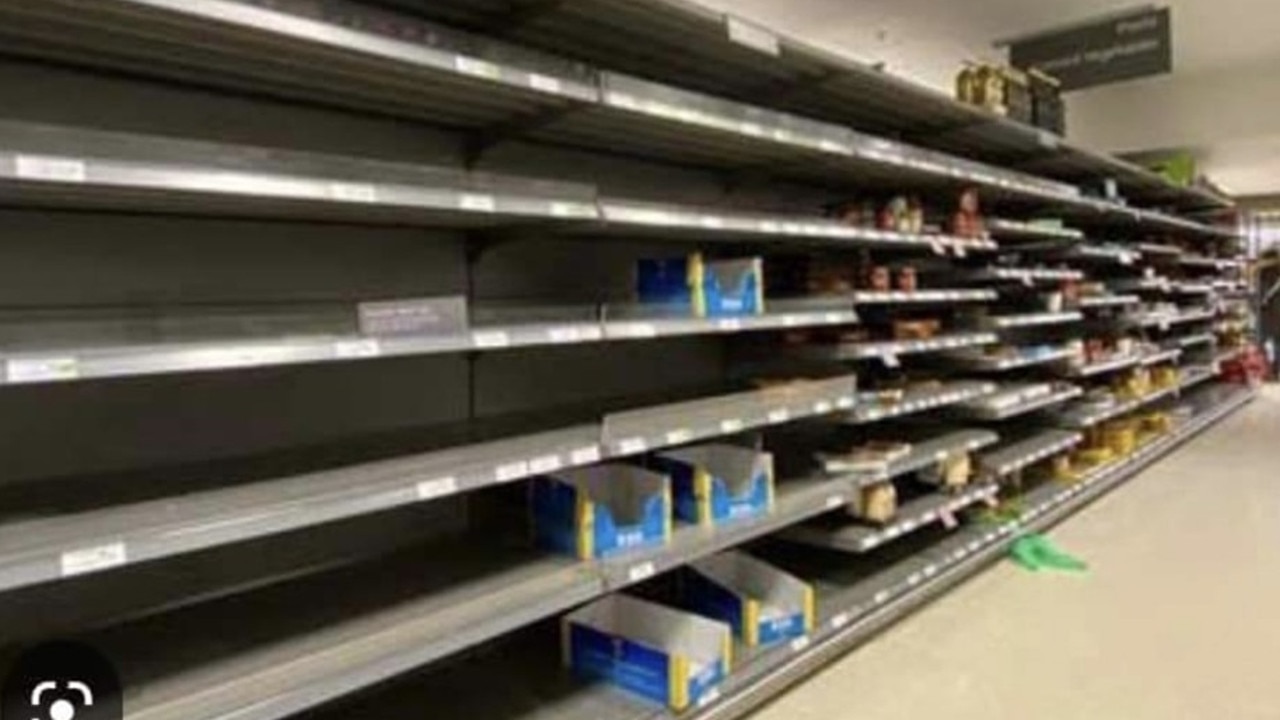
“Well when it gets flooded out and takes an extra four to five days for food to get there, then I don’t blame people for stocking up,” one said.
“Why the hell do people not prepare for a disaster knowing that they’re going to get hit?” another said.
Mapping currently projects the system to continue inland to Central Australia, remaining at cyclone strength until almost the Western Australia/Northern Territory border.
The last category four cyclone to make landfall in mainland Australia was Cyclone Debbie in 2017.
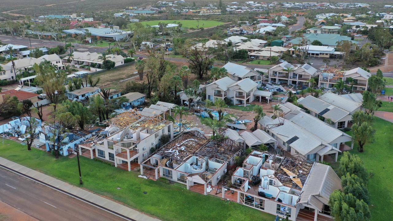
It crossed the coast near Airlie Beach, Queensland, with wind gusts of up to 263km/h and caused widespread damage and flooding.


A category four cyclone is classed as a severe tropical cyclone and is characterised by “very destructive winds” between 225-279km/h.
In 2021, the lesser-categorised Cyclone Seroja devastated 70 per cent of homes in the midwest Western Australia towns of Kalbarri and Northampton, totally levelling some.
In January this year, parts of the Kimberley were ravaged by severe flooding, which destroyed homes and roads and left many communities cut off for weeks.

Reason housing crisis could get worse
Australians are already facing a shortfall of more than 640,000 affordable homes. There’s one reason that might get even worse.

Severe frost alert for Aussie farmers
Farmers are being urged to keep their livestock warm as a freezing start to winter puts animals at risk.

Aussie-first hydrogen servo opens
Australia’s first publicly accessible hydrogen service station has opened, in a huge move towards decarbonising commercial vehicles.