Monster storm threatens to dump 300mm, woman falls in drain
Hundreds of millimetres of rain, strong winds and even waterspouts are set to hit parts of Australia’s east coast this week.
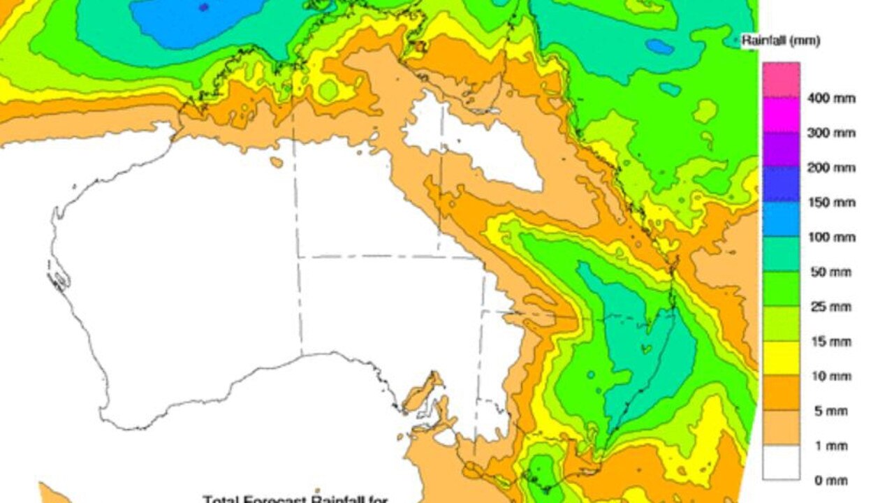
Parts of Queensland could cop up to 200mm of rain, areas of NSW are in line for 300mm, with meteorologists warning residents to be prepared for flash flooding.
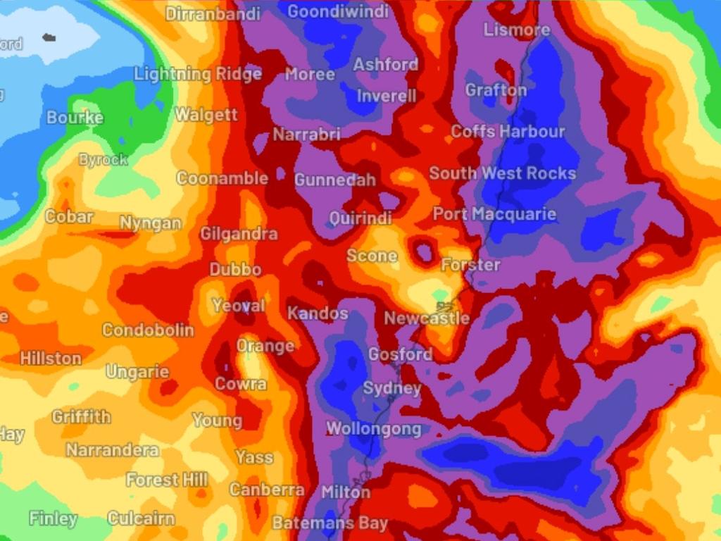
Forecasting from insurer GIO says a powerful low and moisture-rich coastal trough are expected to combine, dumping 300mm of rain ON Friday and Saturday on parts of eastern NSW.
Batemans Bay, the Blue Mountains, Coffs Harbour, Goondiwindi, the Illawarra, western Sydney and Sydney are in the firing line.
Similar heavy falls are also possible for the NSW Northern Tablelands and North West Slopes during Thursday and Friday mornings.
Waterspouts – a column of rotating, cloud-filled wind above water – could form just off the coast along with damaging 100km/h wind gusts.
Sky News meteorologist Rob Sharpe said in Queensland, the weather system could form into an east coast low, causing damaging winds and heavy rainfall, with potential for 50mm of rain a day.
“Over the next few days we’re looking at another rain event and this one will target the east coast, potentially as an east coast low,” he said.
“The rain will really ramp up Thursday around the border of NSW and Queensland and then it’s going to run down the coast, maybe with some damaging winds and damaging surf.”
â›ˆï¸ Today's thunderstorm forecast: Thunderstorms are possible in the southern interior and the far north. They are not expected to be severe, and are most likely in the afternoon and evening. Light showers continuing in eastern districts. Today's warnings: https://t.co/CinugnxqkNpic.twitter.com/3e88W5RZNJ
— Bureau of Meteorology, Queensland (@BOM_Qld) April 1, 2024
“Significant risk of flash flooding, there will be some minor to moderate riverine flooding but because it’s a fairly fast moving system … I don’t think we’ll end up with a major flood.”
The weather warning’s come as the trough system is moving out of Victoria after heavy rainfall battered the state overnight.
One Victorian woman had a miraculous escape after she fell into a flooded stormwater drain northwest of Melbourne.
The 58-year-old woman fell down an embankment and into the Raglan St drain in Daylesford, northwest of Melbourne, about 8.50pm before the fast flowing water carried her for some distance.
Victoria Police spokeswoman Leonie Johnson said the woman was able to pull herself from the drain with a metal pole.
“The water has actually reached her neck and she’s been crying out for help but the sound of the water was so loud that no one could actually hear her,” Ms Johnson told 3AW on Tuesday morning.
“Miraculously, this woman has managed to save herself, so she’s used this pole and pulled herself out of the water and escaped with only minor cuts and bruises.”
The terrifying incident comes as a band of heavy rain and thunderstorms is moving across the country’s southeastern states.
The cold front has caused a severe weather warning to be issued for Victoria’s central and eastern districts after the system soaked the regions overnight.
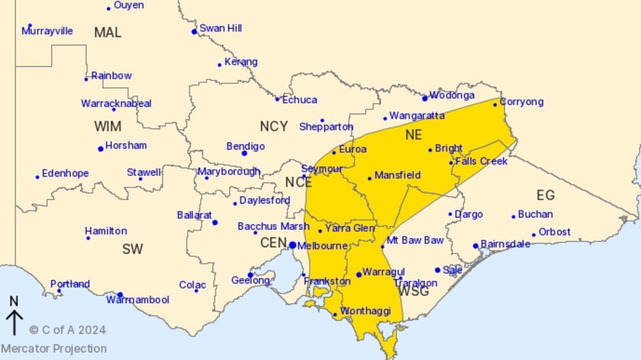
The Bureau of Meteorology predicts the cold front will continue to cause “heavy falls” over North East and parts of Central, East Gippsland, Northern Country, North Central and West and South Gippsland Forecast Districts on Tuesday morning.
Damaging wind gusts with peak gusts of 90km/h will continue to hit the northeastern ranges, including Wonthaggi, Bright, Morewell, Warragul, Moe and Falls Creek.
It comes as Ferny Creek, in the state’s southeast, received 75mm of rainfall since 9am Monday, while Malmsbury and Avalon Station received 68mm in less than 24 hours.
On Monday, bureau meteorologist Stephanie Miles said Victorians should prepare for flash flooding.
“Flash flooding is definitely a possibility with this heavy rainfall, particularly most places that we said before whether they’re expecting heaviest rainfall,” Ms Miles said.
“However, we’re not really expecting any riverine flooding with this one.
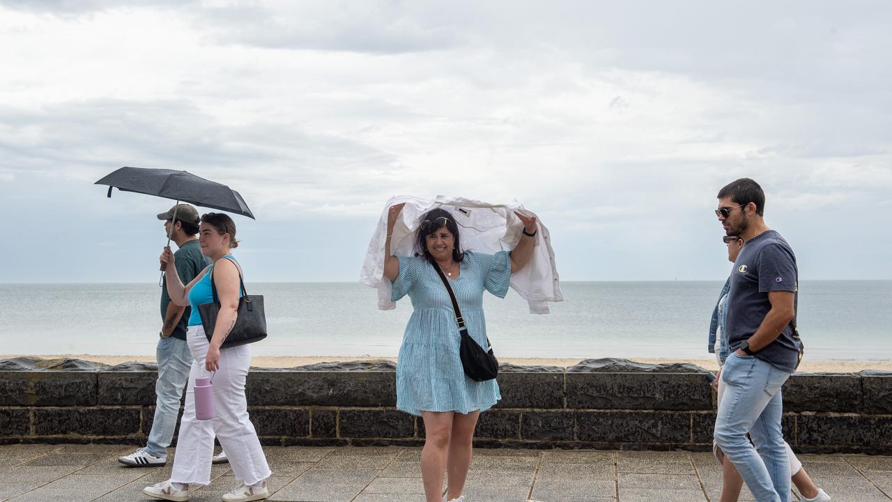
“It’s more so just that flash flooding with the heavy rainfall and thunderstorms that will kind of just produce any nuisance flooding over roads and the likes.”
The State Emergency Service has warned those in the region to avoid travel if possible and remain aware of dangerous hazards including flood water, mud, debris and damaged and fallen trees.
Severe weather warnings previously issued for the Mallee, South West and Wimmera have been cancelled.
The cold front will spread to Tasmania, Gippsland and eastern NSW on Tuesday, before hitting Sydney about midday.
The band is expected to move through far northern NSW and southern Queensland on Wednesday.
A trough of low pressure is also likely develop off the NSW north coast later in the week before moving down the coast and causing torrential rain and gale-force winds from southern Queensland to eastern Tasmania.
Read related topics:Brisbane


