
Victoria weather BOM forecast: Melbourne suburbs at risk of flooding, Maribyrnong River rises
Described as one of the “one of the most significant flood events” in the state’s recent history, several suburbs across Melbourne have been lashed by floodwaters.

Thousands are being told to leave their homes immediately as flooding continues to smash Victoria.
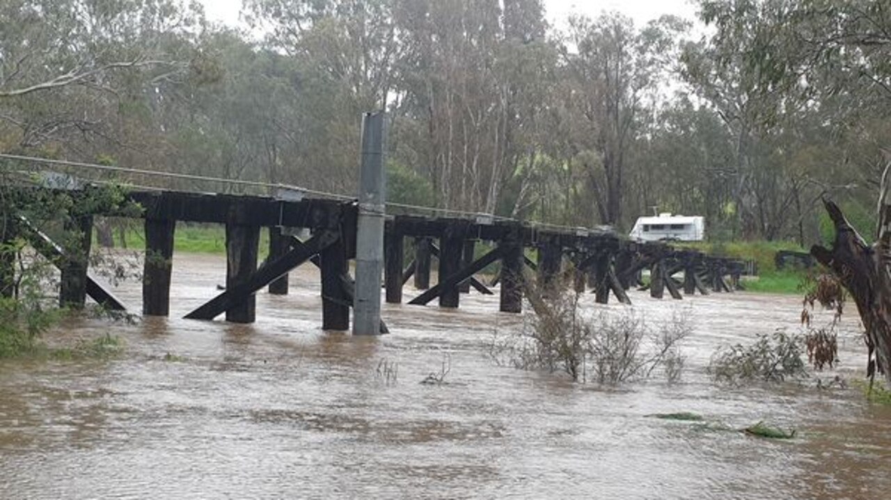
As of 6pm on Friday, residents in Murchison a small riverside rural village located on the Goulburn River are being warned to evacuate immediately as the Goulburn River is expected to exceed the major flooding level of 10.7m on Friday evening.
Emergency services have warned the river may reach around 12m by Saturday afternoon.
Flooding above floor level of a single-story home is likely to occur.
The safest evacuation route is by the Goulburn Valley Highway, and residents have been urged to stay with friends or family in a safe location or travel to a relief centre at the Shepparton Show Grounds.
Extraordinary scenes as Melbourne smashed
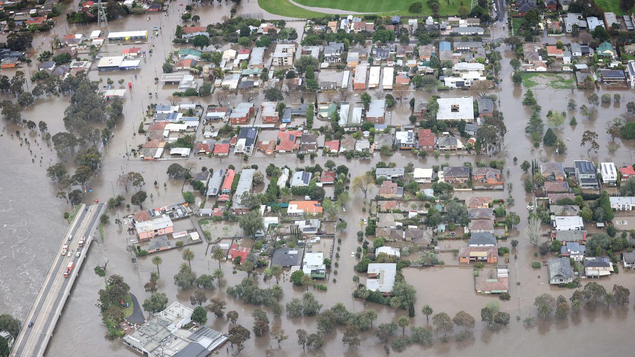
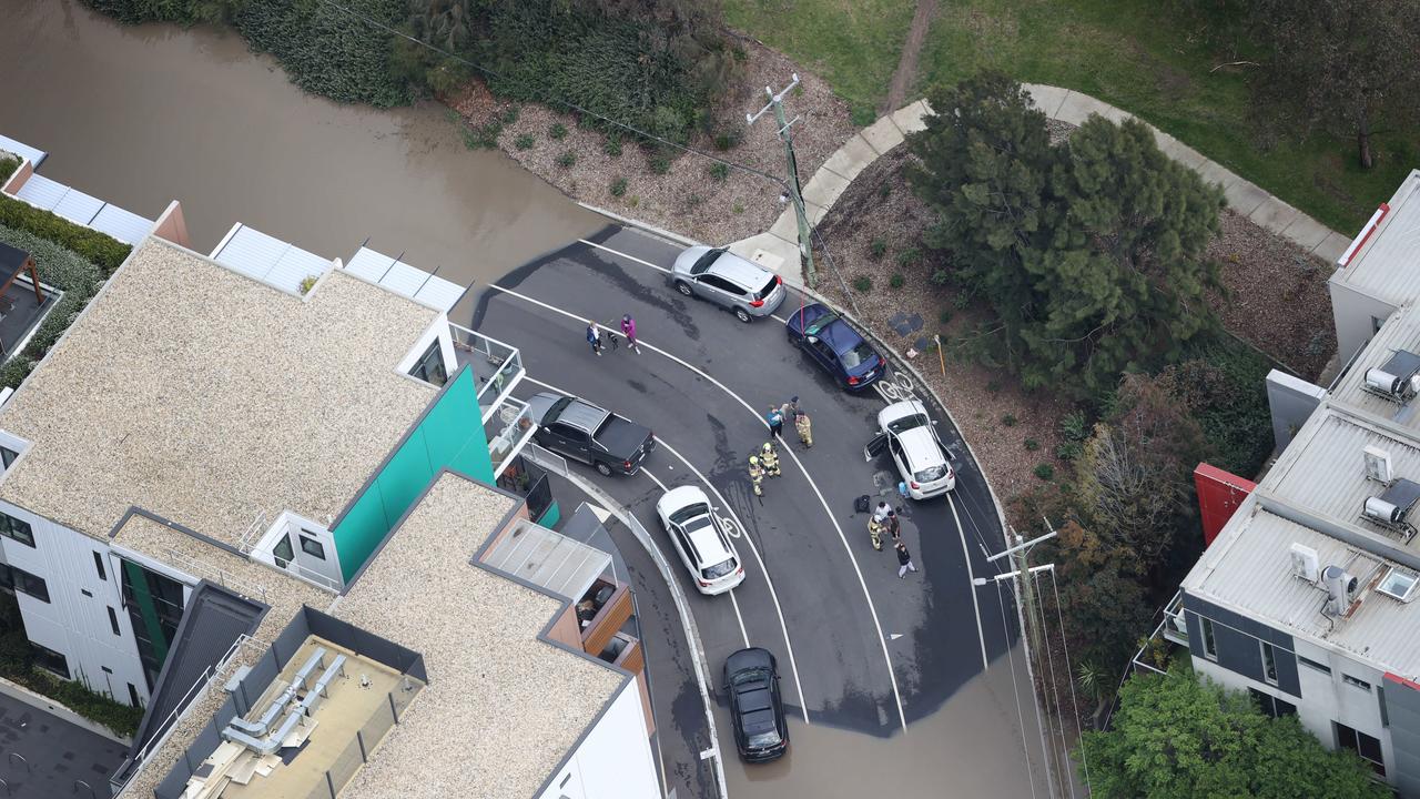
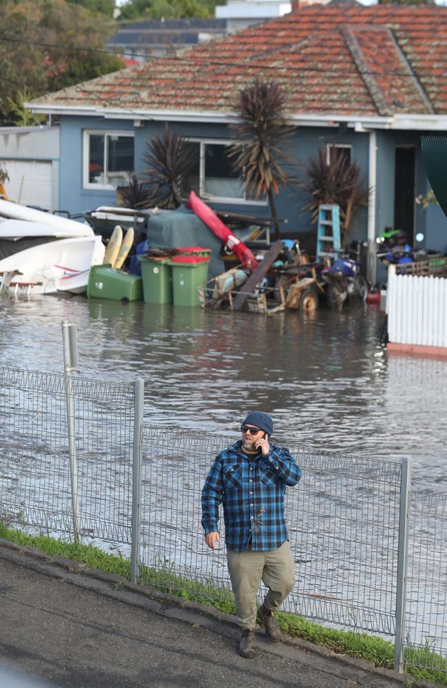
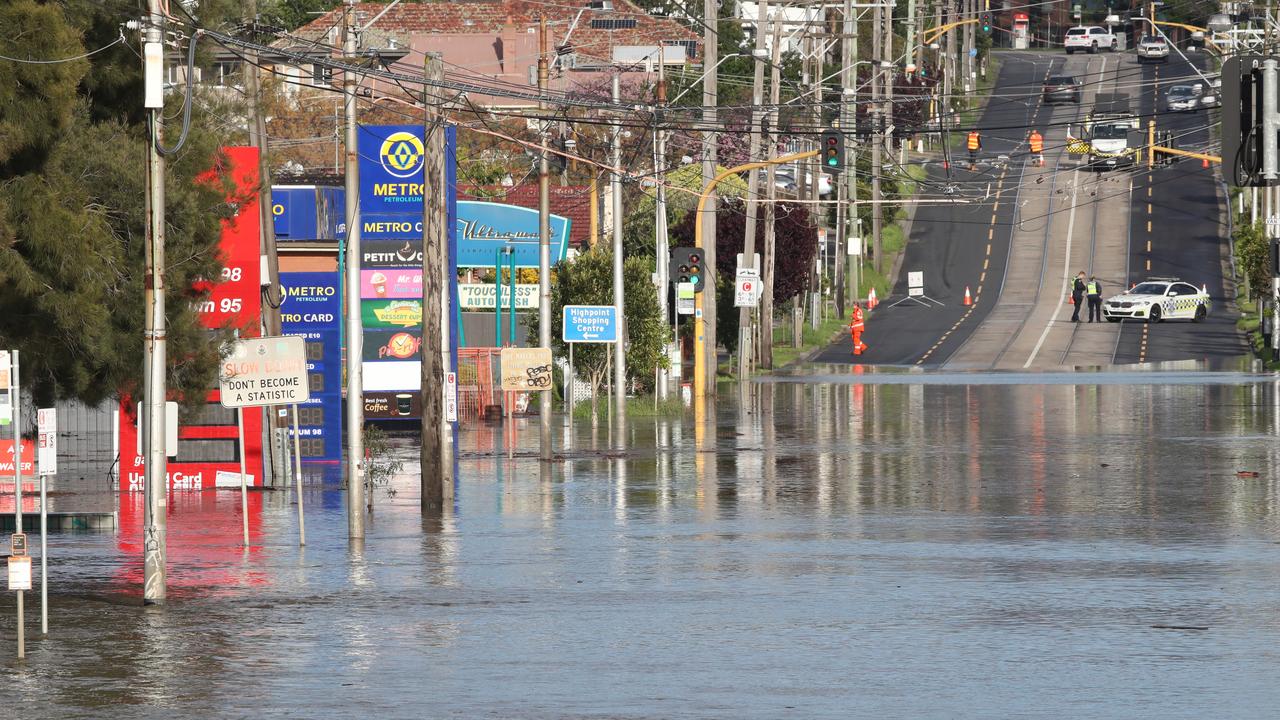
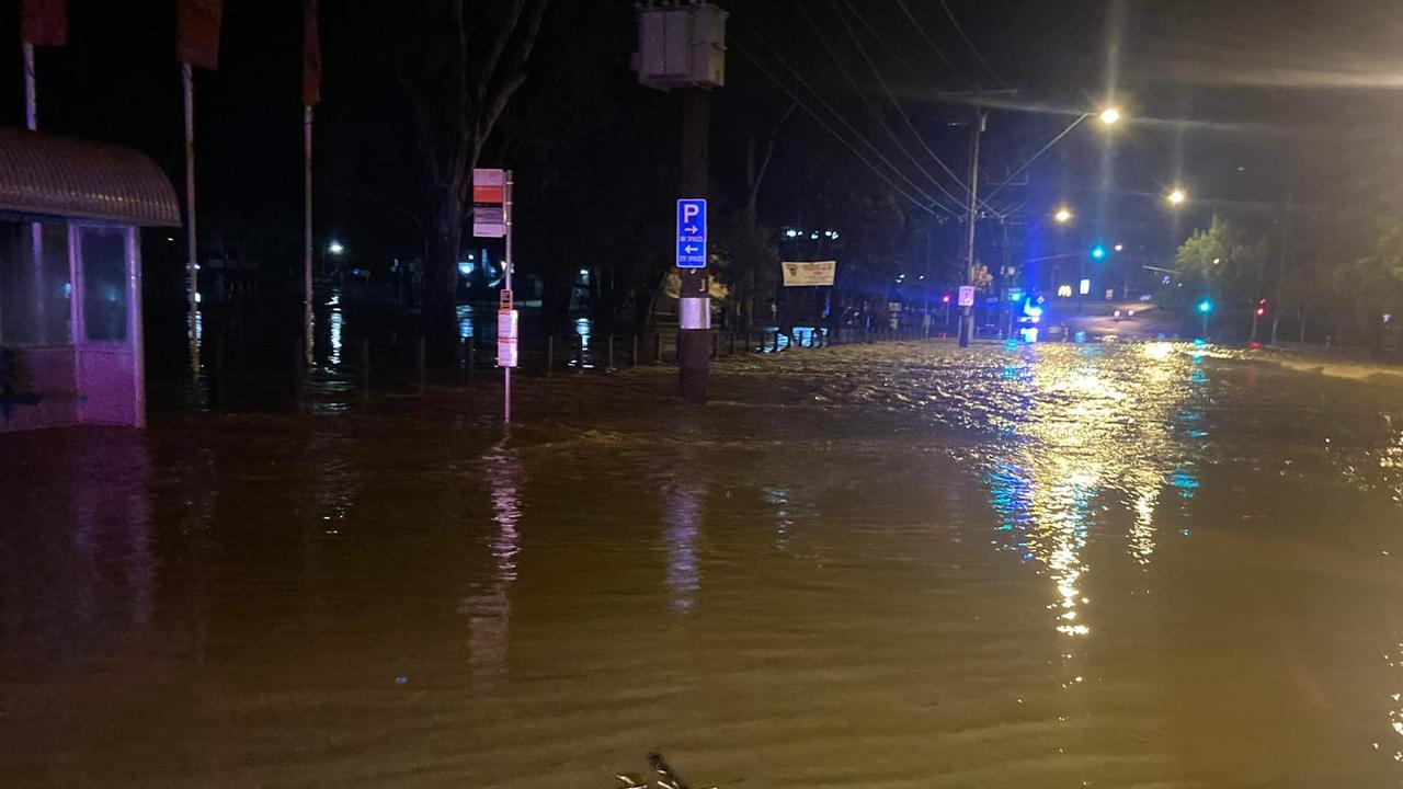
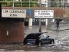
Dozens of suburbs across Melbourne have been left unrecognisable as floodwaters have led to evacuations and widespread inundation.
Forty-two suburbs including Essendon, Ascot Vale, Keilor, Footscray, and Sunshine have been advised to prepare for potential flooding, as the Maribyrnong River peaked at major flood levels.
Vic Emergency – the state’s statutory emergency management authority – urged residents in parts of Maribyrnong to evacuate immediately as of 5.40am on Friday morning. Large swathes of suburbs along the riverine area have also been told to move to higher ground, with “flooding above floor level” in single-story homes “likely to occur in many locations,” authorities warned.
Stream more weather news live & on demand with Flash. 25+ news channels in 1 place. New to Flash? Try 1 month free. Offer ends 31 October, 2022 >
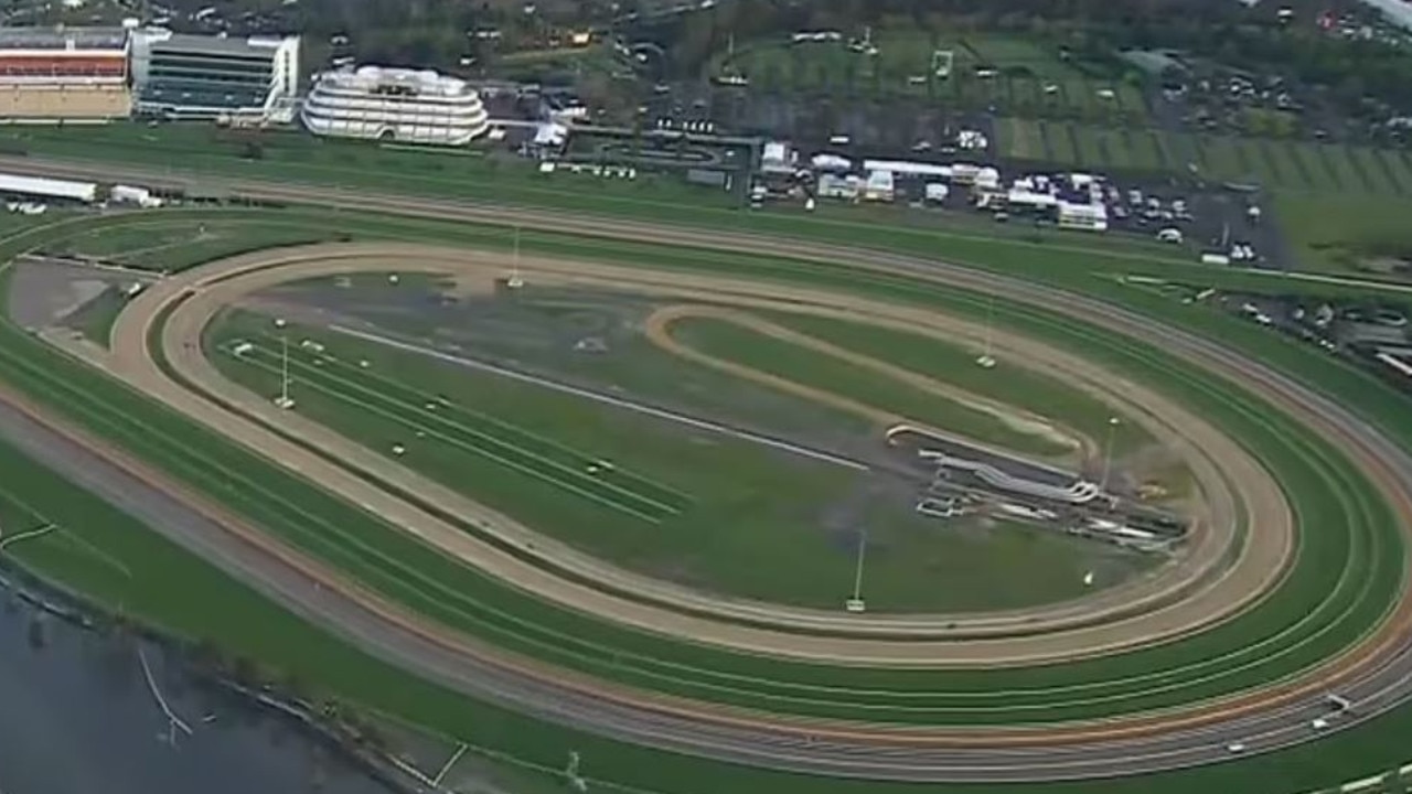
Melbourne’s Flemington Racecourse was surrounded by floodwaters, with inner-city suburbs of Brunswick, Fitzroy and Northcote also put on alert for potential inundation.
500 homes flooded, thousands without power
On Friday afternoon, Premier Daniel Andrews said 4700 homes had currently lost power, with 1500 homes in Victoria’s southwestern town of Apollo Bay affected. He added that
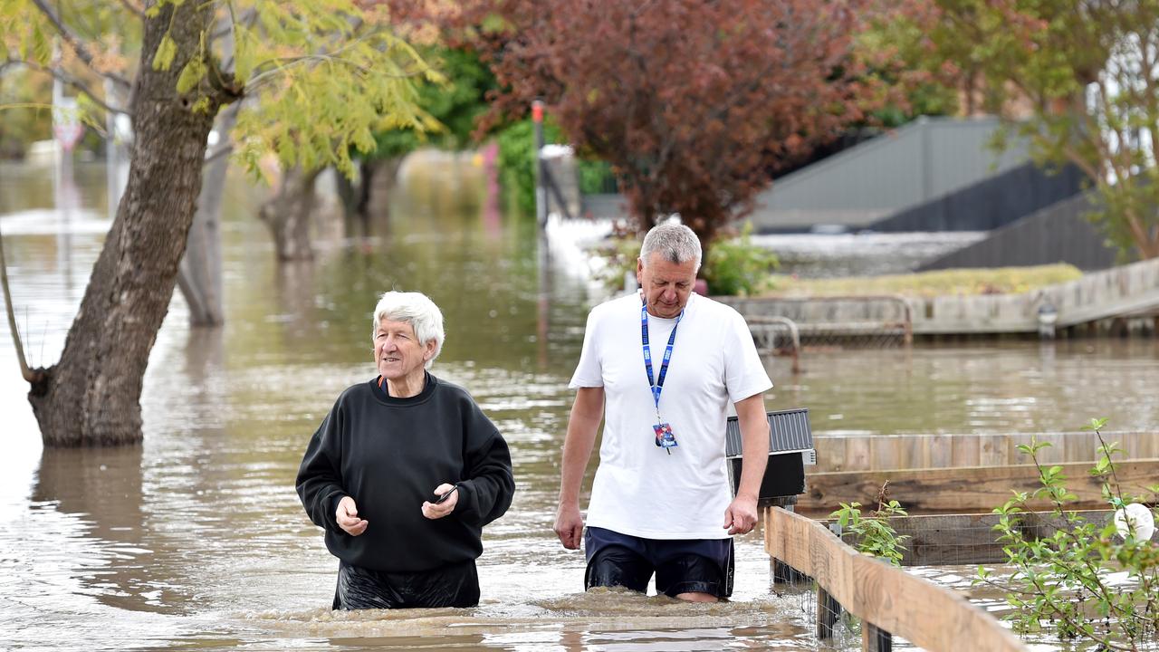
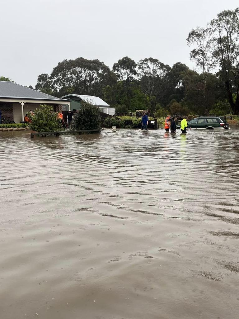
It’s believed more than 500 homes have been flooded across the state, with another 500 properties isolated by rising floodwaters.
Mr Andrews also said that while there was “every chance” that Melbourne’s Mickleham quarantine hub would be turned into a “relief centre,” for those displaced by floodwaters, plans have yet to be confirmed.
“That number will definitely grow,” he said during a press conference.
“We have choppers in the air at the moment making damage assessments, flood impact assessments, (and) they’re fed back in real-time … (but) we’re going to see more and more people that fit into that category.”
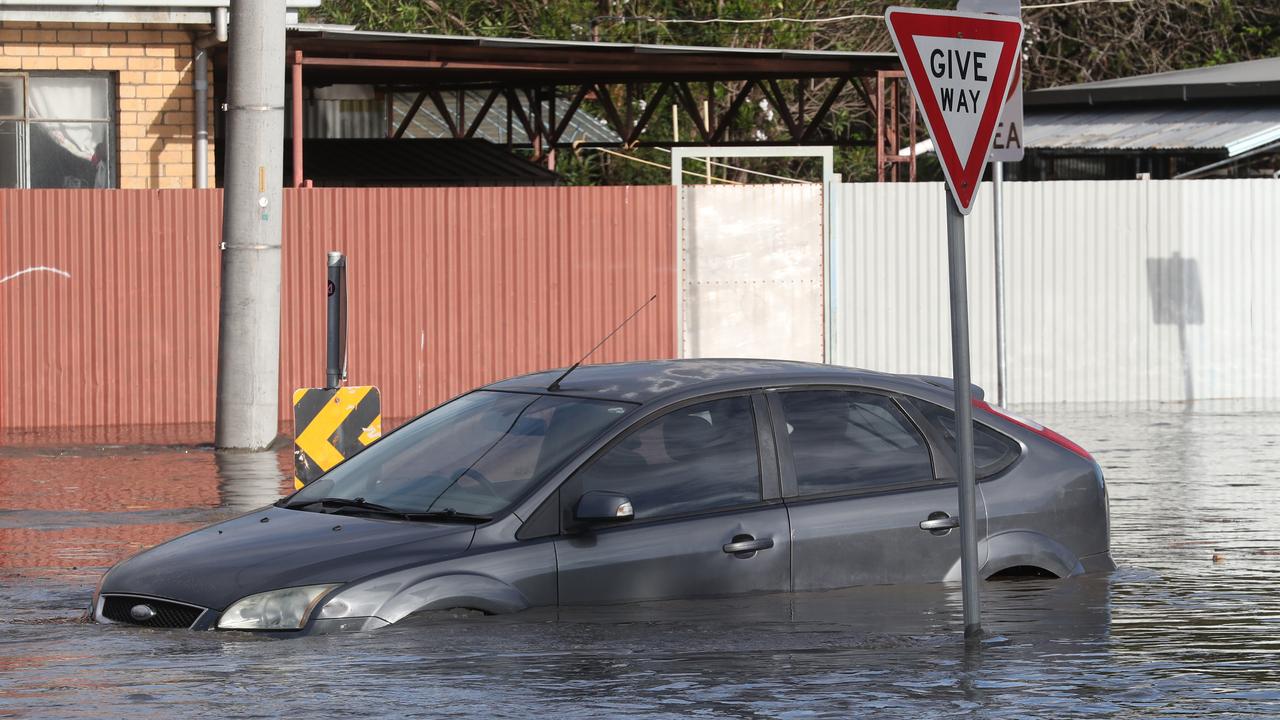
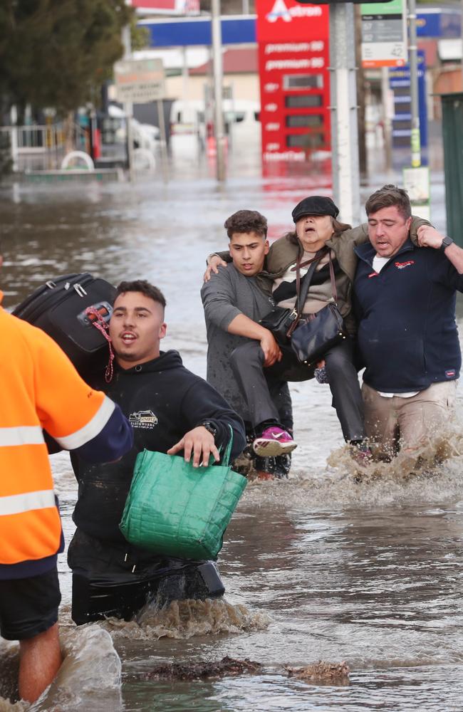
He also urged people to not drive into flood waters, with Mr Andrews estimating that 200 rescues made by the SES “could have been prevented”.
“The key point here is it’s very dangerous for you and it’s also very dangerous for the emergency services, volunteer or first responder to come and rescue you.”
Thousands of homes across the state have also been cut off from power. A flooded substation forced Powercore to disconnect 9800 customers, with only 2600 customers on their network currently connected, the ABC reports.
AusNet Services, which supplies electricity to a large area of Victoria’s east has also reported around 1700 outages. This includes inner-city suburbs of Greensborough, Briar Hill, Boronia and North Warrandyte, and regional areas of Flowerdale, Hazeldene and Hansonville, as reported by the Herald Sun.
The electricity supplier has urged people to switch off and unplug all appliances which may come into contact with floodwaters, while also urging residents to turn off the main switches at the switchboard.
Our crews are working hard to restore power due to major storms pushing through #Victoria. We’re encouraging customers to plan ahead and know the risks of electricity and water. If you are in an area that is at risk of flooding, visit: https://t.co/oG3Ol1sh2x#melbourneweatherpic.twitter.com/apt85oTUxW
— Powercor Australia (@PowercorAust) October 13, 2022
Flooding to continue into next week
While Melbourne’s Maribyrnong River has peaked, Chief Officer of the Victoria State Emergency Service, Tim Wiebusch said the flooding would ‘continue to escalate’ in the coming days.
In the state’s northwest, the Avoca River is set to peak on Saturday afternoon, leaving some properties around Charlton vulnerable to flooding.
Flooding could also continue over the next four weeks in towns located around the Euro, Benalla, Numurkah and Nathalia Rivers which feed into the Murray River.
Mr Andrews warned that the significant weather event was “not over yet,” and would continue to ravage the state “for some time”.
“So managing fatigue among our emergency services, making sure that everybody has a sense of urgency and that we as a Victorian community (don’t become) fatigued by this, will be a really important part of this,” he said.
While Mr Wiebusch mentioned a man near the regional town of Bendigo had been reported missing shortly before Friday’s noon press conference, he’s since been rescued.
The man became stranded after his Toyota Landcruiser was swept into floodwaters. Rescuers said he was found by police around half an hour later, clinging onto a tree branch.
Mr Wiebusch confirmed there had otherwise been no fatalities or serious injuries as a result of the floods.
Beloved pub goes underwater
As of Friday noon, the Maribyrnong River levels have peaked. Previously, an alert issued by the Bureau of Meteorology at 8.10am on Friday said river levels in Keilor were currently at 8.63m and were expected to peak at 8.7m. This was metres above the major flood level of 6.1m.
In Maribyrnong – where the major flood level is marked for 2.9m – levels were currently at 3.46m and expected to hit 3.8m.
Maribyrnong locals have lamented the flooding of the beloved pub, the Anglers Tavern. Perched along the river’s edge, water levels had overwhelmed the ground floor and beer garden.
Around 60 homes near the pub have also been issued with evacuation orders.
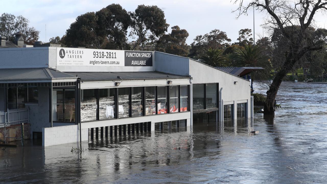
The venue is one of the many businesses which had flooded in the inner-city suburb.
The Bureau warned that flooding in the Deep Creek and the Maribyrnong River catchment could create “extensive inundation,” disruption to traffic and the isolation of some properties.
SES responds for more than 2660 requests
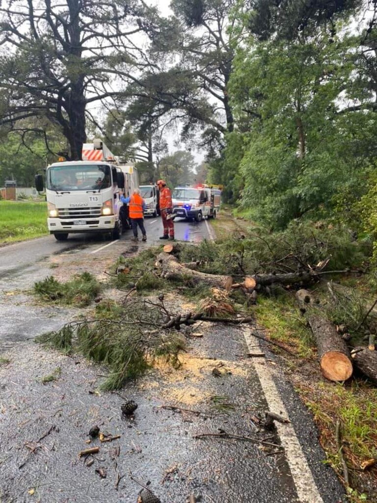
From 7.30am Thursday to Friday, the Victoria State Emergency Service have responded to more than 2660 requests for assistance, with staff aiding in the evacuation of residents and clearing roads.
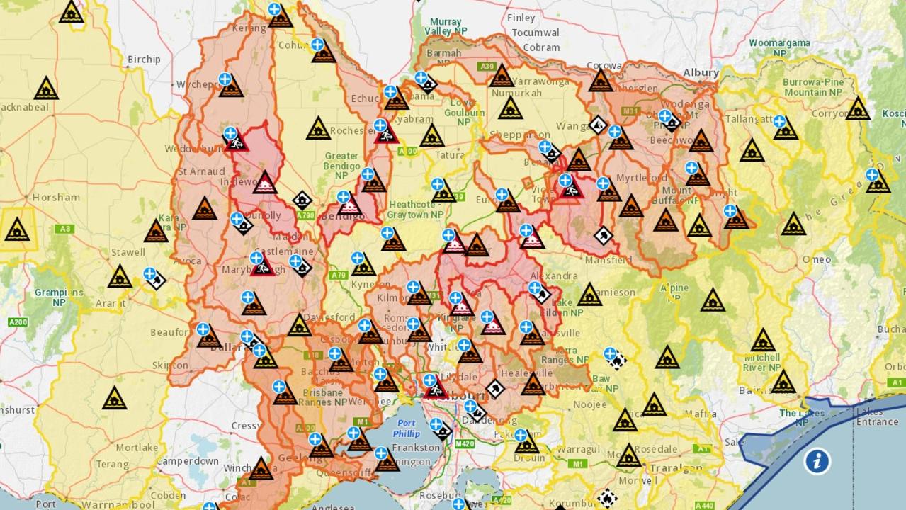
Across the state, a total of 91 flood-related warnings have been issues for Victorians. They range in severity from a Flood Watch for areas near inundated catchments to immediate evacuation notices.
As of 6.30am Friday, affected areas in the five suburbs of Rochester, Maribyrnong, Benalla, Carisbrook and the Seymour township have been advised to leave their homes immediately.
Vic Emergency has advised that homes in the flood catchment zones could be subject to rapidly rising floodwaters.
At 6.37am on Friday morning, some residents in the Goulburn Valley town of Seymour were told it was not too late to leave, with the rising Goulburn River flooding roads and bridges. Those affected have been isolated by floodwaters and have been told to shelter on high ground.
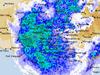
Rain has cleared VIC with scattered showers to follow today; mainly over southern & mountain districts. Snow showers across the Alpine peaks, with isolated thunderstorms in the southeast. Totals through the rest of today generally less than 5mm. Highest totals: pic.twitter.com/WHymdpo2KD
— Bureau of Meteorology, Victoria (@BOM_Vic) October 13, 2022
While the Bureau reports that the state’s deluge is forecast to clear from 6am Friday, the weather event has seen totals peak above 200mm. The biggest falls were witnessed in the state’s Lower Northeast, with Strathbogie North, Charnwood and Moroko Park reporting event totals of 221.6mm, 209.4mm and 187mm respectively.
Rainfall totals in some Victorian towns also exceeded historic October totals dating back to 1863, reports ABC Meteorologist Thomas Saunders. This includes 76mm recorded in Mangalore (dating back to 1957), 71mm in Swan Hill (dating back to 1884) and 66mm in Bendigo (dating back to 1863).
On Thursday, Mr Andrews also warned that the weather event was “one of the most significant flood events” in the state’s recent history.
“That will pose a real challenge over the coming days,” he said.

Three states in for dangerous drenching
Widespread heavy rain, potential flash flooding and damaging winds have continued to threaten northern Tasmania, central and northern Victoria and southern inland NSW, with the BOM issuing severe weather warnings for all three states.
As of Thursday 10am, Tasmania recorded six-hourly totals of 40 to 60mm in the state’s north, with areas in the Western Tiers exceeding totals over 100mm. The southern and Alpine areas of NSW was also lashed with six-hourly totals from 30mm to 50mm.
The Bureau forecast that heavy rainfalls would ease into showers by Friday morning, however “moderate to heavy falls are still likely for some areas” in Victoria and Tasmania.
It’s predicted that areas of Eastern NSW will be hit with light rainfall from early Friday morning, before the weather event finally moves offshore.
42 Melbourne suburbs on ‘Watch and Act’ alert
Aberfeldie
Airport West
Ascot Vale
Avondale Heights
Braybrook
Calder Park
Essendon
Essendon Fields
Essendon North
Essendon West
Flemington
Footscray
Kealba
Keilor
Keilor Downs
Keilor East
Keilor Lodge
Keilor North
Keilor Park
Kensington
Maidstone
Maribyrnong
Niddrie
Sunshine North
Sydenham
Sydenham Park
Taylors Lakes
Tullamarine
Gladstone Park
Hillside
Melbourne Airport
Moonee Ponds
Plumpton
Seddon
St Albans
Strathmore Heights
Sunshine
Taylors Hill
West Footscray
Westmeadows
West Melbourne
Yarraville

200 species dead in ‘unprecedented’ disaster
Scientists have offered a grim outlook for Aussies hoping for an immediate solution to an ‘unprecedented’ disaster leaving the water at Aussie beaches toxic.

Australia told to brace for a soaking
Parts of Australia that have already experienced a wet weekend should expect more downpours in the week ahead.

‘Big’: Wild weather warning to Aussies
Aussies in several states have been warned to brace for a weekend of wild weather, with the risk of floods and damaging winds.