
Tropical Cyclone Uesi heading towards Queensland, NSW coasts
Days after the eastern seaboard was smashed, a fierce tropical cyclone is drifting unusually far south and could hit both Queensland and NSW.

A tropical cyclone gathering strength in the Coral Sea is powering towards Australia.
Depending on where it tracks, it could bring driving rain and winds to already sodden parts of the country, including as far south as New South Wales.
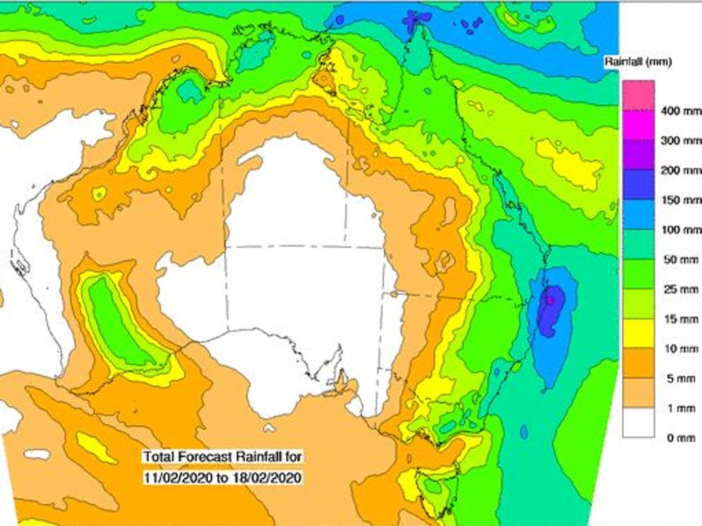
Even without the storm’s influence, Australia’s eastern seaboard is likely to receive more downpours this week with the likely rain total for Brisbane increased overnight from around 100mm over the next few days to as much as 150mm.
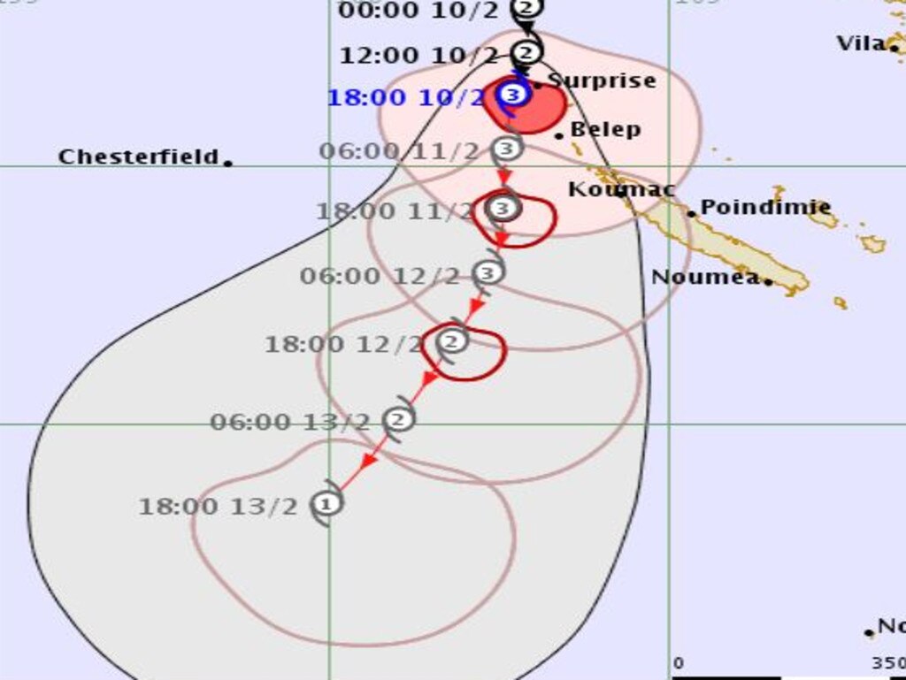
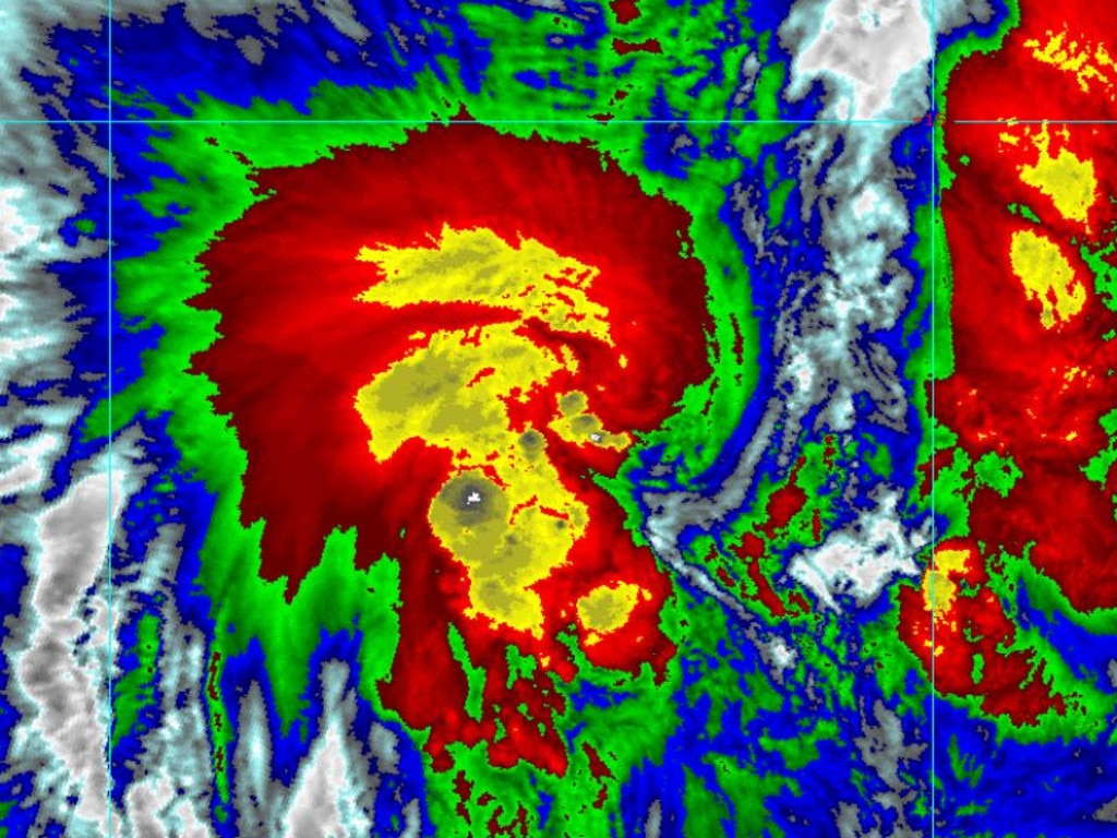
Cyclone Uesi is currently a category 3 storm located just to the north of New Caledonia. Category 3 storms can have winds of around 200km/h.
According to the Fiji Meteorological Service, which is tracking Uesi, its current route should take it in a south-westerly direction towards the coasts of both New South Wales and Queensland. It could enter Australian waters as early as Thursday.
The Australian Bureau of Meteorology also says there is a moderate chance the cyclone could turn southwest towards Australia on Thursday — giving odds of between 20%-50% the storm will enter the Coral Sea’s eastern region.
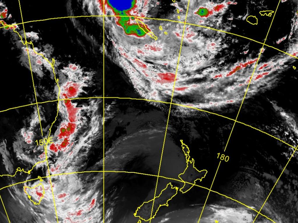
Cyclones usually don’t drift as far south as NSW. Their fuel is warm water but the further south they go the cooler the water gets, reducing the storm’s strength.
But the waters off NSW are unusually warm this year allowing Uesi to potentially head on an unusual trajectory. An area of high pressure is also pushing it towards land.
Like shopping trolleys, however, the path of cyclones is notoriously hard to predict. They have a mind of their own.
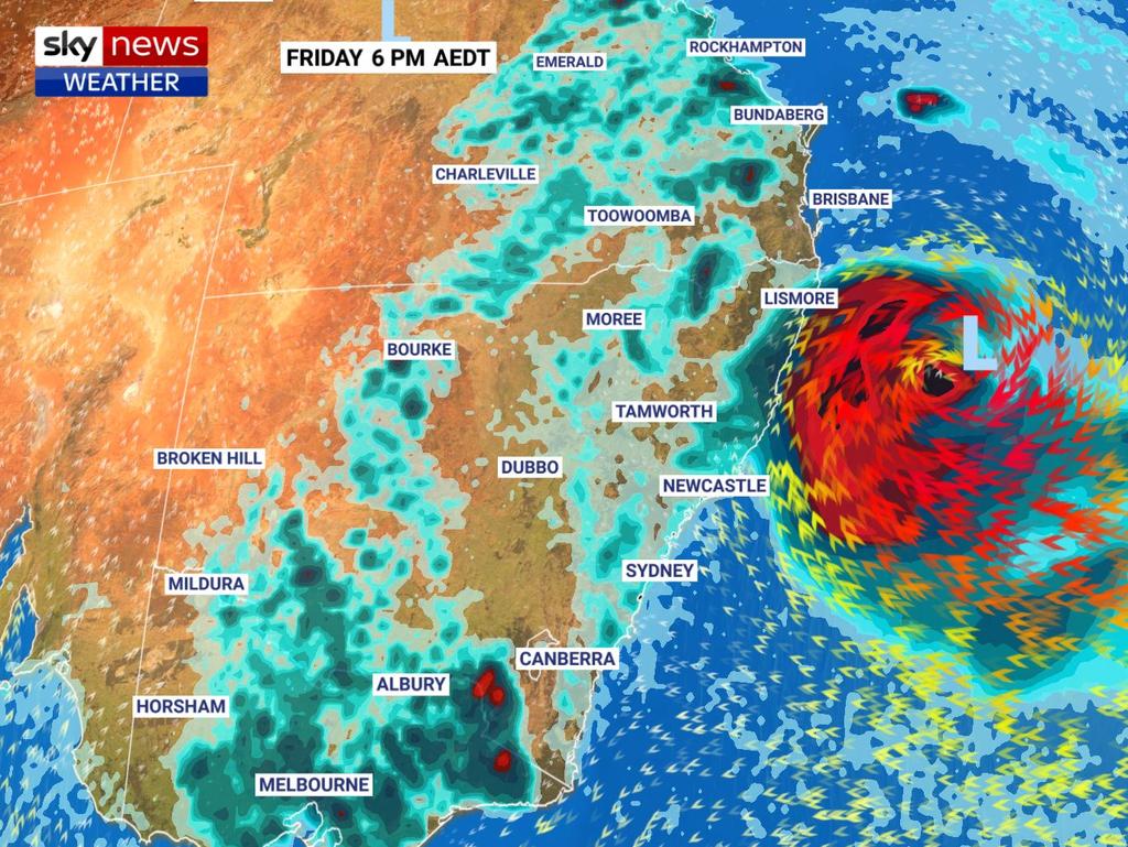
Sky News Weather Channel meteorologist Tom Saunders said the climate models over the past week had been moving back and forth on the question of how close the system would get to the NSW coastline.
“At this point, the most likely scenario is the system will stay just far enough offshore so heavy rain and gales remain off the coast,” he said.
“But it’s getting very close, and it’s something we will have to look at very closely considering the catchments in NSW are now saturated.
“If that system was to be just a little closer it could bring further flooding.”
Even if Uesi doesn’t hit Australia, it’s still going to be a hectic week of weather.
In Queensland, Brisbane could get deluged with more than 150mm of rain, days after almost 100mm came down in a single 24-hour period. Today, up to 35mm could fall, with 45mm on Wednesday and similar amounts until Friday.
Mr Saunders said a humid easterly airstream was pumping moisture into an inland trough, sending rain to central coastal parts of the state.
Some of that moisture is also making its way into NSW with wet conditions in the north of the state.
It could rain every day this week in Sydney with temperatures around the 27C mark. Tomorrow and Thursday could be stormy with up to 20mm of rain dumped on the CBD and up to 35mm in the city’s western suburbs.
Canberra could get some showers over the next few days with similar temperatures to Sydney.
Drizzle in Melbourne is forecast with top temperatures in the mid-to-high 20s this week. Friday could be stormy and wet.
It will be dreary in Hobart with scattered showers and highs in the low 20s.
Adelaide will be mostly sunny for the week. There’s no rain forecast with highs reaching 30C. Hot and sunny conditions are expected in Perth, topping out at 34C on Thursday. It will be stormy in Darwin with afternoon showers and the mercury reaching 33C.

‘Never seen before’: Shock pics of algal bloom
A federal minister has spoken out about the dead marine life from a toxic algal bloom as new pictures reveal the extent of the devastation.

Albo reconnects with Aussie icon in China
Anthony Albanese has gotten a big dose of panda diplomacy in China, reconnecting with an Aussie favourite as he winds down his state visit.

Greens demand PM act on toxic bloom
As one Aussie state continues to suffer from a “disaster” algae bloom that is putting the future of the fisheries industry in crisis, the Greens have made a simple demand from Albo.