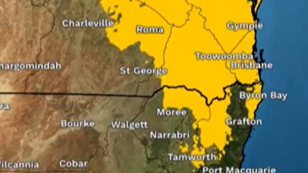
Tropical Cyclone Owen strengthens ahead of landfall as wild weather continues in south
It’s been a dramatic start to the weekend with widespread flash flooding in Melbourne, storm destruction in Sydney and a cyclone bearing down on Queensland.
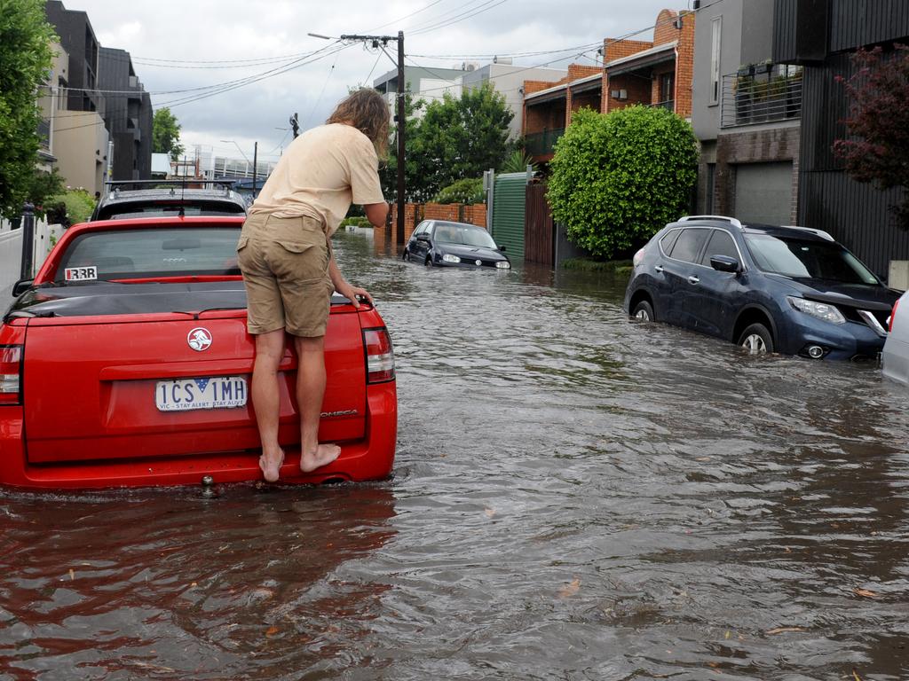
Melbourne has been hit with widespread flash flooding after the Victorian capital was drenched by a supercell storm on Friday afternoon.
Severe weather in Sydney also left a path of destruction, with State Emergency Service crews working through dozens of calls for assistance.
And in Queensland, the “back from the dead” Cyclone Owen has authorities on high alert as it builds and bears down on nervous communities in the north.
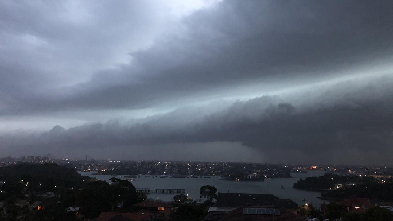
In the state’s southeast, a line of thunderstorms swept the sky earlier this evening.
Earlier, major cities across Australia’s east coast endured commuter and motorist chaos as the worst of wild weather struck late on Friday afternoon.
MELBOURNE
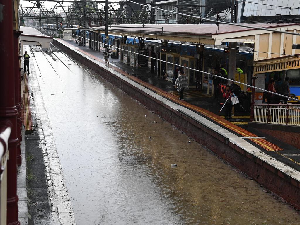
Melbourne copped the worst of it, with videos showing waterfalls of rain cascading down stairs in Flinders St as the storm swept through in just 30 minutes.
The CBD received almost 35mm of rain between 5 and 5.30pm. The havoc even took out Channel 9’s city camera.
BOM senior forecaster Richard Carlyon told The Herald Sun a millimetre a minute was very significant.
Traffic drew to a standstill on Kings Way with only one lane open.
Thousands of peak-hour passengers were stranded in the city.
The SES was called more than 200 times to areas across Melbourne between 6pm and 7pm and thousands of homes are without power.
But today’s rainfall is set to be less than yesterday’s deluge, which dumped more than a month’s worth of rain across the state including Melbourne and Wangaratta.
Maybe I won’t use that entrance into Flinders St station #melbweather #melbstorm #Melbourne pic.twitter.com/ukWXNMlaGu
— Joanna Holman (@joannamuses) December 14, 2018
Friday night on Kings Way.
— Shane McInnes (@shanemcinnes) December 14, 2018
4 lanes down to 1. And even the one lane just getting through. pic.twitter.com/vhubKa7GXY
Rain is causing havoc all over Melbourne.
— 3AW Melbourne (@3AW693) December 14, 2018
This video was just taken in South Melbourne.
Stay safe out there! #MelbourneWeather pic.twitter.com/aAK8C8h9JK
SYDNEY
In Sydney a man was killed and a woman injured in a head-on collision south of the city this afternoon as wild weather lashed the state.
The accident marked what has been a horror week of transport accidents around New South Wales.
Police said a silver Ford Falcon swerved into the northbound lane at the Camden Bypass near Narellan and collided with a black van.
The male driver of the Ford, who police believe is aged in his 30s, died at the scene.
The female driver of the van was also injured in the accident, which a police described as “a mess”, reports The Daily Telegraph.
Camden Bypass is currently closed in both directions and drivers are urged to avoid the area.
Elsewhere there was a 14km-long traffic jam at Eastern Creek westbound on the M4 following a truck rollover earlier today, 7 News Sydney reports.
On the Sydney Harbour Bridge, all lanes have reopened after an earlier car crash on the deck of the bridge.

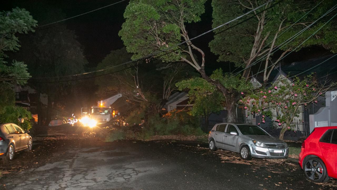
Traffic remains very heavy — southbound traffic is queued back into the Lane Cove Tunnel, while northbound traffic is queued back over the Anzac Bridge to Rozelle.
At Oxford Falls, Oxford Falls Road is closed in both directions between Wakehurst Parkway and Avoona Road due to flooding.
At Roseville, one northbound lane of the Roseville Bridge is closed due to flooding.
In good news, all northbound lanes of the M1 Pacific Motorway have reopened on the Mooney Mooney Creek Bridge after earlier flooding.
Two northbound lanes were closed across the bridge.
Northbound traffic remains very heavy so motorists are still advised to expect significant delays and allow plenty of extra travel time.
Motorists travelling on the motorway between Sydney and the Central Coast are also advised to slow down and drive to the conditions.
Ambulance Inspector John Williams urged motorists to take extra care on the wet roads this afternoon.
M1 PACIFIC MWY: Take extreme care on the mwy btwn Sydney and the Central Coast as a severe thunderstorm moves through the area. pic.twitter.com/hrss1eObK0
— Live Traffic Sydney (@LiveTrafficSyd) December 14, 2018
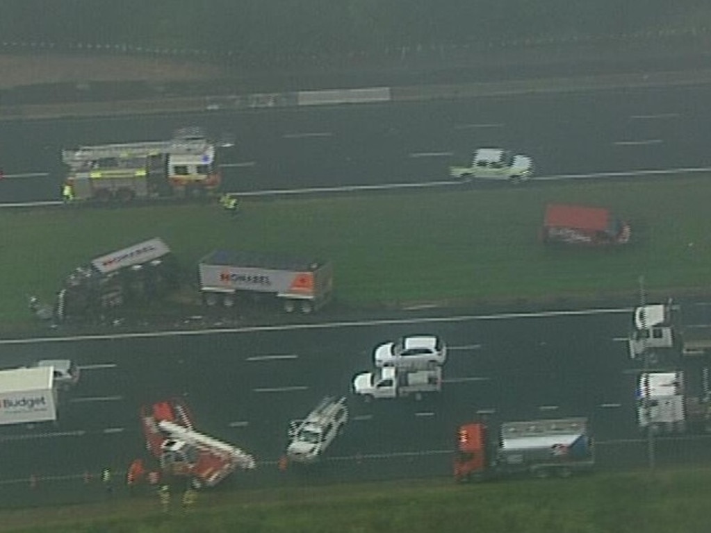
No trains are running between Hornsby and Gosford on the Central Coast and Newcastle line because of urgent power supply repairs caused by severe weather.
Buses are being organised to replace train services in both directions but are not on site.
Passengers are advised to delay their trip or allow plenty of extra travel time, listen to announcements and check indicator boards.
More than 30 flights have been cancelled while others remain grounded as people start trying to escape the city to kick off Christmas holidays early.
One stressed mum shared how there were no prams at the Qantas desk at Sydney Airport so she was “told to scavenge myself for prams at gates”.
She said she found a pram covered in mould and change tables that were urine stained before finding out her flight was delayed with a tired one-year-old.
And this is why the #humefwy Jas flooded and #sydneyairport has closed. #staysafe #takecare https://t.co/6iQYiaChxc
— Alex King (@kalu_sar) December 14, 2018
@Qantas @SydneyAirport had no prams at desk, told to scavenge myself for prams at gates, was covered in mould, change tables urine stained, now delays due to electrical storms with a tired 1 year old pic.twitter.com/IMOKYPvxZz
— Laura Pollock (@LozPollock) December 14, 2018
SPARKED BY A DANGEROUS SUPERCELL
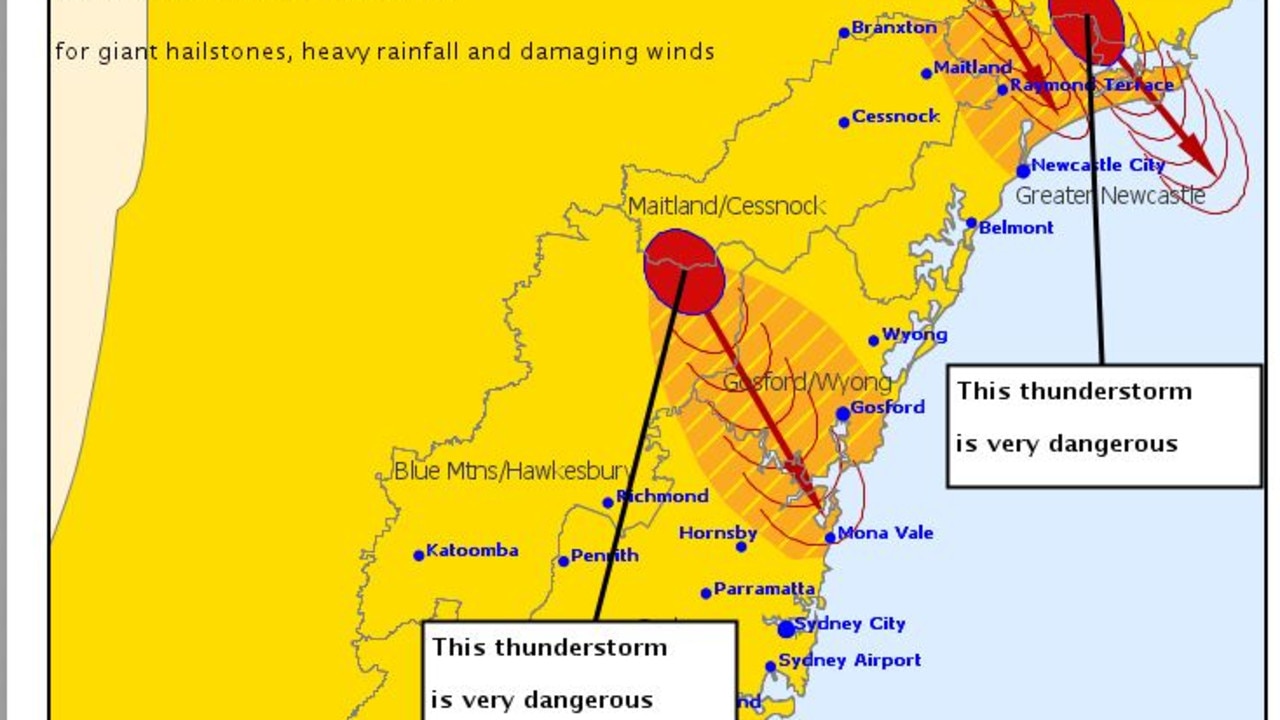
In NSW it started when two “very dangerous" supercell storm warnings were issued for residents of Newcastle and the New South Wales Central Coast.
On Friday afternoon, the Bureau of Meteorology (BOM) said a “very dangerous storm” was tracking towards Newcastle. Giant hail stones, heavy rainfall and damaging winds were predicted.
Visibility on the M1 Pacific Motorway was horrendous at 3pm as the storm rolled over.
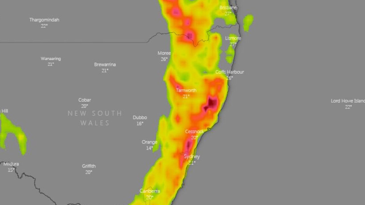
Severe thunderstorms and heavy rain was tipped to hit much of the coastline and as far inland as Orange and Tamworth.
The BOM also said almost anywhere in Victoria could see storms on Saturday.
Supercell storms often bring giant hail, gusty winds and huge downpours.
QUEENSLAND
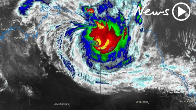
While up in Queensland much of the state’s population is set to be deluged with Tropical Cyclone Owen.
In the last 24 hours it turned back towards Queensland sporting winds of almost 200km/h.
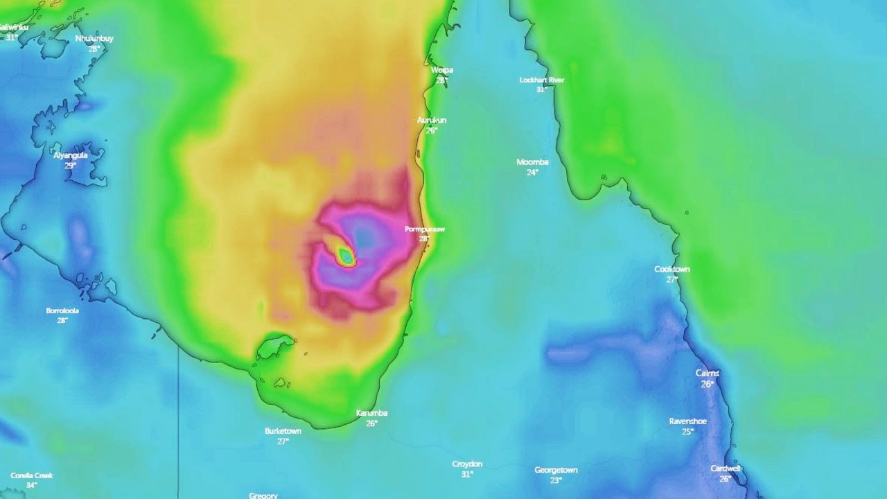
Having made the turn, it is now expected to make landfall early on Saturday morning around the south of the Cape York Peninsula.
Authorities are urging residents to head home and bed down.
Currently a category three storm, it looks set to build into a category four monster with winds of up to 280km/h over the next 24 hours.
Owen is currently sitting off the Northern Territory coast in the Gulf of Carpentaria.
Increasing in power as it sucks up moisture, it will likely make landfall a at some point on Saturday morning and then head east.
A cyclone warning is in place from Port McArthur in the Northern Territory, to Aurukun in Queensland, including Mornington Island, Karumba, Kowanyama and Pormpuraaw.
The storm is expected to become a rain depression after making landfall, with authorities warning of heavy rain with the potential to cause flooding along much of Queensland’s east coast.
“On Saturday there will be heavy falls and still some gales despite it not being a tropical cyclone at that point,” said Sky News Weather channel meteorologist Rob Sharpe.
Cairns could see between 100-150mm of rain on Saturday as Owen passes over, with Townsville copping a similar amount. It all depends on the route Owen takes, as such there is still some uncertainty as to its exact impact.
Moving into Sunday, areas further south will likely feel the brunt with Mackay and Rockhampton forecast to see as much as 120mm of rain.
#SevereStorms have developed again today! Stay abreast of the latest information at https://t.co/kbEs0gFAZX pic.twitter.com/uMLp8ouW7U
— Bureau of Meteorology, New South Wales (@BOM_NSW) December 14, 2018
A very dangerous #Storm is tracking towards Newcastle. Giant hail stones, heavy rainfall and damaging winds are likely with this cell. The situation is evolving, so stay on top of the latest advice at https://t.co/VViWGNMQCo pic.twitter.com/3RVB90b4K9
— Bureau of Meteorology, New South Wales (@BOM_NSW) December 14, 2018
Mr Sharpe said it was a wild weather event in two parts heading across most of Australia.
“Tropical Cyclone Owen is about to lash a huge portion of Queensland while in the south east we have thunderstorms rolling across the country,” he said.
Severe weather warnings have also been in place for damaging winds in Adelaide.
Some homes in Sydney are waterlogged following a short but intense storm that passed over on Thursday evening while the State Emergency Service received 650 calls with power out to hundreds of homes.
But in Perth it’s glorious sunshine, nudging 40C on Friday.
“As it moves down the coast, there will be heavy falls further south but on Monday there’s lots of uncertainty as to where the system will stall,” Mr Sharpe said.
At the moment, it’s looking like the system will stall around the central Queensland coast. If it lingers there, rather than out at sea, that could see rainfall totals shoot up into the 300mm or even 400mm mark.
Speaking on Friday, Queensland Premier Annastacia Palaszczuk pleaded with motorists not to attempt to cross flooded roads after hundreds became stranded in Victoria doing just that.
“Up in Far North Queensland, they are used to a lot of rain (but) if it is flooded, forget it.
Outside of Owen’s path, Brisbane is unlikely to see the concentrated deluge. But that doesn’t mean it’s not going to be absolutely sodden.
Friday and Sunday could see as much as 60mm of rainfall each day and Monday not much less with showers on Saturday too. Possible storms most days with a high of 28C.
WILD WEATHER TO KEEP LASHING THE SOUTH
Moving into the southern states, the low pressure system continues to swirl around several states bringing rain and storms. Its effects will be concentrated on the coasts.
“There could be wild weather on Saturday with further severe storms in eastern New South Wales and we’ll start to see the rain increasing in Tasmania with flood watches a possibility there,” said Mr Sharpe.
Up to 20mm of rain could fall on Sydney on Friday with the possibility of a storm. Heavy showers could be a feature of the weekend with maximums in the upper twenties.
A stormy Friday in Canberra could see between 30-60mm of rain. But come the weekend things will calm down with even some sun on Sunday. Highs of 28C.
#Sydney home full of flash flooding - Use #sandbags to protect your home
— NSW SES (@NSWSES) December 13, 2018
Learn more: https://t.co/8cIDKaVDie pic.twitter.com/WS6ntlk2Lt
🌩ï¸Today's Thunderstorm outlook!ðŸŒ©ï¸ A low east of Mildura is drawing moist air in from the east, posing a threat for thunderstorms this afternoon & tonight. Large hail, heavy rainfall & damaging winds are all possible, especially in the east. Warnings: https://t.co/VdkiZhNUvd pic.twitter.com/02wZEgbLuG
— Bureau of Meteorology, Victoria (@BOM_Vic) December 14, 2018
🌩ï¸Thunderstorm forecast for SaturdayðŸŒ©ï¸ Severe thunderstorms possible over much of #Victoria with greatest likelihood in Gippsland during the afternoon & early evening. Heavy rainfall, large hail & damaging winds are all possible. Storm safety tips at: https://t.co/qLSMylgaTq pic.twitter.com/65xMKnuaRP
— Bureau of Meteorology, Victoria (@BOM_Vic) December 14, 2018
Melbourne is looking at up to 20mm of rain on Friday with showers then lessening. The BOM has said a low east of Mildura is drawing moist air in from the east, posing a threat for thunderstorms this afternoon and tonight in many areas of large hail, heavy rainfall and damaging winds.
A high of 27C on Saturday and 24C on Sunday. Much of the state could see rain with some storms in eastern parts on Friday. A severe weather warning is in place for much of Gippsland, Alpine areas and south of Geelong for heavy rainfall.
As Victoria dries out, Tasmania is just getting wetter. Hobart could see rain all weekend with storms on Sunday and highs of 20-26C. Launceston could see 35mm on Saturday.
Adelaide has a severe weather warning in place for damaging winds averaging 55-70 km/h with peak gusts in excess of 90km/h on Friday, but by the afternoon conditions should calm down.
Some downpours are a possibility on the weekend and maybe even some sun with highs in the mid-twenties.
A scorching 38C in Perth on Friday then 30C on a stormy Saturday then heading into the mid-twenties on Sunday. Storms and some rain in Darwin but the city will likely escape the worst effects of Owen.


