
Tropical Cyclone Jasper to hit category 4 before weakening on Australian approach
The storm reached category 3 on Wednesday and is expected to intensify further as it heads towards Australia.
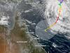
A tropical cyclone, moving towards Australia from the Coral Sea is expected to intensify to a category 4 system in coming hours.
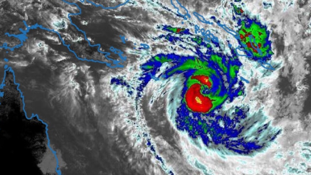
TC Jasper, as it’s been designated, intensified to a category 3 storm on Wednesday afternoon.
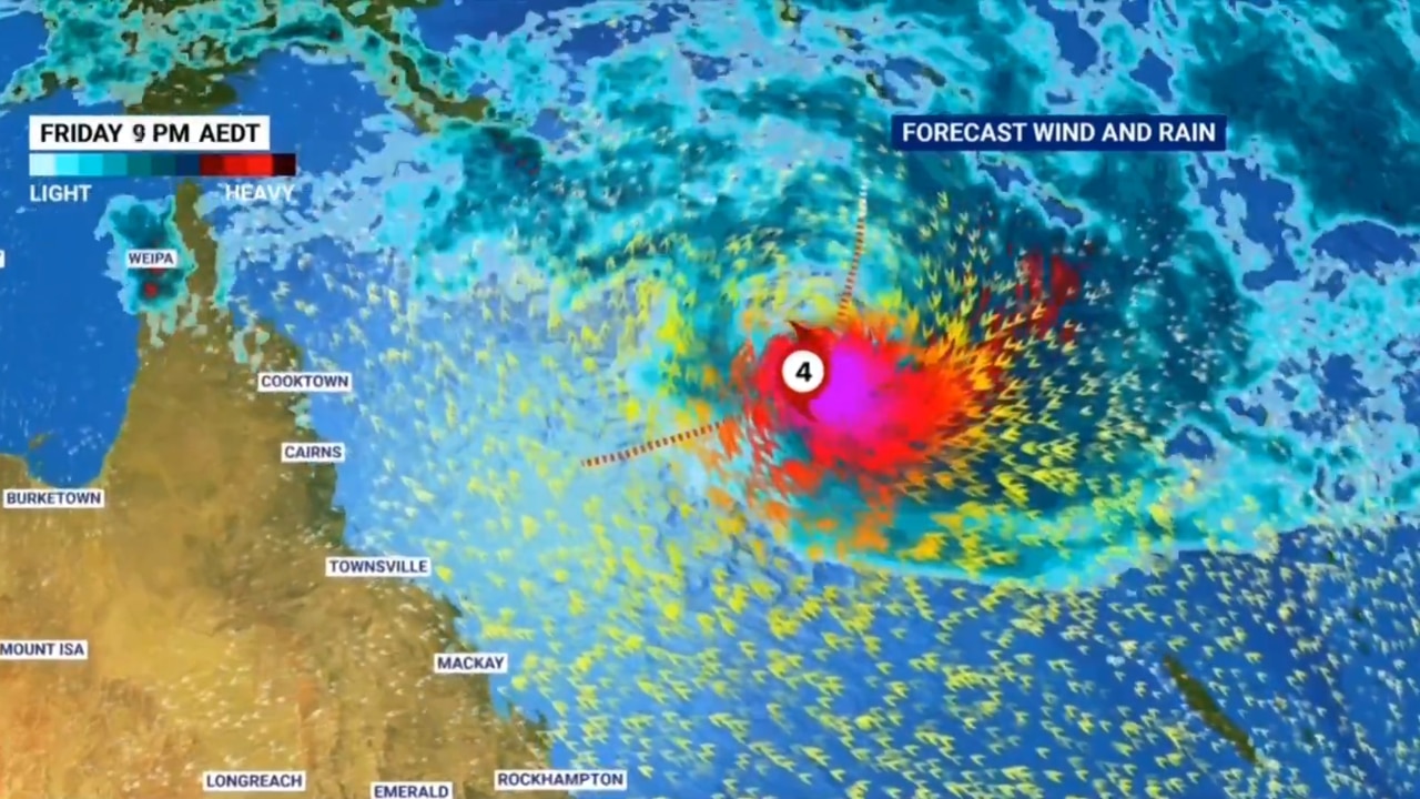
The latest mapping data from the Bureau of Meteorology forecasts Jasper strengthening further to a category 4 late on Thursday as it makes its approach towards the North Queensland coast.
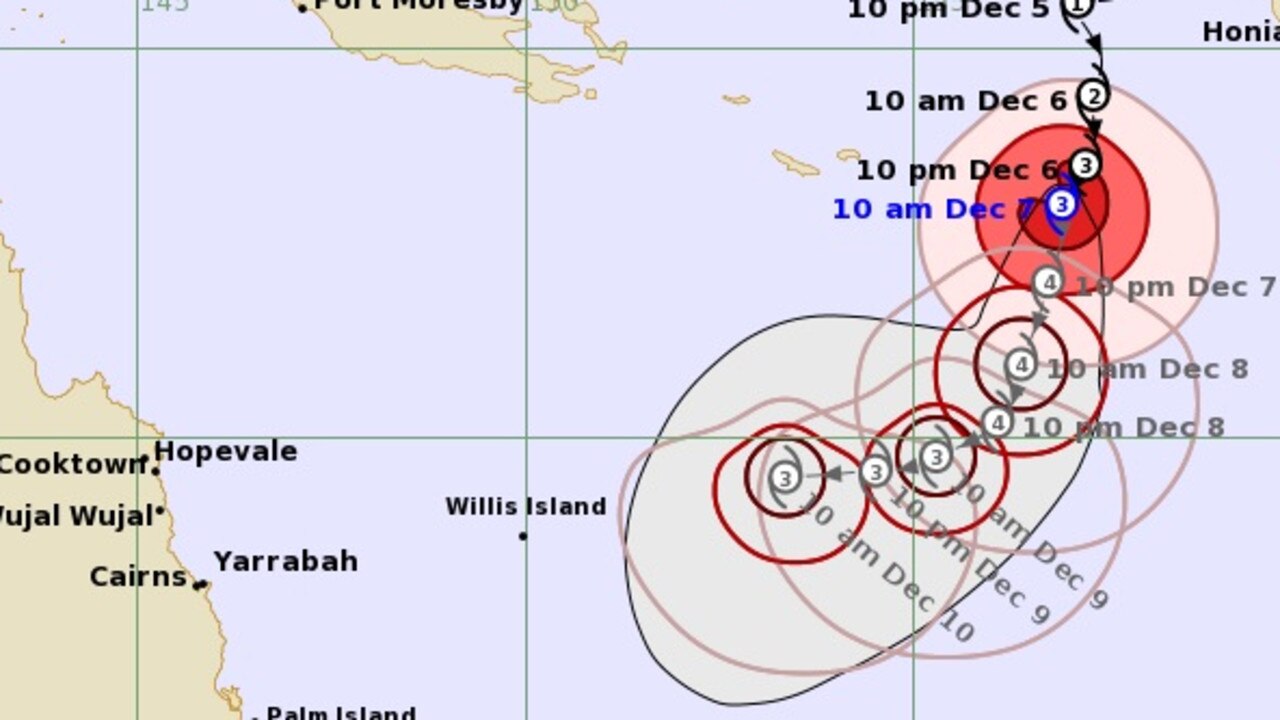
However, the bureau also predicts the system to weaken back to a category 2 by the time it begins to make landfall around Cairns some time next week.
As at 10am AEST on Thursday, Jasper was recorded as having sustained winds near the centre of 140km/h with wind gusts to 195km/h.
Its exact speed of movement wasn’t provided, aside from it being described as “slow moving”.
“Over the weekend, Jasper is likely to weaken and turn to move more to the west towards the Queensland coast,” the bureau’s latest report reads.
“While the timing and severity of a coastal impact remains highly uncertain, the highest risk of a cyclone impact lies between Cooktown and Mackay, including Cairns and Townsville.
“Communities in the region north of Mackay are advised to review their cyclone plan.”
More Coverage
The system may even reach category 5 on Friday, the highest cyclone strength designation.
Meteorologists have described Jasper as unusual, forming early for a year affected by El Nino weather events.
The next update is due at 5pm AEST on Thursday.

Millions brace for brutal cold snap
Residents in the southern part of Australia should rug up extra warm this weekend as a cold snap settles in, bringing lashings of rain and damaging wind.

Reason housing crisis could get worse
Australians are already facing a shortfall of more than 640,000 affordable homes. There’s one reason that might get even worse.

Severe frost alert for Aussie farmers
Farmers are being urged to keep their livestock warm as a freezing start to winter puts animals at risk.