
Temperatures to soar across Melbourne and Sydney
The weekend provided some relief from the punishing heat. Well, that’s over with Melbourne, Brisbane and Sydney set to roast.


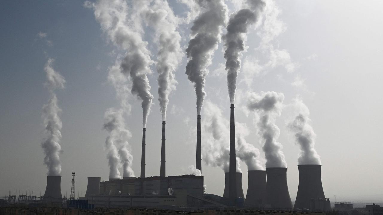
A heat spike will force temperatures to soar across much of the country over the next couple of days, increasing the risk of bushfires and pumping up the smoke haze.
While conditions eased in many places on the weekend, allowing firefighters to push back against the blazes, a spike in the mercury may undo much of that good work.
Melbourne could hit 38C today, inland Victoria is looking at 40C, while western parts of Sydney are forecast to top out at 42C tomorrow.
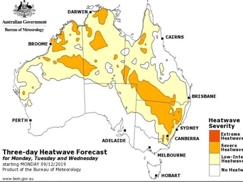
A heatwave covering vast stretches of Australia is in store for the next few days with severe heatwaves stretching across New South Wales, parts of Queensland, the Northern Territory and Western Australia.
The culprit is a fierce cold front sweeping in from the west. Ahead of it, the front is ramping up temperatures. Once it passes, the mercury could fall by as much as 20C in just a few hours.
With any cool change there can be strong winds, which won’t help efforts to control fires. The cold front is unlikely to bring any rain, and that’s what is desperately needed.
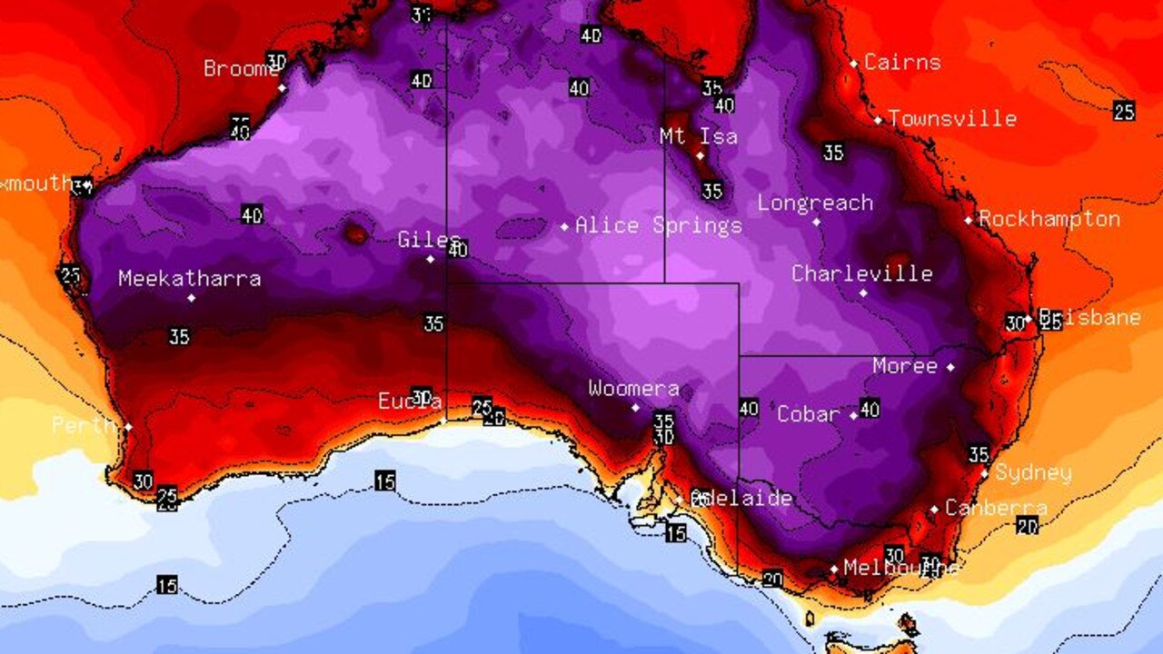
The heat is travelling from Western Australia, which has experienced a run of unusually hot weather in the first few weeks of summer that shows little sign of abating. Yesterday, that heat reached Adelaide with the CBD peaking at 38C at 4pm.
Today in South Australia is a cool by comparison 27C and that will drop to just 22C by Friday with overnight lows around 12C. It will be cloudy with some sun but no rain.
VERY HOT IN VIC TODAY
The heat action is in Victoria today. Expect Melbourne CBD’s 38C to be surpassed by the suburbs with Tullamarine reaching 39C. Bendigo could tip into the 40s, it could be up to 41C on the Murray and 43C in Mildura, where dust storms could be a feature.
The Country Fire Authority has total fire bans in place for the state’s north and northwest.
Melbourne residents should see that cool change roll in around early evening with some gusty winds but little in the way of moisture.
Cows enjoying the early sunshine before it heats up - and boy does it heat up today. Hot for all of #Victoria. A gusty cool change developing. Approximate time of change listed below. Check your location maximum temperature at https://t.co/gOqNFqa5jZ pic.twitter.com/nBki4nkTiH
— Bureau of Meteorology, Victoria (@BOM_Vic) December 8, 2019
An overnight low of 15C will lead into Tuesday where 19C will be as warm as it gets – that’s an almost 20-degree drop on the day before.
The rest of the week will be back to normal Melbourne conditions for summer so far – cloudy with the highs barely making it to 20C. There could be a dribble of rain on Thursday.
Further inland, the drop won’t be as dramatic. Bendigo’s 40C today will decrease to 31C tomorrow and then the mid-20s as the week goes on.
It’s hot in Hobart with a high of 31C today – quite a contrast to the recent snow that fell in parts of Tasmania. The cool change will come in the evening with a high of 21C on Tuesday that will set the tone for the rest of the week. Some showers are forecast towards the week’s end.
Canberra residents will likely be stricken by smoke haze for perhaps the next week, the Bureau of Meteorology has said, with a string of hot days in store.
The mercury will get to 36C today in the capital and then 38C tomorrow before reducing. But that will only be a slight decrease with temperatures unlikely to dip into the 20s before Friday.
HEAT SPIKE IN SYDNEY
Sydney will reach 28C today with possible smoke haze and poor air quality.
About 90 fires are still burning across NSW, half of which are not contained.
The majority are at watch-and-act level, but authorities are keeping an eye on two big fires in the Singleton area – the Paddock Run and Little L Complex fires – and another at Gospers Mountain in Sydney’s northwestern outskirts that has merged with neighbouring fires.
Tomorrow, temperatures will soar to as high as 36C in the CBD. But it’s in the city’s west where it will be really toasty – up to 42C in Penrith. The smoke haze in the west of Sydney is likely to be thicker than in the CBD.
Warm nights of around 19C are forecast all week.
The cold front should push through by the end of Tuesday and drop temperatures to 25C in the CBD and 30C in the west. Rain may be on the horizon with a possible storm rolling through on Friday, but it’s still not likely to fill much of the gauge or even be enough to fully dampen the blazes.
Fire danger ratings in NSW are set for high or very high on the coast, but this is a decrease on last week’s level.
Warm conditions are forecast up the NSW coast with most areas getting into the 30s on Tuesday and smoke haze lingering until the possible storms on Thursday. It will be hotter inland with Bourke potentially hitting 44C on Tuesday.
Another week in the 30s is on the cards for Queensland. A hazy Brisbane will hit 30C today and then climb to 33C midweek with rain likely only on Friday.
The Top End should be hot, steamy and stormy. Darwin will be on highs of 35C all week with afternoon rain and lows of 27C.
It will be sunny, yet again, in Perth with another scorcher of a week. Make the most of today’s 29C because the mercury will be shooting up and is forecast to hit 40C in the CBD on Friday and 41C on the weekend.
– with AAP
Extreme heatwave warning for Aussies
A very hot air mass is sloshing around the country, causing temperatures to reach the mid-to-high 40s over several states.
‘Will be hard’: Pledge to flood victims
Thousands are without power and supermarkets are limiting the sale of essentials as deadly floods smash Queensland in scenes of “incredible devastation”.
‘Hoodwinked’: China is conning the world
An Australian economist says China is conning the world on an important global issue.