Temperatures to plummet as multiple cold fronts race across continent
The next few days will be sunny and almost balmy. Savour them, it’s all a tease before cold conditions could see temps plunge to 8C.
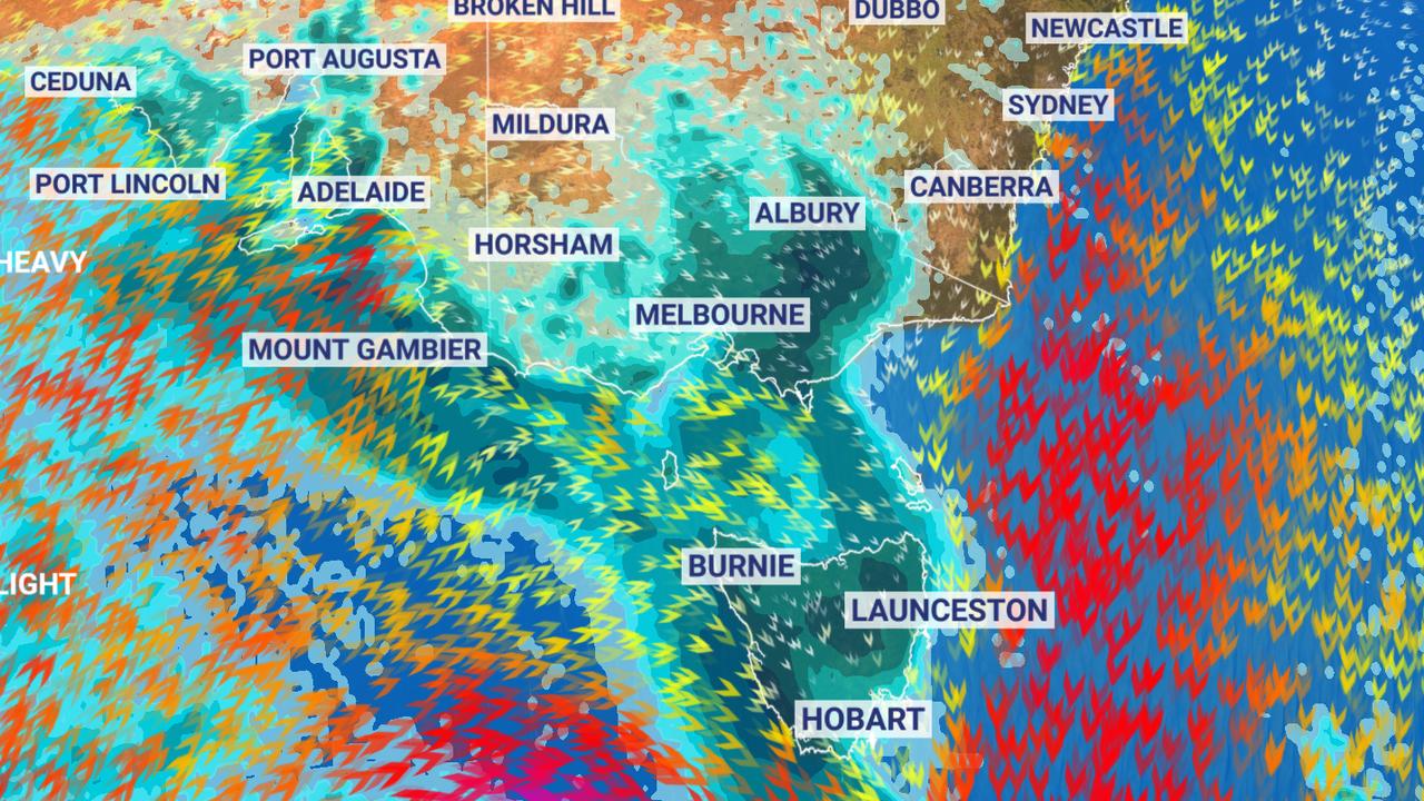
Temperatures will rise across Australia’s south and east for the remainder of the week teasing us with spring like conditions. Then, just when you’re getting used to that, they’ll plummet again taking us straight back into winter as a “wild weekend front” approaches.
Melbourne could see its maximum drop by 8 degrees in just 24 hours as the winds whip up and the rain comes down.
For Western Australians, rain will be the main feature as a soggy week continues with the coast battered by consecutive cold fronts.
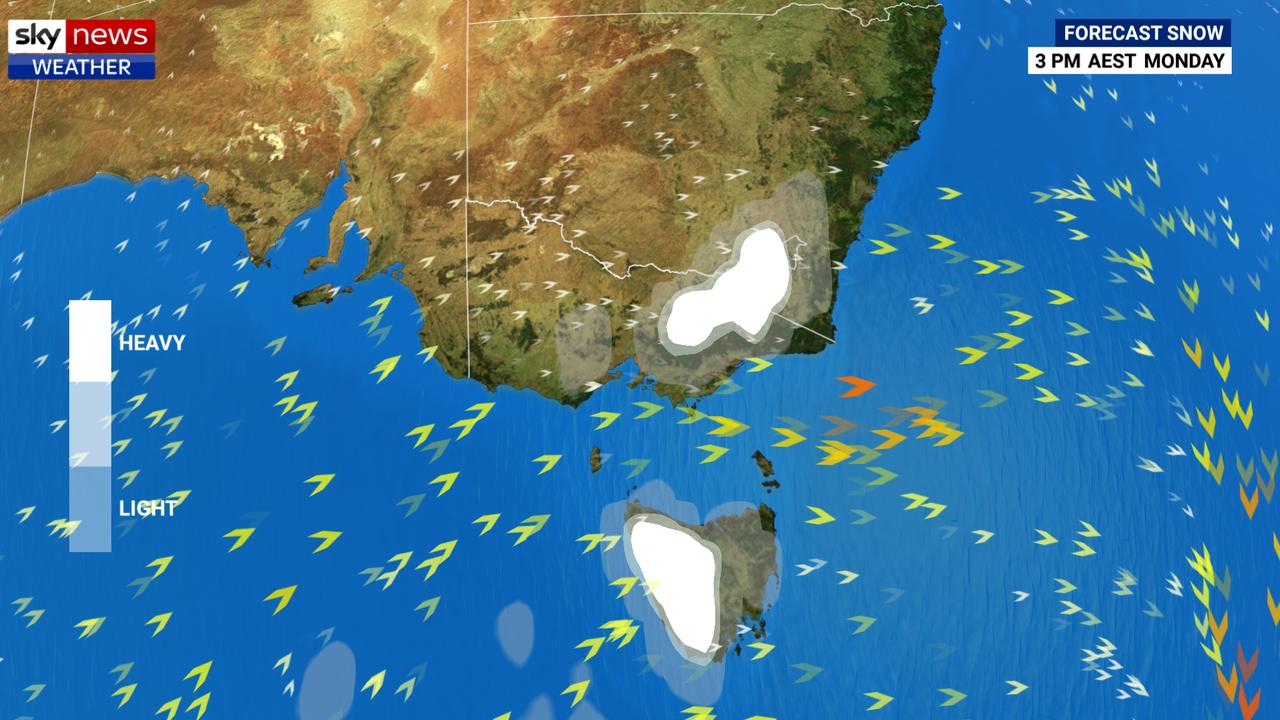
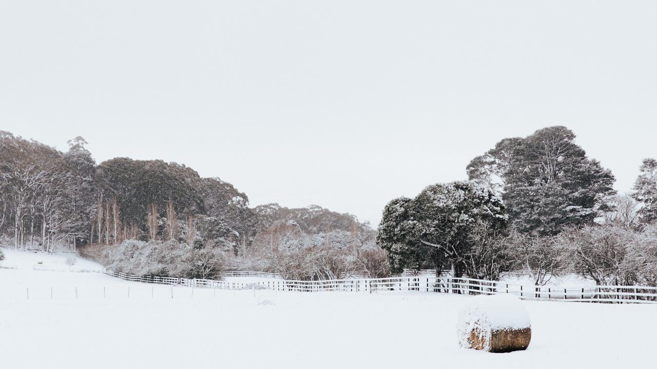
The snow will also make a reappearance in the sky above the resorts after a few days reprieve.
Not that we need much powder. The Snowy Hydro Authority took their weekly snow depth reading yesterday at Spencers Creek, a weather station located between Perisher Valley and Thredbo.
For decades meteorologists have made a weekly trek, or indeed ski, to check how deep the snow is.
And they had a whopper of a measurement this week with a depth of more than two metres. Topping out at 202.7cm, it’s the heaviest snow the station has had in mid-August for 15 years. The average for this time of year is about 160cm
At least another 25cm of snow should fall from late Sunday to Tuesday across the major ski resorts. But it may not get to such low elevations as in recent weeks.
However, before we get there things will warm up in the south east. Frost will be found in many inland areas of New South Wales and Victoria but as the week wraps up, that will be confined to higher peaks as the gauge rises.
A sunny Sydney could get to 25C on Friday, Brisbane as high as 28C on Saturday and Melbourne 20C on Sunday.
The pleasant winter temperatures are due to an area of high pressure floating about the south east bringing generally settled conditions.
“Warmer temperatures will develop over the next few days, but a wild weekend front for the south east could potentially bring severe weather,” said Sky News Weather channel Senior Meteorologist Tom Saunders on Tuesday.
Look towards the west and you’ll see where the next winter spell is brewing. Perth could see a possible storm today and then rain on Friday and Saturday as two cold fronts pass on through.
Expect potentially up to 25mm of moisture over the next week as the mercury fluctuates between 15-19C.
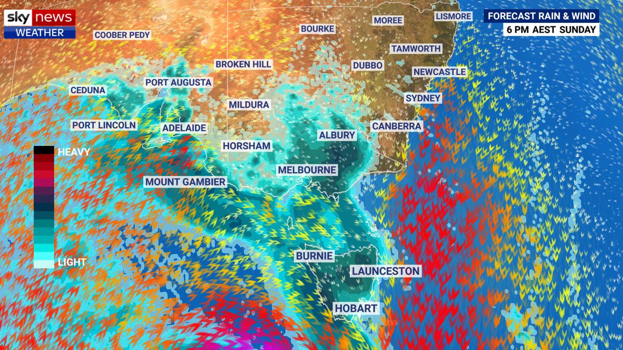
TEMPERATURES SET TO DROP
“This cold front will then race across The Bight on Saturday and ahead of it a strengthening northerly air stream,” said Mr Saunders.
“The first front will bring rain on Thursday and Friday to south eastern Australia. Then a gusty westerly change will come through South Australia early on Sunday and then into Victoria and NSW.”
That will lead to a kind of seesawing in temperatures across the southeast with higher and then milder temperatures on subsequent days. Around the end of the weekend, the mercury will then make a more substantial drop.
For Adelaide that means a high of 19C on Thursday, down to 17C on Friday, 20C on Saturday dropping to 16C on Sunday and then a maximum of a mere 13C on Monday.
Lows will be between 8-11C on the weekend. Up to 25mm of rain could fall from Sunday onwards.
A chilly 14C in Melbourne on Wednesday and Friday, 16C on Thursday, 17C on Saturday and a balmy 20C on Sunday. Look out for some wind and the odd shower. Then it all changes late on Sunday, with Monday barely reaching 12C combined with a high chance of showers. Early on Saturday morning it could get down to 7C.
The multiple fronts will see Hobart reach 16C on Thursday and 17C on Sunday but just 12C on Friday, 14C on Saturday and a bracing 11C on Monday. Lows down to an almost freezing 2C on Saturday morning.
Canberra will be in the mid teens reaching 18C on Sunday and then just 12C for the start of the week. Some freezing mornings too.
A warm and sunny Sydney will steadily rise from 20C on Wednesday to 25C on Friday, then drop to 19C on Saturday and into the new week. Lows of 7C this week but a warmer 12C next week.
Warm and bright in Queensland with Brisbane seeing 24C on Thursday, 28C on Saturday and 29C on Monday with lows of around 12C.
Around 32C and sunny in Darwin with lows of 22C.


