
Sydney’s near-record temperatures, Melbourne’s fire warning and SA still recovering from wild storm
SYDNEY is bracing for near-record temperatures, Melbourne has a fire danger and a severe storm has continued to wreak havoc on South Australia.

SYDNEY is bracing for near-record December temperatures, there is fire danger in Melbourne and a severe summer storm has continued to wreak havoc on South Australia. Welcome to the Australian summer.
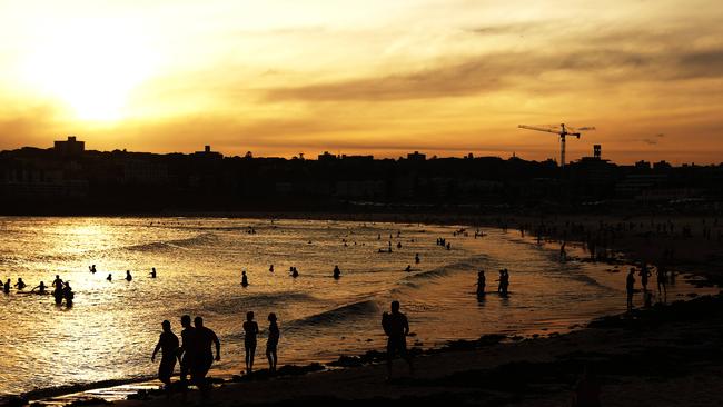
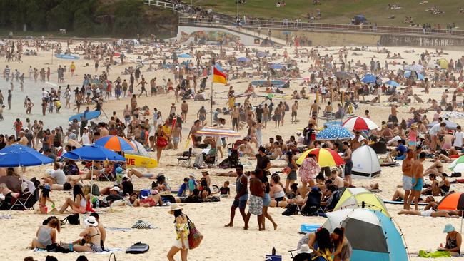
The Bureau of Meteorology is predicting temperatures in western Sydney of 42C today, which will fall just short of the hottest December day ever — Richmond recorded 43.7C on December 21, 1994.
Sydney city will be slightly more tolerable with temperatures peaking at 37C, which is 5.2C cooler than the record 42.2C day on December 20, 1957.
A bureau spokesman said there would not be much relief in the coming days, with 35C predicted for Friday, while New Year’s Eve will reach 30C.
“For all intents and purposes, New Year’s Eve will be a hot and humid one,” he told news.com.au.
“The good news is the temperatures will drop back to 24C by Monday.”

With near-record December temperatures, NSW Police has issued a “heatwave action plan”.
“If you can, it’s a good idea to spend some time in an airconditioned building,” the statement read.
“Everyone needs to take care in hot weather but some people are at higher risk of heat illness, especially if they are older, live alone or are socially isolated.”
Residents are urged to avoid the sun during the hottest part of the day, remain hydrated and limit physical activity.
Signs of heat-related illness include: confusion, dizziness, fainting, nausea, vomiting, weakness, headaches and sweating.
VICTORIA
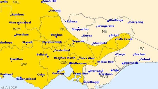
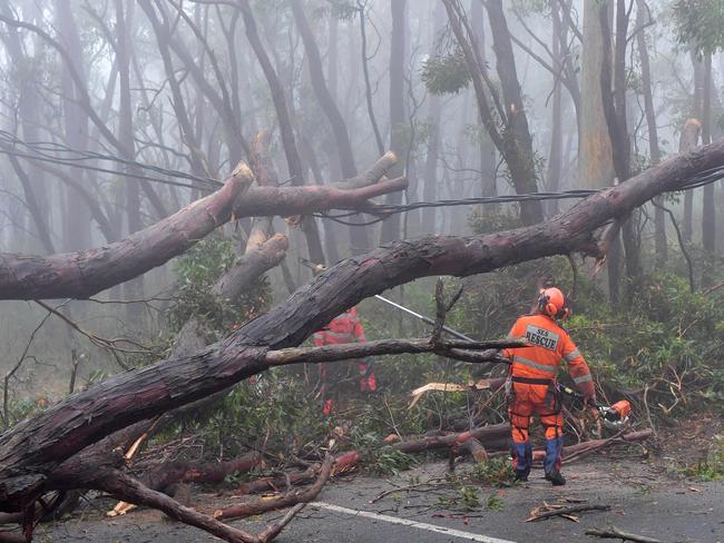
Victoria can expect humid conditions to continue today, with the chance of strong winds and thunderstorms this afternoon.
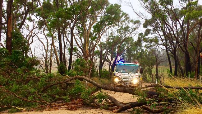
While rainfall up to 50mm is expected throughout the evening, 120km/h winds in elevated areas increase fire danger for Victoria’s north, west and central areas.
A spokeswoman for the bureau said relief from the humidity would come later in the day.
“There is an inland trough pushing across the state, with the highest chance of thunderstorms in central Victoria — including Melbourne,” she said.
“Conditions will increase in the afternoon and continue early into Friday morning.”
Despite suffering a hot 27C on Wednesday, Victoria can expect temperatures to drop in the coming days, with 24C predicted for New Year’s Eve.
SOUTH AUSTRALIA
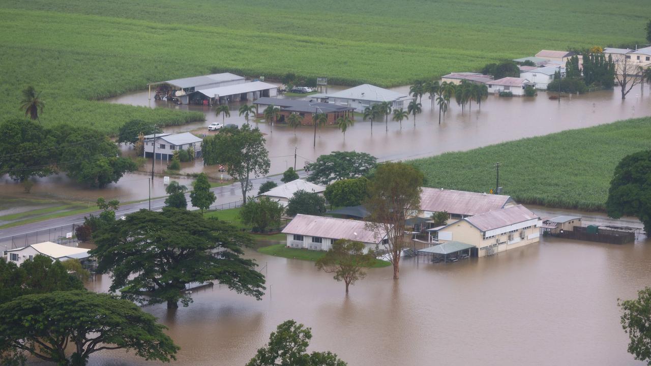
Tens of thousands of homes are still without power, as residents recover from the devastating summer that left a path of destruction across parts of South Australia.
The once-every-three-year event saw heavy rain and destructive winds damage homes and property, with primary producers set to lose millions from damaged crops.
At its peak, 125,000 households were without electricity and the State Emergency Service fielded 1600 calls for assistance.
The storm resulted in the second highest December rainfall for Adelaide, while 120km/h winds destroyed trees and powerlines.
Port Augusta was one of the worst hit areas with its main street becoming flooded after 25mm of rainfall between 6pm and 7pm.
As flows in the River Murray remain high, the SES says water levels are likely to cause minor flooding between Cadell and Mannum.
The storm is the latest setback for primary producers, with hail destroying vineyards, stone fruit and citrus in the Riverland last month and October floods abolishing vegetable crops in the Adelaide Plains.
Primary Producers SA chairman Rob Kerin said the damage from the storms could see prices fall between $50 and $80 a tonne due to a significant downgrade in quality.
“When you’ve got a year like this and you have a fantastic crop sitting out there and have a big rain like this one it’s pretty disheartening,” he told The Advertiser.
Grain Producers SA chief executive Darren Arney predicted the storms would cost growers $100-$200 million.
“Where lots of the rain has fallen, either farmers have finished or are halfway there, but there’s still 3 million tonnes of grain yet to come in,” he said.
How do you plan to escape the heatwave? Continue the conversation with Matthew Dunn on Twitter or Facebook.
Top 10 Aussie beaches revealed
Move over Bronte and Byron Bay, Australia has a new best beach according to the national tourism council
Wild weather leaves passengers stranded
Passengers hoping to get a flight out of a popular holiday spot have been turned away after a regional airport closed its doors amid wild weather.
Jo has $0, no bank account and no bills
Jo Nemeth quit her corporate job ten years ago and has managed to live without a single cent to her name since. But one issue is threatening to disrupt her way of life.