
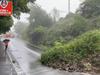
Sydney weather: Heavy rainfall, flooding as new severe weather warnings issued for Northern Beaches
A “life-threatening” storm has hit Sydney‘s northern beaches, with thousands in Manly on alert for evacuation orders.
Roughly 2000 residents in Manly on Sydney’s northern beaches have been told to prepare to evacuate as the Manly Dam threatens to spill over.
NSW Premier Dominic Perrottet said an evacuation order for low-lying properties in the suburb was imminent, but NSW SES clarified at 3pm the alert had been downgraded.
SES Commissioner Carlene York warned conditions could worsen into the night.
“[Residents should] ensure that they are ready to evacuate if we move from a warning to an evacuation order. The rain and thunderstorms have not finished yet. Today there is a chance that [the dam] may go over that area and we may go back up into that evacuation order,” she said.
The Manly Unit of NSW SES warned that residents who need to relocate can access the Seaforth Village Community Centre in the Seaforth Town Centre. The Northern Beaches Council said Freshwater Surf Life Saving Club was also open for people who may need to evacuate.
122mm has already been recorded today at neighbouring Mosman in the six hours to 1.30pm.
The Bureau of Meteorology warned of a “tough 48 hours ahead” for Sydney, with 60,000 people subject to evacuation orders and warnings across the affected areas, according to emergency services.
Stream more weather news live & on demand with Flash. 25+ news channels in 1 place. New to Flash? Try 1 month free. Offer ends 31 October, 2022 >
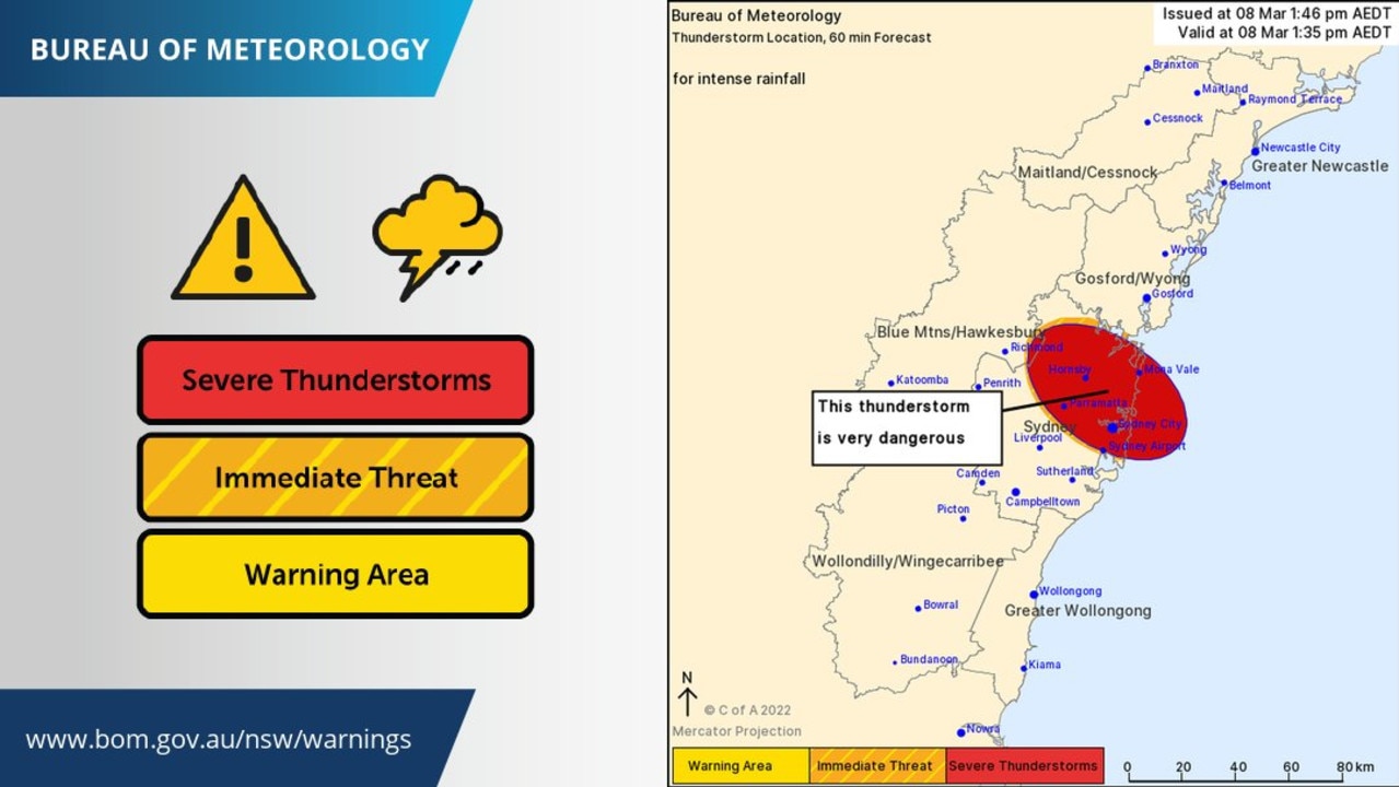
The Bureau of Meteorology warned Sydneysiders to avoid commuting.
“Intense rainfall is likely to lead to dangerous and life-threatening flash flooding. Take care on the roads if you have to be out,” the official weather service said at 1.55pm.
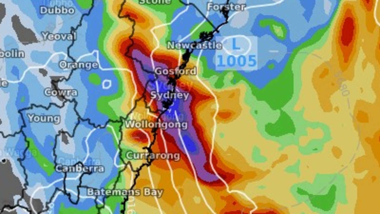
People from the Central Coast to the Illawarra, Blue Mountains, Shoalhaven and Metropolitan Sydney were all urged to batten down the hatches.
“While the rain will clear from the Hunter and eventually the Sydney and Illawarra area tonight, we’ll see the winds really start to pick up into tonight and early tomorrow morning, particularly around the Illawarra escarpment and through the Sydney metropolitan area and coastal communities,” Bureau of Meteorology senior meteorologist Dean Narramore said in an update on Tuesday.
“We could see winds gusting in excess of 90km/h and that’s enough to bring down trees and power lines and with soils already saturated, trees are likely to come down, particularly in hilly areas. Travel is definitely dangerous today, not only because of rainfall but tonight we’ll see possible trees and powerlines down and land slips and flooding of roads.
“It’s still dangerous times out there. If you find a flooded river or creek or causeway, if it’s flooded, forget it. It’s just not worth it. It’s too dangerous out there.”
Mr Narramore said there was “a tough 24 hours or even 48 hours ahead”.
âš ï¸ Severe Thunderstorm Warning update: currently the heaviest rainfall is over the #Illawarra & northern #SouthCoast districts. The situation is being monitored closely, and warnings for intense rainfall may be issued if required. Updates: https://t.co/jJWt2w3VPLpic.twitter.com/HVv2D8ppVr
— Bureau of Meteorology, New South Wales (@BOM_NSW) March 7, 2022
Sky Weather chief meteorologist Tom Saunders also warned Tuesday would be “a critical day with heavy rain set to worsen the flood situation along many parts of the NSW coastline, with a heightened risk of flash flooding, damaging winds and damaging surf developing by the middle of the week”.
“Another low pressure system is forming near the NSW coast, an east coast low drifting down the coast on Tuesday. What’s critical is where that lands,” Mr Saunders said.
Sydney has seen 439.8mm of rainfall in the past fortnight, he added, “a season’s worth of rain” that doesn’t appear to be going anywhere just yet.
The Bureau of Meteorology urged people across the NSW coast and in greater Sydney to prepare for the worst.
“Of particular concern are the already saturated catchments we have from the Hunter all the way down to the Hawkesbury-Nepean and even into the Shoalhaven and Wollongong areas,” Mr Narramore said.
“We’re looking at flooding similar to last week on some parts of the river and in other areas it could be worse than what we saw last week, similar to what we saw in March last year.”
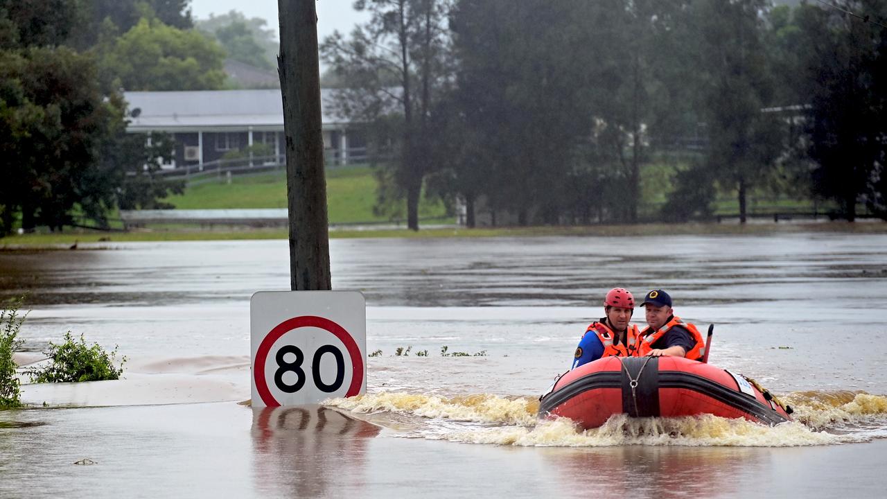
In March 2021, the then “unprecedented” rainfall required thousands to be evacuated from their homes. Tragically a 25-year-old man also died after his car got caught in floodwaters in Sydney’s northwest.
“In Richmond we‘re seeing major entering and with the rain we could see it increase further today with rainfall there, currently exceeding levels we saw last week and approaching levels we saw in March 2021,” Mr Narramore said.
“So really, residents on or near any rivers, creeks or streams, particularly these rivers, if you were impacted last year or last week and you haven’t been already, those rivers are still rising.”
The Bureau predicts heavy, “intense” rainfall across eastern NSW, with damaging winds in excess of 90km/h an additional risk from Tuesday morning, while the State Emergency Service (SES) also called for residents in affected areas to be on alert.
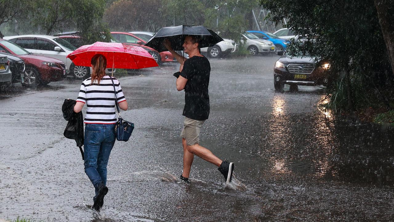
Conditions worsened on Monday night in areas including the Mid North Coast, Hunter, Sydney, Illawarra and South Coast. Landslides, thunderstorms and flooding were affecting multiple areas.
“Heavy rain may cause flash flooding, and river heights could rise rapidly over and above what has been experienced in the past few days. This could happen during the night,” the SES said late Monday.
“Strong winds are expected which could cause trees and powerlines to fall. Landslides are also possible, which could block roads.
“If you live on or near a river, creek or stream, or an area at risk, particularly if it’s already in flood, stay up to date and be ready to take action.”
Evacuation alerts
There are evacuation orders in place for “parts of” these Sydney suburbs:
- Chipping Norton
- East Hills
- Georges Hall
- Holsworthy
- Lansvale
- Milperra
- Moorebank
- Warwick Farm
- Sandy Point
- Pleasure Point
- Picnic Point
- Camden
There are also alerts for people in the low-lying parts of St Georges Basin and Sussex Inlet on the South Coast.
If you live in one of these areas, the exact locations the orders are in place for, as well as additional information, can be found on the NSW SES website.
Two bodies found in Wentworthville stormwater canal
Police have found two bodies in a stormwater canal in Wentworthville in Sydney’s west, the first people to die since the city’s flood emergency began.
The grim discovery was made after a car was found nearby on Monday afternoon in the Coopers Creek Canal, with emergency services searching for the occupants - a mother and son.
The bodies are yet to be formally identified, but belong to a man and a woman.
A crime scene has been set up at the end of Hopkins Street near Toongabbie Creek.
âš ï¸Dangerous driving conditions tonight into tomorrow as bursts of heavy rainfall will likely lead to flash flooding across Sydney roads. Take extra precaution when driving, and never drive through flood water. For details on current road closures go to https://t.co/H6HkaVY637pic.twitter.com/l21v6g6Ceo
— Bureau of Meteorology, New South Wales (@BOM_NSW) March 7, 2022
Latest advice from Transport NSW
Transport NSW has urged motorists to avoid non-essential travel if possible as “more traffic is expected”, along with disruptions to the rail network.
Acting Transport for NSW Chief Operations Officer, Mark Hutchings, said for those that do need to use the roads please stay vigilant and slow down when you are travelling.
“Unprecedented rainfall has seen widespread damage to our road network over the past week and with the wet weather to continue we are asking everyone to be safe when travelling,” Mr Hutchings said.
“It takes twice as long to slow down your vehicles in wet weather, significantly increasing your risk of a crash. So slow down, leave a four second gap between you and the vehicle in front.
Around 20 state roads are currently closed across the network, with Transport NSW asking that people delay their travel if possible and if they are out on the roads please plan ahead.
“To help with congestion around Sydney, Transport for NSW has opened the T2 and T3 lanes for use until 11.59pm on Friday,” Acting Transport for NSW Chief Operations Officer, Mark Hutchings, said.
“Another reminder for anyone using public transport please be advised there will be delays and cancellations across the rail network this week due to flooding. If you are on the network please plan ahead and leave plenty of extra travel time.”
Executive Director Customer Coordination and service delivery, Roger Weeks, said delays heading into and out of the regions should be expected as flooding continues to impact major roads.
“Road crews are on the ground assessing the damage this week where they can but we are expecting more rain which makes repairs difficult and can mean closures on short notice,” Mr Weeks said.
“These crews are doing all they can to keep motorists safe, please show them your respect and understanding – these are people who are working every day and in a lot of cases are also affected by flooding.
“When you do come across a closed road, please do not just drive past the barrier or sign. It is closed because it is dangerous, and by driving on closed roads you are putting not only yourself but our traffic crews at risk.
“We have dedicated teams at the Transport Management Centre and State Emergency Operations Centre monitoring the severe weather and are responding to any incidents in real time.
“We are also working with our Government partners as we move into the recovery phase and we begin to understand the full impact the weather has had on our roads and infrastructure.”
‘Bathtub effect’ could turn flooding deadly
There are also fears the heavy rainfall could trigger renewed flood risks for the already embattled areas along the Hawkesbury, Nepean and Colo Rivers.
Minor to major flood warnings have been issued for the Hunter River and Wollombi Brook at Bulga, Singleton and Maitland, with warnings around the Hawkesbury Neapean Valley area.
River levels back up along parts of the Hawkesbury. Complete inundation of a number of ski parks near Wisemans Ferry. I’m with the good people at the @NSWRFS doing supply drops to residents in Lower Portland this morning. @9NewsSydpic.twitter.com/TqmJQLvNgE
— James Wilson (@WesternWilson9) March 6, 2022
The NSW SES and NSW BOM warned this could lead to a dangerous “bathtub effect” in which broad rivers suddenly narrow which may choke the water flow and lead to flooding.
Areas in the Hawkesbury-Nepean Valley flood plain are prone to some of the most severe flood risks across Australia because five of the major tributaries flow through the area. This includes the Warragamba, Colo, Nepean, Macdonald and Grose Rivers.
Explaining the effect, Sky Weather’s Mr Saunders said the water becomes prone to pooling as it’s unable to reach the sea from the inland areas.
“This is called the ‘Bathtub Effect’, where water backs up and starts filling the flood plain because there’s only one plug hole letting the water out,” he said.

“Flood waters back up into the creeks into the valley and flood islands form as flood waters rise.”
NSW SES have urged residents across the state’s coast and northern inland to prepare their properties. Properties which may be cut off due to rising water levels or flash flooding have been advised to stock up on essential supplies like food, fuel and medicine.
Farmers have also been asked to lift pumps and relocate livestock and equipment to higher ground.


