
Sydney temperatures to soar close to 40C as fire danger set to catastrophic
Weather warnings have never been this dangerous for Sydney, with “exceptionally dangerous conditions” stretching up and down the east coast.

New South Wales is facing a run of weather so severe, and so searingly hot, it could be “history making”, forecasters have warned.
On Tuesday, Sydney’s CBD, which is normally cooled by sea breezes, could top close to 40C, at least 13C hotter than the average November day.
And even when the heat passes, the cold front and rain that will follow could actually have the opposite effect to damping down the fires.
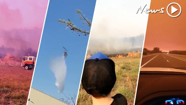
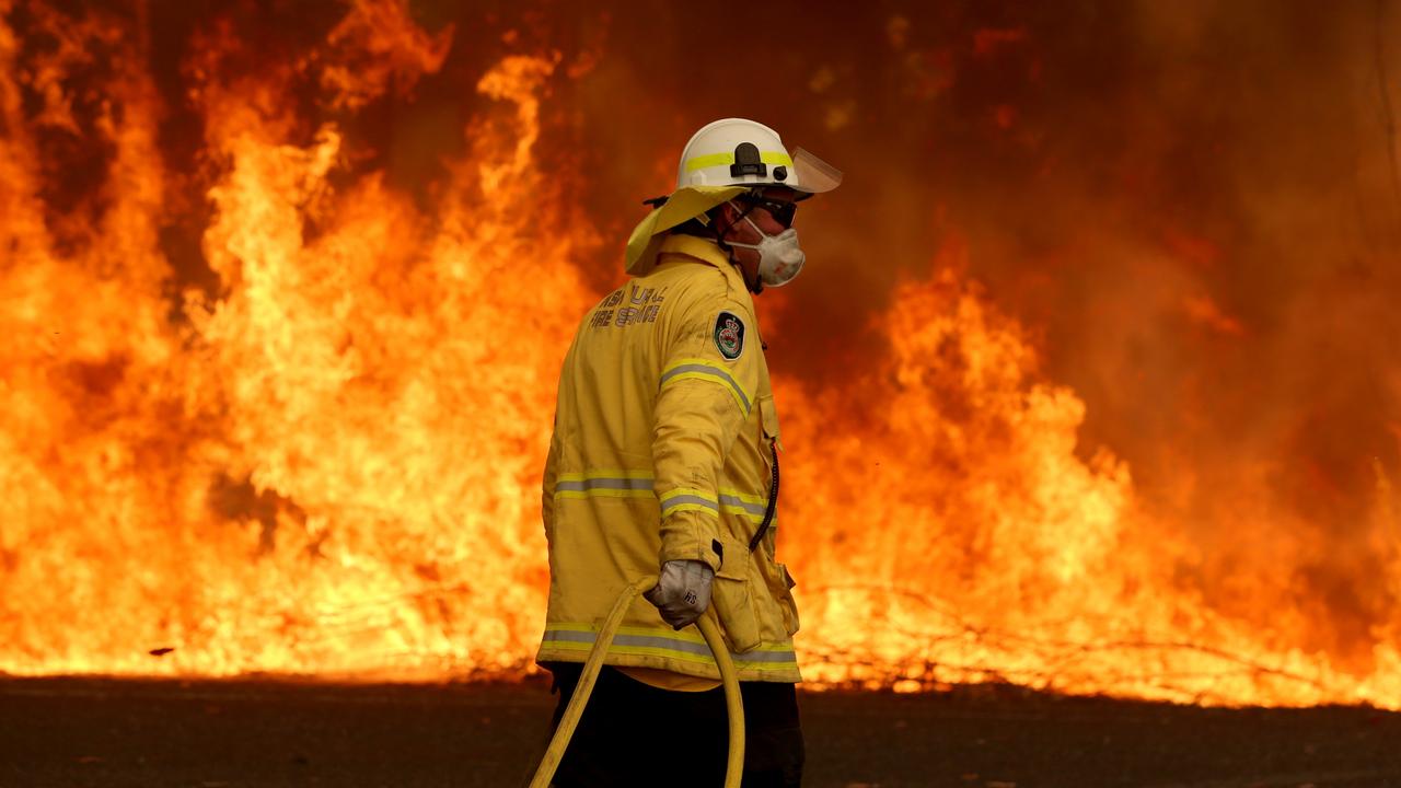
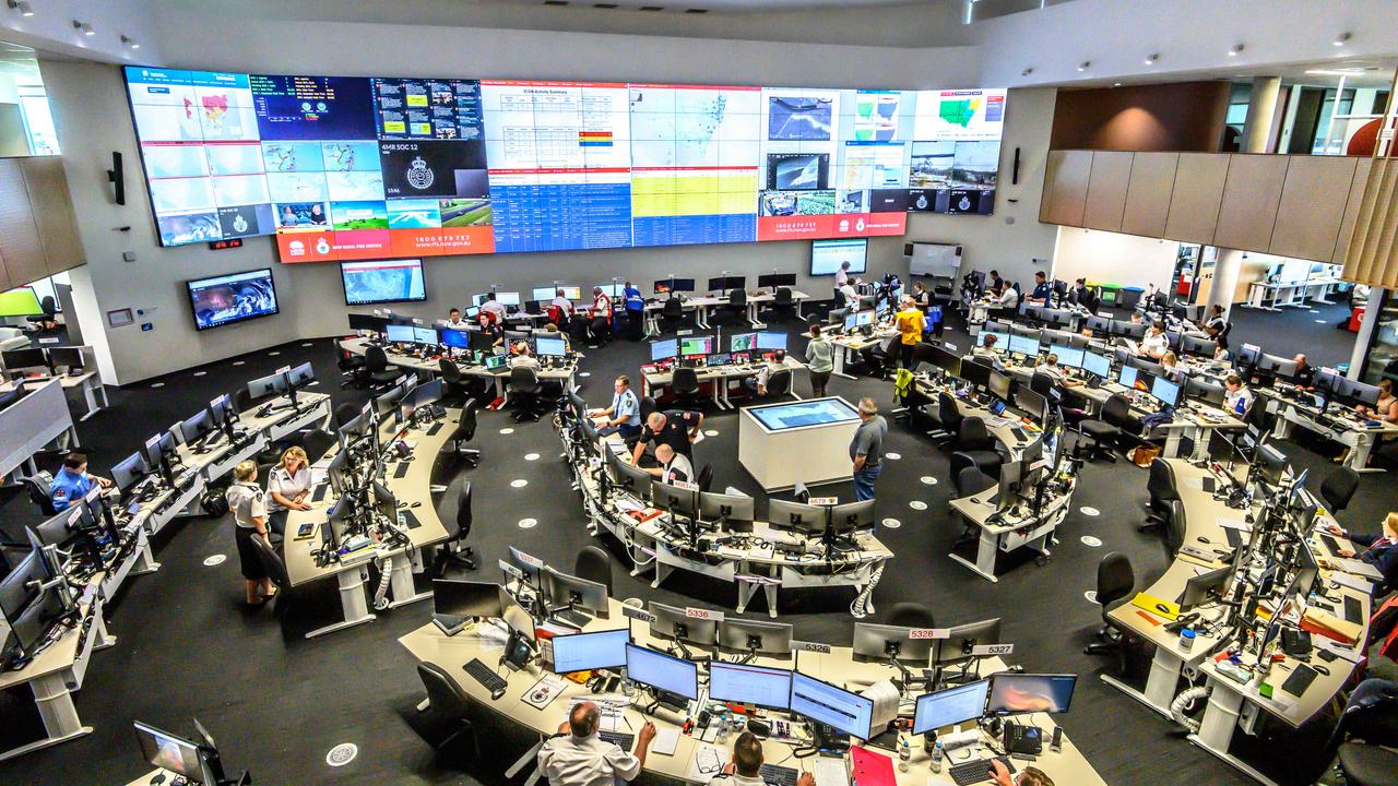
Three people have died and 150 homes have been lost in the state due to the bushfire crisis. Scores of schools will be closed in NSW, while the train operator is assessing which services can run as they pass through the fire zone.
Today there are 64 bushfires burning in NSW – 40 of those are not yet contained, and the Rural Fire Service (RFS) is warning they won’t be by the time the temperatures spike and winds of up to 45km/h roll through tomorrow. There is a total fire ban in the state.
“We’re in the midst of a history-making event as the fire situation continues to unfold,” Sky News Weather Channel meteorologist Rob Sharpe said this morning.
He told news.com.au that the sheer number of bushfire warnings alongside the “catastrophic” level warning for Sydney had simply not been seen before.
“It’s very likely that further homes will be lost and that this could end up being a devastating event for many people,” Mr Sharpe said.
FRONT TO HIT SOUTH FIRST
The heat is rising ahead of a powerful cold front that is moving towards eastern Australia from the west. That will affect South Australia first where temperatures will jump in the city on Monday to 34C before the change hits in the evening.
It will be a big change, too. On Tuesday, Adelaide will see a high of just 17C, some 16C cooler than the day before. And there it will stay for much of the week with lows of around 11C. A fire weather warning is in place.
Melbourne will see a top of 28C on Monday, but it will then drop to a maximum of just 17C on Tuesday as the cold front comes through, bringing with it a sprinkle of rain. Mild, below-average temperatures are forecast for the rest of the week in the Victorian capital.
A severe weather warning is in place for higher ground in the east of the state as those strong, damaging winds rattle through.
A high of 24C is expected in Hobart on Monday before the temperature drops to just 15C on Tuesday with scattered showers ahead of a mild week with cool mornings.
Canberra is warmer with a high of 26C on Monday and 28C on Tuesday. But it will be windy tomorrow as the cold front continues its journey north. A high of 21C is forecast on Wednesday before temperatures return to the mid-teens for the rest of the week.
CATASTROPHIC CONDITIONS IN SYDNEY
Then, somewhere between Canberra and Sydney, it all gets a lot more hairy. The cold front begins to suck in hot desert air rather than cooler air from the south, and the mercury starts to climb far into the 30s.
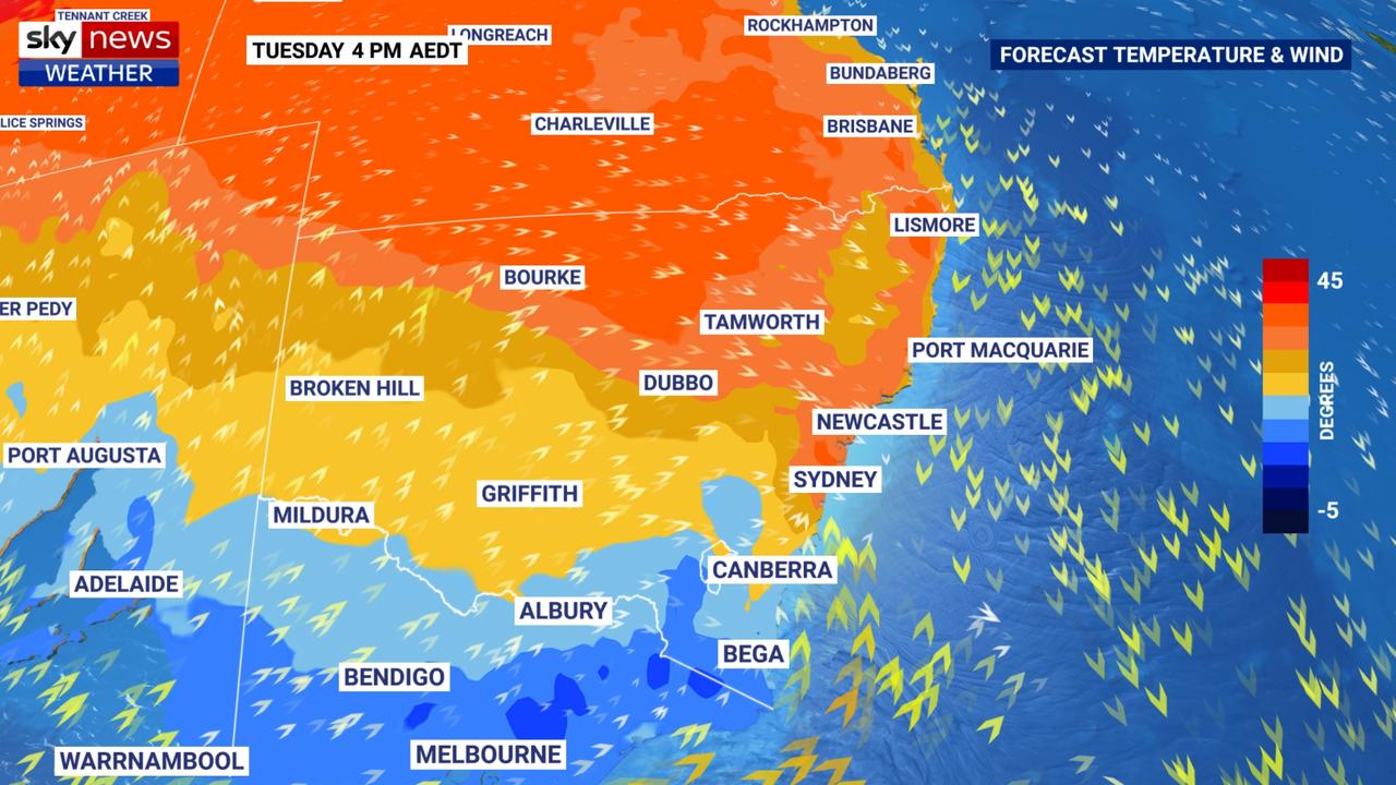
Monday’s high of 27C will be very average for Sydney, but Tuesday’s 37C – and 38C in the western suburb of Penrith – is not. Newcastle is also expected to hit 37C and Wollongong 36C. This time of year, November highs of 23C are what’s expected.
A statewide total fire ban is now in force. That means no fires out in the open anywhere in NSW, for all of Monday and Tuesday. Very dangerous conditions are forecast for tomorrow. Use today to get ready. #nswrfs #nswfires pic.twitter.com/1NSavdxaNx
— NSW RFS (@NSWRFS) November 10, 2019
At 6am there's 64 bush and grass fires across NSW, 40 not yet contained. Many of these fires won't be contained ahead of tomorrow's dangerous fire weather. Catastrophic fire danger has been declared for Tuesday in Sydney and Hunter areas. Use today to get ready. #nswrfs pic.twitter.com/Qto5IF8PUH
— NSW RFS (@NSWRFS) November 10, 2019
While 37C is a worry in itself, it’s not unusual for this time of year. Indeed, it hit 37.2C in the CBD on October 25.
It’s everything else that’s happening that has the potential to turn this hot day into a massive weather worry. Three factors are at play – tinder-dry vegetation, strong winds and low humidity, said Mr Sharpe.
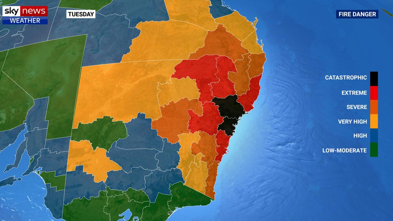
“The reason Sydney has tipped over the edge into the catastrophic fire danger category for the first time is the landscape. Particularly in the far west of greater Sydney it’s very dry at the moment … 99.4 per cent of NSW is drought-affected,” he said.
“The winds and the drought are the big factors here, so is the relative humidity across Sydney and the Hunter being below 10 per cent.
“With extreme fire weather you have spot fires starting potentially 6km downwind. But with catastrophic fire danger, it could be more than 10km – even as much as 20km – downwind a new fire could start, which is exceptionally dangerous conditions as fires are uncontrollable, uncontainable and fast moving.”
RFS spokesman Anthony Clark told the ABC that the catastrophic danger warning covered big population centres.
“Catastrophic is as bad as it gets. Homes are simply not designed to withstand fire under those conditions. So the risk is very real,” he said.
As that cold front powers through, the maximum temperature in Sydney will drop from 37C on Tuesday to 23C on Wednesday.
Further north, around Taree where fires are still burning, it will get to 26C on Monday and then jump to 37C on Tuesday before heading back into the 20s on Wednesday.
It may feel more pleasant, but the cold front is causing consternation for meteorologists and firefighters. It could actually make things a lot worse.
“We will see a cool change come through late on Tuesday, but it’s a southerly buster which is powerful winds and a big wind direction change that will cause havoc for firefighters,” Mr Sharpe said.
The Bureau of Meteorology has warned of damaging winds from the Murray to north of Newcastle as the cold front barrels through with gusts in excess of 90km/h on Tuesday evening.
“Any fires burning near the coast will become extremely dangerous as the change arrives, as the fire flank will suddenly become the fire front.
“We may see a little bit of wet weather, but unfortunately, that’s coming with thunderstorms and that may spark new fires in the east.”
DANGER FOR QUEENSLAND
Queensland has also been affected by the bushfires with fierce blazes in areas around Noosa on the weekend.
“Wednesday is the day for Queensland to see its most dangerous conditions with hot weather and blustery winds moving through,” Mr Sharpe said.
Brisbane will reach a high of 28C on Monday and then jump to 33C on Tuesday and 33C on Wednesday before the mercury dips slightly to around 29C.
Four homes have been lost in the state and 47 fires continue to burn, three of them major, with firefighters battling to get on top of the blazes before the hike in temperatures and winds arrive.
Elsewhere, it will be sunny and 35C degree in Darwin with overnight lows of 26C.
In Western Australia, a run of hot weather continues. In Perth the highs won’t dip below 30C all week. Expect 31C today, 33C tomorrow and 36C on Wednesday.
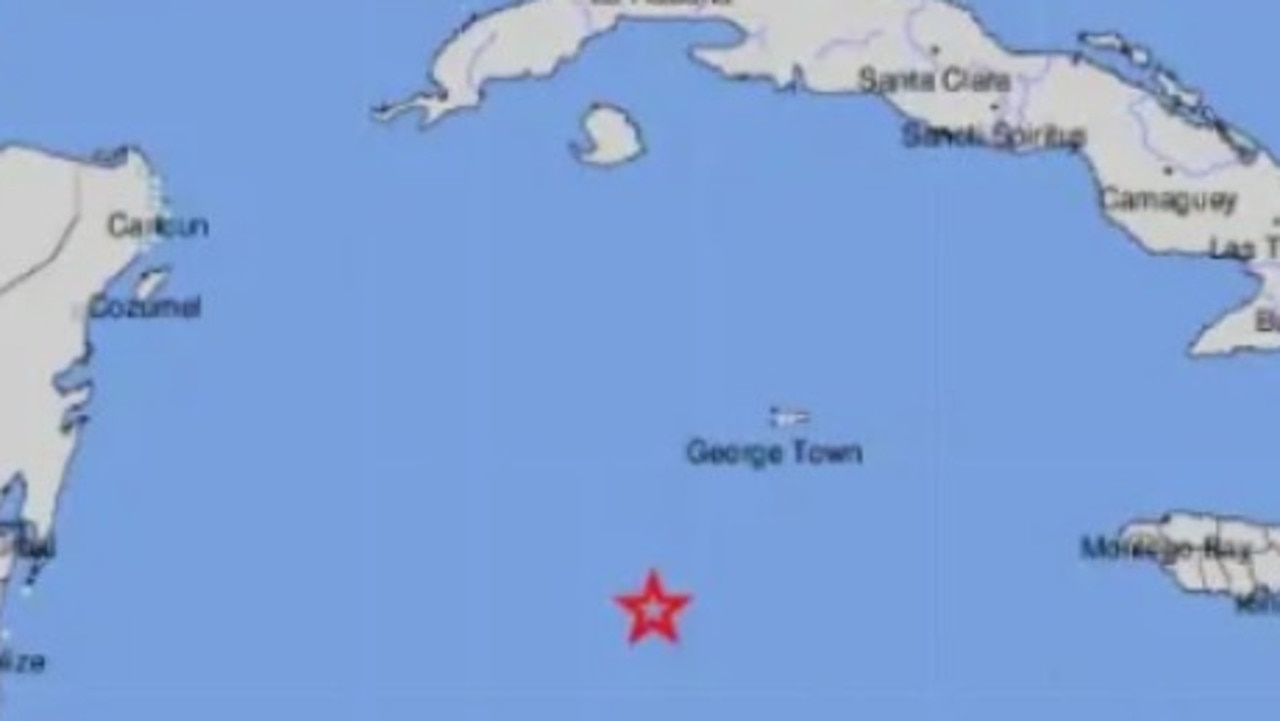
Tsunami warnings after massive quake
A magnitude 7.6 earthquake in the middle of the Caribbean Sea triggered a wave of tsunami warnings around the region.
Cyclone threat for Aussie tourist town
Residents have been warned to stay inside and secure their belongings as a tropical cyclone threatens to develop and smash the coast in the next 24-48 hours.
Top 10 Aussie beaches revealed
Move over Bronte and Byron Bay, Australia has a new best beach according to the national tourism council