
Storms, heavy rain set to batter Queensland, NSW
MASSIVE rainfalls have set records around the country — and the worst isn’t over yet, with more storms on the cards.

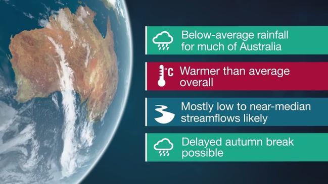
DROUGHT-breaking heavy rain, wild weather and storms are set to cause further havoc across Queensland and parts of NSW today.
North-west Queensland has already been hit by a deluge in recent days with forecasters warning there is even more to come.
New South Wales is also expected to see some heavy rainfall and damaging wind gusts from this afternoon.
Sky News Weather meteorologist Rob Sharpe said the low pressure system that brought the rain to Townsville last week slowly drifted west across Queensland over the weekend.
Mr Sharpe said it was still lingering in the north-west, bringing further heavy falls.
“Townsville saw drought-breaking rain at the end of last week seeing their Ross River Dam rise from 15 per cent to 85 per cent in just a few days,” he said.
“The dam saw a rise of 163,000ML, which is equivalent to 65,000 Olympic swimming pools worth of water.”
He said some towns had already seen their heaviest falls in years.
“Julia Creek has seen 127mm in 24 hours to 9am this morning and Winton saw 102mm — its heaviest rain since the year 2000,” he said.
Severe Weather Warning Update: Heavy rain has extended further north into the #GulfCountry this morning. Currently there is a swath of heavy rain extending from #JuliaCreek to #DonorsHills, with Julia Creek recording 108mm in 6 hours. Next update at 11am pic.twitter.com/DjFrag9dAP
— Bureau of Meteorology, Queensland (@BOM_Qld) March 4, 2018
Cloncurry has recorded 175mm, making it the wettest March in seven years. Mt Isa saw 94mm fall also making it the wettest March in seven years.
The deluge has caused severe flooding, with fears more rain is only going to make the situation worse.
“Over the weekend, Cloncurry had a major flood peak at 7.56m overnight Saturday in Sunday. It was the largest flood peak since 2009,” Mr Sharpe said.
Forecasters also warn the wild weather isn’t going anywhere in a hurry.
“Heavy rain will continue in parts of western Queensland through the working week, before it moves into the Northern Territory by the weekend,” Mr Sharpe said.
“The rain event won’t be as heavy as it moves into the NT as it has been in Queensland.”
Mr Sharpe said southern Queensland, including Brisbane and the Southeast Coast, could also receive thunderstorms into this afternoon and evening.
Brisbane can expect a top of 26C today with showers, 26C tomorrow and 28C on Wednesday with further falls expected.
The Bureau of Meteorology issued a warning for severe storms and heavy rainfall for parts of the state with central NSW expected to be the worst hit.
#Severe #Thunderstorm warning for heavy rainfall for parts of the Central Tablelands, North West Slopes and Plains and Central West Slopes and Plains. See warning at https://t.co/YCckWo5JPv #NSWStorms pic.twitter.com/nxGlel59p0
— Bureau of Meteorology, New South Wales (@BOM_NSW) March 5, 2018
#Thunderstorm outlook for today. Severe thunderstorms containing very heavy rainfall, damaging wind gusts and large hail are possible this afternoon. Keep an eye out on any warnings today at https://t.co/Kx8aI4NQbc pic.twitter.com/jpptlBmphZ
— Bureau of Meteorology, New South Wales (@BOM_NSW) March 4, 2018
“Sydney should just see a few showers in the afternoon — only receiving the dregs of the storms on the ranges,” Mr Sharpe said.
“Storms are unlikely to develop today due to the stable southerly winds running along the coast.
“However the remnants of the storms on the Blue Mountains are likely to drift over Sydney in the late afternoon and early evening, bringing cloud and showers.”
Mr Sharpe said parts of NSW could expect to cop a drenching, with heavy rain, damaging winds and hail possible.
The state has already been hit by some wild weather.
Yesterday storms brought 49mm in just 30 minutes to Dungog in the Hunter Valley.
Mr Sharpe said further storms today could have the potential to cause flash flooding.
Sydney can expect a top of 24C today with showers, and tops of 25C and 24C tomorrow and Wednesday with further rain forecast.
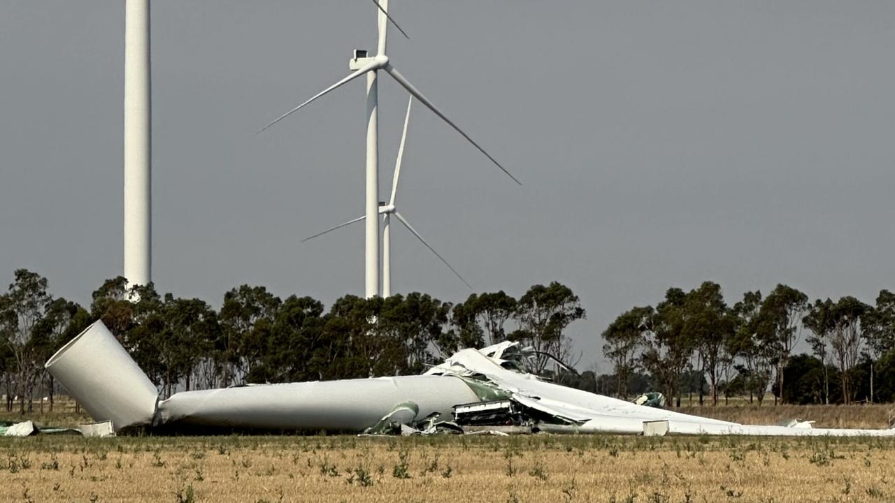
112m turbine collapses on wind farm
A 112m wind turbine has collapsed after severe thunderstorms wreaked havoc in one state, prompting this call.
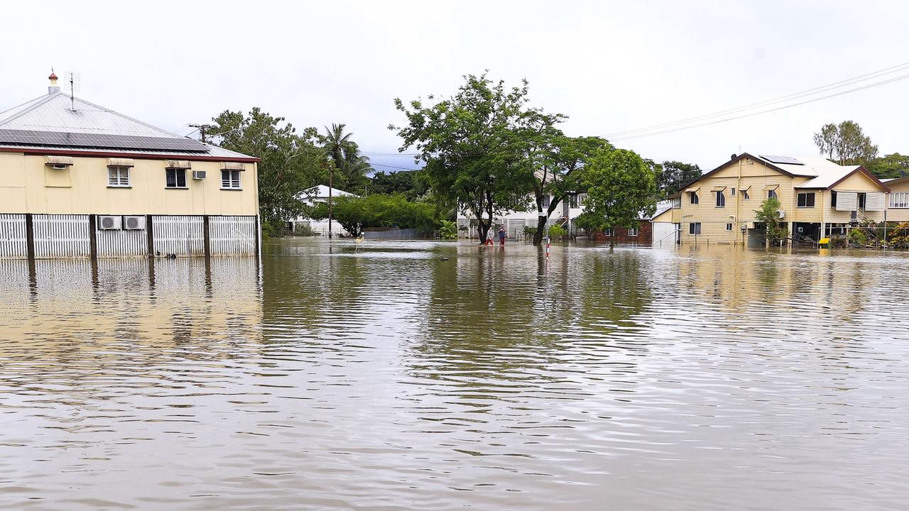
Disgusting act as deadly floods ravage town
Areas of Far North Queensland rocked by the death of two people have been hit by criminals taking advantage of evacuation orders in an act slammed as disgusting.
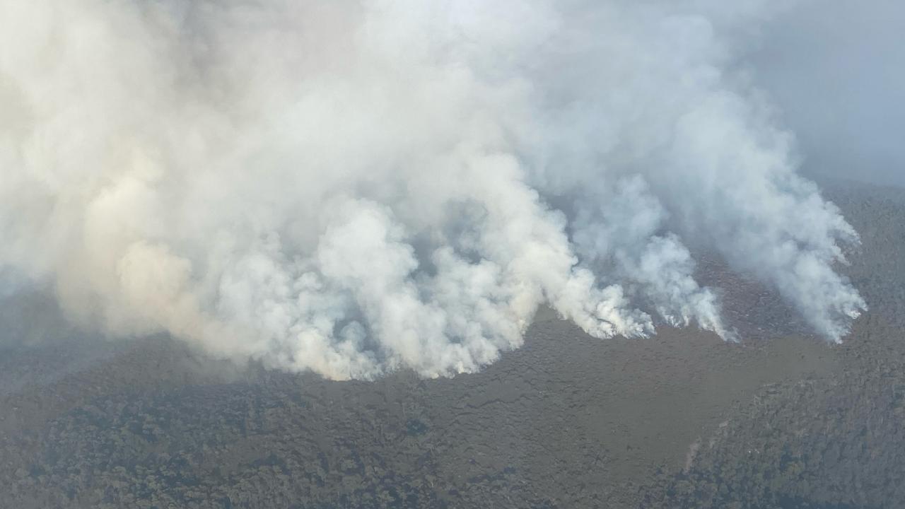
Bushfire outbreak hits popular walking track
A bushfire outbreak triggered by dry lightning is threatening a popular walking track, as firefighters battle ‘challenging’ conditions.