Southeastern Australia warned to brace for ‘windiest spell’ in severe weather
Parts of Tasmania are experiencing flooding, with several communities told to evacuate as other states brace for damaging wind.
Communities in several parts Tasmania are being told to evacuate now as a major flood emergency warning remains in place for the Derwent River and Styx River.
The evacuate now warning was issued for Derwent River from Meadowbank to Macquarie Plains and Styx River from Bushy Park to Macquarie Plains and surrounds about 5.30pm on Sunday.
Tasmania SES issued the alert on the latest Bureau of Meteorology major flood warning for the Derwent River.
.@SESTasmania has issued a Flood Emergency Warning - Derwent River, Meadowbank to Macquarie Plains and Styx River, Bushy Park to Macquarie Plains and surrounds. For more information, go to: https://t.co/j2taquUZFJ or listen to ABC Local Radio. pic.twitter.com/IC6QC8kUyS
— TasALERT (@tasalert) September 1, 2024
Locations likely to be impacted are:
- Meadowbank
- Glenora
- Bushy Park
- Gretna
- Macquarie Plains and surrounds.
Authorities are warning residents to expect some properties to become isolated or inundated with flood hours during the next 12 hours.
Property, livestock, equipment, and crops are also likely to be threatened by flood waters.
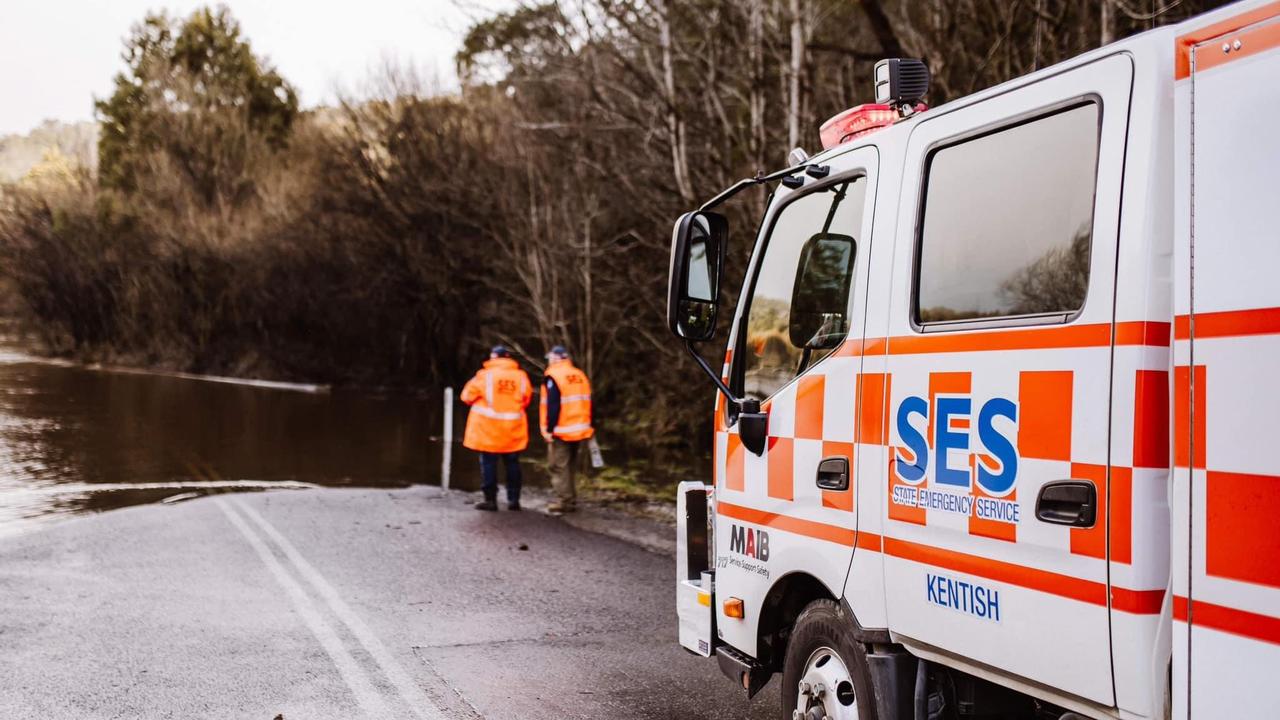
Drivers should also be cautious on the roads, as driving conditions may become dangerous.
Flood waters are a risk to safety, never walk, play, ride, or drive in floodwater.
What to do:
For people living in the alert area and/or near the Derwent or Styx river, SES advises:
- Use your flood emergency plan
- Prepare your property, if it is safe to do so
- If conditions worsen and safe to do so, leave and go to the home of family or friends in a safe location away from the flood affected area.
- Contact family members, friends, and neighbours to alert them of the potential for flooding
An Evacuation Centre has been set up at Derwent Valley Sports and Recreation Centre at 50 Derwent Terrace, New Norfolk.
For life-threatening emergencies, dial triple-0
For emergency flood and storm assistance call the SES on 132 500.
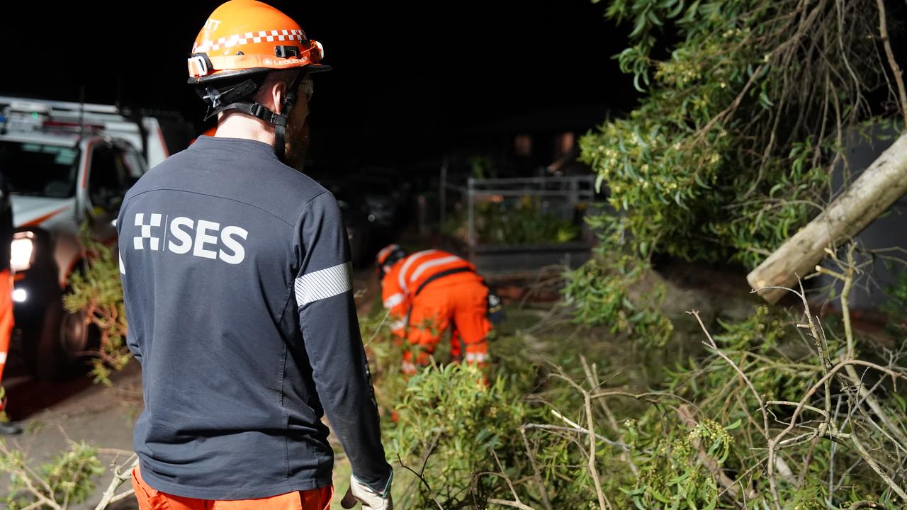
It comes as parts of Australia will continue to face the brunt of wild winds, with some areas expreing gusts of more than 100km/h.
Bureau of Meteorology senior meteorologist Sarah Scully says the winds will be “buffeting” southeastern parts of the country until at least Monday.
“We’ve had a series of cold fronts that have moved across this weekend,” she said.
“We’re forecasting the winds to intensify about southeastern parts of South Australia this afternoon and continue to intensify as the cold front moves eastwards.”
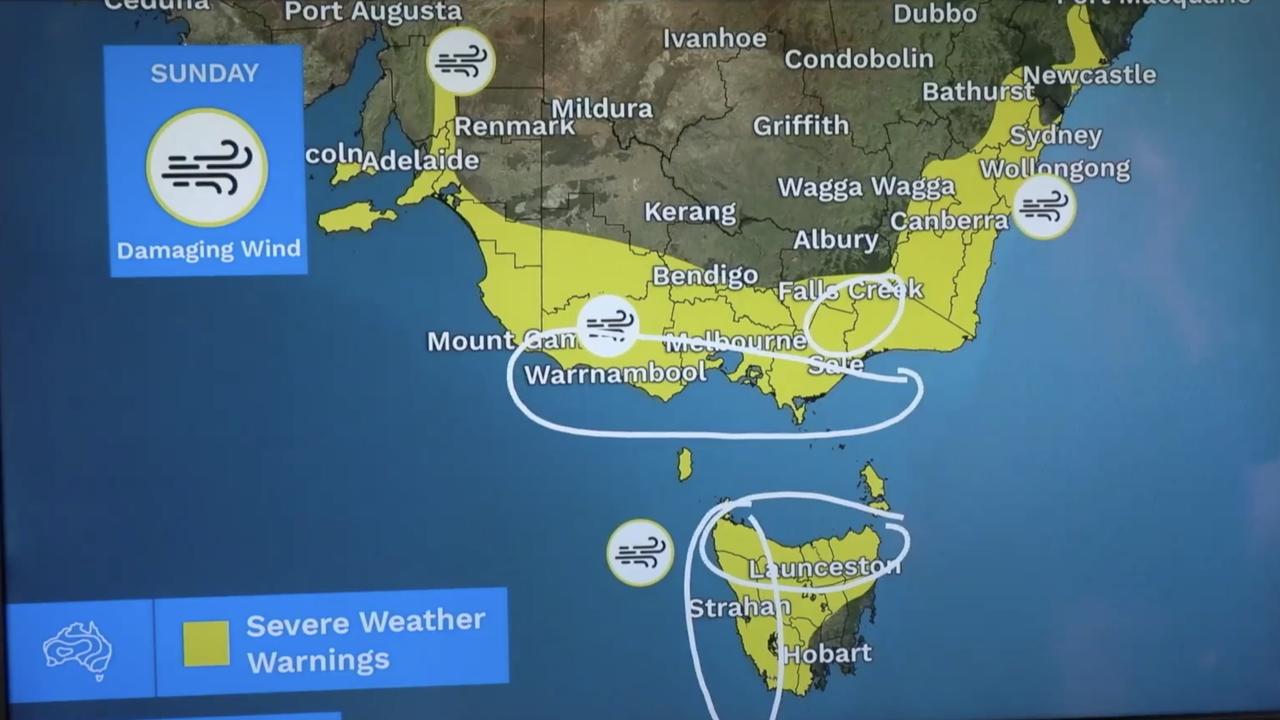
Damaging winds in excess of 90km/h are forecast for the southern eastern areas of the mainland while winds of more than 100km/h for Tasmania are expected for Sunday afternoon.
“There’s also a risk of locally destructive winds in excess of 125km/h about the west coast and central coast of Victoria, including the Bellarine Peninsula and she southeastern suburbs of Melbourne,” Ms Scully said.
“Also the northeastern rangers of Victoria may also have the destructive winds as well as the north and west coast of Tasmania.
“Those winds are expected to east from the west as the cold front tracks eastwards.
“We’re forecasting (the cold front) to move through the Melbourne area somewhere from 2am to 4am.”
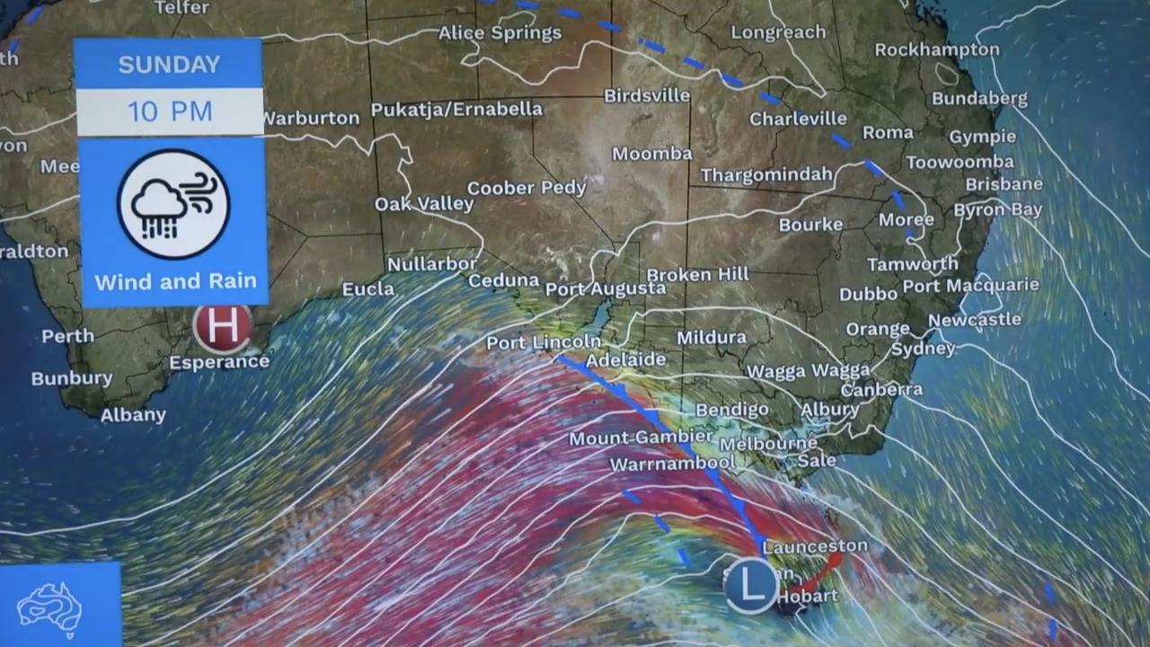
Ms Scully said NSW will start to feel the brunt of the strong winds from the “early hours” of Monday, especially in places like the Illawarra, the Sydney metropolitan and the Hunter Valley.
The Bureau forecasts the cold front to start clearing from late Monday as a high pressure system moves in behind it by Tuesday.
Meanwhile, a further 50mm of rainfall is forecast in western and northern parts of NSW by 6pm on Monday 6pm
Tasmania’s Derwent River is expected to peak at the flood level on late Sunday afternoon.
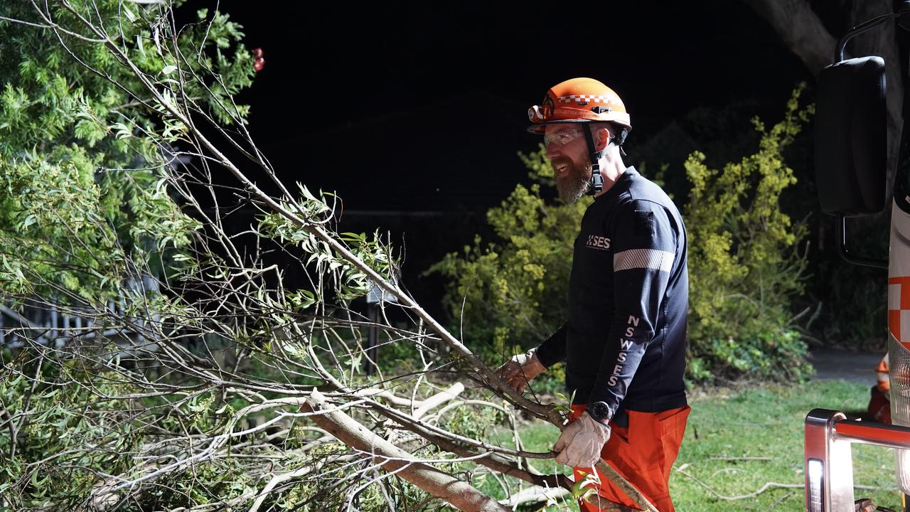
It comes as Australians have been warned the “windiest spell” in the country’s bout of wild weather is still to come, while residents of one state will swelter through temperatures in the mid-30s on the first day of spring.
Much of the country has been blasted with wild weather over the past week, with power cut, trees smashing through homes and rogue backyard items being tossed away by severe winds.
Sky News Weather meteorologist Rob Sharp said another front was set to move through the country’s southeast on Sunday afternoon into Monday, bringing the “windiest spell”.
“I would think that for many places, this could be the windiest spell that we see for the entire event,” he said.
“It’s been an exceptionally windy week for southeastern parts of the country and it’s finishing off in a big way as we start the new season.”
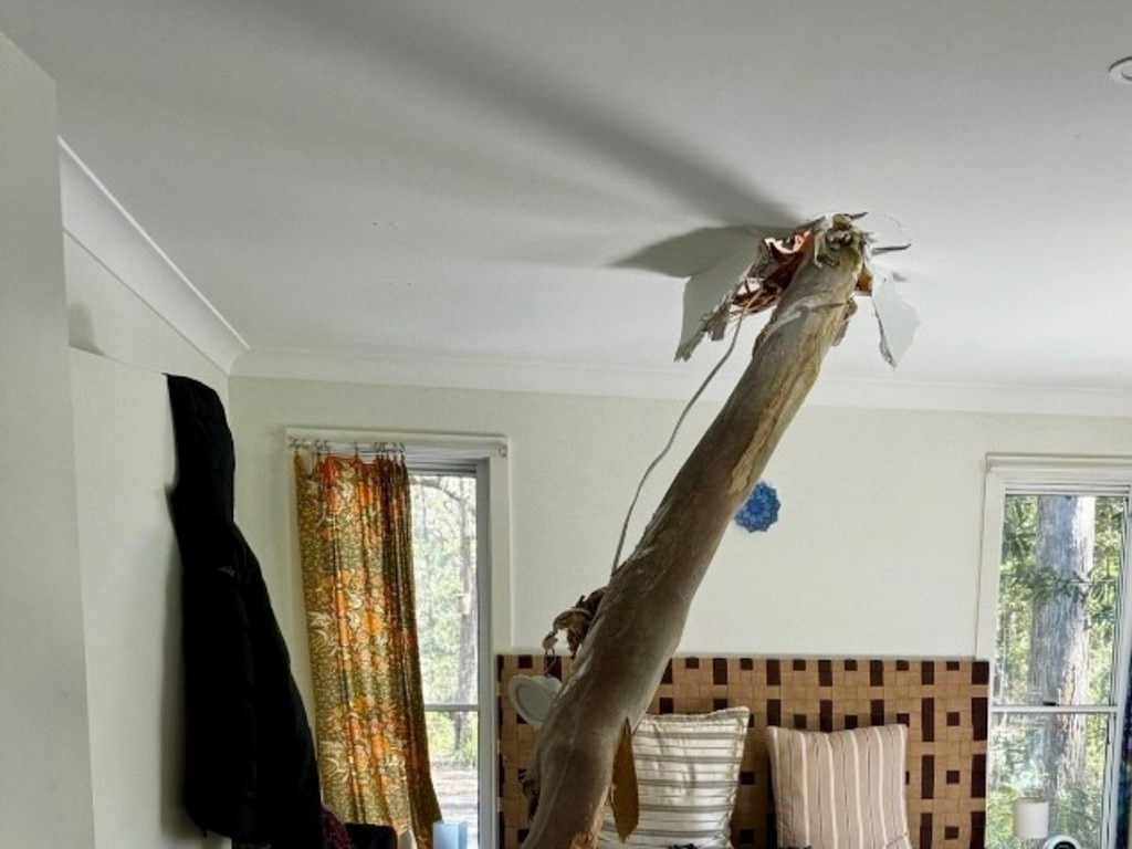
In NSW, a severe weather warning for damaging winds has been issued for the Snowy Mountains and parts of Illawarra, South Coast, Central Tablelands, Southern Tablelands, South West Slopes and Australian Capital Territory Forecast Districts.
Victoria has been warned to brace for damaging, locally destructive wind warnings in Central, East Gippsland, South West, North Central, West and South Gippsland, Wimmera and parts of Northern Country, North East and Mallee Forecast Districts.
The Mount Lofty Ranges, Kangaroo Island, Upper South East, Lower South East and parts of Lower Eyre Peninsula, Yorke Peninsula, Mid North and Murraylands districts in South Australia has been issued a severe weather warning for damaging winds.
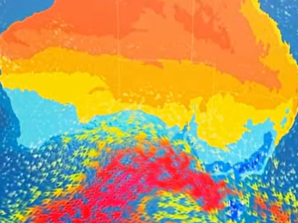
Tasmania has also been issued a severe weather warning for damaging, locally destructive winds for King Island, Furneaux Islands, Western, Upper Derwent Valley, North East, North West Coast, Central North, Central Plateau and parts of South East, East Coast and Midlands Forecast Districts.
However, the windy weather is set to ease for the southeast on Tuesday.
Along with damaging wind warnings, Tasmania has also been slapped with a series of flood warnings, with a flood watch in place for the west, north, northwest and parts of the northeast rivers.
A major flood warning has been issued for the River Derwent while a minor flood warning has been announced for the River Ouse.
Warnings are also in place for the Styx and Tyenna Rivers, with a moderate warning for the Meander River, North Esk River, South Esk River.
Minor flood warnings have also been issued for the St Patricks River, Forth River, Huon River, Macquarie River, Isis River, Lake River, Brumbys Creek and Mersey River
In terms of temperature, Monday is set to be the “coldest day of the week” for the southwest, with the cold air set to move up to Queensland on Tuesday.
However, more heat is forecast to filter down into the country’s south on Tuesday and Wednesday.
“When you look at the coming week as a whole, you can see warmer than usual weather is prevailing again for much of the country, especially through the middle, just like the last couple of weeks, but not quite as extreme,” Mr Sharp said.
“I’m not expecting records to be broken, but it is going to be a hot start to spring for many parts of the country.”
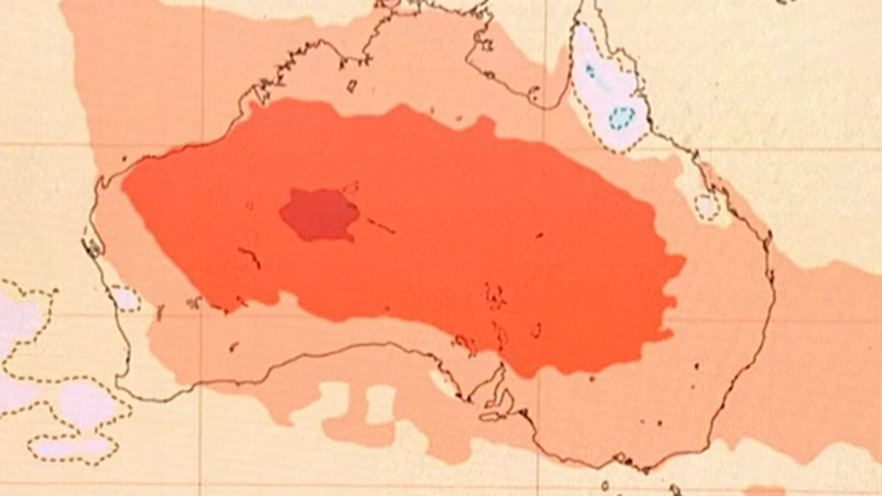
Sydney is tipped to reach a high of 28C on Thursday while Melbourne is set to reach a top of 22C despite showers.
Brisbane is expected to reach a high of 34C on Monday, with Perth’s warmest day also appearing to be Monday with a top of 25C.
Adelaide is forecast to reach 25C on Wednesday while Hobart is tipped to reach a top of 19C on Wednesday while showers are set to persist throughout the week.
Canberra is set to reach a high of 23C on Friday while Darwin is tipped to reach 36C on Wednesday.
Read related topics:Weather


