
Soaring temperatures in Sydney while Melbourne cools down
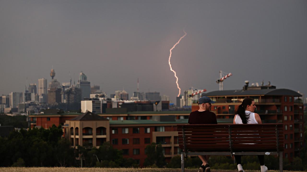
Fierce, but swift, storms have barrelled up the NSW coast hitting Newcastle and Sydney. And more could be on the horizon as temperatures soar.

The New South Wales coast was pounded with severe thunderstorms this afternoon. Over in Western Australia the big fear is bushfire licking at Perth’s southern suburbs.
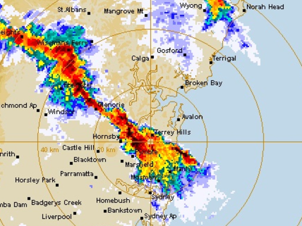
The Bureau of Meteorology issued a warning for heavy rainfall, damaging winds and large hailstones for eastern areas of the state including Sydney and Newcastle and it delivered.
There were reports of marble size hail falling in the Galston area, north of Sydney.
In northern parts of Sydney and Newcastle, around 20mm of rain fell in just one hour.
But the storm was swift and pinpointed – with Sydney south of the harbour not seeing a drop of moisture while the north shore was being lashed.
UPDATE | Video filmed in Galston shows heavy rain and hail currently falling in the North West Sydney region. pic.twitter.com/zCuLwl0oVN
— 2GB 873 (@2GB873) November 25, 2019
Wild storm across Newcastle, 6.45pm. Lightning, heavy rain and strong wind. Scenes from harbourside suburb of Carrington.. @9NewsSyd @Ausgrid #storm #weather #rain pic.twitter.com/M6cBgEPZqd
— David Threlfo (@David_Threlfo) November 25, 2019

MORE STORMS DUE
For the rest of the week Sydneysiders are set to swelter though conditions 10C or more above average with further warnings of waves of storms rolling through the city.
Temperatures will rise ahead of a cold front marching up the NSW coast. Sydney’s CBD could reach 33C on Tuesday with 36C in the western suburbs.
Overall this week, conditions are far more favourable to keeping a check on the bushfire crisis although the cold front could whip up some blazes.
On Monday storms flared up across the interior of NSW. Later in the day these made their way towards Newcastle and Sydney bringing heavy rainfall, damaging winds and hail.
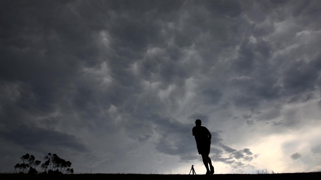
Residents took to social media to uploaded image of dark and moody skies and hail thundering down.
Storms are also a possibility on Tuesday afternoon as well. That’s when the cold front is expected to roll through the city. And it could be another short, sharp, storm with concentrated downpours blasting up the NSW coast. By the end of Tuesday night it might all be over and Wednesday should see a more average November high of just 23C in the Harbour City.
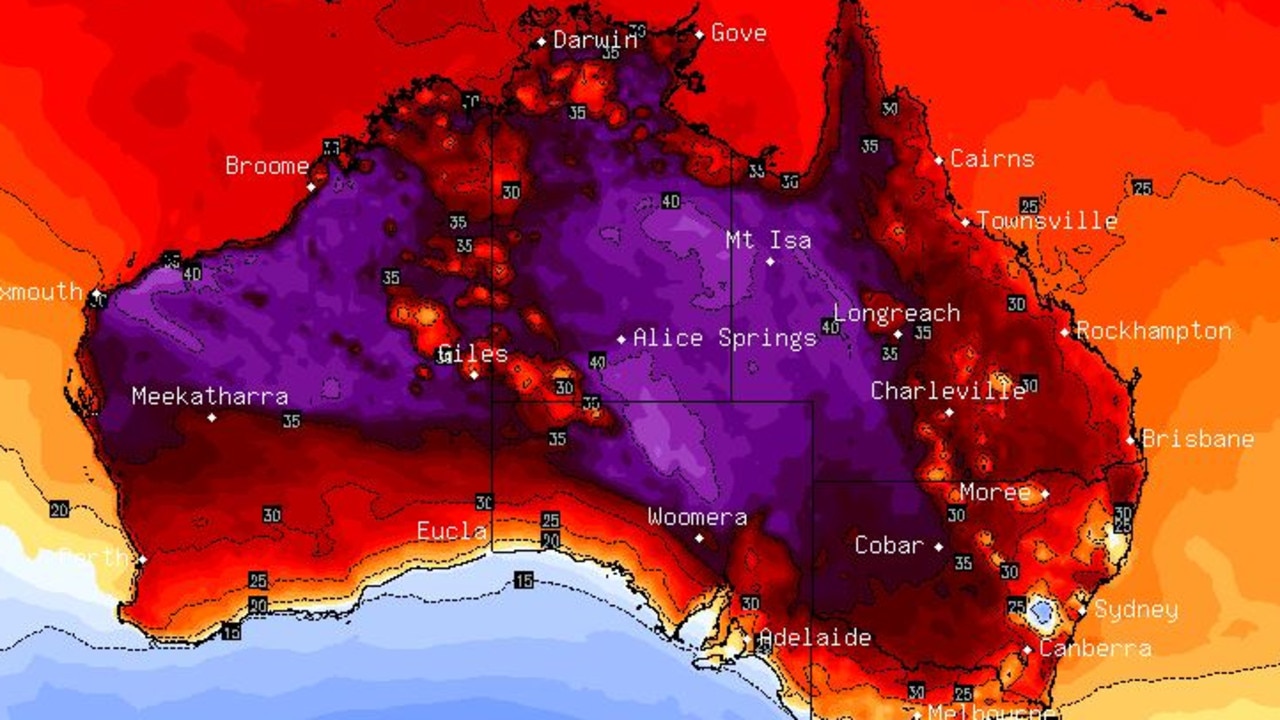
Head up the coast and there is a forecast of 36C on Tuesday in northern parts of the state, like Grafton. Then the cold front will do its work and by Wednesday expect a 10 degree drop in the mercury before it heads back up to the 30C mark later in the week.
Brisbane is looking at 31C on Tuesday and Wednesday and just a small drop to 29C on Thursday with mostly sunny conditions.
CHILLY IN MELBOURNE, BUSHFIRES IN PERTH
Stormy in Darwin with highs of 34C all week and around 25C overnight.
Perth will see a string of days at 30C or above. 32C on a sunny Tuesday, reaching 33C on Wednesday. No rain expected in the WA capital with the maximum bouncing round 30C all week and overnight lows in the mid-teens.
A bushfire was threatening lives and homes near Kwinana in Perth’s southern suburbs on Monday night.
The bushfires moving fast in a north-easterly direction in The Spectacles and Mandogalup and residents were being urged to leave or prepare to actively defend their properties.
Firefighters were on the scene and a number of roads were closed.
Much more agreeable in Adelaide. A high of just 21C on Tuesday following the cold front, edging up to 26C midweek and then back down to 20C. Mostly sunny but possible showers later in the week.
Jacket weather in Melbourne. Just 16C on Tuesday. Then 24C on Wednesday before 21C for the end of the week and even cooler heading into the weekend. Grab the umbrella on Tuesday.
Similar conditions in Tassie. A high of 17C in Hobart on Wednesday and the around 20C most days ahead of a cool weekend. A shower or two can be expected just about all week.
A hot Monday in Canberra will give way to 28C on Tuesday and a possible storm. Sunny and warm in the capital for the rest of the week, reaching 32C on Friday.
– with AAP.


