‘Significant’ weather to hinder Easter weekend plans
Australians with fun Easter long weekend plans may have to reconsider with a wild and wet cold front moving in to disrupt barbecues and egg hunts.
Australia’s eastern states are bracing for a blustery Easter weekend with thunderstorms and freezing temperatures to rain on the parade of anyone planning an outdoor egg hunt.
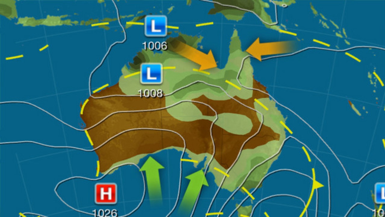
A strong cold front will be moving across southern Australia over the next few days with the east coast bracing for thunderstorms on Friday and winter-like conditions for the rest of the weekend, according to the Bureau of Meteorology’s Miriam Bradbury.
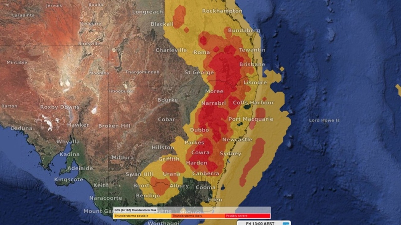
“It’s really tomorrow, Good Friday, that we’re expecting the most significant weather, with severe thunderstorms a risk through central and eastern Victoria, all the way up the east coast of NSW and extending into Southeast Queensland as well,” she said.
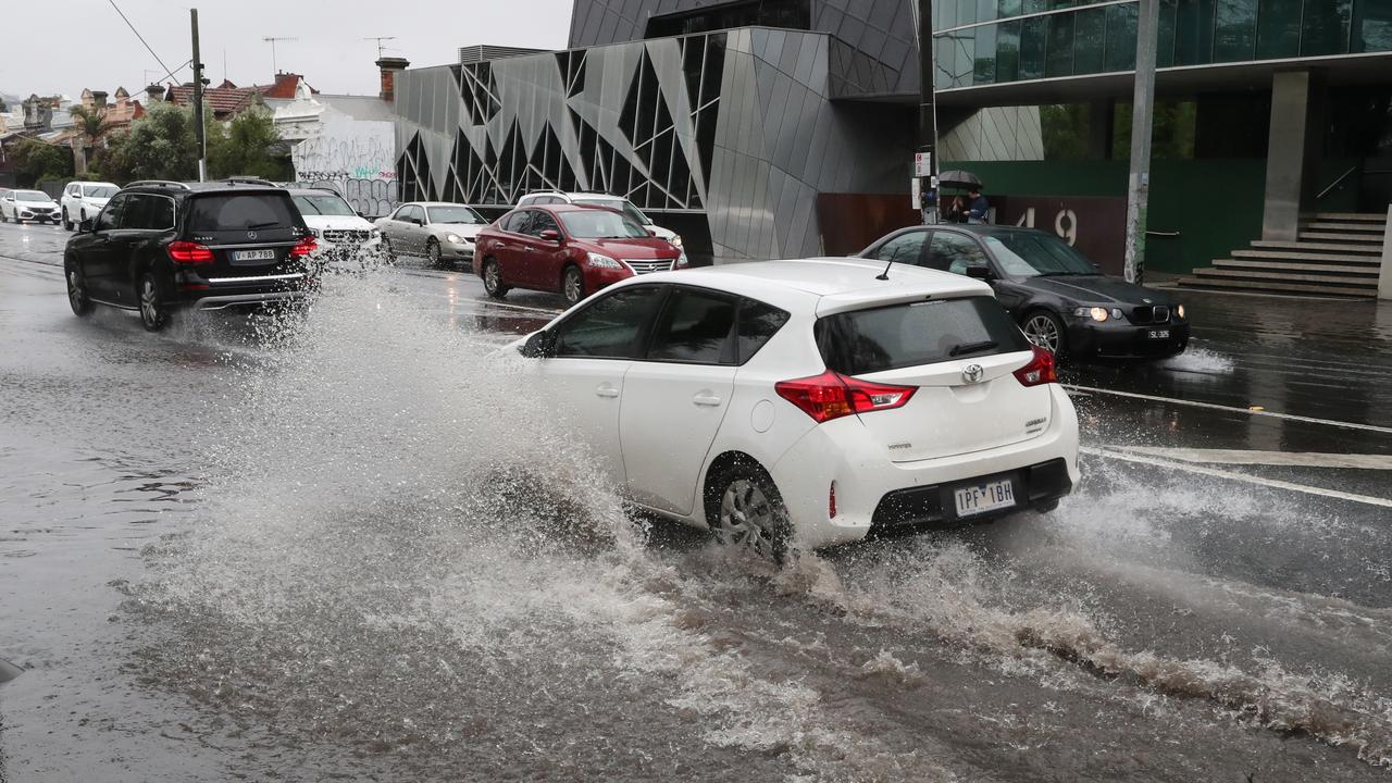
“These storms could become severe producing heavy rainfall that may lead to flash flooding, damaging wind gusts that could bring down trees or power lines, and large hail.”

The system will move offshore on Saturday, but that does not mean better weather is on the way.
“[It will] bring in a very vigorous south to southwesterly air stream, so what that means for our weather is windy conditions.”
After Saturday’s winds will come freezing temperatures on Easter Sunday.
Here’s a more detailed look at the weather, state by state.
VICTORIA
Victorians will shiver through some of the coldest conditions in the nation across the long weekend, with predictions that Melbourne will have its coldest Easter in 80 years.
“On Friday, a combination of showers, possible storms, clouds and a cooler westerly change will see daytime temperatures struggling to get into the low 20s in Melbourne,” WeatherZone Meteorologist Ben Domensino said.
“But this will just be a preview of the colder weather that lies ahead on the weekend.”


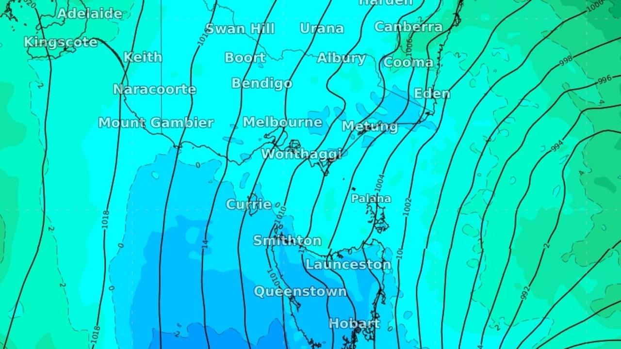
Colder air will be brought into Melbourne as the weekend progresses as south to southwesterly winds set in.
The BOM is predicting Melbourne will reach a maximum of 14C degrees on Sunday, possibly putting it at the coldest Easter ever recorded in the state.
“It’s been a long time since we’ve seen an Easter this cold ... the coldest Easter we have on record was in 1924 when we didn’t exceed 13.9C degrees,” Ms Bradbury said.
“So if we really struggle to reach that 14C degree maximum temperature on Sunday, this may be a contender.”
Showers were already developing on Thursday evening and would increase overnight into Friday, according to Ms Bradbury.
“[Melbourne] most likely will wake up to some rainfall and also some possible thunderstorm activity with most of the storms in Melbourne likely through the morning and early afternoon period then easing,” she said.
The worst of Friday’s storms will be felt through Central and Eastern Victoria where a major system brings in the risk of flash flooding, damaging wind gusts and large hail.

Victoria’s alpine ranges could be in for some snow due to the cold front moving through, with Ms Bradbury predicting that snow will fall above 14,000 metres on Sunday.
The state is also set to not get a reprieve from the wintry conditions on Monday, with showery weather and a small chance of hail on many people’s day off.
NSW
Sydneysiders and residents in other cities along the entire length of the NSW coast should be on high alert for intense and widespread storms across Friday, according to the BOM.

There is the potential that supercells could hit in the area’s between Sydney and Brisbane, so residents are urged to check the BOM’s website for severe weather updates.
Parts of the state most impacted by storms could see up to 50mm of rainfall, bringing with it fears of flash flooding, Ms Bradbury said.
However, the majority of the state are expected to see low to moderate rain totals between 10 and 20mm of water.
Friday’s storms will come with a minimum of 17C degrees and maximum of 24C.
Easter Sunday will be sunny but temperatures will drop with a minimum of 14C degrees and a maximum of 21C degrees predicted.
QUEENSLAND
Queensland will be one of the few states that will kick off the Easter weekend with settled conditions across most of its inland and northern areas.
It’s a different story for Brisbane and the rest of the state’s southeast, Ms Bradbury said.
“Severe thunderstorms are possible across southeast Queensland through Good Friday, once again with the risk of heavy rainfall, damaging winds and large hail and that‘s most likely through the later part of Friday morning going into the afternoon and evening period,” she said.
Those conditions aren’t expected to stick around beyond Friday after the storms clear away from Brisbane through Saturday.
Easter Sunday is set to be perfect for an Easter egg hunt, with settled and fairly mild conditions across the southeast of the state.


