
Severe weather warning for southern Australia as north soaked
Destructive wind gusts and blizzards are in the offing as millions brace for another weekend of wild weather.
Millions have been warned to expect a wet and wild weekend as a two cold fronts sweep across southern Australia, bringing “damaging winds” and persistent rain.
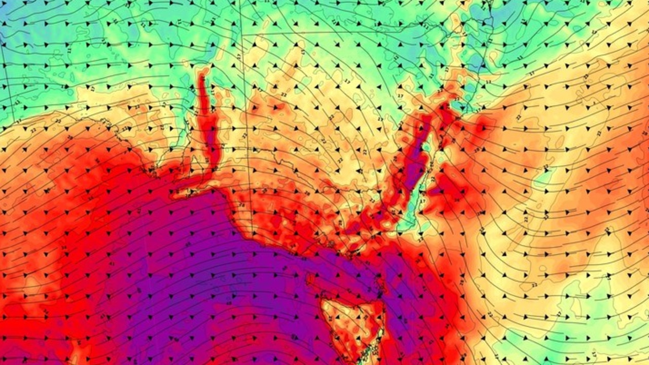
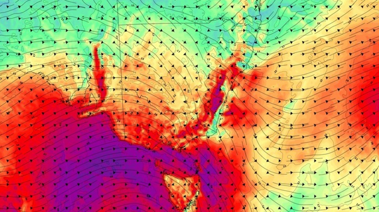
A powerful cold front is expected to whip through South Australia late on Friday before passing over southeastern Australia, only days after similar system moved through the state.
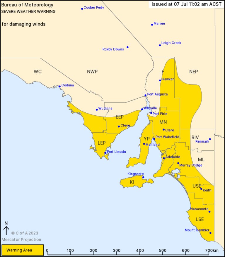
The Bureau of Meteorology issued a severe weather warning for the region on Friday, with “isolated destructive” wind gusts up to 125km forecast for Friday night and into early Saturday.
“This system is much stronger and is expected to make land later on Friday, then sweep across the southeast of Australia on Saturday,” BOM meteorologist Miriam Bradbury said.
“This is expected to bring some moderate to high falls to parts of Victoria and western Tasmania, which may lead to some river rises.
“So, keep an eye out for possible flood warnings (...) There are many risks and hazards over the coming days associated with these weather fronts.”
Ms Bradbury said Adelaide is expected to be hit by the most powerful wind gusts late on Friday, before the systems moves in Melbourne and northwestern Tasmania on Saturday morning.
From Saturday, the system will hit parts of southeastern NSW as it moves offshore, with areas of the NSW south coast, Illawarra, Central and Southern Tablelands in the firing line.
The weather system is expected to weaken as it moves off the coast on Sunday, with colder and more unstable air moving in behind the system possibly resulting in hail and thunderstorms.
“Decent snowfalls are expected across the resorts – as low as 1000m,” Ms Bradbury said.

💨 Very windy across the southeast on Saturday. Damaging winds are possible for parts of the #Illawarra, #BlueMountains, Southern Tablelands & Snowy Mountains.
— Bureau of Meteorology, New South Wales (@BOM_NSW) July 7, 2023
â„ï¸Blizzards are possible, with lots of snow and strong winds forecast for the Alps.
See https://t.co/UqlGxUsuBw for more pic.twitter.com/88uFmTJDJT
“However, while this sounds like good news for the school holidays, it is also coupled with high winds.
“This means we might see wipe-out or blizzard conditions through Saturday and early Sunday.”
As a result, Melbourne is forecast to reach just 14C on Saturday, with 1-4mm of rain expected.
Adelaide will likewise reach just 15C on Saturday, with a high chance of up to 10mm of rain.
Hobart is also expected to be shiver through another wet weekend with a high chance of showers.
Further up the coast, Sydney will reach 19C across the weekend, while Brisbane will reach 21C.
The nation’s capital will catch the edge of the cold front system, with rains forecast for Saturday.
Canberra will reach a maximum of just 9C on Saturday, with the mercury dipping as low as 3C.
The cold snap comes as much of northern Australia braces for another “unseasonable” deluge.
A northwest cloud band spread heavy rains across the Northern Territory and northwest Queensland.
Mt Isa and Cloncurry smashed monthly rain records earlier this week, with more falls expected.
SkyNews forecasts 50-100mm of rain could smash swathes of northwest QLD, including Mt Isa.
Areas around the regional centre, as well as Burketown, are also warned of potential flash-flooding.
The system is expected to head towards the coast over the weekend, with falls intensifying on Monday.

Chilling ‘ring of fire’ warning after quake
Experts have warned that the largest earthquake in 14 years could set off a chain of volcanic eruptions across the Pacific Ocean – putting millions at risk.

Worst yet to come as millions drenched
One Aussie state is expected to receive up to 150mm of rain within days, as its capital city sets a bleak winter record.

Quick-thinking surgeons save patient’s life
Gripping footage has shown how a team of quick-thinking surgeons reacted to the world’s biggest earthquake in 14 years.