
Severe weather season outlook for forecasts more heatwaves but fewer cyclones for Australia
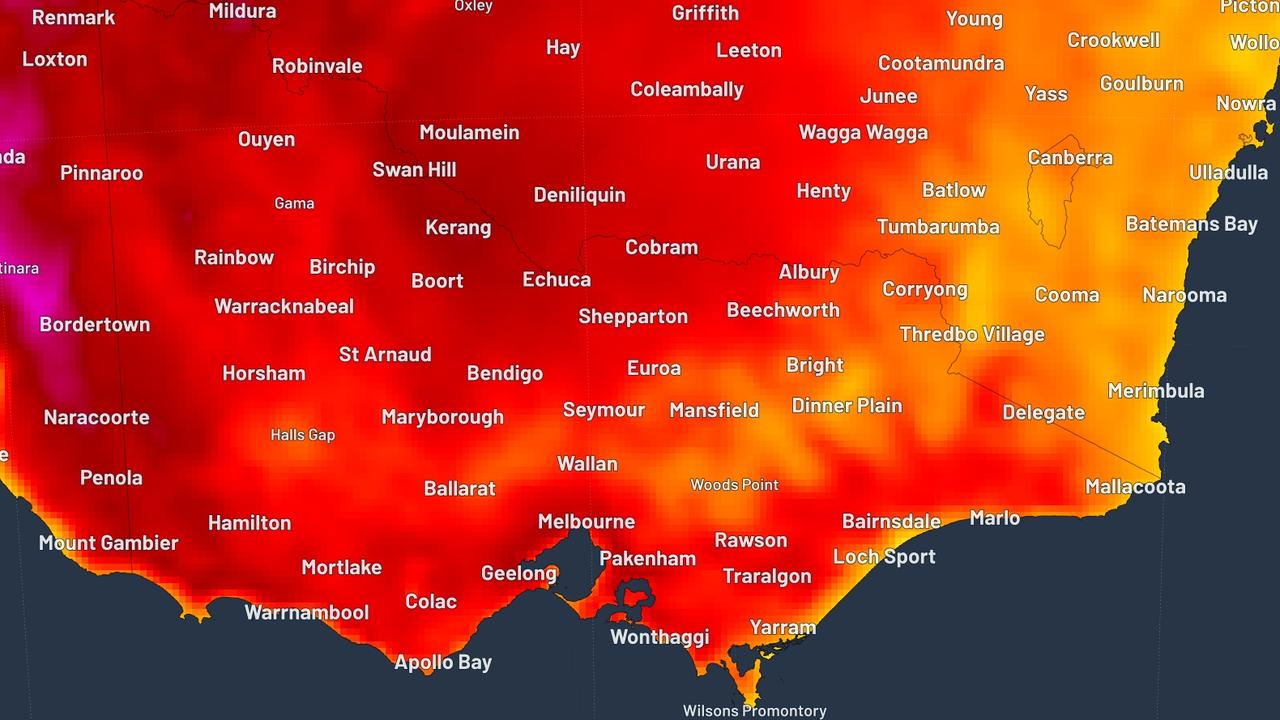
A bowl of searing heat is set to build in the centre of Australia in the run up to summer leading to more heatwaves as the rain goes AWOL.


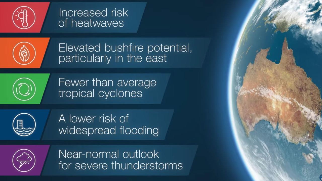
Australia can expect more heatwaves and bushfires during spring and summer but fewer cyclones could cross the coast.
The Bureau of Meteorology (BOM) has released its severe weather season outlook with a warning to not be “complacent” about the risks during the most hectic meteorological months of the year.
The severe weather season officially lasts from October until March.
In short — it’s set to be sweltering and lacking in rain.
The outlook comes as one of Australia’s biggest insurers revealed 2018 was the most “intense storm season” in years with hail damage double the long term average.
Residents of Berowra Heights in Sydney’s north made the most claims last year for storm damage, according to NRMA Insurance.
Australia’s two main climate drivers are El Nino/La Nina in the Pacific Ocean and the Indian Ocean Dipole (IOD) to the west. The former is in neutral while the IOD is in a positive phase.
“The Bureau outlook shows we’re likely to see warmer and drier than average conditions for the coming months,” the Bureau’s head of long-range forecasts, Dr Andrew Watkins said.
“This is due largely to a record strong positive IOD, that leads to drier air than usual over northwest Australia that supplies much of Australia’s rainfall.”
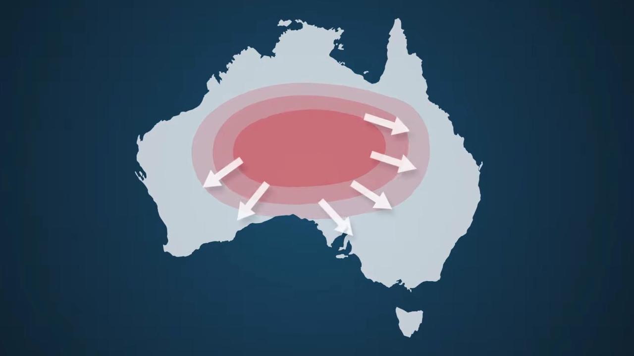
WELL OF HEAT
Drier conditions and moisture starved soils all lend a hand in heating up the continent. As summer approaches, air is likely to cook up in a mass in the Red Centre even more than usual. That will then be dispersed by winds to the coastal areas of southern and eastern Australia leading to heatwaves.
A likely late start to the northern wet season meant more heatwaves are essentially inevitable.
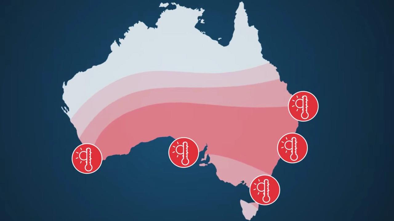
They might be less dramatic than, say, cyclones but heatwaves are the deadliest type of severe weather. Hot days followed by hot nights impede the body’s ability to recover.
For most people this can lead to a sleep interrupted, uncomfortable night. But for around 15 per cent of people it can lead to feeling unwell and even heat stress.
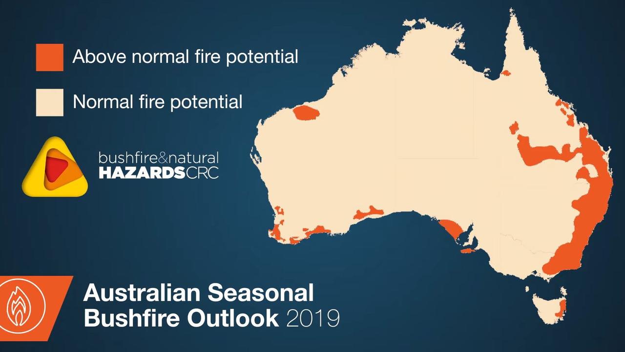
The risk of bushfires is also likely to go up given how dry many parts of southern and eastern Australia are at the moment.
Deadly bushfires have already rocked parts of southern Queensland and northern New South Wales with the BOM warning the east coast and south west Western Australia are particularly at risk.
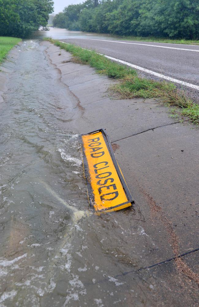
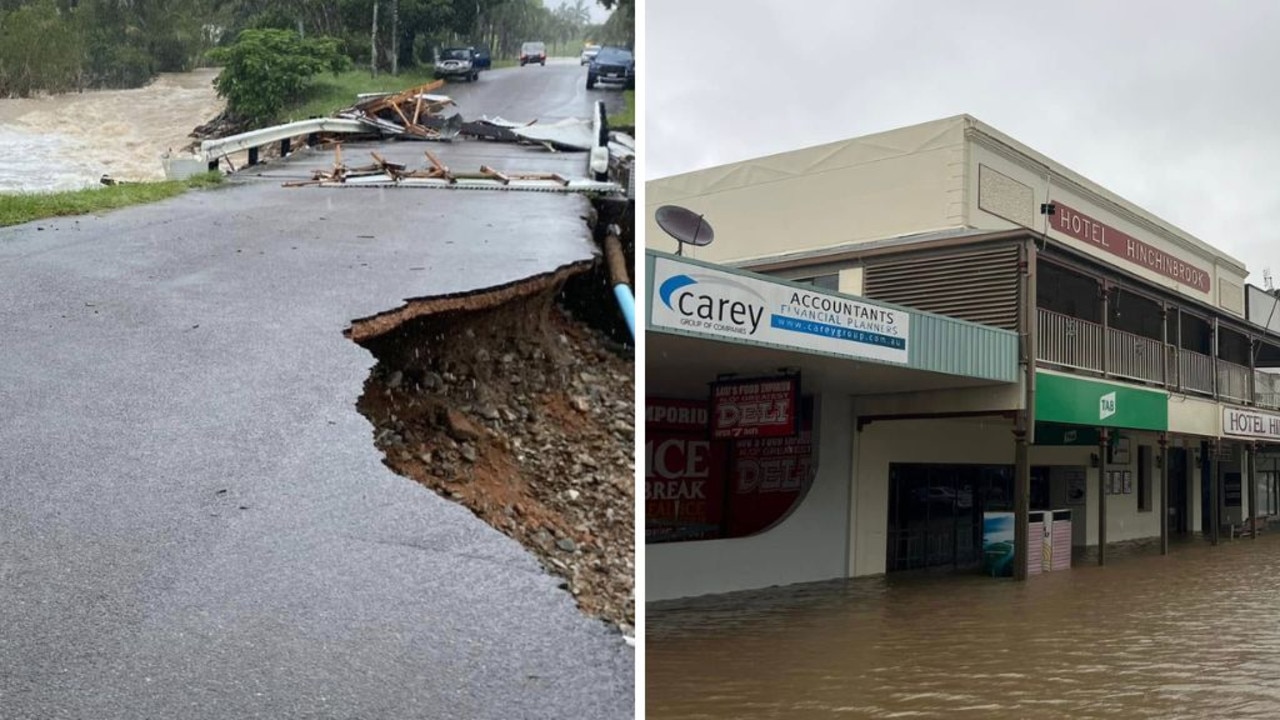
Flooding is likely to be less of a concern and there is just an average change of severe thunderstorms that can lead to floods. However, thunderstorms and slow moving rain events can still cause tremendous damage.
Record rain in February in northern Queensland killed thousands of cows and created a temporary river 60km wide as the Flinders River swelled as water made its way to the Gulf of Carpentaria.
RELATED: Floodwater swells Queensland’s Flinders River into a 60km-wide ‘mega river’
“Severe thunderstorms and significant rainfall events can happen at any time,” said Dr Watkins.
“Not being complacent and taking the time to know your weather and know your risk is one of the best ways to stay safe during the coming severe weather season.”
CYCLONES
There’s a 65 per cent chance of fewer tropical cyclones during this summer, the BOM said. It’s usual for 11 cyclones to form in the waters around Australia and four of those generally cross the coast.
But there’s never been a cyclone season without at least one making landfall.
“This means that despite a reduced risk this season, all communities in Northern Australia must be ready,” he said.
“Even if cyclones stay well out to sea, they can still pose a significant risk to property and lives through strong winds, intense rain and flooding, and storm surges.”
Insurer NRMA said 61 per cent of all home claims in 2018/19 were due to damage caused by storms, the highest since 2014.
Sydney’s Hills District and the city’s northern and western suburbs had the most claims with the Central Coast near the top of the list.
Berowra Heights, Castle Hill, Chipping Norton, and West Pennant Hills in Sydney and Wamberal on the Central Coast were the suburbs with the most storm-related claims last year.
The NRMA said dangerous storms were the most common natural hazard in Australia and caused more damage and destruction than cyclones, floods and bushfires.
‘Don’t return’: Deadly floods to worsen
Residents have been urged not to return home as deadly floods continue to smash one state, as towns are cut off and some areas record more than a metre of rain.
‘Hoodwinked’: China is conning the world
An Australian economist says China is conning the world on an important global issue.
State smashed by ‘hours of lightning’
Thousands have gone without power as wild storms battered one state, with “hours of lightning” recorded in a major city and its surrounds.