
‘Unprecedented’: At least three states drenched as wild weather continues
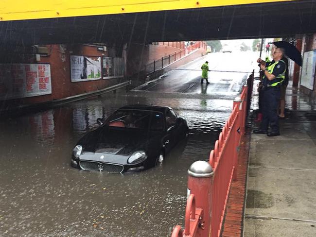
A MELBOURNE driver made an expensive mistake when attempting to drive through flood waters in a luxury sports car.

A MASERATI driver unintentionally destroyed the luxury sports car after attempting to drive through a flooded underpass in Melbourne’s inner west last night.
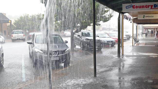
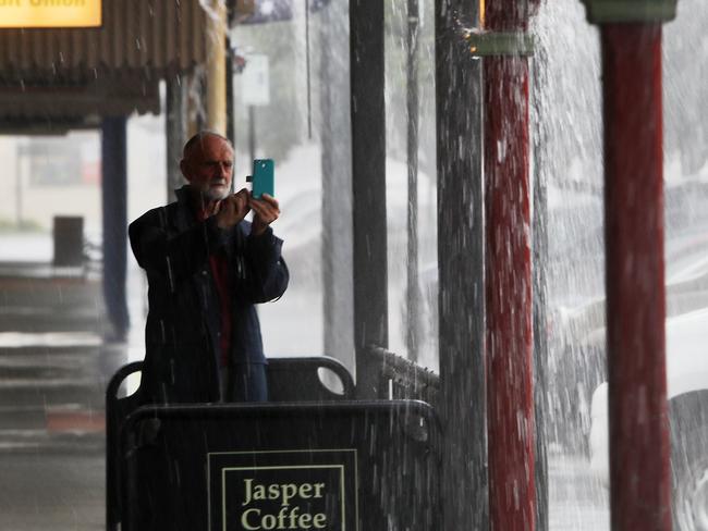
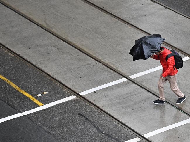
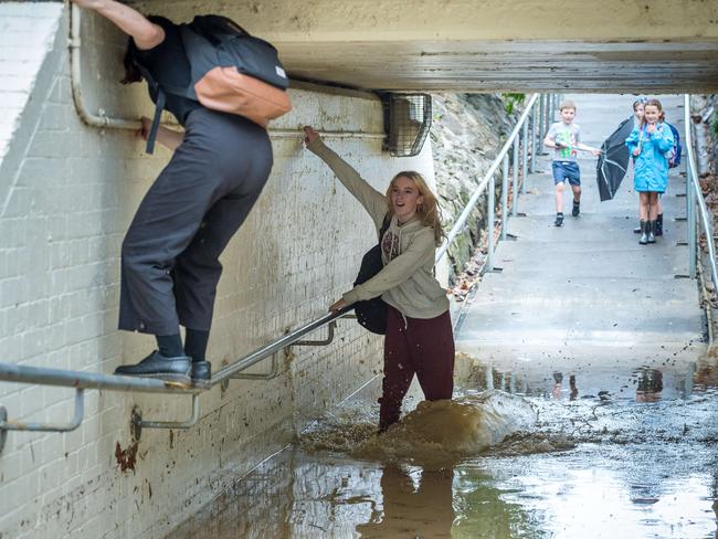
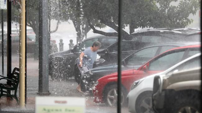
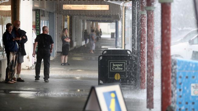
Despite criticism of the ominous warnings in Melbourne, heavy rain hit the city on Saturday evening causing flash floods and hundreds of calls to emergency services.
There were more than 1300 call outs to the emergency services overall with 133 received by the control centre in just an hour from 5.30pm.
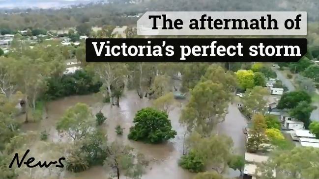
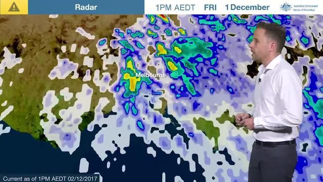
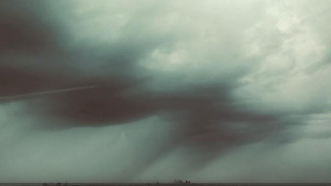
The storm front hit the state on Friday, with the northeast the worst affected as Euroa, Myrtleford and the Buckland Valley faced severe flooding.
“We think after that the main low will move away and we will just see showery, cool weather through most of the state for the remainder of Sunday,” Bureau of Meteorology senior forecaster Scott Williams said.
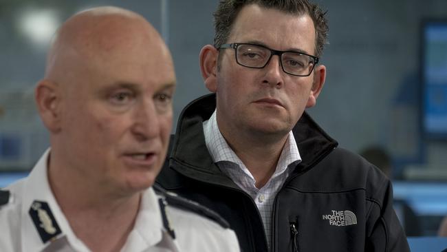
Premier Daniel Andrews urged all Victorians to stay vigilant and look after each other, particularly those in the flood-threatened centres.
“Some of these rainfall totals we’ve seen are well and truly an entire summer’s rain almost in just a 24-hour period,” he told reporters in Melbourne on Saturday.
WILD WEEKEND
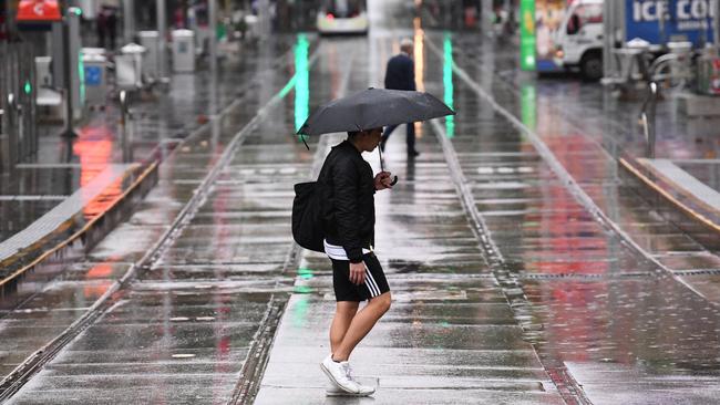
At about 3.30pm yesterday a band of heavy rain barrelled off the Blue Mountains into Sydney and Wollongong.
While the threat of severe thunderstorms across NSW has passed, parts of the state were still expected to cop a drenching with communities warned to prepare for possible flash flooding.
The Bureau of Meteorology issued a severe weather warning for heavy rainfall in southeastern parts of the state including the Snowy Mountains and south coast on Saturday.
An earlier severe thunderstorm warning for Gosford, Sydney and the Southern Tablelands was been cancelled.
Brisbane could experience between 30-40mm of rainfall on Sunday and Monday.
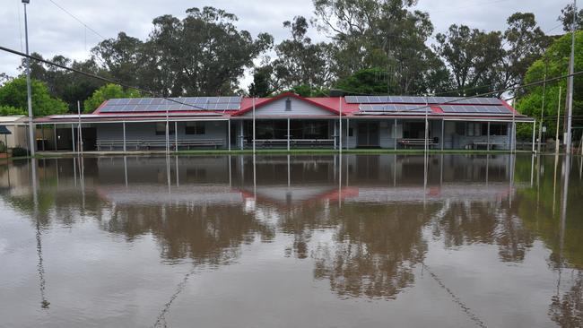
Meanwhile, in north east Victoria and southern NSW, the most heavily affected areas, rainfall records have tumbled.
Echuca, on the Murray, has received 127mm of rain, more than has fallen since records began in 1881. Other areas will have received more than 200mm of rain, the Bureau of Meteorology (BoM) has said.
The record-breaking rains was a “fairly exceptional” event, BoM senior forecaster Scott Williams said.
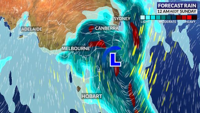
“Over the past 48 hours we’ve seen the development of a very large and quite intense weather event across southeastern Australia ... Victoria has borne the brunt of it,” Mr Williams said.
SCROLL DOWN FOR YOUR WEEKEND WEATHER FORECAST
Parts of Victoria have seen their heaviest rainfall ever with 186mm falling on Mount Wombat and 170mm at Euroa in the state’s north. Strathbogie has seen 165mm just since 9am on Saturday.
Severe #thunderstorm warning for damaging #winds and heavy #rainfall for #Metropolitan #CentralTablelands #CentralWestSlopesPlains and parts of #NorthWestSlopesPlains, #SouthWestSlopes, #Illawarra, #Hunter #LowerWestern and #Riverina. Latest warnings at https://t.co/dhhYAqlblr pic.twitter.com/aitzOdzCVP
— Bureau of Meteorology, New South Wales (@BOM_NSW) December 2, 2017
The SES has received more than 1300 calls for help so far, roughly half of them in the Melbourne area.
On Saturday, the weather bureau defended its dire warnings after eyebrows were raised following far lighter downpours in Melbourne than were expected.
“The way that it’s panned out has been similar to what we were predicting,” said the Bureau’s Dr Andrew Tupper.
Other states have also been hit. Canberra saw 35mm of rain and Wagga Wagga 43mm.
A number of stations recorded their largest #daily #rainfall totals in December yesterday. These include Yalgogrin Nth (95mm), Gunbar (67mm), Griffith (61.4mm), Gundagai (58mm), Yanco (53.6mm) and Deniliquin (47.4mm). See the latest totals at https://t.co/znZc90Dabo pic.twitter.com/6mcfVlYmQN
— Bureau of Meteorology, New South Wales (@BOM_NSW) December 2, 2017
#Echuca, #LakeEildon and #Strathbogie have seen their heaviest #rain on record for any month. Well over 100mm and well over 100 years of data. #severe #flood @SkyWeatherAUS
— Thomas Saunders (@TomSaundersSNW) December 1, 2017
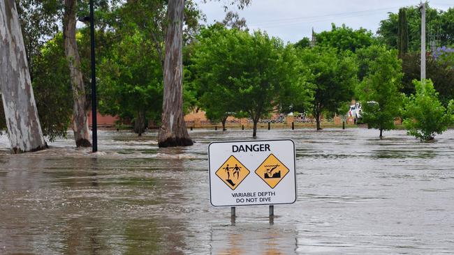
All southbound lanes on the HUME FREEWAY between #Benalla & #Euroa are CLOSED due to flooding. Southbound traffic detour is via Shepparton. For road closures visit https://t.co/KhrVo3Fcki Never drive through floodwater. It takes just 15cm for a small vehicle to float. #vicfloods pic.twitter.com/NCgZHO1azk
— VICSES News (@vicsesnews) December 1, 2017
The BoM’s Dr Tupper said Melbourne was lucky to escape the worst of the rain on Saturday which skirted the city’s northern outskirts.
He defended the BoM’s warnings including that the rain could cause a “threat to life”. At one point a metrologist compared the rain to the Titanic sinking saying, “They didn’t think the Titanic would sink, but it did two hours later.”
“You judge the severity of the event, before you know exactly where that event is going to hit,” said Dr Tupper.
“That’s why we went out very hard because we could see it was certainly going to be a large and impacting weather event,” he said.
“We’re getting much better at forecasting it but we know we won’t always get it with precision three or four days before the event. The way that it’s panned out has been similar to what we were predicting.”
An elderly couple became trapped in their car in floodwaters near Seymour on Friday night, rescued by a farmer in a tractor who plucked them to safety.
Late on Friday, Victoria’s Emergency Services Commissioner Craig Lapsley warned, “We’re not out of it. It hasn’t necessarily been across the state yet but it’s coming and the Bureau has been very clear in their forecast.”
Widespread falls of 20 to 40mm across the #Melbourne area in the 24 hours to 9am today, with falls in excess of 50mm across parts of the Dandenong and Yarra ranges: https://t.co/IZ4Tjyll1h pic.twitter.com/R0zVqYfi0E
— Bureau of Meteorology, Victoria (@BOM_Vic) December 2, 2017
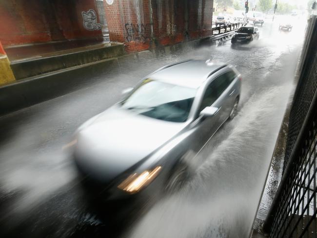
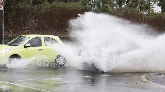
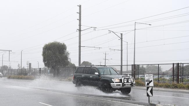
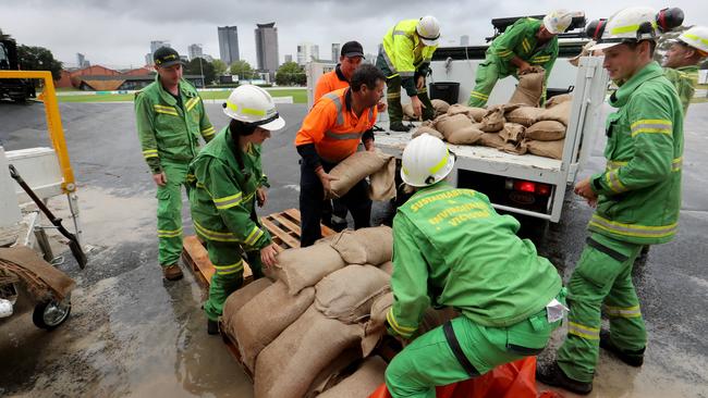
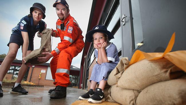
Five hundred State Emergency Services (SES) staff are on standby in Victoria on Saturday. The number one piece of advice: do not drive through flood waters.
Research released on Friday from NRMA Insurance showed a third of drivers weren’t confident of their skills in heavy rain.
“The reality is, it only takes a small amount of floodwater to make even a large vehicle unstable and potentially float away,” spokesman Ramana James said.
Sky News Weather’s Mr Saunders told news.com.au a complex low pressure system was behind the weather event.
“A very warm and humid northerly airstream has drifted over southeast Australia and will clash with cold air moving north from the Southern Ocean,” he said.
“Warm air colliding with cold air is a volatile mix and led to the formation of a deep and complex low pressure system over southeast Australia.”
Mr Saunders said weather patterns across Australia took a dramatic swing this spring over Australia following the driest September on record for parts of eastern Australia.
He said “rain arrived with a deluge” in October and continued through November, which boosted the seasonal figures to near or even above average for many regions.
“Brisbane has totalled over 250mm by the end of November, the city’s wettest spring in seven years,” he said.
— with AAP

Greens push for $4bn cut to insurance costs
The minor party has proposed a five-pronged attack to lower rising insurance premiums which they say could save households a total of $4bn.
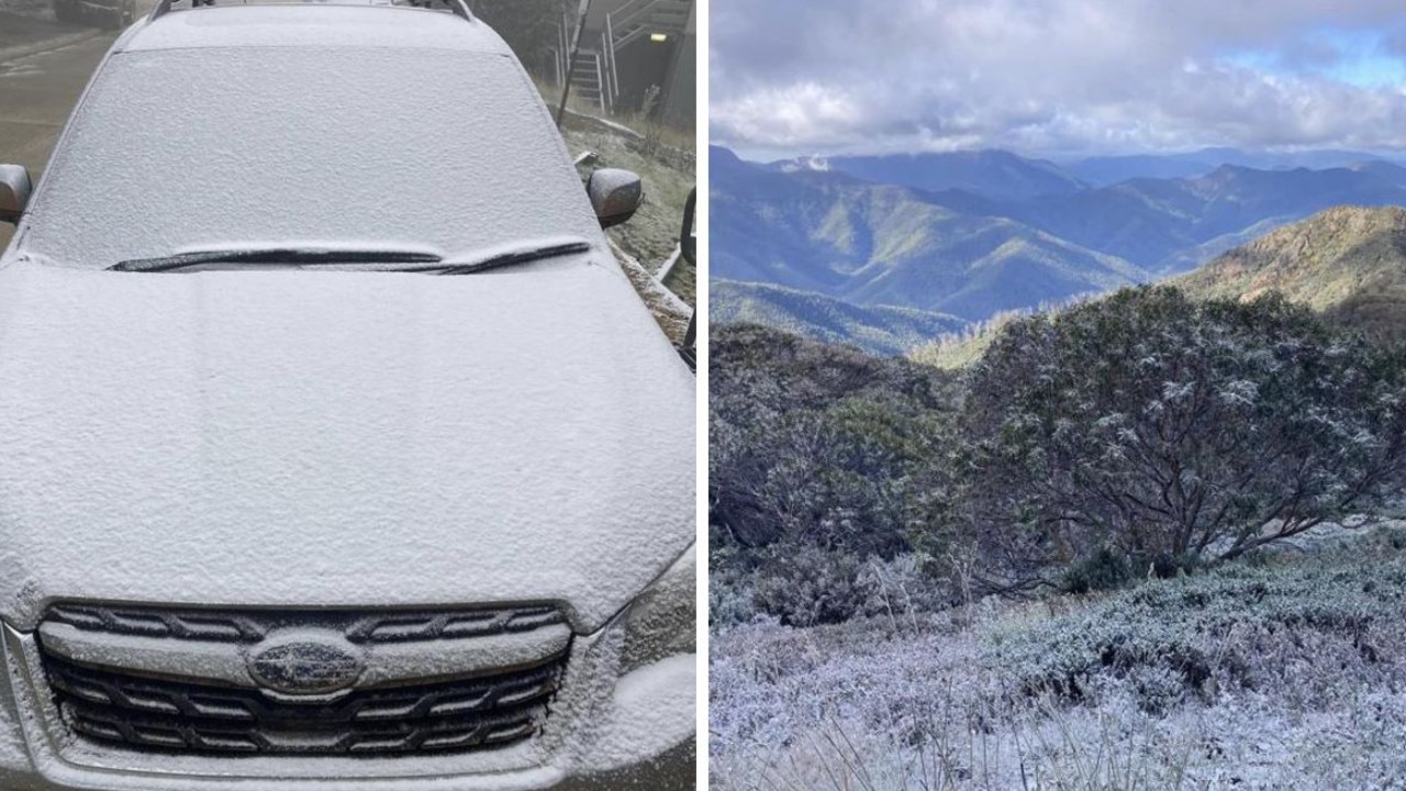
Aussies freeze as temperature plummets
Australians have been warned not to pack away their puffer jackets just yet after one state recorded temperatures up to 10C below average.
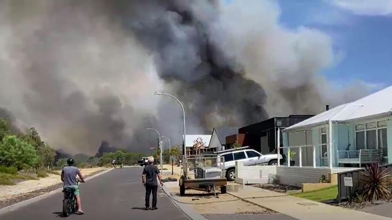
‘Avoid the area’: Bushfire threatens town
Authorities have warned residents of Dunsborough in West Australia to avoid the area as a major bushfire threatens homes.