
Renewed cyclone fears days after narrow Gabrielle miss
Flooding events, heatwaves, cyclones and bushfires are challenging emergency services teams across the country.
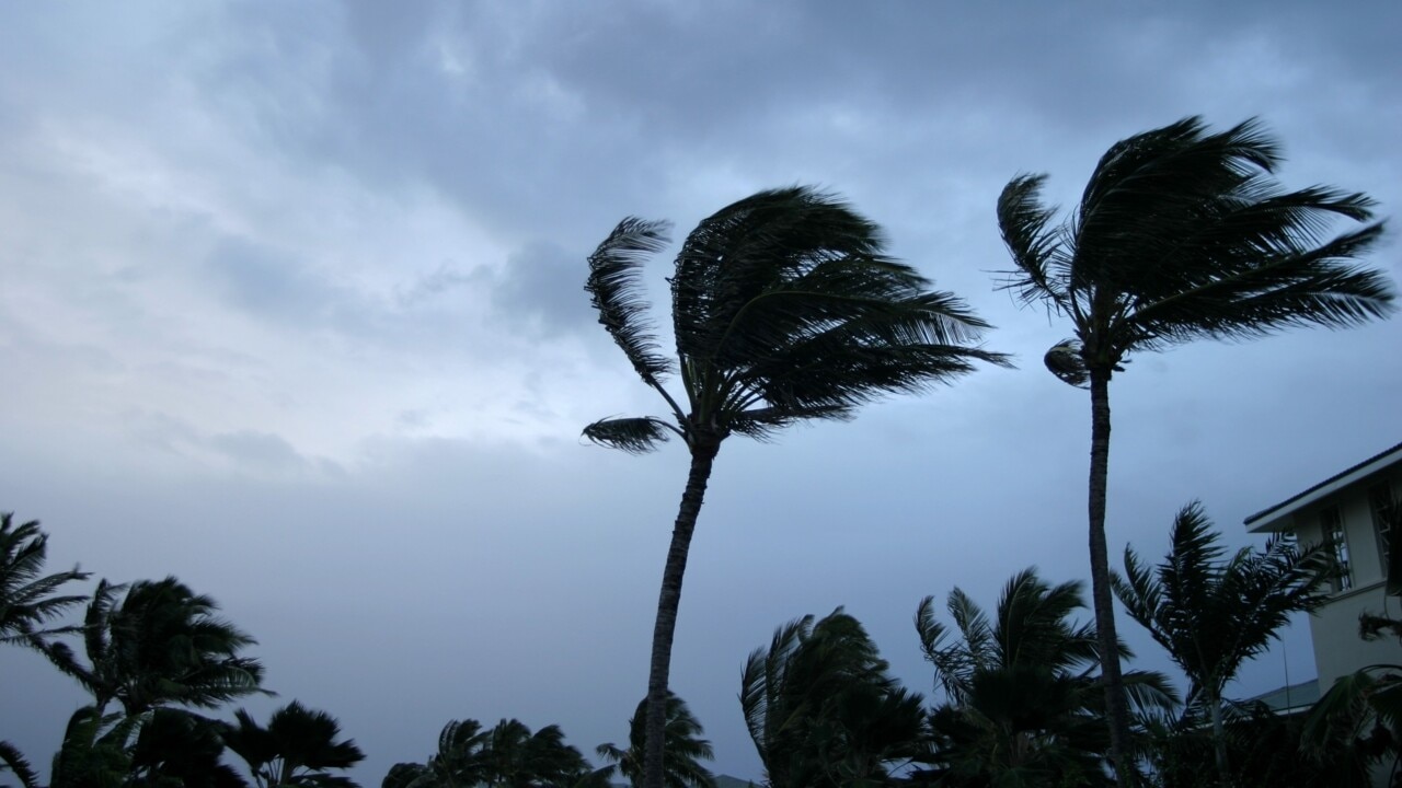
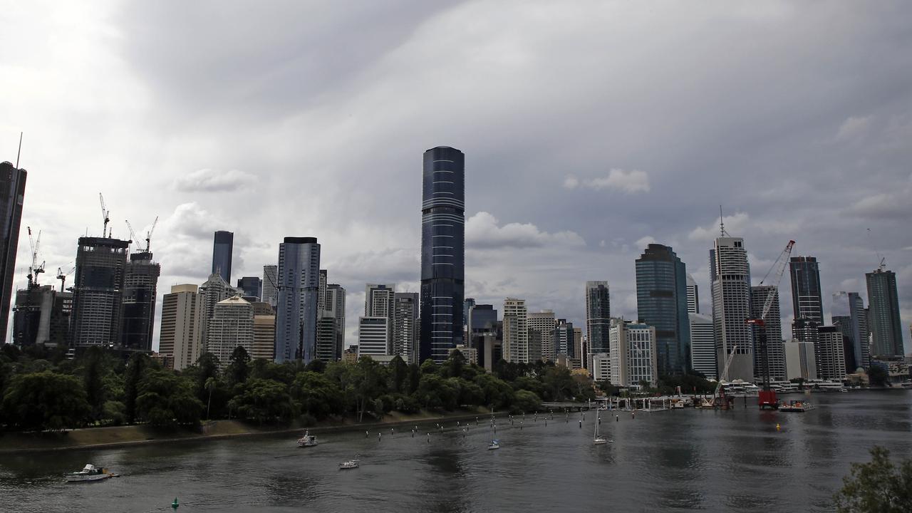
Queensland is bracing for a day of extreme weather conditions, potentially fighting both bushfires and flash flooding – as a cyclone brews just days after Norfolk Island dodged the worst of ex-Tropical Cyclone Gabrielle.
Meanwhile, a state of emergency is currently in place for Auckland as Tropical Cyclone Gabrielle continues to track southeast towards New Zealand.
Air New Zealand was forced to cancel more than 500 flights on Monday due to the cyclone, while some stations in Gisborne have recorded wind gusts of up to 160km/h and rain levels of 15-30mm in a single hour.

Queensland
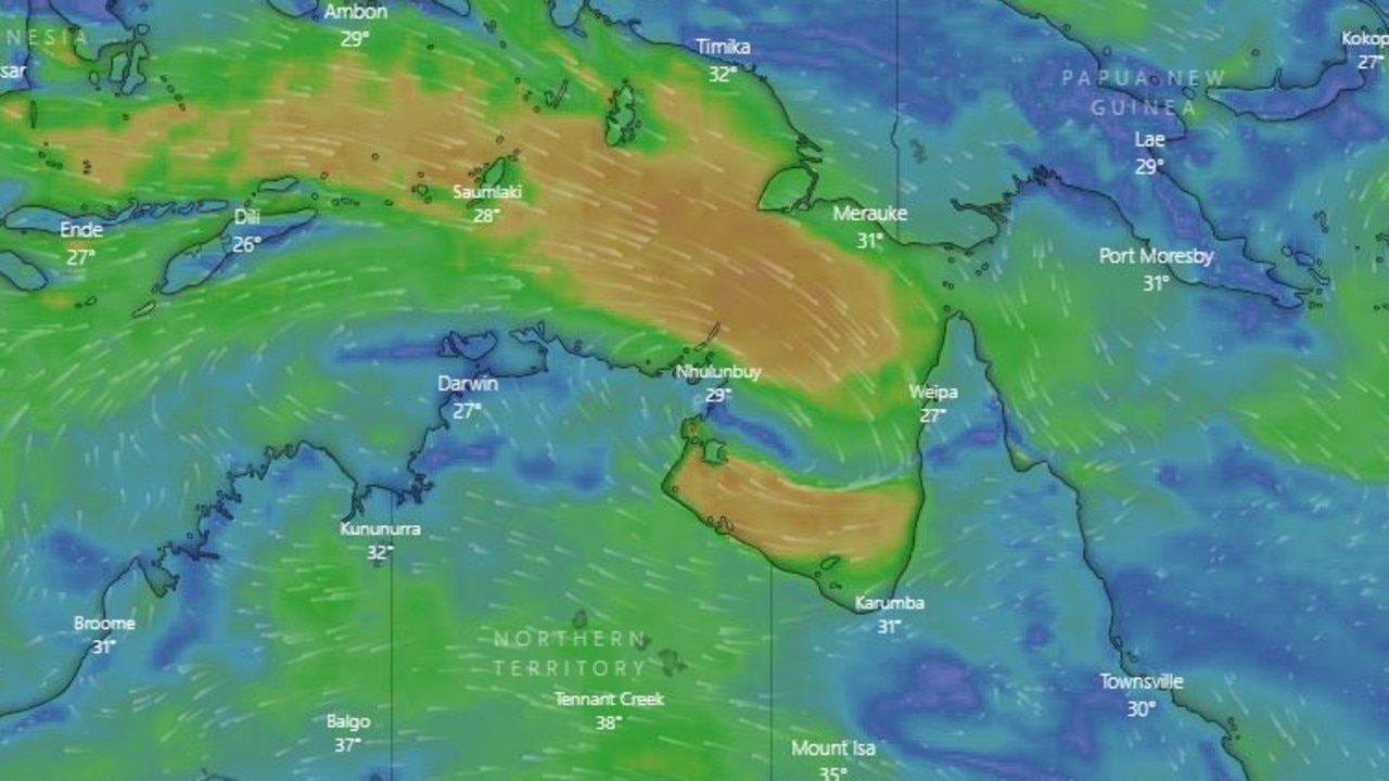
There are currently 16 active weather warnings across Queensland, including major floods, heatwaves and tropical cyclones.
While ex-Tropical Cyclone Gabrielle was downgraded to a deep low early on Sunday morning, the Bureau of Meteorology stated on Monday the system “still remains very strong” and more than 10 flood warnings remain in place throughout the state.
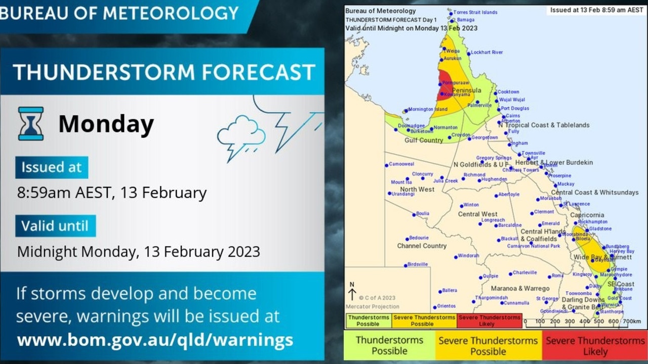
Severe thunderstorms are possible, while large waves may cause minor flooding to low-lying coastal areas on Monday.
Meanwhile, Far North Queensland is on flood watch as severe weather warnings for damaging surf remain in place.
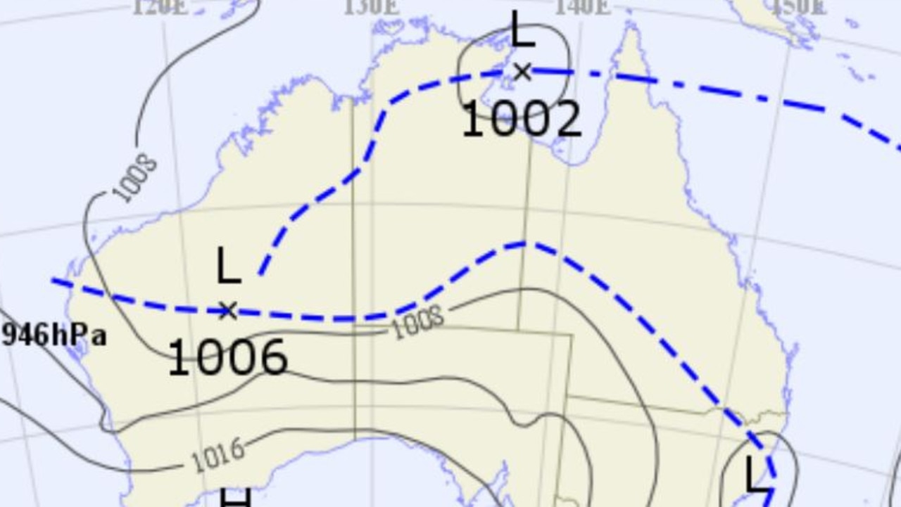
While the system continues moving southeast towards New Zealand, according to BOM another tropical cyclone could develop early on Tuesday morning as a Tropical Low develops near the Gulf of Carpentaria.
Latest data released on Monday states the system currently sits at a 20-50 per cent chance of developing into a cyclone, with the majority of impacts to hit the Northern Territory while Gulf Country faces the possibility of heavy rain and large tides.
Severe thunderstorms are likely to threaten the Western Peninsula with heavy rainfall, with possible severe storms and damaging winds to occur across the Capricornia, Wide Bay and Burnett districts.
Some regions continue to swelter through a heatwave, with the entire state forecast to sweat through temperatures starting at 30 degrees, exacerbating conditions which are fuelling around 50 bushfires across the regions.
Queensland Fire and Emergency Services state operations co-ordinator James Hague said the state faced “very difficult conditions” on Monday.
“A combination of high temperatures … but also very dry air, very low humidity and a fair bit of wind … makes controlling fires very difficult,” Mr Hague told ABC News.
“Unfortunately, we are expecting another warm day – not as warm and not as challenging as (Sunday), but still a very difficult day, so the conditions will probably worsen through the day as the heat of the day comes on.”

This comes as residents at Montrose near Tara in the Western Downs were evacuated after an emergency warning was issued for a fire bringing “significant threats” to various structures on Sunday.
“The main area of concern is the area in the Western Downs, Darling Downs and then down into the southeast corner, but also up as far as north of Gympie,” Mr Hague said.
“We have had a number of firefighters who were affected by heat stress and so on. They were treated on the scene by our partners in the QAS, who have been helping us in very challenging conditions.”
Mr Hague said one fire near the Beaudesert area was discovered to have been started by a mower hitting a rock, while the causes of the other fires remain under investigation.
A severe weather warning is still in place for the Arnhem and Carpentaria districts, while a cyclone watch warning has also been issued.
Northern Territory
Gusts up to 90km/h could develop from Cape Shield to Port McArthur, while heavy rainfall and flash flooding threatens the region around Groote Eylandt on Monday.
Dangerous surf warnings have been issued for northwest-facing coasts of the Wessel Islands and areas around the exposed Carpentaria and southeast Arnhem coasts to Groote Eylandt until early Wednesday, with waves up to four metres expected, according to BOM.
The monsoon trough will bring widespread showers and thunderstorms across the territory throughout the week, bringing with it potentially damaging winds near coastal areas.
NT residents are being urged by Emergency Services to take appropriate precautions, including preparing for power outages and ensuring pets and animals are safe.
Western Australia
Western Australia can expect showers and gusty thunderstorms over the Kimberley and Pilbara throughout the week, while very hot temperatures will persist over the northern parts of the state.
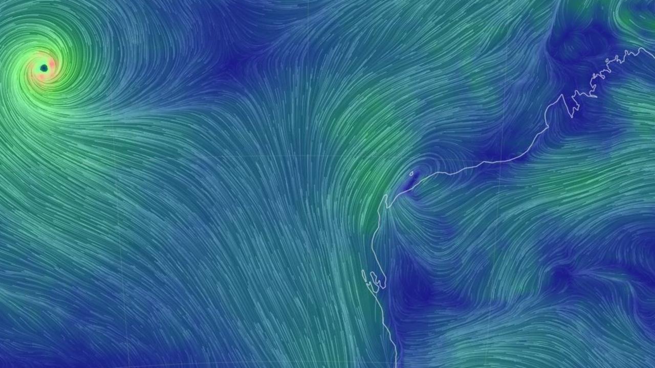
A severe heatwave warning remains in place for the Kimberley, Pilbara, North Interior and South Interior Districts until Wednesday, while Severe Tropical Cyclone Freddy is likely to continue westward and should pass out of the Australian region on Tuesday.
Midwest Inland remains under an Extreme Fire Danger forecast on Monday as dry and hot conditions ahead of gusty south-westerly winds lead to elevated fire dangers.
NSW and ACT
A low-pressure trough is slowly moving through NSW and the ACT on Monday, with some showers in the northeast to be expected until Thursday.
A high pressure system will bring stable conditions inland, with mostly dry weather across the regions expected during the second half of the week.
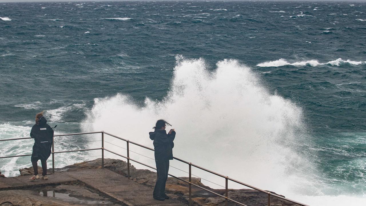
Hazardous surf warnings are in place for Monday and Tuesday, with swell conditions expected to be hazardous for coastal activities such as boating and swimming.
The areas affected are the Byron Coast, Coffs Coast, Macquarie Coast, Hunter Coast, Sydney Coast and Illawarra Coast.
Victoria
Victoria can expect dry and mild weather this week, with moderate winds and some possible fog in the south on Wednesday.
South Australia
South Australia is forecast to remain hot and dry throughout the week. However, BOM has issued a warning of a chance of a thundery shower around the North West Pastoral district on Monday.
A Flood Watch and Act issued on Thursday remains in place for areas between Cadell and Mannum on the River Murray and for the Lower River Murray.
Tasmania
Tasmania can expect fine weather, with some possible showers early in the week, as well as afternoon sea breezes until Thursday.

Reason housing crisis could get worse
Australians are already facing a shortfall of more than 640,000 affordable homes. There’s one reason that might get even worse.

Severe frost alert for Aussie farmers
Farmers are being urged to keep their livestock warm as a freezing start to winter puts animals at risk.

Aussie-first hydrogen servo opens
Australia’s first publicly accessible hydrogen service station has opened, in a huge move towards decarbonising commercial vehicles.