
Queenslanders warned of floods, ‘triple digit rainfall’ after some areas recorded more than 240mm of rain in a day
Australians in one state have been warned to brace for more “triple digit rainfall” and potential flooding after falls of more than 240mm were recorded.

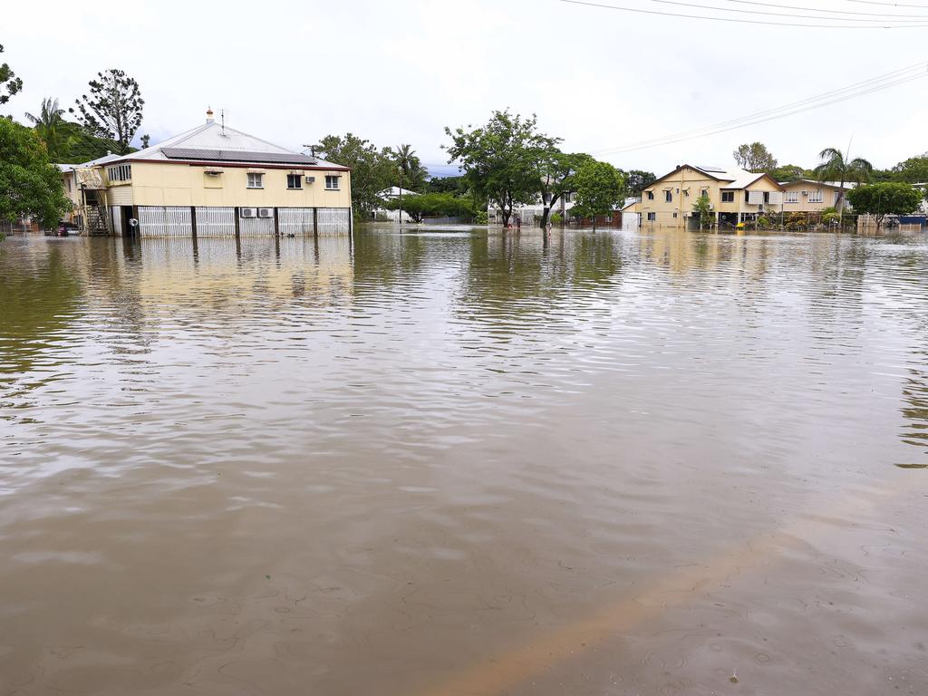
Queenslanders have been warned to brace for floods and “triple digit rainfall” as some areas recorded more than 240mm of rain in less than 24 hours.
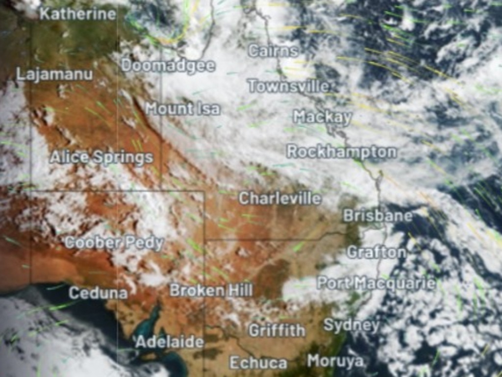
Bureau of Meteorology senior meteorologist Miriam Bradbury said the state’s northeast tropics had experienced widespread rain and showers, with Paradise Lagoon recording 248mm of rain between 9am Monday and 5am Tuesday.
About 75mm of the rainfall was recorded in just an hour, Ms Bradbury said, while Paluma recorded 235mm of rain between Monday and Tuesday mornings.
She warned that wet weather was set to continue, with flood warnings in place across the state.
“It’s likely that some locations, particularly about the north tropical coast, will receive triple digit rainfall totals day after day,” Ms Bradbury said.
“This will result in river rises and potentially significant flooding.
“Heavy falls should start to ease back later this week, although showery weather is likely to persist into the weekend.”
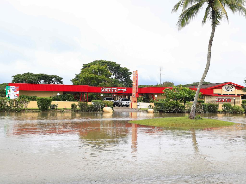
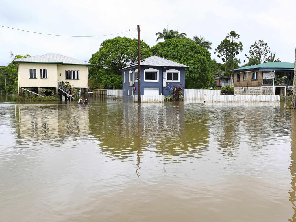
The warning comes just a month after nearly 200 Ingham homes were hit by floods, according to the ABC, with Hinchinbrook Shire Mayor Ramon Jayo saying there was still “a lot of trauma”.
Mr Jayo said “things can change in a heartbeat” and urged people to prepare for potential flooding.
A moderate flood warning was issued for the Tully River, while an initial moderate flood warning was also put in place for the Bohle River.
Minor warnings were issued for the Johnstone River catchment and Mulgrave and Russell rivers, while a flood warning was put in place for the Black River and Bluewater Creek.
A final flood warning was issued for the Lower Condamine River, while the North Tropical Coast was issued an initial flood watch.
“Catchments are quite wet, so rivers will respond quickly to any further rainfall,” Ms Bradbury said.
“Additional flood warnings or changes to the flood watch area are possible in the next few days as that heavy rainfall continues a risk.
“As we see this heavy rainfall risk continuing we may also issue a severe weather warning or a severe thunderstorm warning as needed to flag the areas where that heavy rain or flash flooding are of greatest concern.”
She said heavy rain was expected to continue over the north tropical coast in the coming days, with showers to extend towards inland and central Queensland from Wednesday.
“This means the coastal range in Townsville may see their heavier falls from later today into Wednesday,” Ms Bradbury said.
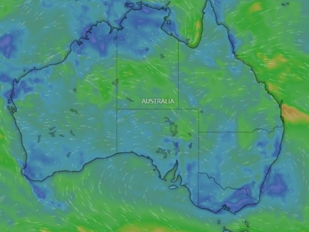
“This wet weather is due to that persistent easterly flow winds blowing from the east bringing moist air from out over the ocean and directing it against the coast and the ranges.
“These easterly winds are combining with a surface trough lying in the Gulf of Carpenteria, together producing the cloudy skies, the rain and the cooler temperatures.”
Brisbane is tipped to reach highs of 28C and 29C as the rain persists, while Sydney is expected to have a cloudy week with a high of 29C.
Melbourne is set to experience showers from Thursday despite a high of 30C before temperatures plummet to a top of 23C on Friday.
Perth can expect a sunny week with temperatures soaring to 33C on Saturday, while Adelaide is set to hit a high of 32C on Wednesday before possible showers on Thursday, bringing temperatures down to 28C and 29C for the rest of the week.
Hobart is also in for rain from Thursday through to the weekend, with a top of 27C expected on Thursday.
Canberra is also expected to experience showers from Thursday into the weekend despite temperatures tipped to hit 31C on Thursday and Saturday.
Darwin is expected to remain steady at highs of 32C and 33C through the week; however, showers and possible thunderstorms are likely.


