
Queensland and NSW to cop severe thunderstorms
WARNINGS have been issued for severe thunderstorms and heavy downpours across much of the country as wild weather continues to rage.
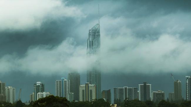
SEVERE thunderstorms and heavy downpours will continue to batter Queensland and NSW in the coming days.
Queensland has already copped up to 300mm of rain across the weekend in one of the worst starts to the wet season on record.
According to the Bureau of Meteorology, strong winds, heavy rain and possible storms are expected will continue to lash the state in coming days — particularly in the north where the bad weather could persist until Wednesday.
On Saturday, Brisbane recorded its wettest February day in 46 years — copping a massive 136mm of rain making the period its wettest day since May 2, 2015, when 183mm fell.
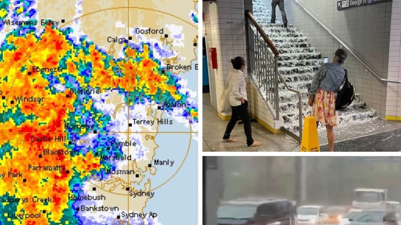
The bureau also issued a severe thunderstorm warning for parts of NSW and ACT — including the Southern Tablelands and parts of Illawarra, South Coast, Central Tablelands, South West Slopes and Australian Capital Territory Forecast Districts.
“Severe thunderstorms are likely to produce heavy rainfall that may lead to flash flooding in the warning area over the next several hours,” the warning reads.
“Locations which may be affected include Nowra, Braidwood, Canberra, Goulburn, Yass and Queanbeyan.”
Almost all Sydney beaches have been closed today due to dangerous surf conditions, according to Beachwatch NSW.
Lifeguards report that due to dangerous surf conditions, almost all Sydney beaches are closed today; those with flags up are Palm, Collaroy, South Steyne and Bondi.
— Beachwatch NSW (@BeachwatchNSW) February 25, 2018
Dawn Fraser baths are closed due to potential for stormwater pollution today.
Canberra residents are mopping up after a day of heavy rainfall, with some areas hit with more than 50mm of rain in an hour.
The ACT State Emergency Service had received more than 200 calls for help on Sunday evening as heavy rainfall closed roads and led to some flash flooding.
Woolshed Creek, in Canberra’s northeast, received about 45mm of rain in the hour to 10am Sunday, according to the Bureau of Meteorology.
Many residents posted images on social media showing flooded basements and swollen creeks as authorities urged people not to drive through flooded roads. The majority of the rain fell in the morning, however it persisted throughout the afternoon as a trough gradually contracted to the northeast.
Bureau of Meteorology forecaster Steph Spackman said there would only be light showers and drizzle overnight.
“It will start to clear out about mid morning Monday and we’ll still have those southeasterlies, but the precipitation should be gone by then,” she told AAP.
The Australian National University announced its Acton campus would be closed on Monday due to the flooding.
The university said while child care centres would open as usual, students and staff shouldn’t come to the campus as “essential safety checks on infrastructure including bridges, creek banks and electrical switchboards” were being conducted.
#Heavy #Rainfall with #thunderstorms. See latest #warning at https://t.co/bukUyiXp4Z pic.twitter.com/lZ2GGgbGzO
— Bureau of Meteorology, New South Wales (@BOM_NSW) February 24, 2018
Severe thunderstorm warning updated, with heavy rainfall redeveloping around #Townsville. Heavy falls possible elsewhere in the warning area, with damaging wind gusts possible in the northwest. Updates: https://t.co/kR2Xz4GYzJ pic.twitter.com/cYsZIAG2Gn
— Bureau of Meteorology, Queensland (@BOM_Qld) February 24, 2018
Jonathan How from the Extreme Weather Desk at the Bureau of Meteorology, told news.com.au on Sunday that the heavy rain and thunderstorms in Brisbane will subside by the end of the day — but other parts of Queensland can expect to cop it for a few more days.
“It is quite unusual to see this amount of rain, at this time of year in Queensland and we’re seeing some of the biggest daily totals of rainfall in years,” he said.
He added that it’s going to feel very hot in parts of SA and central and western Victoria in the coming days — as temperatures could reach the mid-thirties. However, a cold front is expected to move in by the middle of next week.
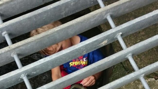
The nasty weather in Queensland almost proved fatal for one young boy, who is lucky to be alive after becoming stuck in a drain on one of the state’s wettest days.
According to theCourier Mail, four-year-old Drazic Grimmett was playing with friends in a Morayfield park Saturday morning when he crawled up a stormwater drain.
After travelling about 50m along the pipe, he was unable to get out.
He was eventually rescued by four Caboolture firefighters who had to remove the stormwater grate to get him out.
Among the flash flooding, two tourists had to be rescued by swift-water crews on Friday night after their car was swept from a causeway at Kobble Creek, near Dayboro.
The pair escaped their vehicle but were washed 200m downstream. A four-year-old was also pulled from a drain in Morayfield, north of Brisbane, where he was playing unsupervised before being stuck for more than 20 minutes.
In the past 24 hours the SES has responded to 400 call-outs, mainly in the southeast.
About 150mm of rain has fallen in Brisbane since 9am on Friday, and the drizzle is expected to continue early this week.
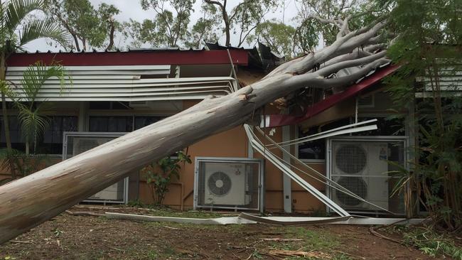
Around 30,000 properties across north and central Queensland were left without power as the wild storms hit and left extensive damage to properties on Tuesday.
The Bureau of Meteorology has issued a flood watch in the Gulf country, as significant storm activity is forecast in the next few days.
The deluge swamping southeast Queensland has delivered average monthly rainfalls within 24 hours, producing flash flooding, road closures and overspilling dams.
The Bureau of Meteorology said the upper low system saw many areas from the Sunshine Coast to Gold Coast receive more than their monthly average in one day.
The bureau’s latest figures show Toolakea (northwest of Townsville) copped a whopping 498mm in five days last week — making it the wettest part of the state.
Binna Burra in the Gold Coast Hinterland was the most rain-sodden in 24 hours with 215mm, while Springbrook, Tamborine Montain and Numibah all topped 200mm.
In Brisbane, Park Ridge in the southern outskirts had the most with 167mm and Kenmore Hills received 163mm.
Nambour was inundated on the Sunshine Coast with 156mm, while storms further north saw Paluma, near Townsville, receive 174mm.
Bureau forecaster Lauren Pattie said the chance of thunderstorms early next week could still see some areas receive more large dumps.
“There’s still a chance of seeing heavy falls but they’re more isolated and associated with thunderstorms rather than the widespread and excessive rain we’ve seen,” she told AAP.
SEQ Water advised 13 ungated dams were spilling as the catchment’s average rainfall for the coastal areas ranged from 130-230mm.
“The SEQ Water Grid ... climbed to 76.8 per cent — a 1.2 per cent increase in the past 24 hours. Inflows for the dams will continue over the next few days,” it said in a statement.
The Grid, which makes up nearly 90 per cent of southeast Queensland’s total water storage, has captured over 35,000 million litres of water flows as of Saturday morning.
Farmers out west could also celebrate some welcome help with storms dumping more than 50mm in central Queensland areas.
It came as the Isaac region was offered federal disaster assistance funding after copping torrential rain this week in storms rated worse than Cyclone Debbie by locals.
— with AAP
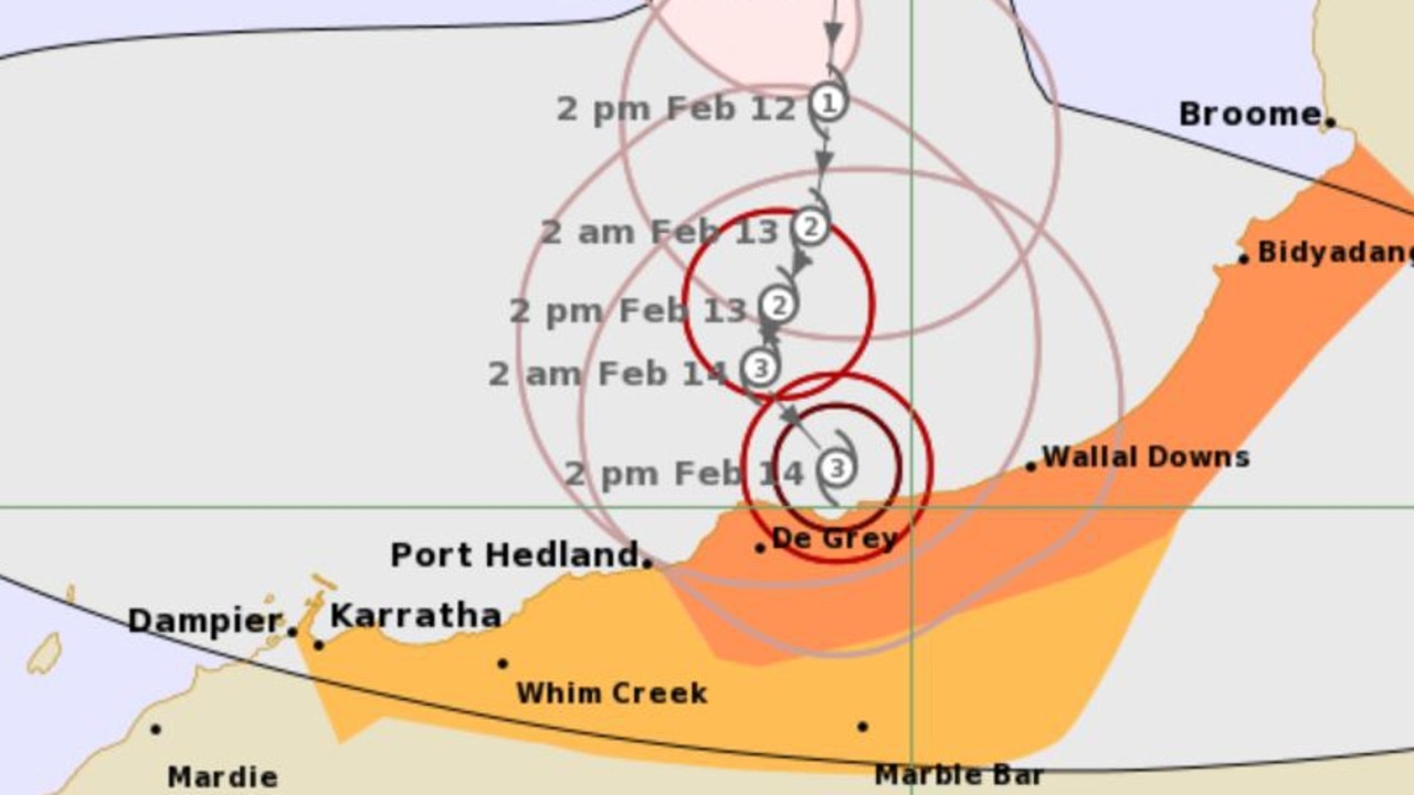
State braces for days of cyclonic weather
Western Australian residents have been warned a cyclone is expected to hit as the country’s torrent of wild weather shows no sign of slowing down.
State braces for more severe storms
More than 20 people have been rescued after becoming trapped in floodwaters while thousands are without power as storms threaten to smash NSW for a second day in a row.
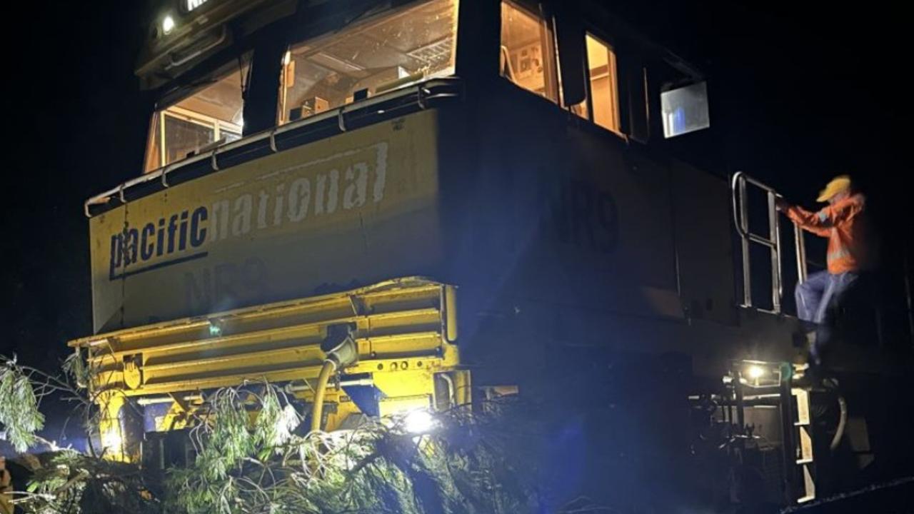
Train crash causes diesel spill in beloved region
Emergency services are mopping up a diesel spill in a tourist region after a train crashed into a tree.