
Queen’s Birthday long weekend weather: Cool days and frosty nights across southeast
Antarctica has sucked Queensland’s usual winter conditions down south. But that doesn’t mean it will be warm this long weekend.


The Queen’s Birthday is set to be sunny but cool with the possibility of freezing fog on higher ground.
All states bar Western Australia and Queensland will have a public holiday on Monday.
Expect lows of just 5C in Melbourne, 3C in Tasmania and -2C in the capital on the first weekend of winter. You may even need a scarf in Brisbane with the city dipping down to a mere 11C overnight on Saturday.
RELATED: 27 cosy things to wear at home
Large areas of frost are likely across Tasmania, Victoria and New South Wales particularly on higher ground.
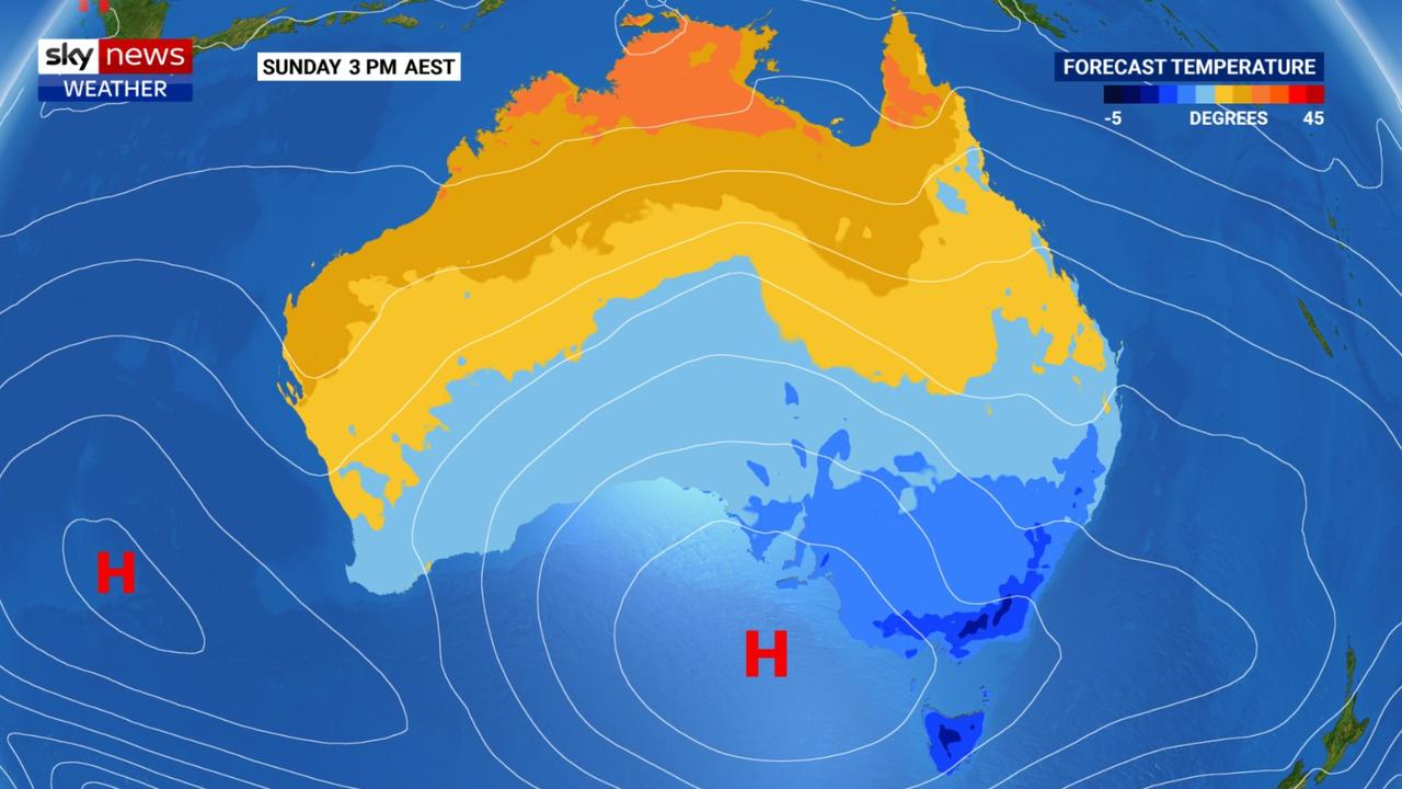
“This long weekend is looking cool across southeastern Australia,” said Sky News Weather meteorologist Rob Sharpe.
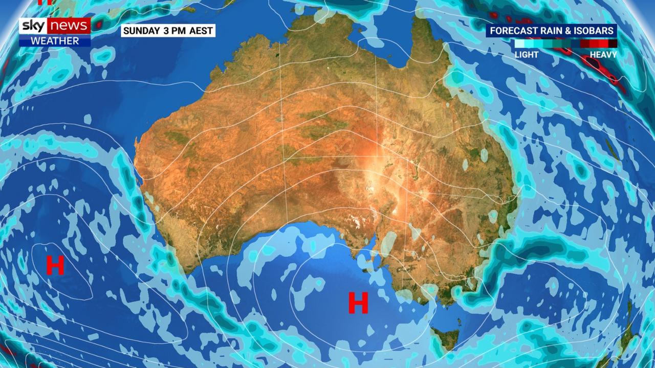
“A weak cold front will cross Tasmania on Friday, brushing southern Australia on Saturday and then the southerlies look to bring showers along the NSW coast on Sunday and Monday.”
ANTARCTIC INFLUENCE
You can pin the blame for the shiver-inducing conditions on Antarctica, or at least it’s weather systems, which are dragging a large area of high pressure across southeast Australia.
High-pressure systems bring generally calm conditions and often result in clear skies. In winter that can lead to mild days with the sun shining down but chilly nights and frosty mornings as, without clouds to hold it in, all the heat escapes.
“The reason why the high has been allowed to become so dominant is because the southern annular mode, known as SAM, has become positive,” Mr Sharpe said.
“During a positive SAM the westerly winds surrounding Antarctica contract southward. At this time of the year that leads to Australia typically seeing fewer and weaker cold fronts and the high-pressure systems are allowed to sit further south.”
What would be more typical winter conditions in Queensland are effectively pulled further south. While more dramatic weather that might be more characteristic of a Victorian or Tasmanian winter – icy winds, storms, and snow producing clouds – are sucked out to sea towards the pole.
In Sydney, the calm conditions will bring really very consistent temperatures fluctuating only between highs of 17-19C for the rest of the week, into the weekend and beyond.
Sunny but showers, possibly heavy, are likely from Sunday. Expect lows in the high single digits.
In the Blue Mountains temperatures will dip to 0C overnight for the next few days with the possibility of freezing fog, a treacherous combination that could see heavy frost.
Indeed, large swathes of higher ground across the east, and even lower elevations in Victoria and Tasmania, are likely to experience frost over the weekend.
Canberra will see generally pleasant wintry conditions of around 13C for the next week with clear skies. But the mornings will be cold – -2C all weekend and into Monday.
Similar daytime temperatures to Canberra in Melbourne but the nights will be slightly milder – although you wouldn’t exactly call them warm. The mercury could drop to 6C in the CBD going into the weekend and hit just 4C early on Monday. Showers possible on Saturday and Sunday.
Rainy in Hobart on Friday followed by partly cloudy days. The city will see a high of 14C on Friday falling to 11C on Saturday with lows of between 3-4C on the long weekend.
Adelaide will peak at 14C-15C for the next week with sunny skies peppered with clouds. At dawn it could get as low as 6C.
“In the west a small low is likely to approach the coast on Saturday night into Sunday, but it will weaken before it arrives, therefore only bringing a few showers to the west coast and southwest corner,” Mr Sharpe said.
That could mean Albany and Margaret River may see some rain. But Perth is likely to remain dry and actually rather warm with maximums of 25C dipping slightly into the new week. Minimums of 11C for the next couple of days and then up to 13C.
Brisbane will be cold overnight – well, cold for Brisbane. It could get as low as 11C for the next few nights, slightly warming up early next week. The days will be sunny and wintry warm with highs of 23C.
Toasty in the Top End reaching 31C through the Queen’s Birthday weekend then sinking to 18C early in those Darwin mornings.

Aussie miner drops F-bomb 10 times in rant
An Australian miner’s expletive-laden rant about the future of coal-burning has caught the attention of the world’s richest man.

Aussie city’s coldest morning in 15 years
An Australian capital city has recorded its coldest morning in more than a decade, with temperatures close to freezing.

Luxury homes trashed in Aus ‘tornado’ hell
The sudden storm tore through streets, damaging homes, uprooting trees, and knocking out power across multiple suburbs.