
‘Inland sea’ emerges in Aussie outback as Qld prepares for another week of rain
Wild photos have shed light on conditions as one state is smashed by rain, with severe weather and flood warnings issued ahead of another soggy week.

Inland seas have been captured in wild photos of Queensland’s outback as the state braces for another week of rain.
A severe weather warning has been issued for those in the Maranoa and Warrego as well as parts of the Central Highlands and Coalfields, Central West and Channel Country forecast districts.
Heavy rainfall is set to continue over the southern interior on Thursday before moving further south and east.
“Heavy rainfall which may lead to flash flooding is likely to continue through the warning area during the rest of today, with a general southward trend of the heaviest falls,” a Bureau of Meteorology alert stated.
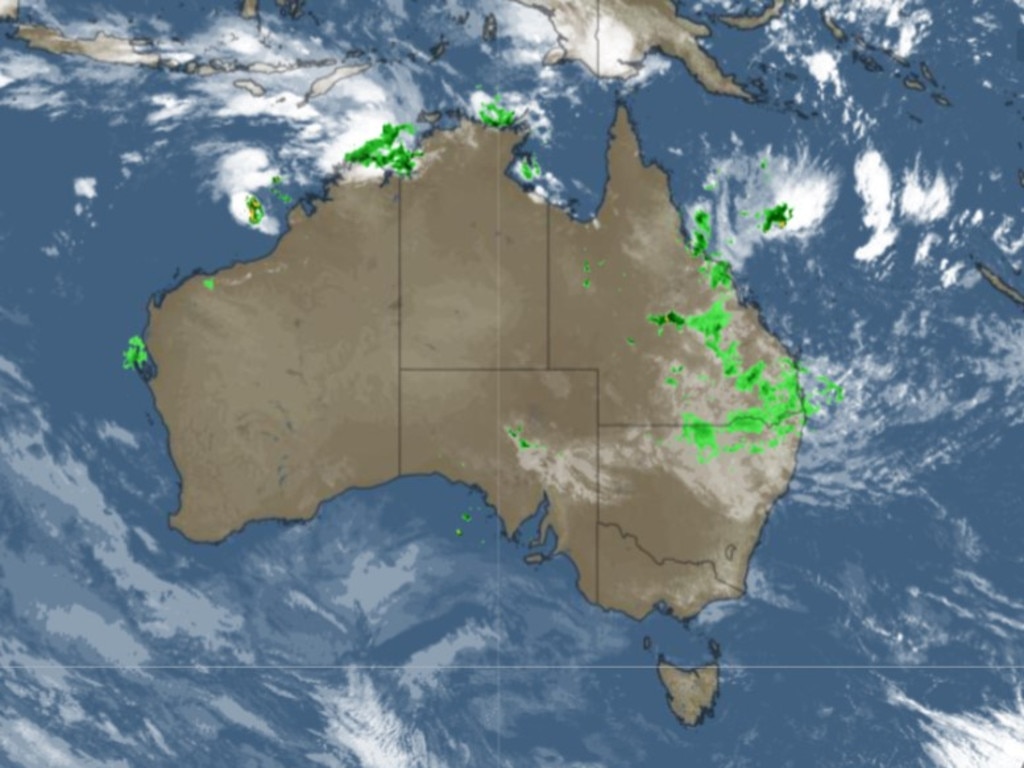
About 170m of rainfall was recorded in the 24 hours to Thursday in Bogewong, with isolated falls of up to 120mm within six hours possible across the warning areas.
Bureau of Meteorology meteorologist Helen Reid said between 200 and 400mm of rain had fallen across western and southwestern Queensland over the last few days, with more on the way.
“We’re expecting widespread 100-200mm of rainfall across much of central and southern inland Queensland over the coming days and also moving into eastern Queensland later this week and into the weekend,” Ms Reid said.
The heaviest falls are likely to be around the central and southern inland and potentially around parts of the Queensland coast.
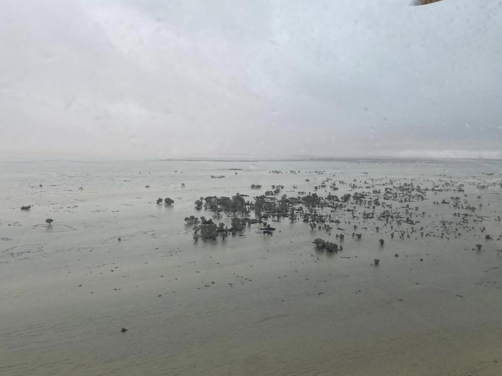
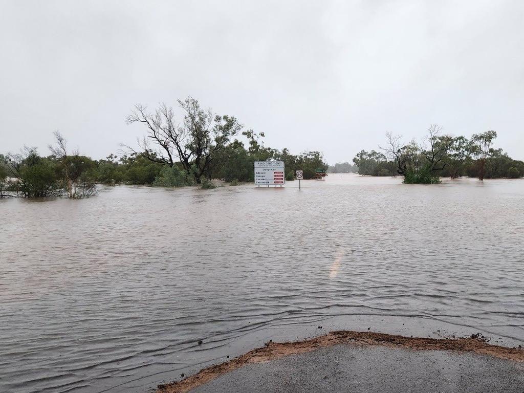
Wild photos have captured the extent of the rainfall, with parts of the Australian Agricultural Company’s South Galway Station in Channel Country – about 1300km northwest of Brisbane – submerged.
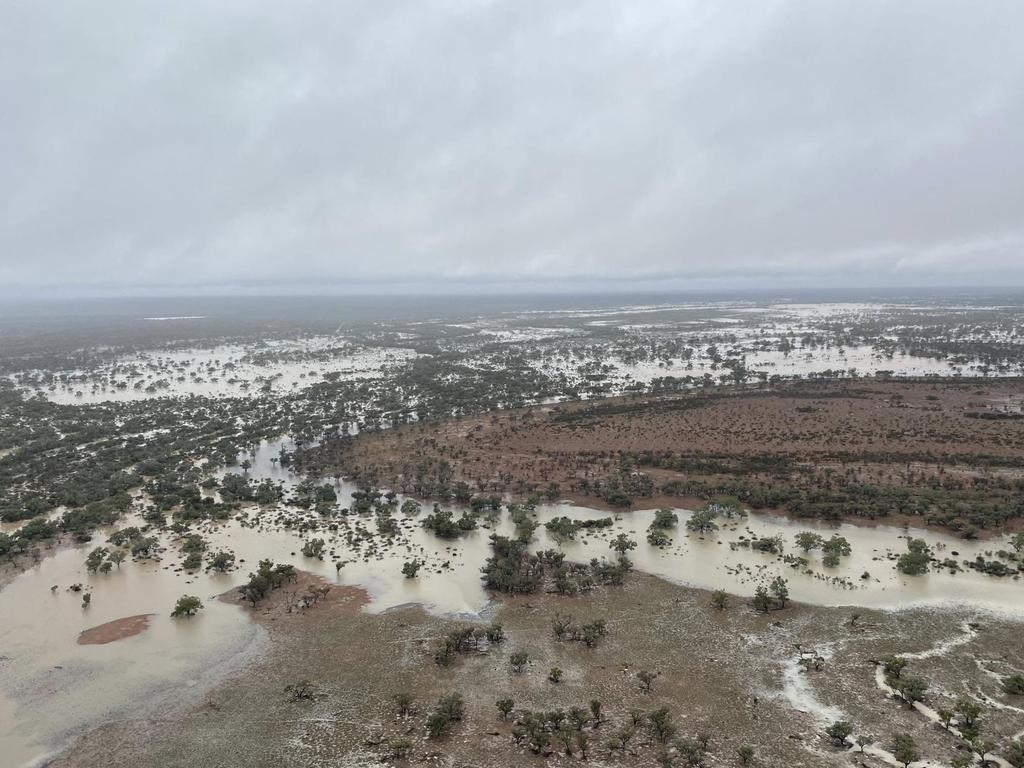
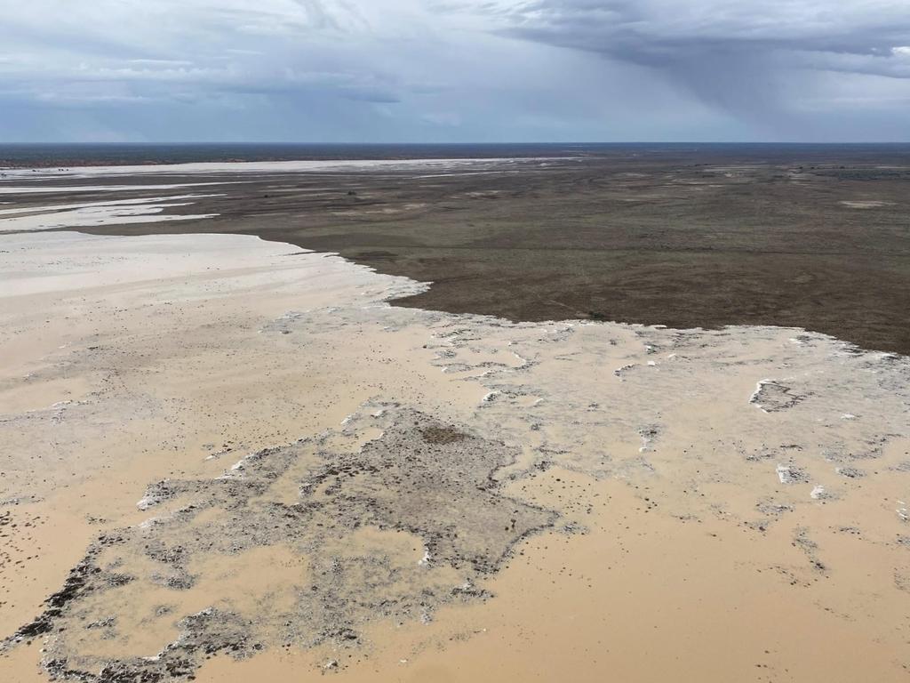
Trees creep out of the water in the photos shared by the company, which owns and operates Australia’s largest cattle herd in Queensland and the Northern Territory.
“Queensland’s Channel Country is starting to turn it on!” the company wrote.
Emergency as flooding affects homes
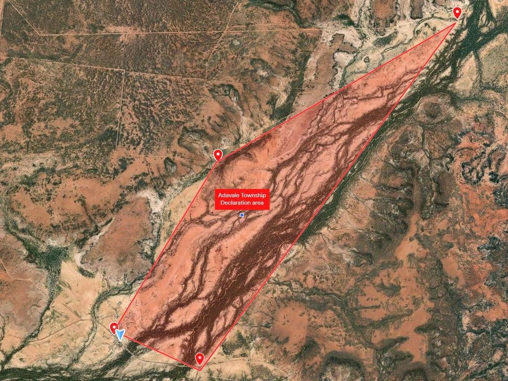
Queensland Police issued an emergency declaration under the Public Safety Preservation Act (PSPA) for Adavale, a tiny rural town west of Roma, about 8.15am on Thursday.
“Emergency services have received multiple calls that the town is currently inundated by floodwater and floodwater is impacting homes,” the alert said.
An exclusion zone was put in place for the intersection of Adavale Rd and Adavale Blackall Rd, Adavale Rd and Langlo Crossing Adavale Rd, Patricia Downs Rd and 5km northeast of Dutton St and Adavale Rd and Quilpie Adavale Rd.
“A place of refuge has been established at the Adavale Town Hall,” the alert stated.
“If you are in a life-threatening situation, please call triple-0 (000) immediately.”
Deluge to soak Queensland, northern NSW
The wet weather is set to slowly move towards South East Queensland, with widespread rain to hit much of Queensland and potentially northern and eastern NSW.
“Through NSW we can see widespread falls of 50-100mm across northern and eastern NSW and that includes southward along the coast even into the Sydney area,” Ms Reid said.
“We could see even higher falls of 100-200mm along coastal parts from the Queensland central coast south to the NSW border.
“The heaviest rain will likely be on Friday and Saturday in these areas, and as catchments are already wet, particularly in northeast NSW and South East Queensland, we could see increasing flash and riverine flooding depending on exactly where those heaviest falls occurred.”
Major flood warnings have been issued for the Bulloo and Georgina rivers, Haughton River catchment, Paroo, Thomson and Barcoo rivers, Cooper Creek and Western River.
Moderate warnings are in place for the Eyre Creek and Bohle, Flinders and Cloncurry rivers.
The Ross, Herbert and Warrego rivers have all been issued minor flood warnings as well as an initial minor flood warning for the Burdekin River.
Queensland Premier David Crisafulli said parts of Queensland “resemble an inland sea with heavy rain continuing to fall” in a post to X on Wednesday.
“Queenslanders are no stranger to extreme weather but we’re urging impacted communities to monitor warnings and listen to authorities as the wet weather persists,” Mr Crisafulli wrote.
Right now parts of Queensland resemble an inland sea with heavy rain continuing to fall.
— David Crisafulli (@DavidCrisafulli) March 26, 2025
A number of major flood warnings and flood watches are in place throughout our State and some communities are isolated.
Queenslanders are no stranger to extreme weather but we're urging… pic.twitter.com/4pXknCwW1D
Brisbane is forecast to experience a chance of showers all the way through to next Wednesday, with temperatures hitting a max of 29C.
Sydney is also expected to experience potential showers through the week with a high of 27C tipped for Sunday, while Melbourne is set for possible showers through the weekend with a top of 30C forecast for Friday.
Perth is in for some sun, with a high of 38C on Thursday, while Adelaide is tipped to be cloudy heading into the weekend with a top of 33C on Friday.
Hobart is expected to be hit with a shower or two from Saturday with a top of 24C on Friday, while rain is set to hit Canberra on Friday, temperatures dropping from a top of 27C on Thursday to 23C on Friday.
Darwin is tipped to experience showers and possible storms heading into the weekend with a high of 32C.


