
‘Polar vortex’: Australia battered by cold snap as summer approaches
Parts of Australia are being smashed by a freezing “polar vortex”, sending temperatures plunging less than two weeks from the start of summer.

Parts of Australia are battling winter-like temperatures despite the fact that the official start to summer is now just days away.
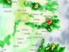
A “polar vortex” stretching from Antarctica has caused the mercury to plunge across the nation’s southeast, with NSW, Victoria, the ACT and Tasmania all facing abnormally cool November conditions.
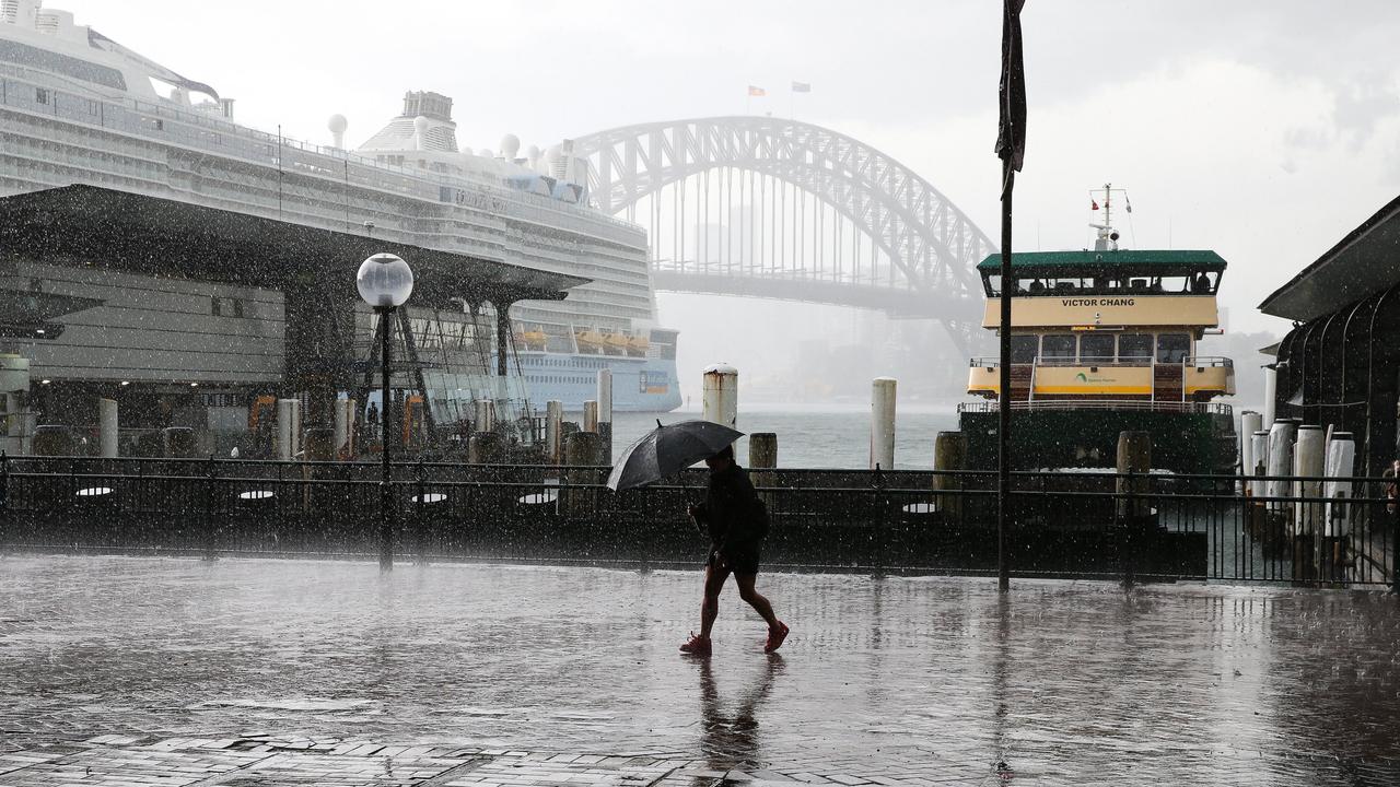
Temperatures dipped to 10C in Sydney on Thursday, and will reach a high of 20C, while Melbourne recorded a low of 9C in the early morning, with a maximum of 20C expected.
It was even brisker in Canberra, recording just under 4C and expecting a high of 18C, while Hobart shivered through an 8C morning, with a high of just 16C ahead.
Weekend weather
Looking ahead, the Bureau of Meteorology predicts that conditions are set to improve over the weekend, with Sydney looking forward to days of rare sun, with a low of 14C and high of 25C on Saturday, followed by a low of 19C and high of 29C on Sunday.
But Melbourne will face showers and a possible storm on Saturday with a minimum of 14C and a maximum of 24C, and showers with a minimum of 13C on Su day and a maximum of 19C.
There will be a shower or two in Canberra on Saturday with a low of 7C and high of 23C, with showers easing on Sunday with a minimum of 13C and maximum of 18C.
The conditions will be dreary in Hobart over the weekend, with rain developing on Saturday with a low of 9C and high of 22C, with rain continuing on Sunday with a low of 12C and high of 18C.
Adelaide will also cop showers and growing wind on Saturday along with a low of 17C and high of 24C, with the conditions continuing on Sunday with a minimum of 12C and maximum of 19C.
In Perth, there will be a possible shower on Saturday and a minimum of 10C and maximum of 20C, and Sunday will be partly cloudy with a minimum of 11C and maximum of 23C.
Brisbane will enjoy a mostly sunny Saturday with a minimum temperature of 16C and reaching 28C, followed by showers and a possible storm on Sunday and a low of 20C and high of 32C.
And Darwin will have a shower or two and possible storm with a minimum of 26C and maximum of 33C, with the same stormy conditions on Sunday with a low of 26C and high of 34C.
What’s causing the cold snap?
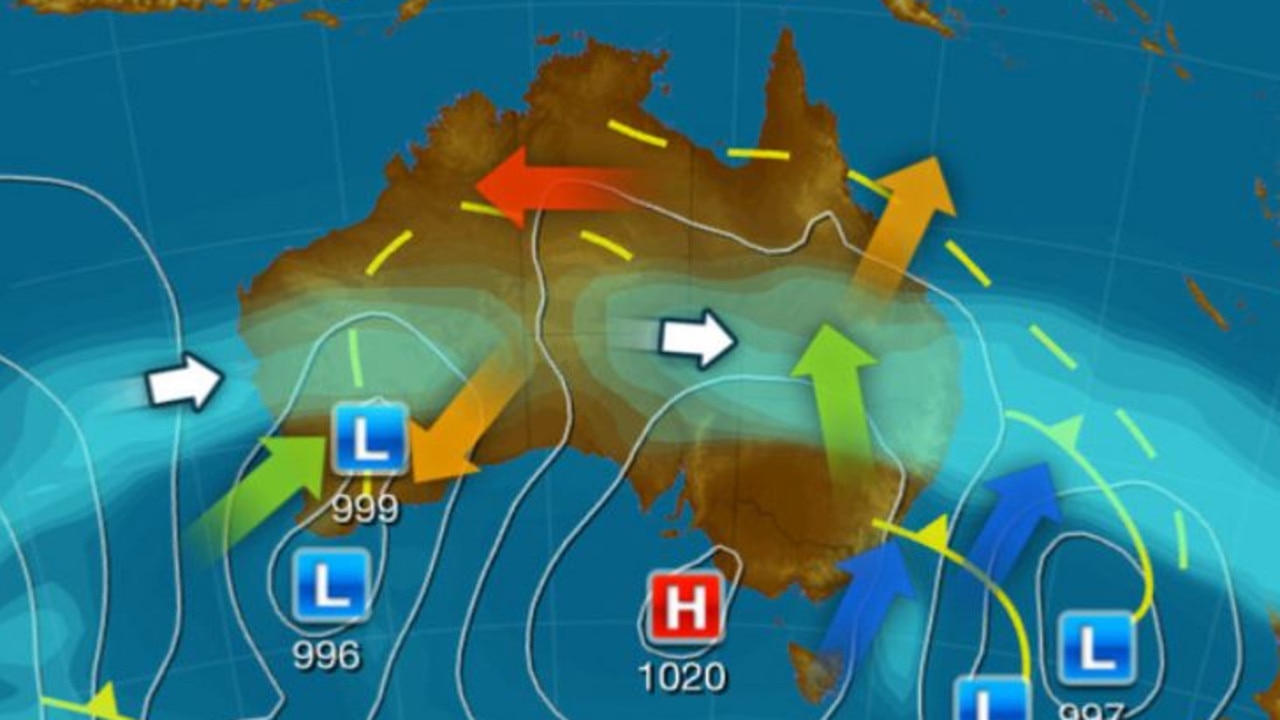
According to Weatherzone, a “strong polar vortex could influence Australia’s weather this summer”, as a result of the stratosphere around Antarctica cooling over the past few months.
That cooling is now starting to influence our weather in the lower atmosphere.
“The polar vortex is simply a large band of powerful stratospheric winds that flows around our planet’s north and south poles in the cooler months of the year,” Weatherzone reports.
“The strength and shape of the polar vortex in the stratosphere can influence weather systems in the troposphere.
“This year, the stratospheric polar vortex has been unusually strong and cold, which may lead to changes in the weather across the Southern Hemisphere over the coming months.”
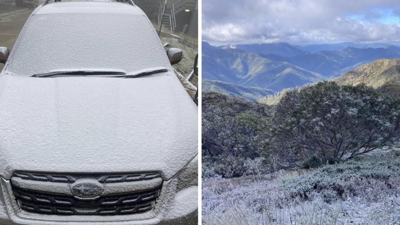
On Wednesday, Weatherzone also reported that a “contrasting mix of late-spring weather just caused a massive 50ºC temperature range across Australian during the last 24 hours”, with Fitzroy Crossing in WA recording 43C on Tuesday afternoon, followed by a freezing -7C at Mount Hotham in Victoria early on Wednesday morning.
“The weather is always dynamic in Australia at this time of year, thanks to stifling hot air masses building up over the tropics and regular pulses of much colder air sweeping over southern Australia,” it reported.
“These contrasting weather patterns and temperatures produced a wild mix of weather across Australia over the last few days.”
Wild weather rocks NSW
It comes amid weeks of wild weather wreaking havoc across NSW.
Family sent me this video from Marrickville, Sydney. Freak hail storms wrapping the city 🥲 #ClimateCrisis “summer†is around the corner… pic.twitter.com/fIRGdXJTWj
— Mia Castagnone (@CastagnoneMia) November 16, 2022
On Wednesday afternoon, an icy blast brought hail and bitter winds to the state capital, leaving the city briefly covered in a snowlike blanket.
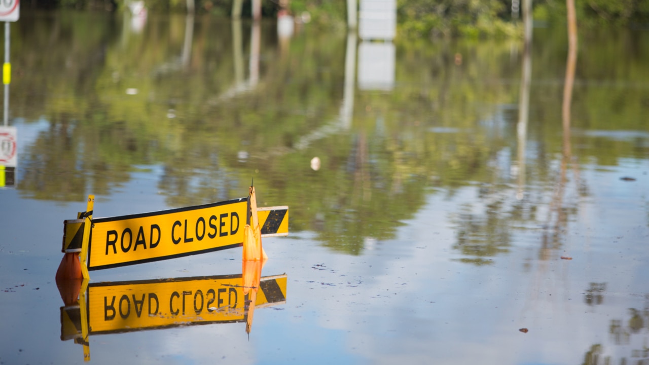
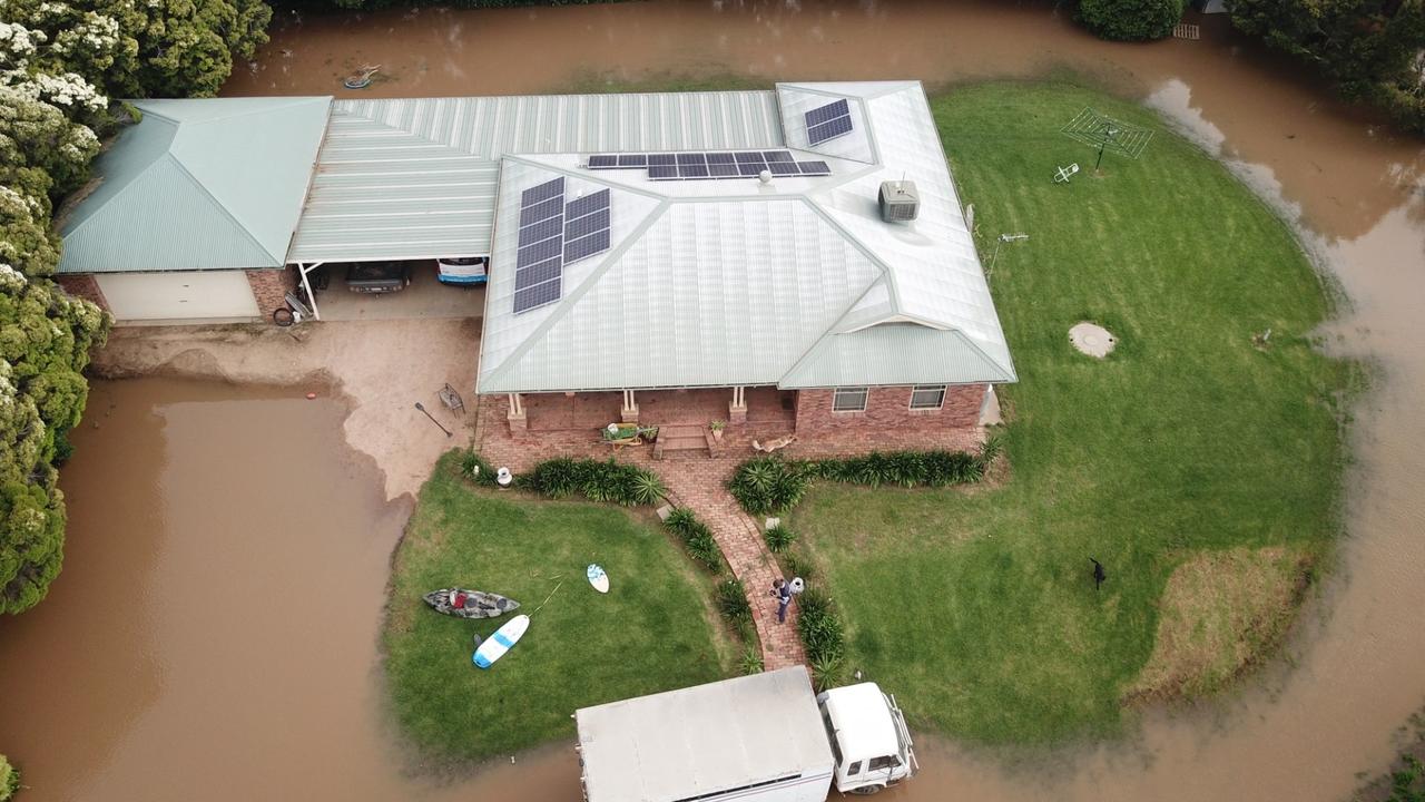
But the wintry conditions are far from the worst problem plaguing NSW, with towns in the state’s Central West region currently ravaged by severe flooding, particularly around Forbes and the Lachlan River.

Greens push for $4bn cut to insurance costs
The minor party has proposed a five-pronged attack to lower rising insurance premiums which they say could save households a total of $4bn.
Aussies freeze as temperature plummets
Australians have been warned not to pack away their puffer jackets just yet after one state recorded temperatures up to 10C below average.
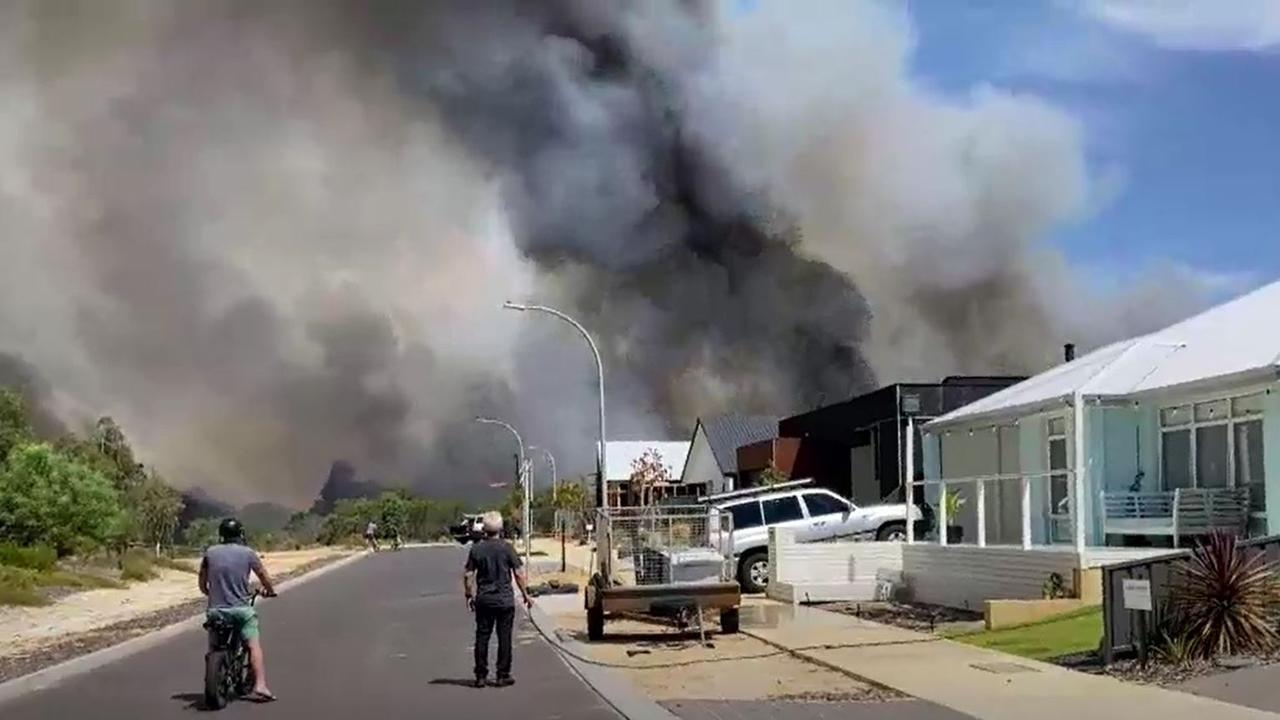
‘Avoid the area’: Bushfire threatens town
Authorities have warned residents of Dunsborough in West Australia to avoid the area as a major bushfire threatens homes.