
Polar pulse in south east could lead to thundersnow
The end of the week will see a bizarre contrast in weather with maximum temperatures 40C lower in Victoria than some parts of Queensland due to a vicious cold front.

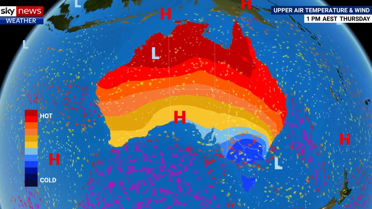
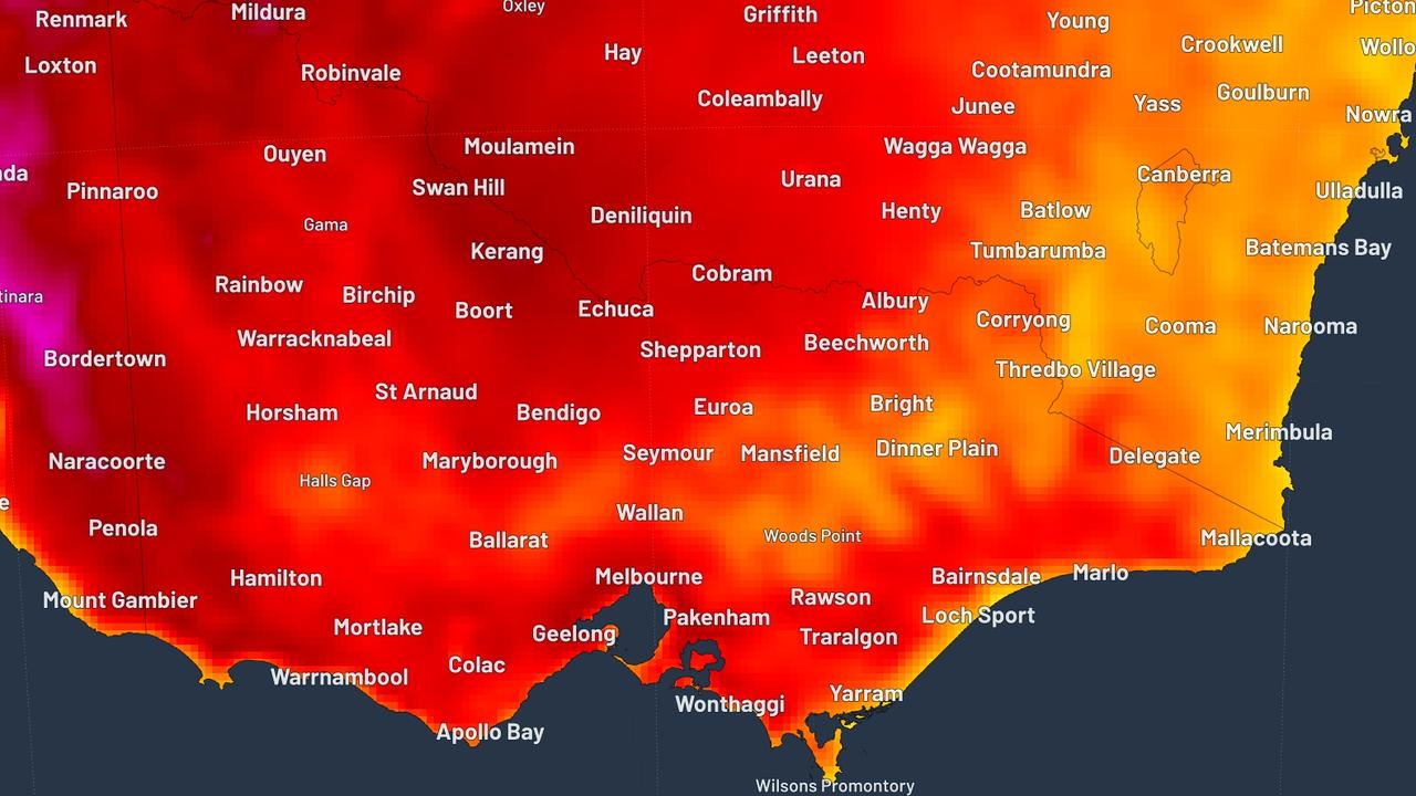
Australia will be split in two weather wise, with near record temperatures in the north but conditions so cold and angry in the south there’s a risk of thundersnow later this week.
A pulse of polar will sweep across Victoria and Tasmania at the same time as elevated fore danger in northern Australia and a possible severe tropical storm that could rock through south east Queensland.
The contrast is so strong, the difference between maximum temperatures in parts of Queensland and Victoria could be as much as 40 degrees.
On Thursday, Cloncurry in western Queensland will likely top out at 39C, yet Mt Hotham in the Victorian Alps will peak at a more than freezing -1C.
Even between Brisbane and Melbourne there will be a difference in the 3pm high of around 20 degrees.
“A cold front will drop temperatures across southern Australia for the next 24 hours,” Sky News Weather channel meteorologist Tom Saunders said.
“But north of that front, we have near record high temperatures and elevated fire dangers through central northern and some eastern parts of the country.”
Cold and wet in Melbourne. Tomorrow’s low of 15C will likely be repeated on Saturday but could get to 22C on Friday. Lows of 8C. Inland, and Ballarat will struggle to get to 12C tomorrow and the higher you go the colder it will get.
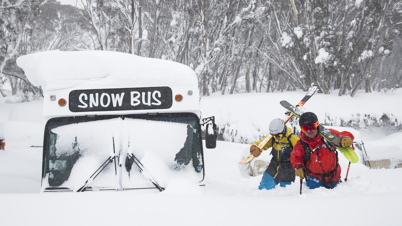
“Because of that cold polar air there will be thunder and hail on the Alps and even thundersnow is possible, that’s thunderstorm that produces snow,” Mr Saunders said.
“It will be cold enough for Alpine snow with some temperatures below 10C and that’s in the middle of the afternoon — we’re not talking about minimums we’re talking maximums.”
That lick of polar air will also take in Tasmania. Hobart will peak at 17C on Thursday and just 14C on Saturday with minimums of 7C. A high of 18C on Friday. Some rain.
Adelaide has already seen some storms. Going forward, the city will see the same pattern as Victoria and Tasmania with mild temperatures divided by a short spike in the mercury on Friday just ahead of the cold front. Adelaide is looking at 18C then 21C on Friday, slipping back again to 17C on the weekend. Mostly sunny from tomorrow onwards.
A mix of sunshine and showers in Canberra. Today’s 23C max will slide to 16C tomorrow then around 20C on the weekend. Friday should be sunny.
WARM IN THE WEST, EAST AND NORTH
Pleasant in Sydney with temperatures in the mid twenties with some sunshine. Saturday should see the warmest day with 28C in the city and 30C in the west.
The other capitals will be toasty warm.
Perth is on 22C and the mercury will steadily rise during a sunny end to the week with a maximum of 31C on Saturday before gradually settling back into the mid-twenties.
Darwin, it will come as no surprise to anyone, will see highs of 35C, lows of 24C and dry days with lots of sunshine.
âš ï¸ #Fire Weather Warning issued for Darwin's rural area with hot, dry northerly winds expected late this afternoon. Check https://t.co/kHOEQmtxxW for details and stay tuned to @secureTerritory for bushfire info. pic.twitter.com/GmVIHbR5X2
— Bureau of Meteorology, Northern Territory (@BOM_NT) October 16, 2019
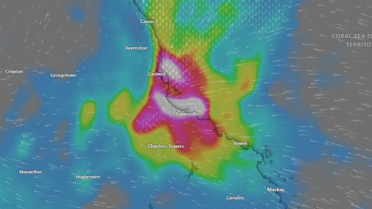
Severe #thunderstorms forecast around #SEQld and the central interior during Thursday afternoon and early evening. Damaging and locally destructive winds, large hail and heavy rainfall are all possible. Check local forecasts on our new website: https://t.co/mW2Iym6lDW #QldStorm pic.twitter.com/mIa0hbZdKl
— Bureau of Meteorology, Queensland (@BOM_Qld) October 16, 2019
It will barely get out of the thirties in Brisbane with 33C tomorrow and 31C on Saturday although there could be a dip on Friday. Ipswich is forecast to reach 34C on Saturday. A possible storm could lead to a good dumping of rain on Thursday.
Further north, in Townsville, it’ll be 31C all week. Head west and Julia Creek could see as many as five day with highs above 40C.
‘Don’t return’: Deadly floods to worsen
Residents have been urged not to return home as deadly floods continue to smash one state, as towns are cut off and some areas record more than a metre of rain.
‘Hoodwinked’: China is conning the world
An Australian economist says China is conning the world on an important global issue.
State smashed by ‘hours of lightning’
Thousands have gone without power as wild storms battered one state, with “hours of lightning” recorded in a major city and its surrounds.