
Ocsnowber strikes again in the Blue Mountains for the second time in 24 months.
WILD weather is battering the east coast with heavy snowfalls in some areas, and it’s not the first time we’ve seen this. What’s going on with our weather?
OCTOBER is the new July in the Blue Mountains, just west of Sydney. In fact, it’s snowier than July ever was.
Exactly two years ago this week, the Blue Mountains town of Blackheath, at about 1100m above sea level, experienced its heaviest snowfalls (in any month) in 20 years. The snow was so heavy that locals literally skied and snowboarded down the street.
Well they tried, anyway.
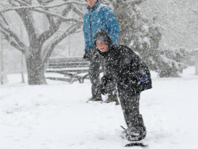
Last night, it snowed just as heavily. Blackheath residents reported around 10cm of snow on the ground, while even more fell at other locations on the western fringe of the mountains at towns like Lithgow and Little Hartley.
Here’s how one Blackheath weather guru saw his backyard last night.
No power, trees down in my street. Snow melting with rain now: pic.twitter.com/YAhflpNKMQ
— Blackheath Weather (@BlackheathWx) October 14, 2014And this morning.
My backyard at 6:30am. It will melt pretty fast today. pic.twitter.com/IQsQe5yfIY
— Blackheath Weather (@BlackheathWx) October 14, 2014The Blue Mountains are famous for being dramatically beautiful rather than snowy. At their highest point, they reach barely half the altitude of Mt Kosciuszko, Australia’s highest peak at 2228m. They’re also about six hours further north.
All the same, the Blue Mountains do see occasional snow, especially in midwinter. Long time locals say those falls aren’t as regular or as heavy as they were before the climate started warming, but the odd dusting is still expected.
What’s not expected is October snow, let alone snow this heavy in virtually identical weather systems two years apart.
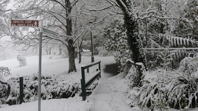
Here’s a classic Blackheath pic from the 2012 snow dump.
And here’s a fresh tweet from this morning in Blackheath, where one enterprising local used his barbie to cook brekky in lieu of power.
Good morning from #Blackheath no power means bbq breakfast in the snow! pic.twitter.com/luTuxyVzbD
— Julia Holmwood (@julajulz) October 14, 2014Now check these two weather maps. They’re a meteorological mirror image. The first one is the 2012 system.
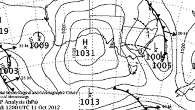
And here’s the second one. Even to the untrained weather eye, you can see they look pretty similar.
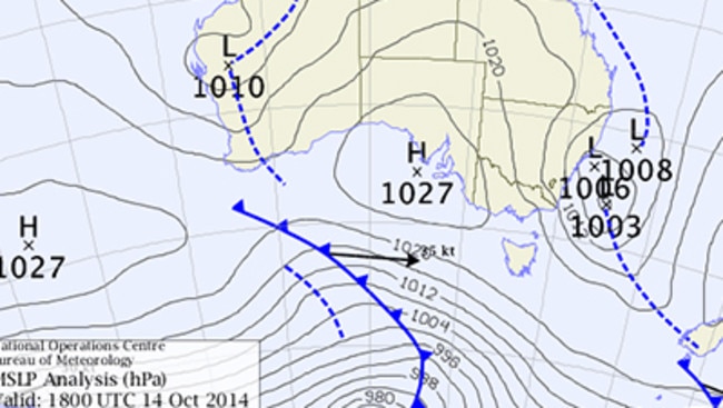
All this wild weather has been caused by a pretty normal weather system called an east coast low (ECL). If you live in Adelaide, Melbourne or Perth, your Southern Ocean storms tend to whip by pretty quickly. But ECLs can hang round off cities like Sydney and Brisbane for quite a few days.
This one has been intense but fairly quick moving and should be all wrapped up by tomorrow. It’s also colder than your average springtime ECL due to a bunch of complicated meteorological reasons and one fairly simple one, namely that the air is being sucked up from the south.
And all this just a year after the devastating October bushfires.
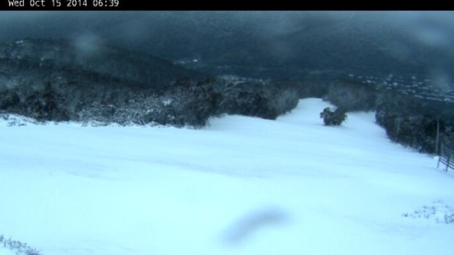
Meanwhile down at Thredbo, would someone please open the chairlifts again?

200 species dead in ‘unprecedented’ disaster
Scientists have offered a grim outlook for Aussies hoping for an immediate solution to an ‘unprecedented’ disaster leaving the water at Aussie beaches toxic.

Australia told to brace for a soaking
Parts of Australia that have already experienced a wet weekend should expect more downpours in the week ahead.

‘Big’: Wild weather warning to Aussies
Aussies in several states have been warned to brace for a weekend of wild weather, with the risk of floods and damaging winds.