
NSW weather: Severe thunderstorm and weather warning issued for NSW
Potentially severe thunderstorms have been forecast for just about all of one state, bringing rain and warnings for damaging winds.

Potentially severe thunderstorms have been forecast for almost all of NSW as a trough and a cold front sweep across the state.
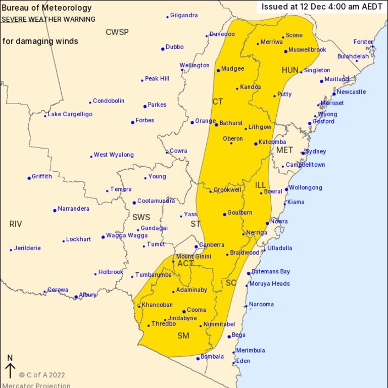
As of early Monday morning, a severe weather warning for damaging winds peaking at 125km/h have been issued over alpine areas above 1900m. Damaging wind gusts of around 100km/h could also hit areas like Nowra, Mudgee, Bathurst, Katoomba, Goulburn and Cooma.
Areas with elevated terrain are most at risk of damaging winds, however conditions are expected to ease heading into Monday evening.
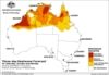
⛈ï¸Monday 12/12 Storm Forecast⛈ï¸
— Bureau of Meteorology, New South Wales (@BOM_NSW) December 11, 2022
Storms possible for much of NSW on Monday as a trough & cold front move east. Severe storms possible in the east, with risk of damaging winds and heavy rain in the south, and added risk of large hail in the north. Warnings: https://t.co/E4Z9hYgIXqpic.twitter.com/DpWfAFNebN
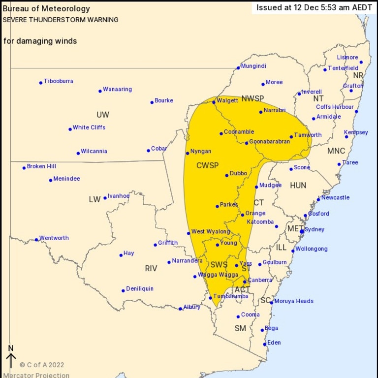
Large-ranging, severe thunderstorm warnings for damaging winds have also been issued for people across much of central NSW.
Sky News meteorologist Rob Sharpe said the storms will likely be “fast-moving” and “racing out to the coastline”.
On Monday, the biggest risk for severe thunderstorms will be in the interior of Queensland and northern NSW.
For Queensland, the risk of severe thunderstorms will increase into the week.
By Wednesday, Mr Sharpe said there may be supercell storms, with “destructive wind gusts,” and “giant hail”.
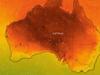
â›ˆï¸ Monday 12/12 Thunderstorm Forecast ⛈ï¸
— Bureau of Meteorology, Queensland (@BOM_Qld) December 11, 2022
Storms are possible for much of Qld on Monday. Severe storms may bring damaging winds, large hail and heavy rain for parts of central, southern and southeast inland Qld. Warnings will be issued here if required: https://t.co/EYFBD3MTQzpic.twitter.com/jOa0rUbBSQ
Victoria’s ‘last warm day’
Meanwhile, the Bureau of Meteorology (BOM) reports Victoria saw its “last warm day” on Sunday.
A high chance of showers are now forecast for Melbourne throughout the rest of the week, with highs of just 18C. Wednesday is shaping up to be the coldest day of the week with up to 10mm of rainfall and a temperature range of 9C to 15C.
Mr Sharpe said a “remarkable summer cold spell” was likely to bring “colder than usual” weather and “significant rainfall” with more than 50mm over eight days set to hit all of Tasmania, southern Victoria, including Melbourne, and southern border towns in NSW.
Hobart is in for a week of light showers with temperatures unlikely to exceed 20C.
Today is the last warm day across Victoria for a while. We will see a sequence of Winter-type cold fronts crossing the State this week. Snowfalls developing above 1400m Monday, lowering to 1000m late Tuesday & only lifting to 1200m Wednesday. https://t.co/pPWGcuSDfh
— Bureau of Meteorology, Victoria (@BOM_Vic) December 11, 2022
Extreme heatwave to ease
While temperatures drop in the southern states, it’s a different story for Australia’s north.
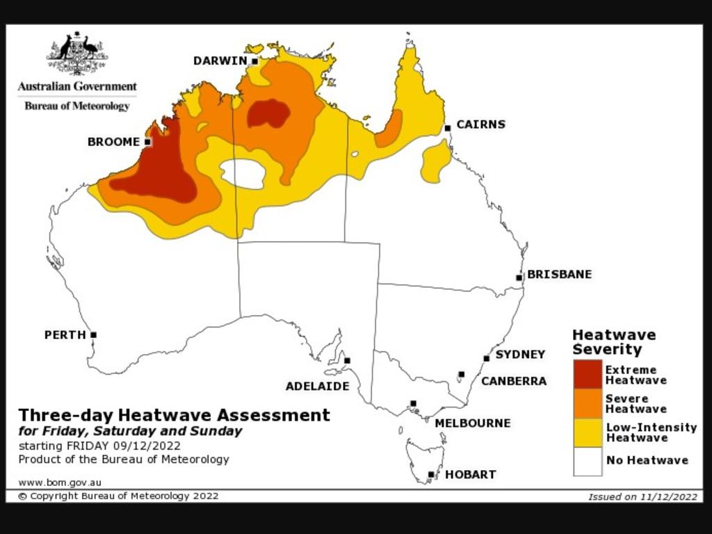
After sweating through a relentless heatwave over the weekend, Saturday saw temperatures hit 43.9C at Wyndham Airport and 43.6C at Marble Bar in northern WA.
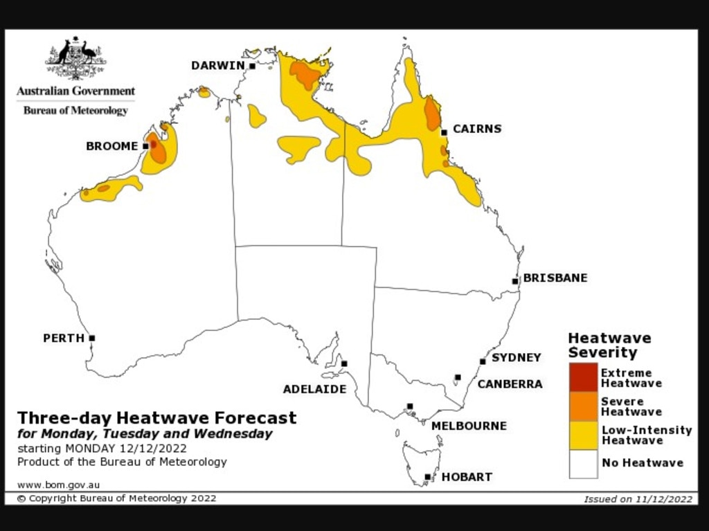
However, conditions across Australia’s top are likely to ease from Monday onwards.
Mr Sharpe said the worst of the heatwave will dissipate by Monday, coinciding with the arrival of wetter weather.
“We’re talking about extra cloud, extra showers and thunderstorms starting to take shape from Monday over the north of the country,” he said.
“That allows that heat to ease back significantly.”

200 species dead in ‘unprecedented’ disaster
Scientists have offered a grim outlook for Aussies hoping for an immediate solution to an ‘unprecedented’ disaster leaving the water at Aussie beaches toxic.

Australia told to brace for a soaking
Parts of Australia that have already experienced a wet weekend should expect more downpours in the week ahead.

‘Big’: Wild weather warning to Aussies
Aussies in several states have been warned to brace for a weekend of wild weather, with the risk of floods and damaging winds.