
Northwest Australia dodges severe tropical cyclone threat
Severe Tropical Cyclone Herman has intensified to category 4 overnight but is expected to turn around before reaching the mainland.
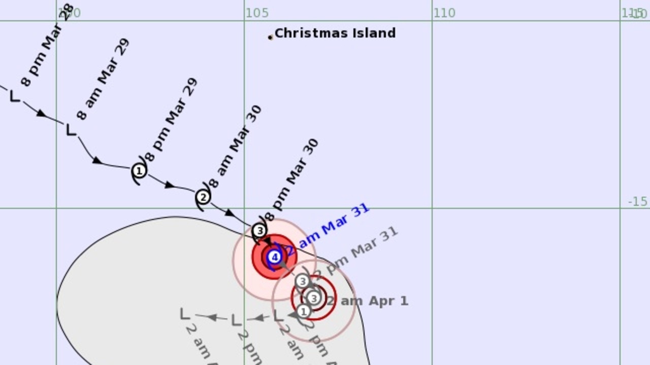
A severe tropical cyclone, which intensified to category 4 in water off Australia’s northwest early on Friday morning, is expected to weaken as it heads towards the West Australian coast.
Tropical Cyclone Herman was tracking more than 1000km northwest of Exmouth about 2am AWST, according to the Bureau of Meteorology, heading south-southeast at 15km/h.
However, its expected to weaken over Friday as it continues heading towards the mainland.
“During the weekend it is then expected to move towards the west, further away from the Australian coast, and continue to steadily weaken,” the bureau in an early morning update.
It’s not expected to impact the Australian mainland or any island territories – including Christmas Island.

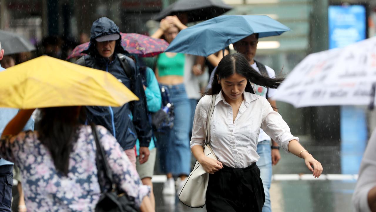
After copping storms and heavy rain earlier in the week, WA’s northern regions are expected to remain relatively dry on Friday and into the weekend, but the state’s southwest, including Perth, has felt the rain overnight.
Perth has a high chance of showers on Friday, becoming less likely in the afternoon, coupled with the chance of a thunderstorm – possibly severe – with a top of 23C.
It warms up over the weekend with partly cloudy conditions on Saturday and 27C, with a mostly sunny 28C on Sunday.
It’s a wet start for Adelaide too, a medium chance of showers on Friday, becoming less likely in the afternoon and evening, partly cloudy and heading for a top of 22C.
It’s cloudy and down to 19C on Saturday, clearing to a mostly sunny 22C on Sunday.
Darwin is heading for a top of 34C on Friday, partly cloudy with the slight chance of a shower, with similar conditions to follow over the weekend.
Mostly sunny and 29C the top for Brisbane before a partly cloudy 28C on Saturday, and partly cloudy with a high chance of showers on Sunday, down to 26C.
The bureau predicts a sunny 25C for Sydney on Friday before it turns partly cloudy with a high chance of showers on Saturday, down to 22C, and more showers and 23C on Sunday.
More Coverage

Canberra can look forward to a partly cloudy 21C on Friday, a shower or two and 20C on Saturday and a partly cloudy 20C on Sunday.
Melbourne is heading for a top of 19C on Friday with a high chance of showers developing late in the day and into Friday evening. The gloom is hanging around, with a medium chance of showers on Saturday and a top of 16C, with showers easing on Sunday, partly cloudy and a top of 19C.
Hobart can look forward to a top of 17C for Friday with an afternoon shower or two. A top of 17C is on the cards again for Saturday, with some cloud cover moving in on Sunday and a top of 19C.

New warning in wake of “bomb cyclone”
Residents in areas of the NSW coastline smashed by this week’s “bomb cyclone” have been issued a fresh warning.

More flights axed, chaos as storm shifts
Flights have been cancelled, thousands remain in the dark and commuters face ongoing disruptions amid a freak storm – equivalent to a category 1 cyclone – in NSW.

‘Diabolical’: Fury as mansions swallowed up
A row of waterfront mansions are close to collapsing into the ocean as massive swell erodes the beach. One fed-up homeowner says it exposes a “diabolical” failure.