
Tropical Cyclone Penny making landfall near Weipa as category one system
UPDATE: Cape York is in for a long night of rain and galeforce winds after Cyclone Penny made landfall earlier today.
UPDATE 6PM: Cape York is in for a long night of rain and galeforce winds after Cyclone Penny made landfall earlier today.
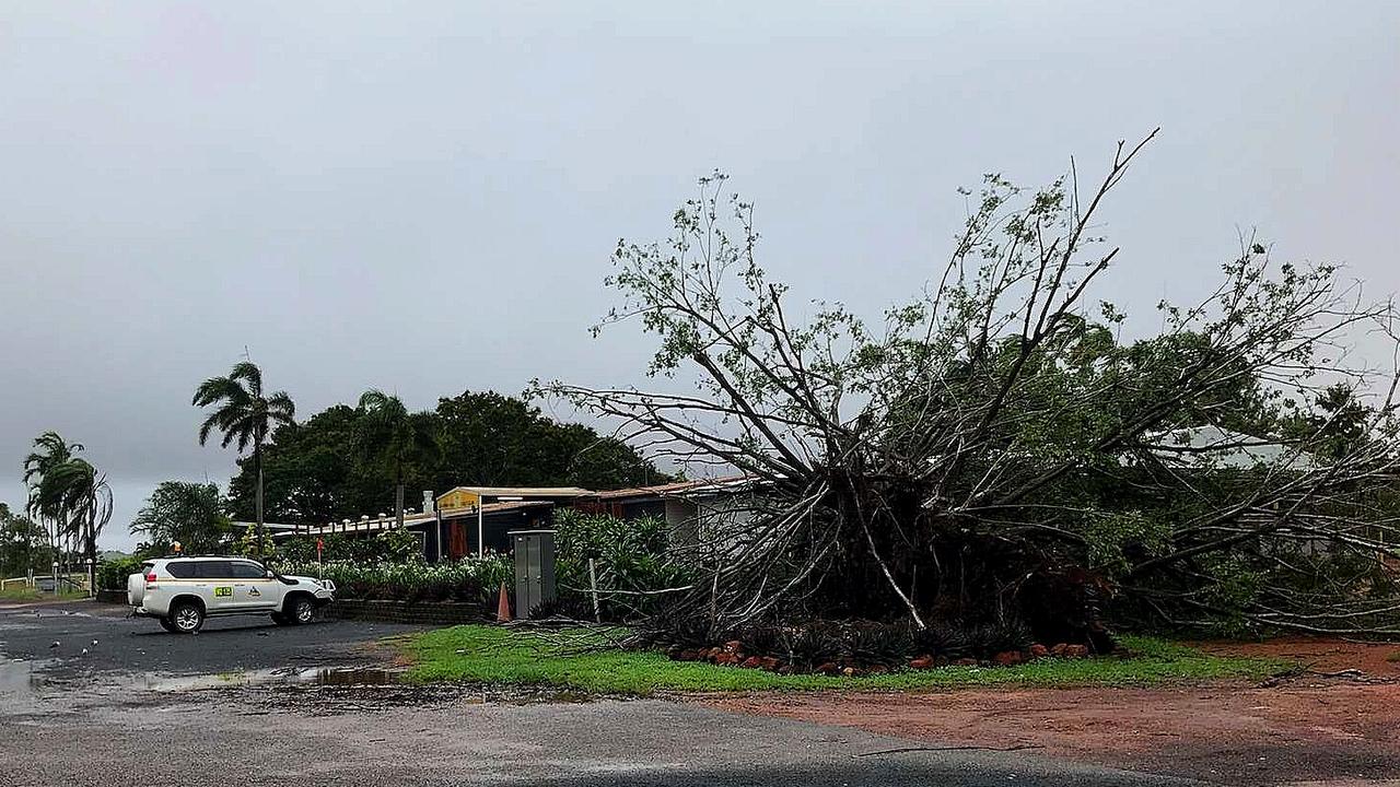
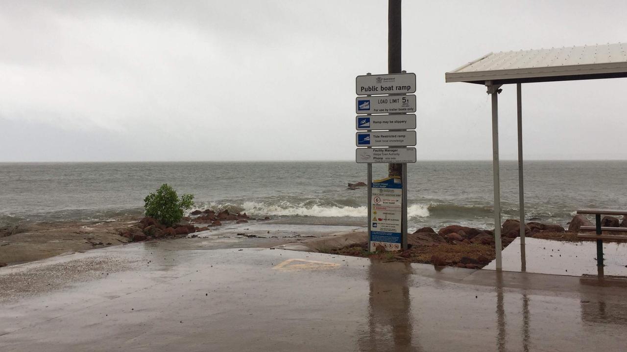
The cyclone brought gale force winds to Weipa.
Cyclone Penny almost at Weipa and blowing my Beach Almond trees around. Was hoping to attract Palm Cockatoos this year so please don't come down! pic.twitter.com/4aNaMb3SnE
— Chris MacColl (@CMacColl) January 1, 2019
The Bureau of Meteorology reported the system made landfall at 3.30pm and weather stations on the ground recorded sustained winds at the centre of 75km/h, with wind gusts of up to 100km/h.
Bureau forecaster Dean Narramore said the arrival of the Cyclone Penny coincided with a 3.30pm high tide, which was also the highest astronomical tide of the year.
“Some of the gauges are approaching near the highest astronomical tide in Weipa an around the Torres Strait Island …and that is why we have warning for abnormally high tides in the Torres Strait,” he said.
Higher than normal tides are expected around Weipa and Thursday Island for the rest of the night and tomorrow.
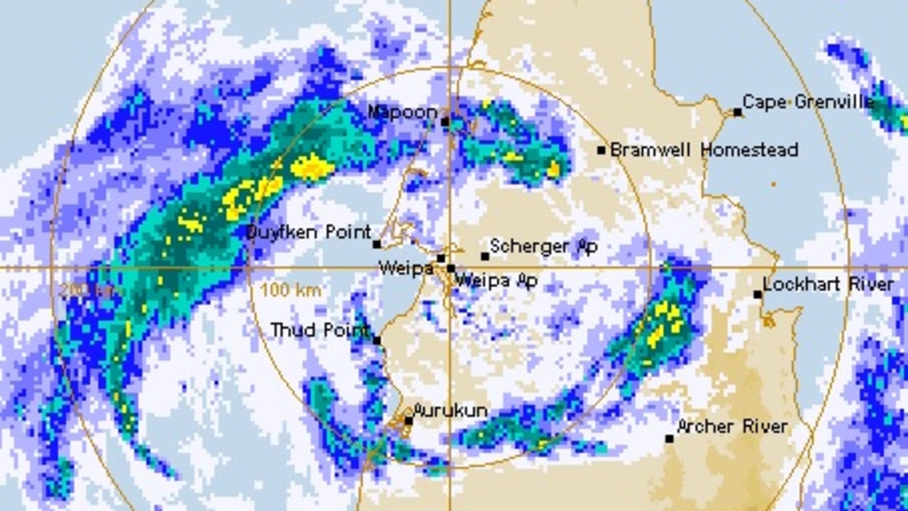
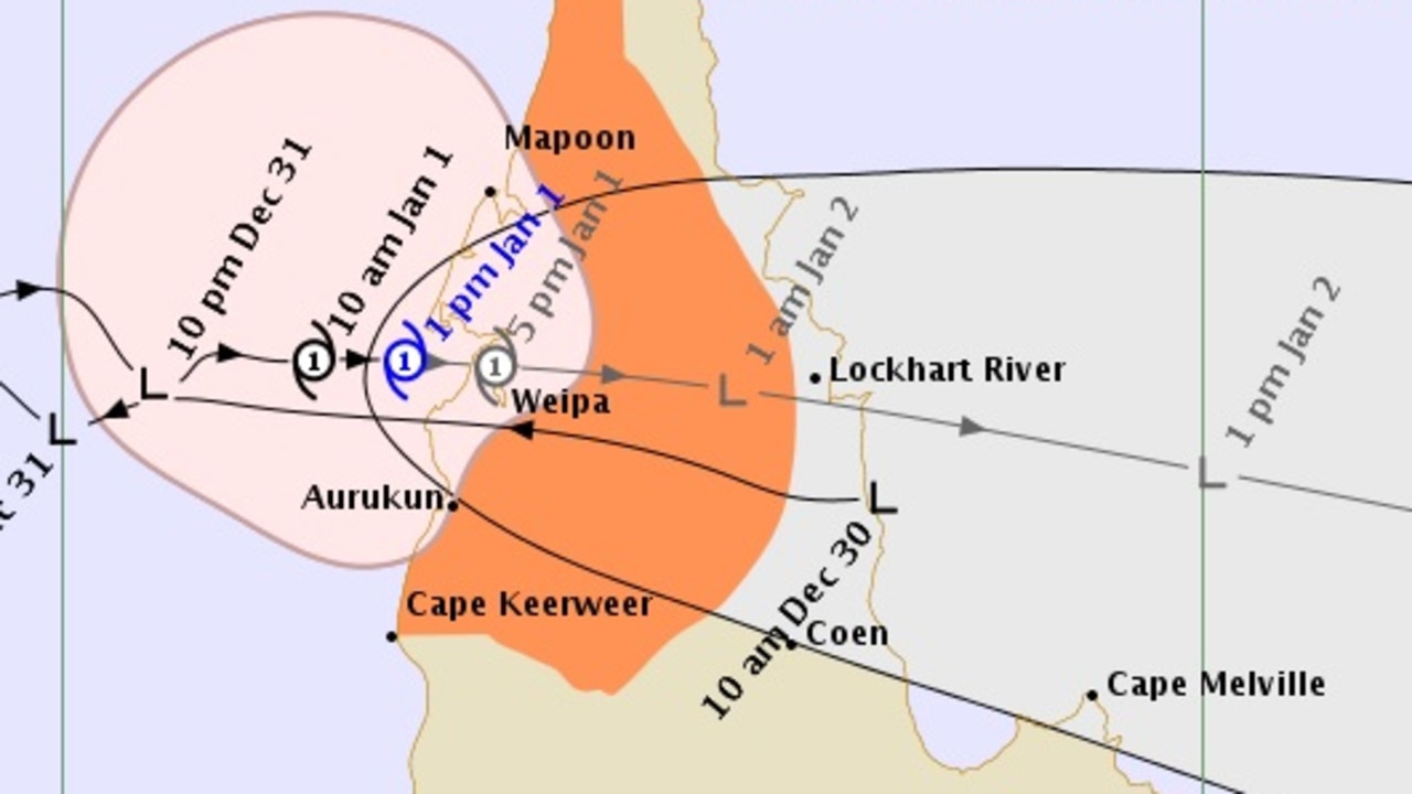
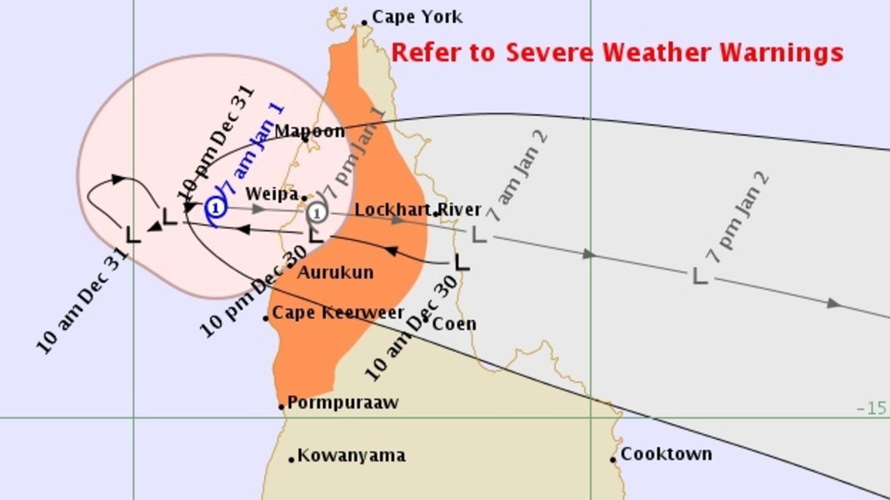
UPDATE 3.45PM: The centre of Tropical Cyclone Penny is making landfall on the coast between Weipa and Thud Point as a category one system.
The Bureau of Meteorology said the system was moving east at 13kmh with sustained winds near the centre of 75kmh with gusts to 100kmh.
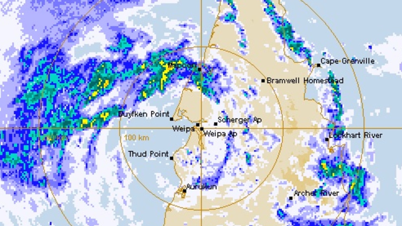
Tropical Cyclone Penny will weaken into a tropical low later this evening as it crosses Cape York Peninsula.
The bureau says the remnant low is expected to enter the Coral Sea during Wednesday and continuing moving eastwards, away from the Queensland Coast.
UPDATE 2PM: Tropical Cyclone Penny is approaching Weipa and is expected to make landfall as a category one system between 4pm and 6pm today.
The system is currently 45km west of Weipa and 75km north northwest of Aurukun and is moving east a 11kmh.
Cyclone Penny is expected to weaken into a tropical low over Cape York Peninsula later tonight.
The Bureau of Meteorology advises gales, with gusts up to 110 kmh, are occurring on the western Cape York Peninsula coast between Cape York and Aurukun.
Cyclone Penny almost at Weipa and blowing my Beach Almond trees around. Was hoping to attract Palm Cockatoos this year so please don't come down! pic.twitter.com/4aNaMb3SnE
— Chris MacColl (@CMacColl) January 1, 2019
Gales are expected to extend to adjacent inland areas of western Cape York Peninsula this afternoon and evening as the cyclone approaches the coast.
Gales may extend further south to Cape Keerweer later today if the cyclone takes a more southerly path.
Isolated damaging wind gusts may occur otherwise with monsoonal thunderstorms over the Torres Strait Islands and northeast Cape York Peninsula, and a separate Severe Weather Warning is current for these conditions.
Heavy rainfall, which may lead to flash flooding, is likely across Cape York Peninsula and parts of the North Tropical Coast today and Wednesday.
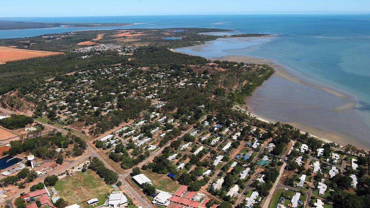
Heavy rain and gusty winds were already beginning to affect the remote mining town of Weipa by 10am this morning.
Weipa Town Authority chairman Michael Rowland told the Cairns Post early signs that the storm was near were evident in the town and there was a certain acceptance among the people that severe weather was on the way.
“It’s like there is a resignation that this is the way it is up here at this time of year,” he said.
Mr Rowland said all mining operations had ceased and Qantas had announced all flights in and out had been cancelled.
He said all preparations that could be made had been made and it was now a “wait and see” situation.
“I think everybody is on alert and aware and has made sure everything is as secure as possible and we emergency backups are in place.”
Regional harbourmaster captain Michael Barnett has issued a red alert for the Ports of Weipa and Amrun and Skardon River.
The port of Weipa and Amrun is now closed to normal movement and only emergency movement is permitted.
A Yellow Alert for the Port of Cape Flattery and Port of Lockhart, however a yellow alert for Thursday Island had been cancelled.
A Flood Watch remains current for coastal catchments north of Cardwell, including catchments across the Cape York Peninsula.
A separate Severe Weather Warning is also current for rainfall on the northeast tropical coast.
Queensland Fire and Emergency Services (QFES) Far Northern Region Assistant Commissioner John Bolger said it was important for locals to follow the directions of authorities and either shelter in place until the cyclone passed or relocate to a safer place if asked.
“Keep up to date with the movement and severity of the cyclone by listening to local radio and watching the BoM website,” he said.
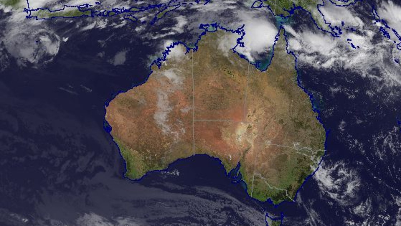
EARLIER 8.15am: Cyclone Penny has officially been named by the Bureau of Meteorology as the system in eastern Gulf of Carpentaria gathers power and tracks for the coast at 8km/h.
Pormpuraaw to Cape York including adjacent inland areas are in the impact zone of the Category 1 system expected to cross the coast near Weipa this afternoon.
Sustained winds near the centre of storm of 75km/h and wind gusts to 100km/h have been recorded.
The Port of Weipa and Port of Amrun is now closed to normal movement, with only emergency movement allowed.
Tropical #CyclonePenny has formed in the #GulfofCarpentaria and is expected to cross the coast near #Weipa this afternoon. For tropical cyclone updates visit: https://t.co/8jWPAwGyJW pic.twitter.com/lg2oec1iOm
— Bureau of Meteorology, Queensland (@BOM_Qld) December 31, 2018
The cyclone may reach Category 2 if it moves slower than expected and spends more time over water.
Queensland Fire and Emergency Service (QFES) asked Far Northern residents and visitors to prepare for heavy rainfall, damaging winds and possible flash flooding.
QFES Far Northern Region Assistant Commissioner John Bolger said it was important for locals to follow the directions of authorities and either shelter in place until the cyclone passed or relocate to a safer place if asked.
“Those who remain in place should shelter in the strongest part of the house and ensure their emergency kit is close by,” Mr Bolger said.
For storm and flood assistance contact the State Emergency Service on 132 500 and in a life threatening emergency call triple-0.
Weipa Town Authority on Monday night advised all flights between Weipa and Cairns for today had been cancelled.
“Qantas has advised that all flights from Cairns to Weipa and return on Tuesday 1st of January 2019 have been cancelled due to forecast severe weather,” it advised.
“The Rio Tinto charter flight has also been postponed for 24 hours pending further weather assessment. For commercial flights please contact Qantas regarding rescheduling of flights.”
Originally published as Tropical Cyclone Penny making landfall near Weipa as category one system

‘Won’t survive’: Huge fear for Aussie treasure
Politicians have been served a major wake-up call when it comes to the management of one of the world’s most-treasured natural wonders.

Professor accuses government of lying
A professor of archaeology has accused a state government of lying in a report about the impact of industrial emissions on Aboriginal rock art.

‘Nonsense’: Albo slams Greens over salmon
The prime minister has gone after the Greens in Question Time over salmon farming in Tasmania.