
The key to forecasting deadly megathrust earthquakes
THE force can twist the earth like a piece of ‘elastic’ with devastating consequences. This is how they happen.

AUTHORITIES have found the key to forecasting deadly megathrust earthquakes, and say the answer could be right under our feet.
Deadly earthquakes could now be predicted by monitoring the movement of tectonic plates beneath the earth’s crust to identify those that have “locked up” and are at risk of shattering, scientists claim. By studying underground, authorities could gain precious minutes during devastating earthquakes — meaning the difference between life and death.
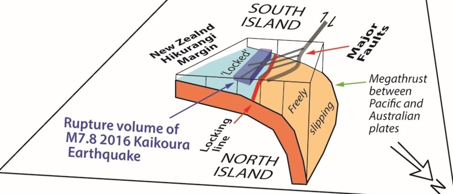
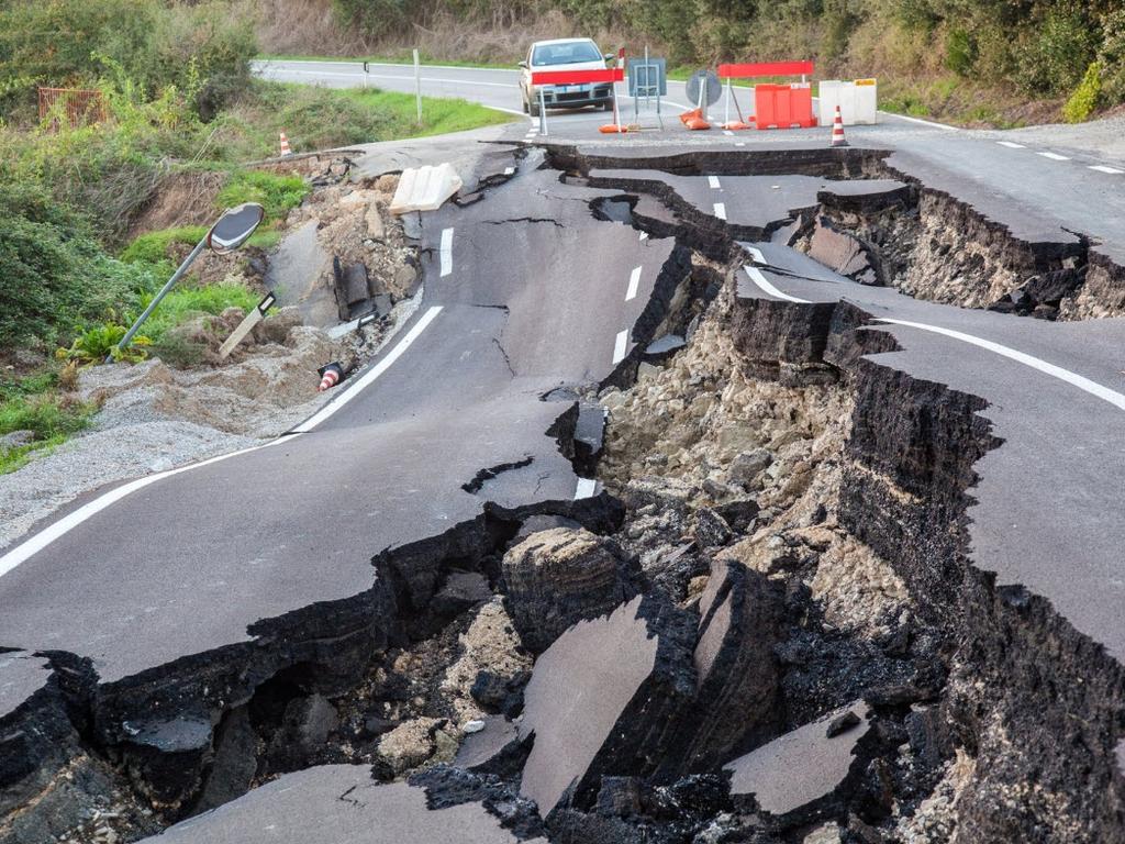
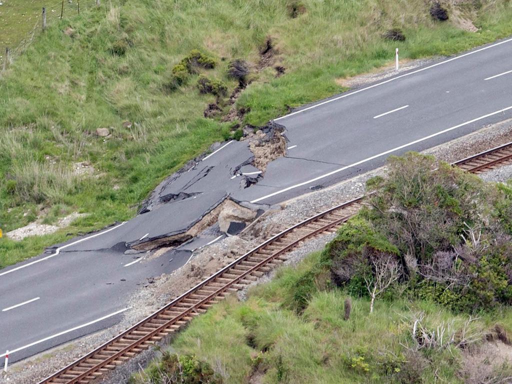
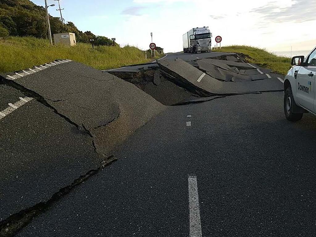
A report, released last week, looked into New Zealand’s worst ever megathrust earthquake, which occurred in the town of Kaikōura on the nation’s South Island in November 2016.
The Victoria University of Wellington researchers studied more than 20 years of earthquake data and concluded that many deadly quakes are controlled by a concept known as the “megathrust”.
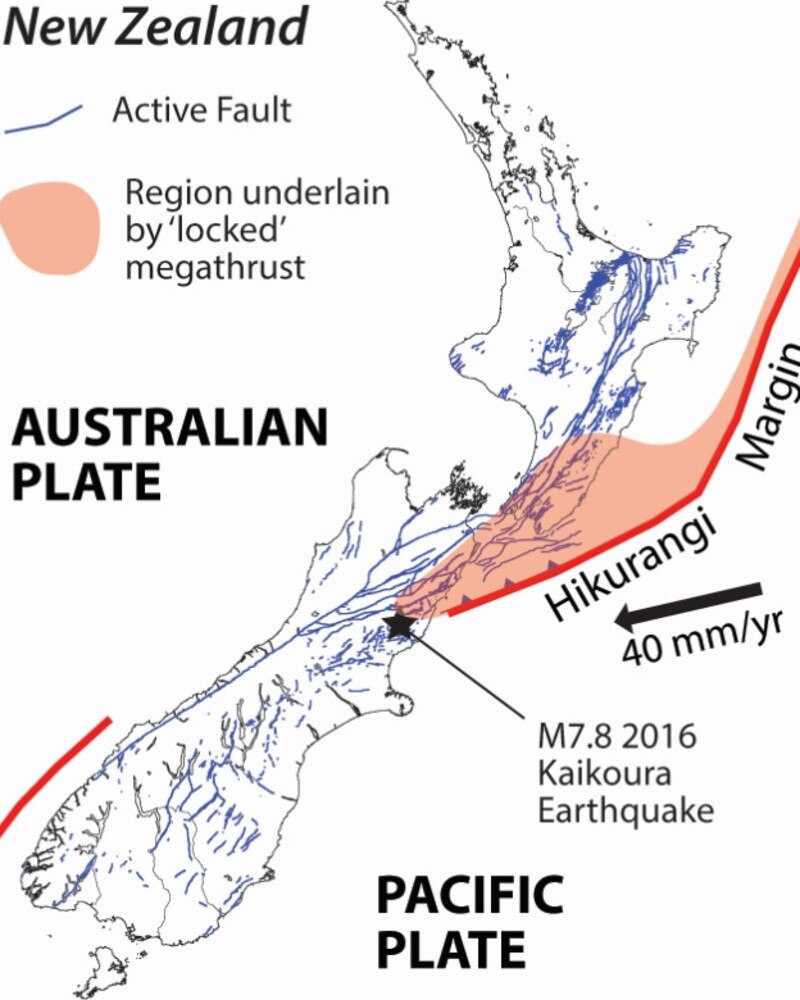
Lead author Associate Professor Simon Lamb said the megathrust occurs when a tectonic plate slips beneath another and locks both in place, restricting easy movement.
“If you look deeper than 30km beneath the earth’s surface, the megathrust is moving all the time, with plates sliding underneath one another day by day, hour by hour,” Prof Lamb said.
“But when locking occurs at shallower depths, the megathrust becomes stuck and can twist and distort the earth like a piece of elastic.”
The team found that the pressure placed on this megathrust ultimately becomes too much and the area will shatter, which creates an earthquake.
The researchers examined 20 years of GPS data recorded before the devastating Kaikōura quake to “understand what caused events like this”.
The Kaikōura quake, which killed two people, recorded a magnitude of 7.8 and involved about 20 different fractures in the earth’s crust in the space of two minutes.
“The Kaikōura Earthquake initiated a complex pattern of fault movement, essentially shattering the landscape, and causing a cascade on 20 or more faults,” Prof Lamb said.
“This was the biggest on shore earthquake in New Zealand for the last 150 years.”
The earthquake immediately sparked a tsunami that created waves of seven metres.
“We showed that what’s actually causing these big earthquakes in New Zealand and indeed around the world is this deeper movement on the megathrust,” Prof Lamb said.
Prof Lamb also said the megathrust that caused the quake actually lies beneath a 600km stretch of New Zealand’s land mass.
“Nothing is fixed beneath New Zealand, the plates are moving up to a few centimetres each year and we can track those movements very precisely using satellites to predict future quakes,” he said.
He said the findings can help “predict when you will get the next shattering event of the landscape” and can be applied to areas around the world that lie above a megathrust.
“Anywhere in the world where you have one plate sliding underneath another,” he said.
“There are no shortage of places where this is happening like south East Asia and North America into Canada”.
According to Prof Lamb, the entire Pacific Rim is underlaid by megathrusts as well as areas such as Myanmar, Java and Indonesia.
“Really all of the world’s big tourists destinations,” he said.
Prof Lamb said he hoped the findings will also help to predict the location of quakes in the future, which will better equip authorities and emergency services when planning for rescue missions.
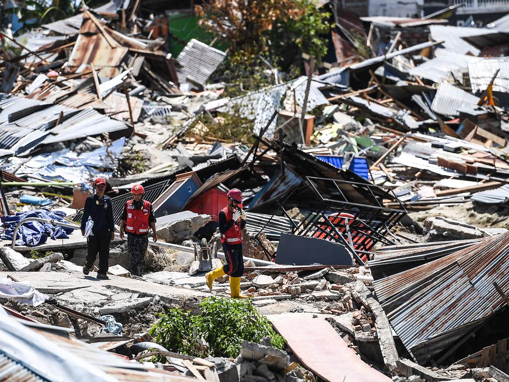
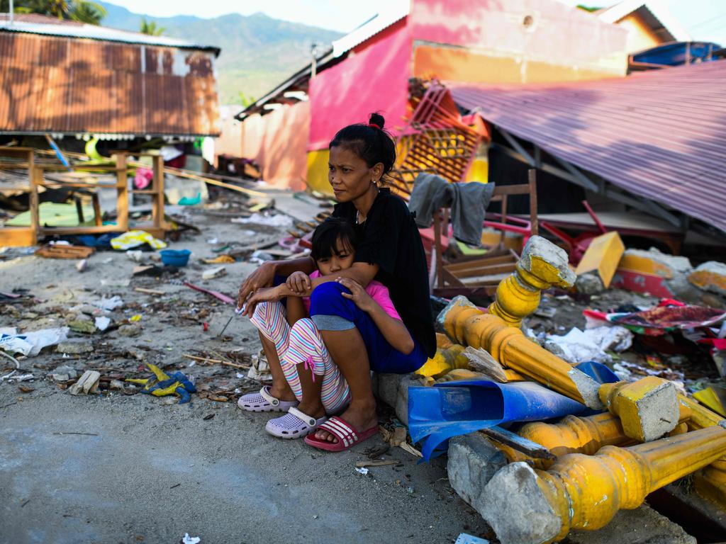
The report’s release comes after a magnitude 7.5 earthquake struck Sulawesi Island in Indonesia, sparking a devastating tsunami.
The tsunami swept through coastal villages, destroying homes and displacing hundreds of thousands of people in its wake.
The Indonesian National Board for Disaster Management released a statement on Friday, claiming the official death toll had risen to 1,558.
Reuters reported that more than 70,000 homes were destroyed by waves that reached up to six-metres in height.
Perhaps the most terrifying part of the Suluwesi disaster is that about 1,000 people are believed to have been buried alive by three-metre deep mud, which was liquefied by the earthquake in parts of Palu city.
So far in the village of Petobo, only 26 survivors have been found and 48 in its neighbouring village of Balaroa.
“We will continue searching,” Sutopo told Reuters.


