
Brisbane weather: Thunderstorm warning for southeast Queensland
UPDATE: THE weather bureau has cancelled its storm warning for the southeast and commuters are only just starting to breathe easier after heavy delays in peak hour. | STUNNING STORM PICS
UPDATE: Traffic congestion around Brisbane, caused by this afternoons storm and heavy rain, has finally cleared.
Only the Bruce Highway at Narangba, heading northbound, is still feeling the effects of the bad weather.
Energex has been working throughout the afternoon to restore power to affected homes after the large thunderstorm swept across southeast Queensland.
Just over 1000 homes are currently affected, with the majority on the Sunshine Coast with 767.
The Moreton Bay area has 176 homes affected, inner-Brisbane suburb Bardon with 100 homes affected, and only minimal homes affected in the Gold Coast and Somerset regions.
Many flights in and out of Brisbane Airport are still experiencing delays.
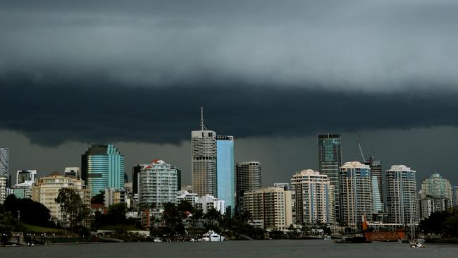
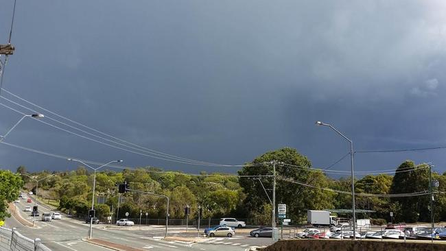
EARLIER: Brisbane residents have been battered by hail and rain as a large thunderstorm hit Queensland’s southeast.
Dark clouds moved over the city just before 3pm on Tuesday after the Bureau of Meteorology issued a severe thunderstorm warning for the region. At 4.15pm, the warning was cancelled.
The bureau said the immediate threat of severe thunderstorms had passed, however storms were still occuring in the area with small hail possible.
At 5.20pm, more than 2000 homes on the Sunshine Coast were without power after the severe thunderstorm swept through the area.
Mooloolaba is the worst affected with 1752 homes affected, and Alexandra headland with 270 homes affected.
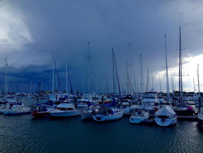
GALLERY: Stunning storm pictures
Commuters can expect a long trip home this afternoon as the after effects of this afternoon’s storm causes traffic congestion on major Brisbane roads.
Delays are expected on:
- Bruce Hwy at Narangba heading northbound
- Gympie Rd at Chermside heading northbound
- Ipswich Motorway at Oxley heading outbound
- Lytton Rd at Hemmant heading westbound
- Pacific Mwy at Brisbane City in all directions. Reports of delays out to Toohey Forest
- Pacific Mwy at Greenslopes heading inbound
- Sandgate Rd at Nunah due to power outages
- Western Freeway at Indooroopilly heading outbound
Energex has reduced the number of power outages around southeast Queensland back under 1000 after the 4,700 earlier this afternoon.
The Moreton Bay region is experiencing the brunt of it, with 849 homes affected around the area.
The inner-Brisbane suburb of Bardon has 100 homes affected due to fallen powerlines, and Logan, Gold Coast and Somerset now only have a few houses now affected.
over 2,000 homes on the Sunshine Coast are without power after the severe thunderstorm swept through the area.
Mooloolaba is the worst affected with 1,752 homes affected, and Alexandra headland with 270 homes affected.
Earlier, a spokesperson for the Queensland Fire and Emergency Service said they have had around 10 calls for assistance, but no requests for help in regards to flash flooding at this stage.
The spokesperson said most of the requests for help were north of Brisbane. (SCROLL DOWN TO VIEW RADAR)
Thousands of homes around southeast Queensland were without power after the large storm cell swept through this afternoon.
Over 4,700 homes are currently affected, with 3,156 in suburbs around the Brisbane City, 778 around Moreton Bay and 760 around Logan.
South-east bikeway at Stones Corner/Greenslopes completely submerged. #bnestorm pic.twitter.com/JgVMlwczX1
— David Alexander (@davidFalexander) September 29, 2015Other areas affected include the Gold Coast, Ipswich and Somerset.
Departing flights at the Brisbane Airport have been grounded and delayed as the storm cell continues to move out to sea. The majority of flights departing until 4.30pm have been delayed.
Some incoming flights have also been affected.
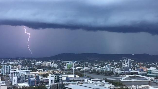
Energex said there has been 10,000 lightning strikes over southest Queensland since 2pm this afternoon.
A BNE airside view. In case you are wondering, this weather will slow operations today #bnestorm pic.twitter.com/p4HCC825ZK
— Brisbane Airport (@BrisbaneAirport) September 29, 2015Earlier, an updated Bureau of Meteorology severe weather warning has been issued, with Brisbane now also in the firing line.
#bnestorm from Brisbane Domestic terminal pic.twitter.com/0wVMQokxR2
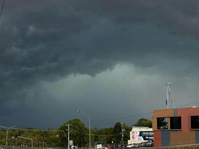
— Case Bunting-Mahanga (@C_B_M_43) September 29, 2015The storm cell stretches from Caboolture to Logan, with Strathpine, Albany Creek, Lake Samsonvale, Kallangur, Narangba and Burpengary expecting to receive the storm around 2.50pm.
The storm will hit Brisbane, Redcliffe, Brighton, Scarborough, Deception Bay and Beachmere around 3:20pm.
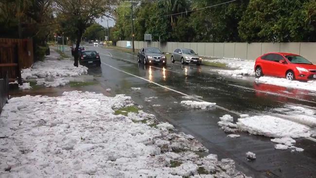
Weather forecaster Kev Hutchins said hail is “likely”, and could be large in size (greater than 2cm wide).
“The storm is continuing to head east and hail is likely, but we can not say where the hail will fall, if it will fall at all,” he said.
Warning areas include Brisbane, Ipswich, Moreton Bay, Beenleigh, Caboolture, Toowoomba, Kingaroy, Caloundra, Taroom, Yarraman, Gayndah and Mundubbera.
Areas around Esk and Wivenhoe have already caught the brunt of the storm, with pea sized hail reported. Small hail has been reported at McDowall, north of Brisbane, and also around the Toowoomba area.
Light hail has also been reported at Bray Park, North Lakes, Mount Ommaney area, West End and Oxley.
Lightning strikes over Brisbane CBD #bnestorm pic.twitter.com/FKgc5s3u3z
— Alle McMahon (@AlleMcMahon) September 29, 2015Atkinson Dam received 25mm of rain, Bellview Bay 18mm and Fullham 14mm.
Storm front #bnestorm approaching brisbane city @7NewsQueensland pic.twitter.com/qPW1xPyhsl
— Patrick Condren (@PatrickCondren) September 29, 2015Earlier, the Bureau of Meteorology warns that, at 2:20 pm, severe thunderstorms were detected on weather radar near Harrisville, Lake Manchester, Upper Brookfield, Mount Nebo, Highvale and Dayboro. These thunderstorms are moving towards the east and are forecast to affect Strathpine, Albany Creek, Lake Samsonvale, Kallangur, Narangba and Burpengary by 2:50 pm and Brisbane CBD, Redcliffe, Brighton, Scarborough, Deception Bay waters and Beachmere by 3:20 pm.
“Damaging winds and large hailstones are likely,” the warning reads The warning area currently extends from Ipswich to as far north as Maroochydore.
Hail has been falling in Esk.
Couriermail.com.au readers are taking to Facebook to track the weather. Read the comments to stay up-to-date.
Earlier, Bureau of Meteorology forecaster Kevin Hutchins says several storms are active across Queensland due to a “severe trough” over areas north to Julia Creek, near Mount Isa, and south to the Darling Downs.
Mr Hutchins says the southeast storm, which was close to Toogoolawah at 1.15pm, “will make things unstable all over the region” over the coming hours but he couldn’t say specifically which areas may be impacted.
The storm is heading east and there’s a possibility large hailstones and strong winds could hit Brisbane’s north.
Queensland Fire and Emergency Services advises residents in affected areas move vehicles under cover, secure loose outdoor items and seek shelter. For emergency assistance contact the SES on 132 500.
Originally published as Brisbane weather: Thunderstorm warning for southeast Queensland

‘Nonsense’: Albo slams Greens over salmon
The prime minister has gone after the Greens in Question Time over salmon farming in Tasmania.
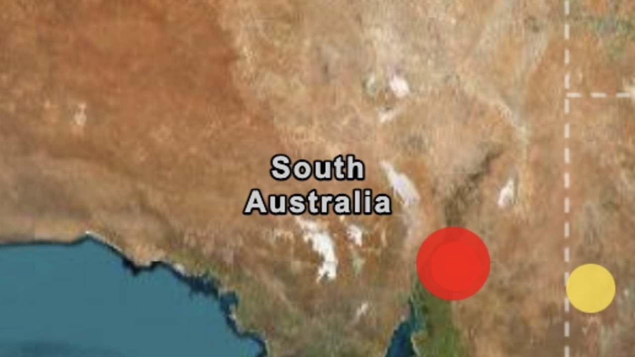
Small town rocked by earthquake
A small Aussie town has been rocked by a 4.5 magnitude earthquake, with people living near the epicentre reporting shaking houses and a loud rumble.
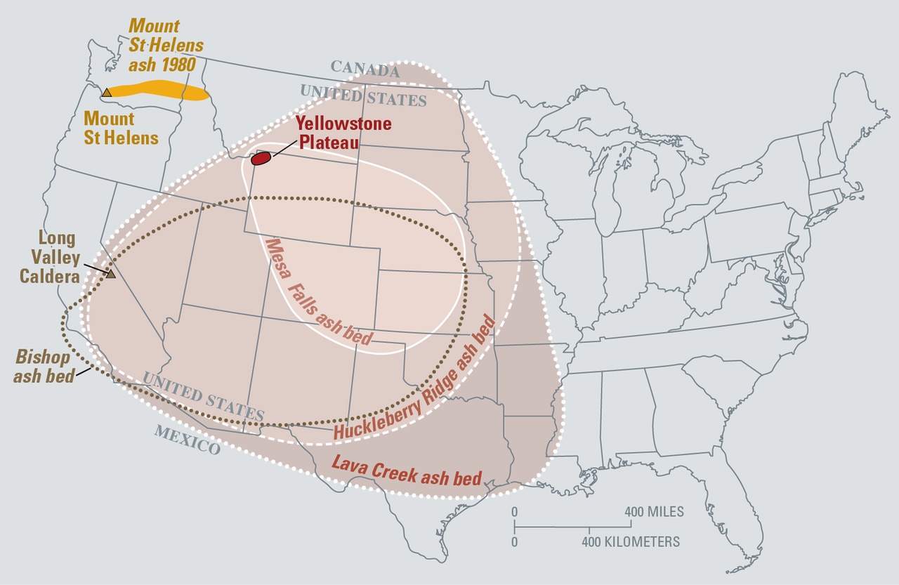
Supervolcano shift stirs fears of eruption
Scientists say the enormous Yellowstone supervolcano is stirring in its sleep, with concerns the subterranean monster could blow.