
Millions across NSW suffering through hottest day in over two summers
More than 30 fires are burning as an extreme heatwave pushes temperatures in one state up to dangerous levels.
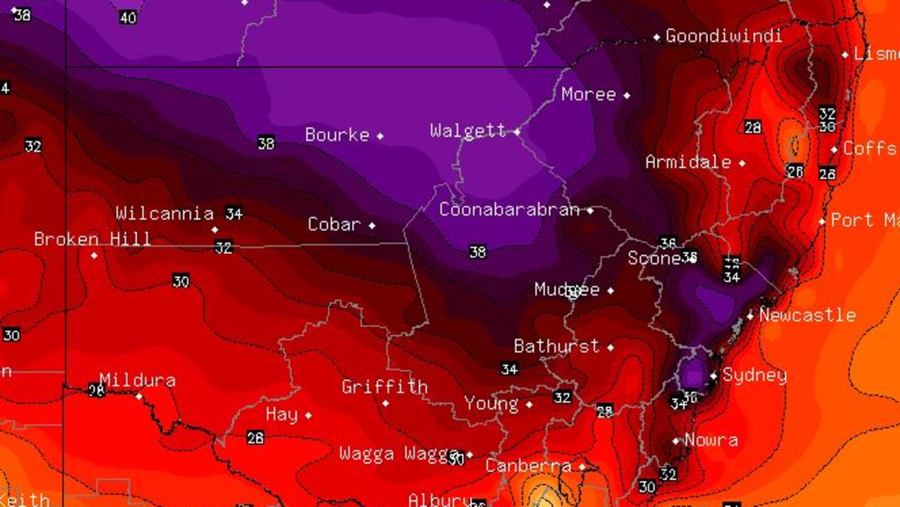
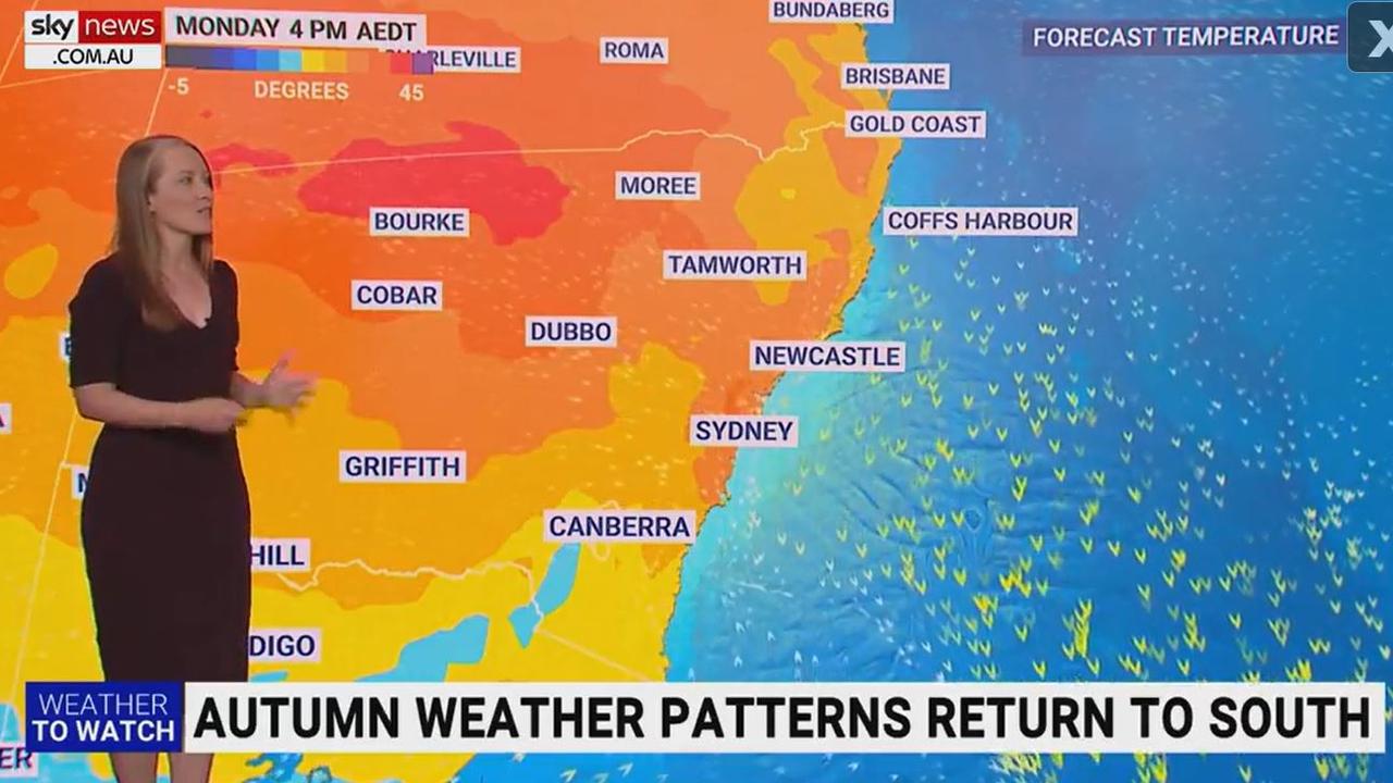
Temperatures are climbing towards 40C ahead of a scorching week, with heatwave conditions lingering on the NSW coast.
Hot air is moving across the country, causing an autumnal heat spike, with western towns like Bourke expected to hit 40C in the coming hours.
Sydney’s CBD is expected to push over 31C for the first time this year, with a forecast of 36C.
“Summer heat not seen since September 2021 will arrive on Monday across NSW where millions will feel the warmest conditions in over two summers,” Sky News meteorologist Alison Osborne said.
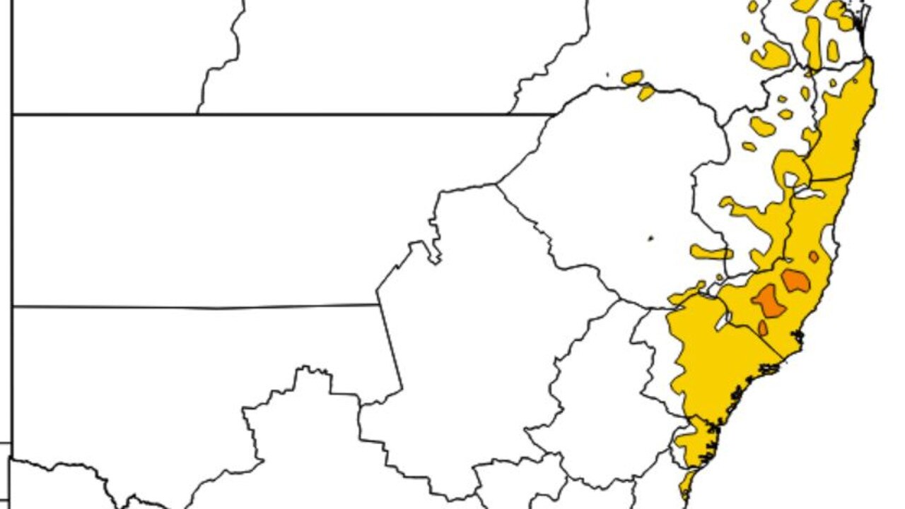
Grassfire activity had been increasing over the weekend across the state, with an Extreme Fire Danger warning issued for the Greater Hunter, Central Ranges and Lower Central West Plains regions.
There are currently 36 fires burning across the state, with one out of control blaze in Tambaroora already tearing through 169 hectares of land on the Central West.
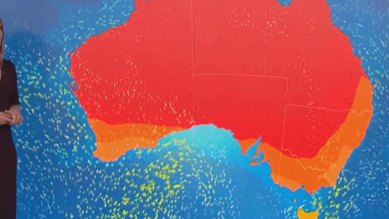
The heatwave will also impact parts of Queensland and Western Australia, while parts of Tasmania could see snow.
Heavy rains in the Top End continue to bring flooding risks and have blocked off a key transport route to Western Australia.
Bureau of Meteorology (BOM) senior meteorologist Sarah Scully said hot conditions on the eastern coast are due to shifting hot northerly winds moving ahead of a cold front.
“For much of NSW on Monday through to Wednesday, it will be hot and windy, elevating fire dangers particularly about the NSW Ranges and Western Slopes,” she said.
Hot, dry and windy weather means increased fire danger across parts of NSW today.
— NSW RFS (@NSWRFS) March 6, 2023
At 11am Monday 6 March there's 37 bush and grass fires across the state, including one at Watch and Act (Alpha Rd, Tambaroora, Mid-Western LGA). #NSWRFSpic.twitter.com/xZl90NeC70
“We’re expecting low intensity heatwave conditions for parts of eastern NSW … while southeastern Australia will have a series of cold fronts with temperatures dropping well below average.
“There’s even a chance of snow about elevated parts of Tasmania on Wednesday.”
Heavy rains will continue to batter the Top End, courtesy of a monsoon trough dipping down over Cape York Peninsula over Queensland.
“That’s drawing in moisture over Northern Australia at the moment, bringing increased storm activity,” Ms Scully said.
“A number of flood warnings and watches have been issued across northern parts of the country.
“There are a number of impacts on the community; last week very heavy rainfalls across the Top End resulted in a number of communities being evacuated. Conditions have actually eased, however that large body of water which created those flooding conditions last week is moving downstream.
“This has caused flooding over the Victoria River crossing, the main route for transport between the NT and WA, and it’s expected to remain impassable until Thursday.”
Western Australia has enjoyed heatwave relief, with some very isolated patches of low intensity heatwave conditions to occur over the next week.
However, Perth is in for another hot week, with maximum temperatures ranging from 27C to 34C peaking on Tuesday. The city will be sunny early in the week, with possible showers on Wednesday before skies clear up again on Friday.
Sydney will sweat through maximum temperatures of 36C on Monday and 34C on Tuesday, with temperatures remaining in the high 20s for the rest of the week and some possible showers on Saturday.
Melbourne can expect a cool week after its steamy weekend, with maximum temperatures ranging from 17C to 24C and possible showers on Wednesday.
Brisbane is set to swelter through a week of hot temperatures, with the mercury poised to tip over 30C every day, peaking at 34C on Wednesday and Thursday. It will be partly cloudy towards the end of the week with showers expected on Friday and Saturday.
Adelaide will be cloudy, with possible showers on Monday and Wednesday. Temperatures will remain relatively cool, hovering in the low 20s before climbing to a maximum temperature of 25C on Friday and Saturday.
It will be a dreary week for Hobart, with rain expected Monday through to Wednesday. Cooler temperatures will reach a maximum of 23C on Monday before dropping to 15C on Wednesday.
Canberra is set for a week of beautiful weather following a weekend of storms, with partly cloudy skies and maximum temperatures ranging from 29C on Monday to 20C on Wednesday.
It will be a very wet week for Darwin, with showers and possible storms expected every day except for Friday. Maximum temperatures will hover in the low 30s all week with minimum temperatures of 25C.


