
‘Giant’ hailstones, destructive winds and heavy rain to hit Qld
Giant hailstones are set to pound southeast Queensland amid warnings to residents of a ‘very dangerous’ impending thunderstorm.
Giant hailstones are set to pound southeast Queensland with residents warned of a “very dangerous” impending thunderstorm.
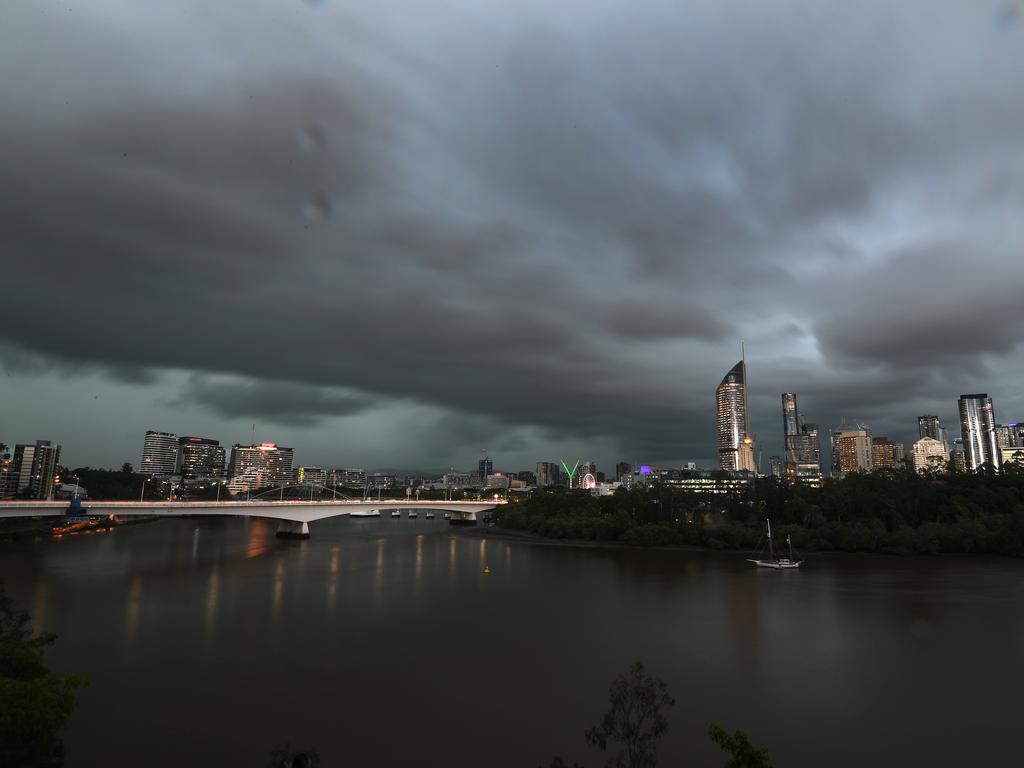
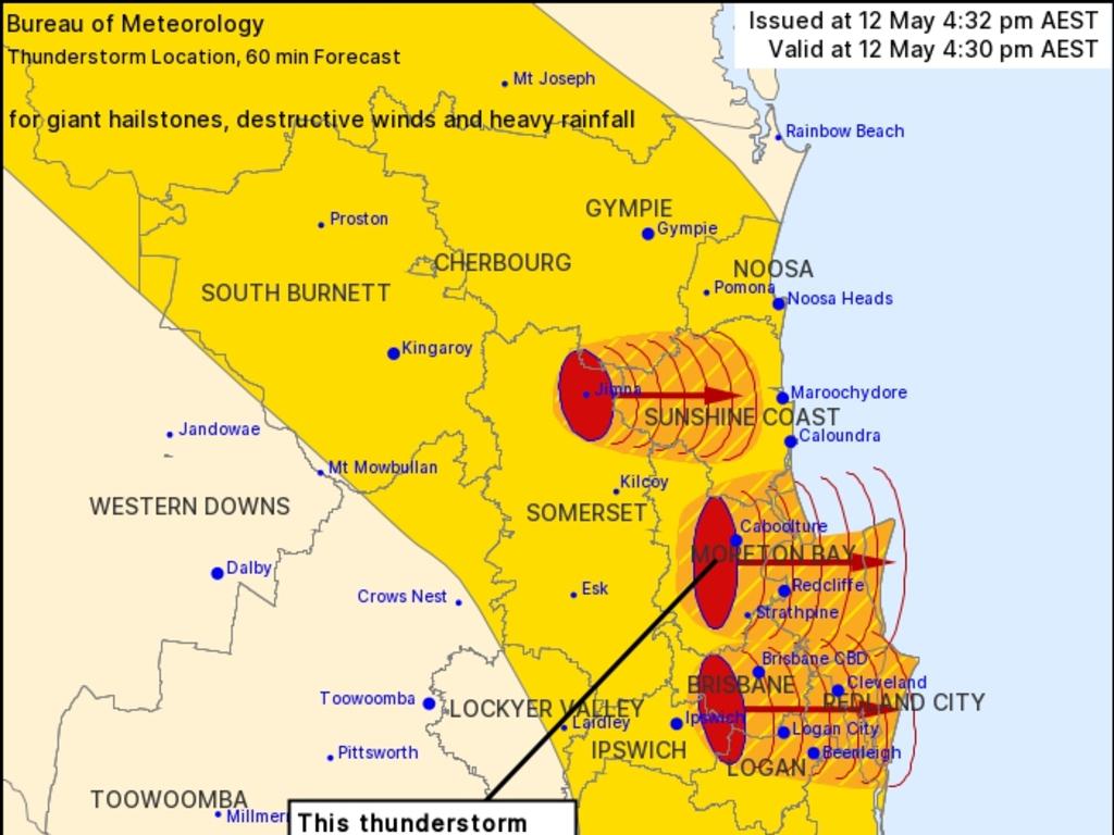
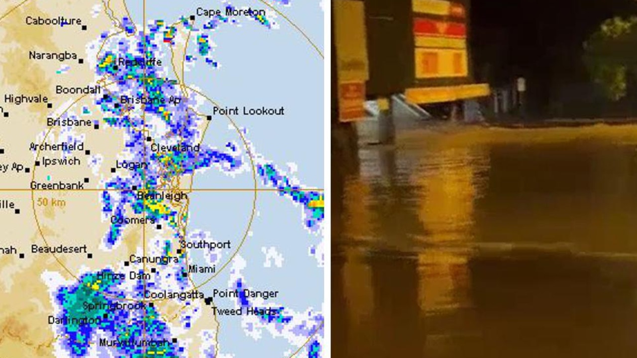
The weather bureau delivered a severe thunderstorm warning about 4.30pm on Wednesday, saying it would bring “giant hailstones, destructive winds and heavy rainfall”.
Giant hail is forecast between Redcliffe and Woodford, including Caboolture and Bribie Island as a severe thunderstorm moves south towards Brisbane, the bureau said.
Severe storms are expected to hit Brisbane CBD, Beenleigh, Logan City and Borumba Dam by 5pm and Cleveland, Nambour, Mapleton and Yandina by 5.30pm.
Thunderstorms deemed “very dangerous” are also expected to hit Strathpine, Redcliffe, Beerburrum and northern Bribie Island by 5pm and northern Moreton Island, Comboyuro Point, Cape Moreton and waters off Bribie Island by 5.30pm.
“Giant hailstones, destructive winds and heavy rainfall that may lead to flash flooding are likely,” the bureau said.
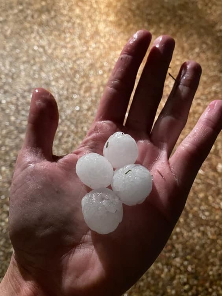
Hailstones measuring 5cm have been reported near Toogoolawah, two hours north of Brisbane, on Wednesday afternoon.
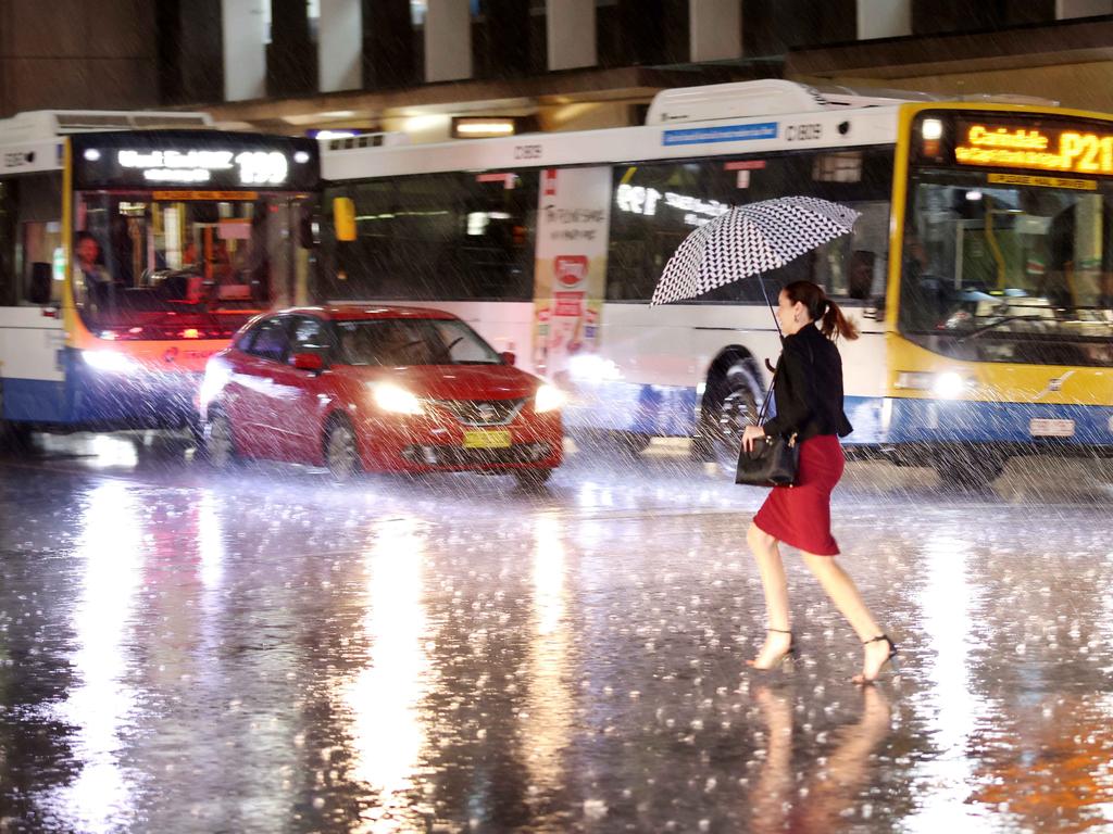
Brisbane residents were texted warnings from local authorities urging them not to drive and to take shelter immediately.
The Queensland Fire and Emergency Services also advised people to seek shelter, preferably indoors, and to beware of fallen trees and powerlines.
A more general severe thunderstorm warning is also current for the Wide Bay and Burnett, Southeast Coast and parts of the Central Highlands and Coalfields, Capricornia and Darling Downs and Granite Belt districts.
It came as hailstones the size of 20 cent coins earlier battered the nation’s east coast as locals braced for more “violent” and “explosive” storms to come.
In New South Wales, a minor to moderate flood warning was issued for the Darling River while a severe weather warning for damaging winds was in force for Lord Howe Island.
A warning was also issued for Victorian sheep graziers, who were told there is a risk of losses of lambs and sheep exposed to the cold south-westerly winds and rain extending from the west on Thursday.
Likely affected areas include parts of the North Central, South West, Central and West and South Gippsland forecast districts.
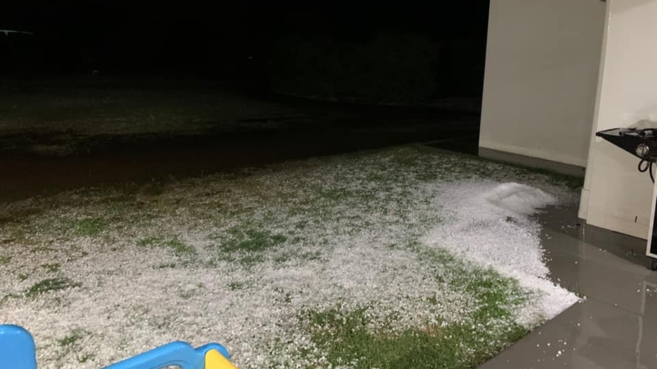
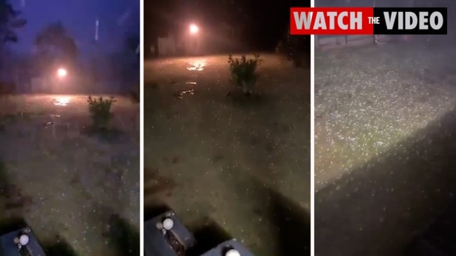
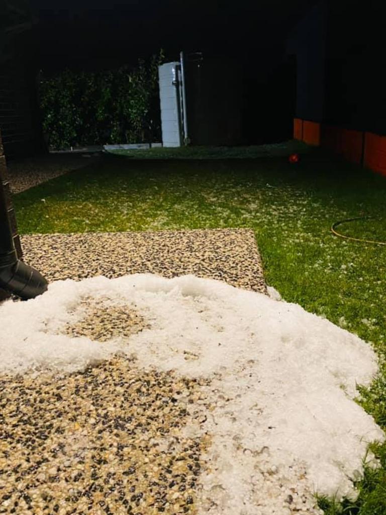
Overnight, large hailstones wreaked havoc in southeast Queensland, with hail up to 5cm in diameter falling in multiple areas.
Wellcamp, Newtown and Toowoomba all saw hail sized between 3cm to 5cm at about 8pm, with Toowoomba also copping 45mm of rain in just 30 minutes.
Marble-sized hail also fell at a camping ground in Thane, west of Warwick.
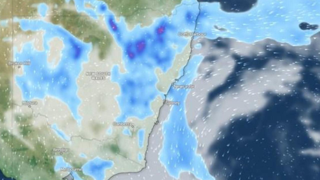
A separate weather system delivered heavy rain to southeast NSW with Merimbula recording 124mm in 24 hours to 9am on Wednesday, its heaviest rain in more than 20 years.
Melbourne also recorded its third coldest day of the year with the maximum temperature reaching just 15.6C at 1pm on Wednesday. It was also the third coldest night of the year, dropping to 7.3C.
Sky News chief meteorologist Tom Saunders said southeast Queensland and eastern NSW were experiencing a “late season storm outbreak”.

“The storm season generally finished up in April but right now we’re seeing explosive storms in this region,” he said.
“A cold pool of air moving aloft across NSW, meanwhile at the surface temperatures are slightly above average and as a result we’re seeing an unstable atmosphere leading to further thunderstorms on Wednesday.”
Mr Saunders said severe storms were “essentially guaranteed” in southeast Queensland and northeast NSW on Wednesday with further damaging winds, hail and flash flooding.

There is also set to be another burst of showers in Victoria and Tasmania to end the week as well as three to four cold fronts sweeping across the states on Thursday, Friday, Saturday and Sunday.
Up to 25mm of rain could fall in west Gippsland and the west coast of Victoria, with up to 50mm on Tasmania’s west coast.
But there will be very little rain north of the Great Dividing Range.
“From Thursday onwards we are expecting several cold fronts to move across the state and temperatures are expected to dip down further with below average temperatures from Thursday onwards to early next week,” weather bureau senior meteorologist Michael Laczko said.
‘Prepare to isolate’: Wild weather warning
Residents have been warned to “prepare to isolate” as one state is smashed by rain in a wet end to the long weekend.
Women injured by lightning amid Anzac deluge
Two women have been injured in separate lightning strikes after one Aussie state was pounded by more than 200mm of rain over Anzac Day.
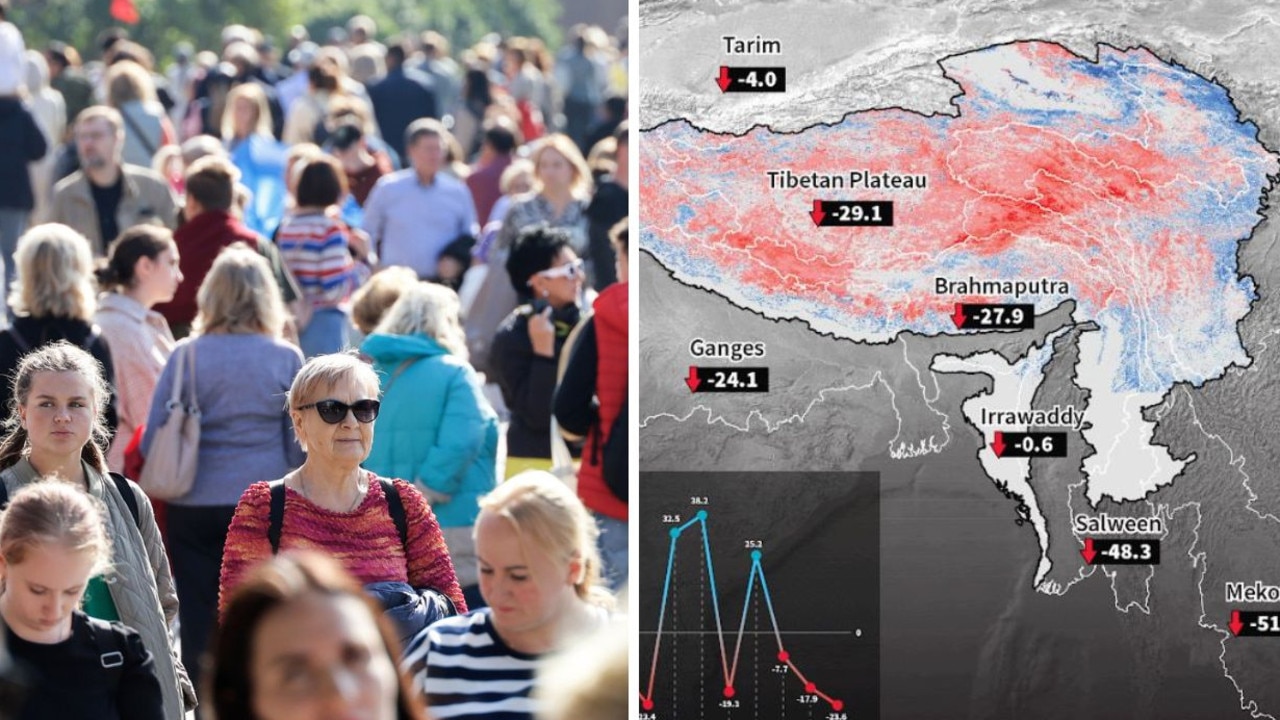
Chilling event could eradicate 2 billion lives
A freak weather event in one of the world’s most densely-populated areas is threatening two billion lives.