
‘Hottest October weather for years’ as temperatures soar ahead of a Polar change
Aussies are bracing for boiling hot weather over the next few days — but one town has already sweated through its hottest October day in a century.

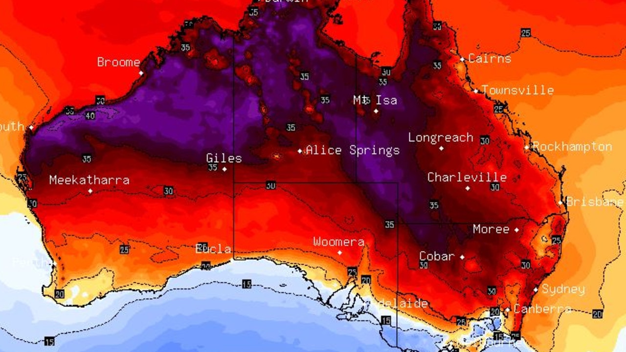
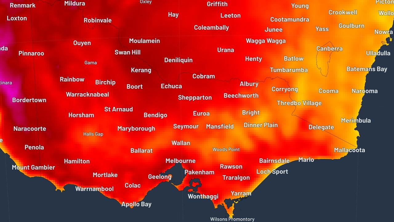
The “hottest October weather in years” is set to fry eastern Australia over the next couple of days.
Forecasters have actually upped their predictions of how high the mercury could go.
A big swath of hot continental air was sitting over the middle of Australia however thanks to a strong north-westerly, the warm air has moved to the east coast.
The hot air already hit parts of South Australia with the southern state recording some of its warmest October weather in years.
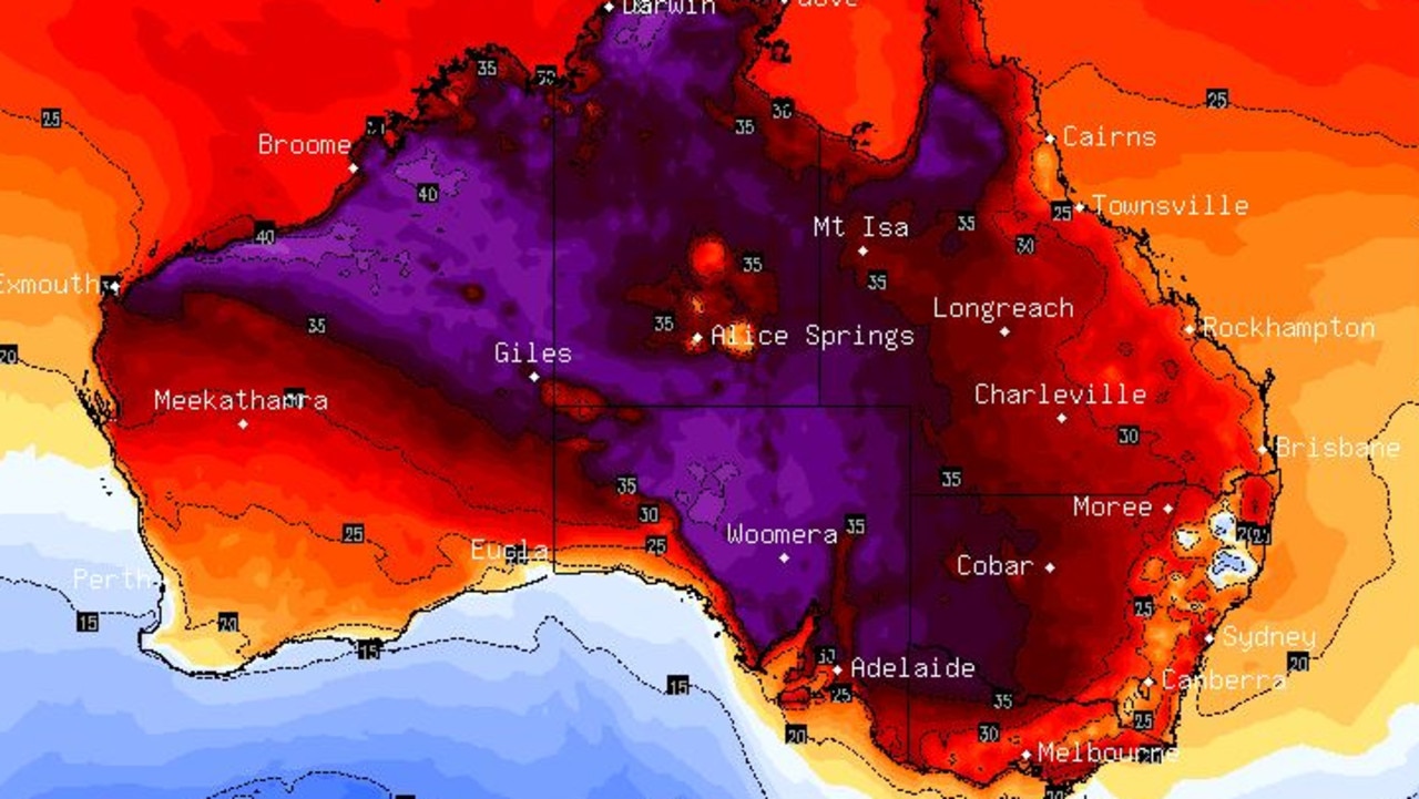
Port Lincoln, which hit 41C yesterday, was the first time the town had experienced a 40C-plus day. Mount Gambier, which hit 34.4C had its warmest October day in 105 years while Adelaide locals had their hottest October day in five years.
As the warm north-westerly moves to the east coast, the wind also brings increased dust in the air and very high fire dangers for most of the state.
More than 40 bushfires are burning in New South Wales, the Rural Fire Service has said.
But despite the hot weather for yesterday and today, that sweltering weather will eventually lose out to a polar blast coming from the south.
The chilly wind will quickly cause temperatures to plummet by as much as 20C in 24 hours and bring the risk of drenching rains, strong winds, and even snow and hail for southern areas.
Hot weather is coming and that means an increased risk of bush fires. Have the conversation with your family now about what you’ll do in a fire. Don’t wait and see. Make your plan at https://t.co/EkQp8gBNbG. How fireproof is your plan? #nswrfs #nswfires pic.twitter.com/1LSFJyhZ2J
— NSW RFS (@NSWRFS) October 23, 2019
Reminder: Total Fire Bans have been declared for Thursday 24 October 2019 in the following Fire Ban Districts:
— Country Fire Service (@CFSAlerts) October 23, 2019
Northwest Pastoral, West Coast, Eastern Eyre Peninsula, Lower Eyre Peninsula, Flinders, Mid North, Mount Lofty Ranges, Yorke Peninsula, Kangaroo Island, Lower South East pic.twitter.com/RRLTN0wz1t
“The hottest October weather for years is set to descend and there is the risk of out of control bush fires and dust storms,” said Sky News Weather channel meteorologist Tom Saunders.
Things have cooled down significantly for Adelaide with a projected high of 19C today and similar temps into the weekend. Yesterday, the South Australian capital hit 37C, 15C above the usual temperature for this month. Fire weather warnings remain in place for many parts of the state.
Melbourne is looking at 26C, with a partly cloudy day and potential for showers and into the weekend, the temperature will struggle to hit above 17C. The weather will be similar in Hobart with highs reaching 26C and blustery conditions on the Apple Isle. Canberra will top out at 29C today with showers and thunderstorms expected later today.
And then it’s all change as the heat loses the weather battle to a burst of Antarctic air.
“What will follow is a gusty cool change with polar air moving through southern Australia from Friday and Saturday and that will cause a dramatic drop in temperatures for those areas,” said Mr Saunders.
“The front will also bring some showers on Friday to south east Australia and they will increase on Saturday with wind, hail and thunder in southern Victoria along with snow around the Alps and highland parts of Tasmania.
“The hot weather will be followed by a cold blast.”
The Bureau of Meteorology (BOM) has warned of damaging winds across central Victoria and possibly into Melbourne today.
SYDNEY SET TO SIZZLE
Eastern Australia will see a similar see saw of blistering heat and then a drop, but about 24 hours later.
“Warm air will be carried east into New South Wales and the winds will pick up leading to elevated fire dangers,” said Mr Saunders.
Yesterday’s 27C in the Sydney CBD was barely even a warm up for today which is now expected to hit a sweltering 35C. Even Bondi, usually cooled by the sea breezes, will be a scorching 33C.
Inland and it just gets hotter with Penrith reaching 37C today.
The cooler temperatures should begin to be felt on the weekend with a high of 31C in the CBD on Saturday and then a more reasonable 23C on a sunny Sunday. Penrith will only dip below 30C on Sunday.

Across the Tweed and Brisbane is looking quite reasonable in comparison with a run of sunny days reaching 28C and maybe just sneaking above 30C on the weekend.
Up to 35C with possible storms in Darwin headed into the weekend.
In the West, mild conditions in Perth with a high of 21C today, 23C on Friday but getting up to 33C on Sunday. Mostly sunny and fine.
Despite the boiling conditions, it won’t be a heatwave. A heatwave is officially defined by the BOM as three or more days of unusually high maximum and minimum temperatures in any given area.
These are then divided into bands depending on seriousness, with “extreme” heatwaves the most dangerous as they can prove debilitating to even the fit and healthy.
The above average highs will be relatively short lived in most areas so it’s probably more accurate to think of it as a heat “spike” rather than a heatwave.
However “low intensity” heatwave conditions could occur north east of Sydney and south of Canberra.
‘Don’t return’: Deadly floods to worsen
Residents have been urged not to return home as deadly floods continue to smash one state, as towns are cut off and some areas record more than a metre of rain.
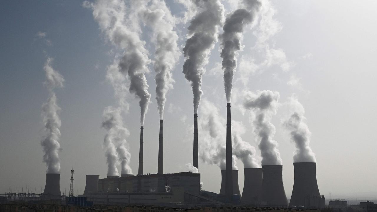
‘Hoodwinked’: China is conning the world
An Australian economist says China is conning the world on an important global issue.
State smashed by ‘hours of lightning’
Thousands have gone without power as wild storms battered one state, with “hours of lightning” recorded in a major city and its surrounds.