
Storms bringing heavy rain and possibly hail to hit NSW, Qld, as Victoria is on flood watch
An ‘unusual’ bout of stormy weather is expected to bring damaging winds and hail stones to NSW and Queensland.


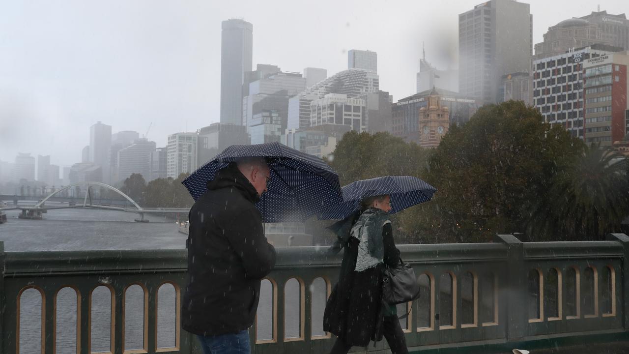
An “unusual” trough hovering over Australia’s eastern coast is expected to bring another day of heavy rain, storms and possibly large hail.
It comes after more than 100,000 lightning strikes were recorded across southern Queensland overnight, from Roma to Brisbane, weather bureau meteorologist Pieter Claassen said.
The wild weather has led to severe thunderstorm warnings for large hailstones and damaging winds being issued for parts of Queensland and NSW, while eastern Victoria is on floodwatch.
As well as thunder and lightning, Monday’s overnight storms brought hail near Toowoomba, west of Brisbane.
The severe storms continued to lash Queensland’s south east on Tuesday, with a severe thunderstorm warning issued on Tuesday evening for damaging winds and large hail over the next few hours.
The warning applies to people in parts of the Central Highlands and Coalfields, Wide Bay and Burnett, Darling Downs and Granite Belt and Southeast Coast Forecast Districts.
Mr Claassen said the storms may move towards Brisbane and the Gold Coast late on Tuesday and into Wednesday.
Widespread showers across south east Queensland and parts of the state’s east are also expected on Wednesday, before clearing on Thursday.
“The main risk tomorrow is more of the heavy rainfall than the large hail and damaging risks. Though there is still a slight risk of large hail and damaging wind gusts,” he said.
A severe thunderstorm warning was also issued on Tuesday night in New South Wales, for people in parts of the North West Slopes and Plains and Northern Tablelands Forecast Districts.
Locations which may be affected include Tenterfield, Urbenville, Liston, Drake, Emmaville and Ashford.
Meanwhile in Victoria, a flood watch is in place for East Gippsland and parts of West Gippsland, with minor flooding likely.
It came as a strong cold front moved over the state’s east early on Tuesday, bringing heavy rain.
Mr Claassen said it was “pretty unusual” to see severe thunderstorm activity at this time of year.
“It does happen on occasion when we get these big cold pools of air moving north over New South Wales towards Queensland, which is happening at the moment,” he said.
“But quite unusual because we saw a very similar event last week, so it’s been back to back events.”

The wild weather is being driven by a trough combining with a cold pool of air high up in the atmosphere, which is allowing the storms to form, he said.
“It is pretty unusual for May to see severe thunderstorm activity,” Mr Claasen said.
“It’s essentially making the atmosphere quite unstable over NSW and south eastern Queensland.”
SEVERE Weather Warning for HEAVY RAINFALL.
— VicEmergency (@vicemergency) May 10, 2021
For people in East Gippsland and parts of Central, South West and West and South Gippsland Forecast Districts.
Issued at 4:55 am Tuesday, 11 May 2021.
Stay informed: https://t.co/T05ONtwAm3pic.twitter.com/0WaxLkPm4E
Weatherzone meteorologist Graeme Brittain said rainfall totals reached 27mm at Green Cape, NSW within five hours.
“We had some pretty heavy falls of rain there less than a week ago so the river systems are already quite full,” he said.
There was also 49mm of rainfall in Victoria’s Mount Moornapa since 9am Tuesday, with Mount Waldron also recording 47mm.
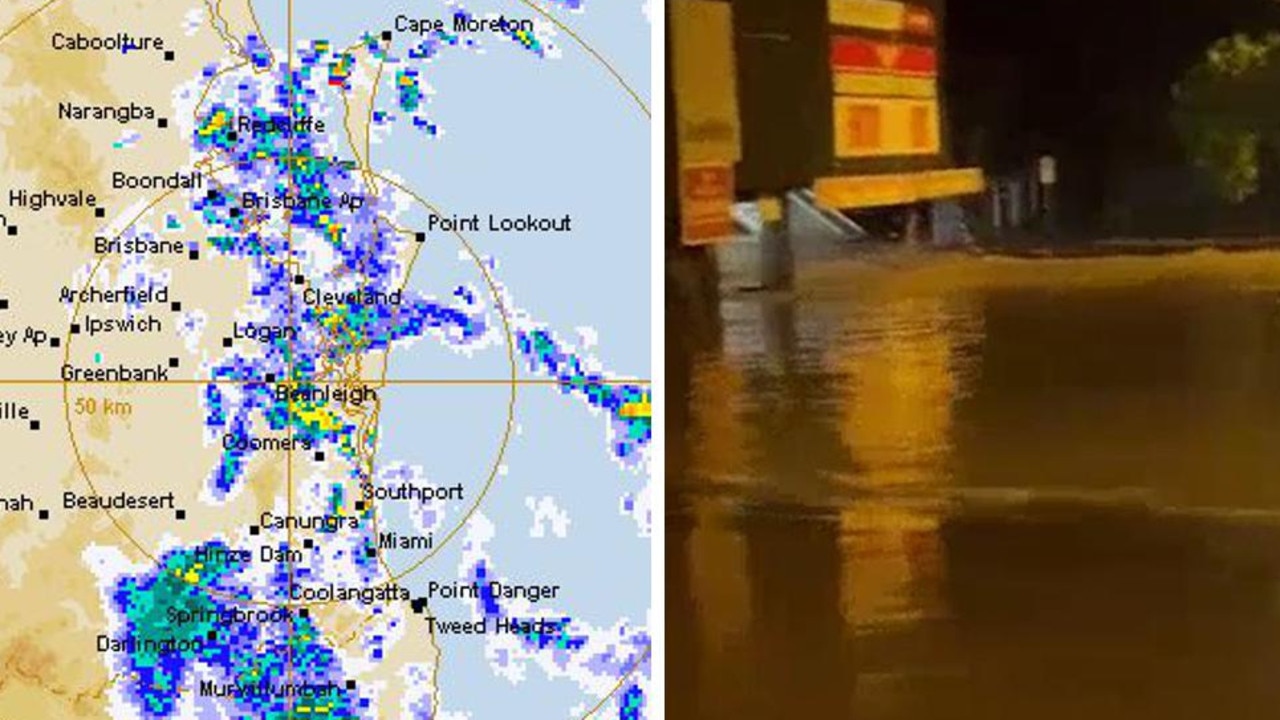
Women injured by lightning amid Anzac deluge
Two women have been injured in separate lightning strikes after one Aussie state was pounded by more than 200mm of rain over Anzac Day.

Millions facing long weekend washout
Long weekend plans could be under threat across swathes of the country as millions brace for heavy rain and thunderstorms.
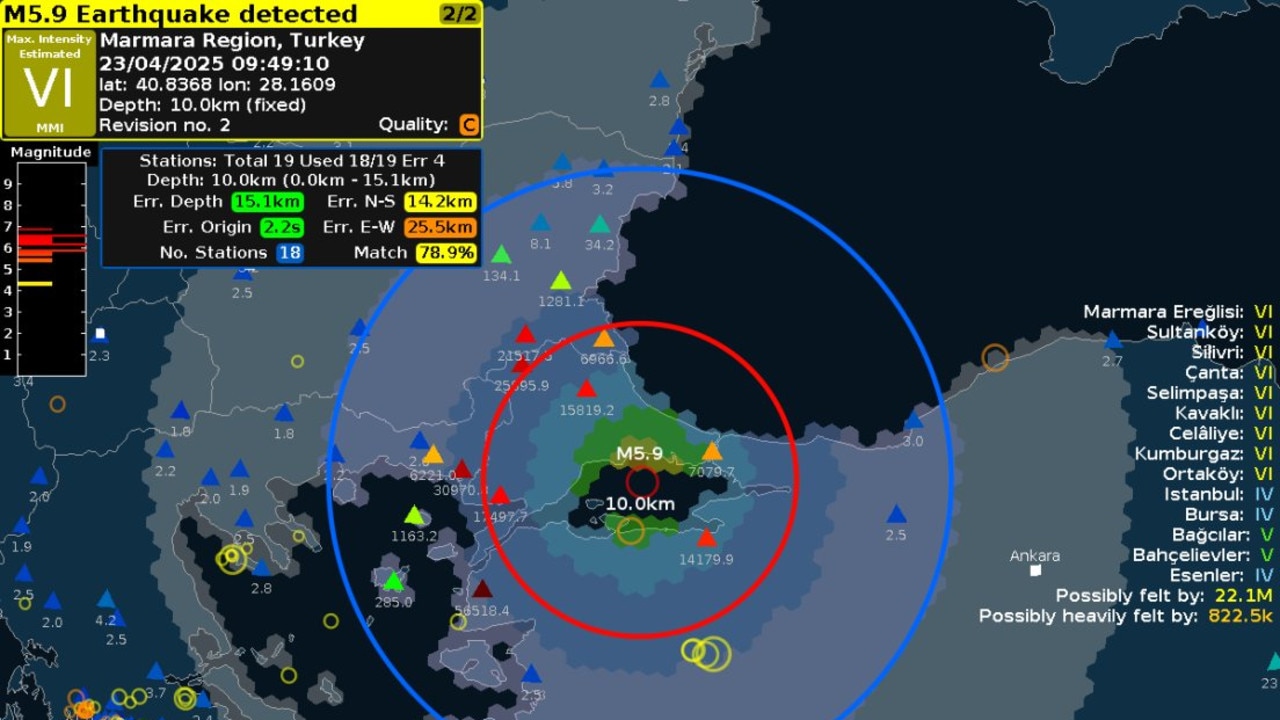
Major city rocked by earthquake
People have rushed onto the streets after the city was hit by a 6.2 magnitude earthquake on Wednesday.