Heatwave, stormy conditions to dominate Australia Day celebrations as Jan 26 capital forecasts revealed
Storms, heatwave conditions and cyclones – Aussies across the country’s capital cities will be experiencing it all this Australia Day as the national outlook is revealed.
Storms, heat and cyclonic conditions are set to dominate Australia Day as some capital cities face scorching heat conditions, while others brace for heavy rain.
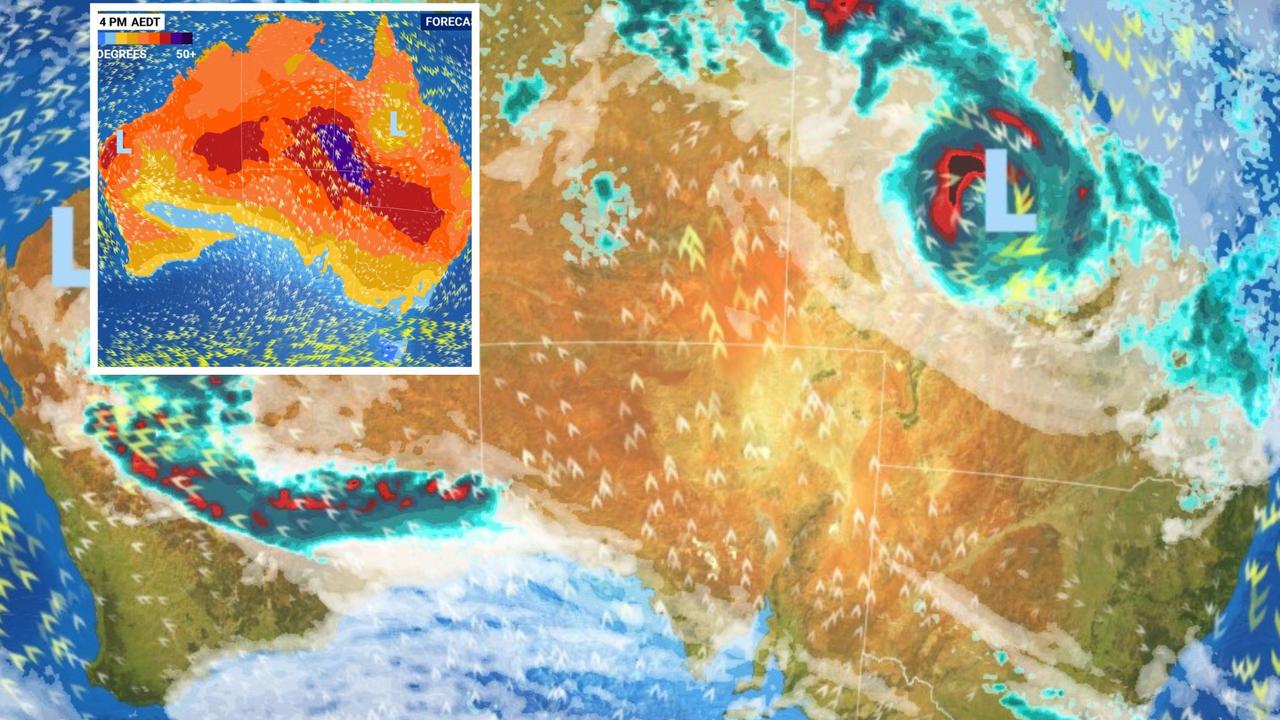
Parts of northern and central Queensland are facing threats from a tropical cyclone system bearing expected to make landfall through the week, while much of Northern Australia continues to endure monsoonal rains from a separate tropical low.
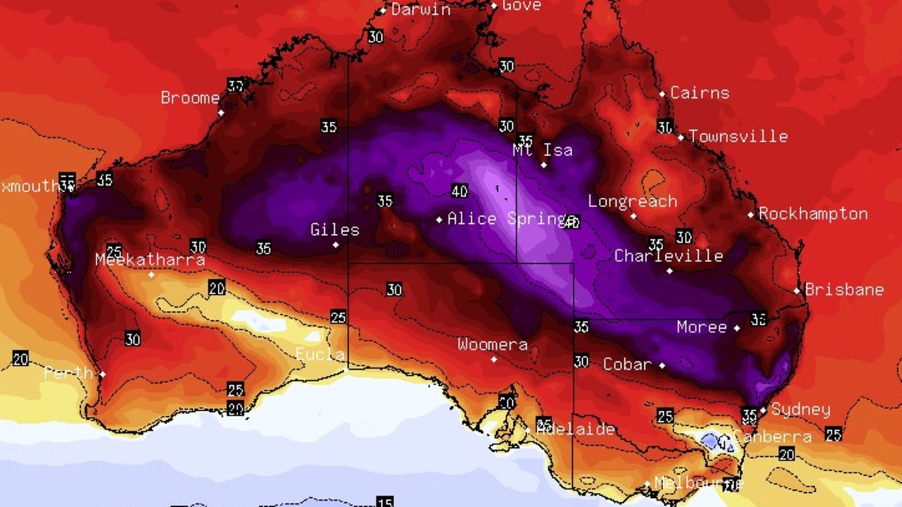
Sky News Weather meteorologist Rob Sharpe said the capitals would be a mixed bag for the national holiday on January 26 – some facing heatwave conditions while others will remain in the comfortable 20s.
Here’s what the forecast looks like in the coming days:
NSW
Sydney will be at the end of its heatwave by the time Australia Day comes around, with temperatures this week set to reach into the mid-30s.
Mr Sharpe said the night of the 25th was likely to be the “hottest” of the season so far at a minimum temperature of 25C.
He explained the heat would build quickly into the 30s on Australia Day but would then be halted by a southerly change in the middle of the day.
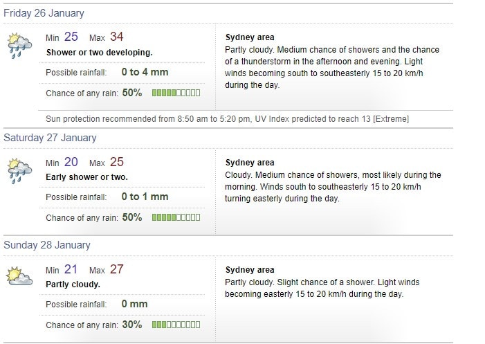
“If the southerly is delayed it could even nudge 40C with the chance of an afternoon storm,” Mr Sharpe said.
“People heading to the beach or outdoor events need to drink plenty of water and use lots of sunscreen.”
Over the long weekend, maximum temperatures will remain in the mid to high 20s with a moderate to light chance of showers.
Queensland
Brisbane will be warm and humid this Australia Day with a medium chance of showers, with the mercury set to climb to a maximum of 32C.
Up to 4mm could fall in parts of the city, most likely in the afternoon and evening, with a chance of thunderstorms, the Bureau of Meteorology has forecast.
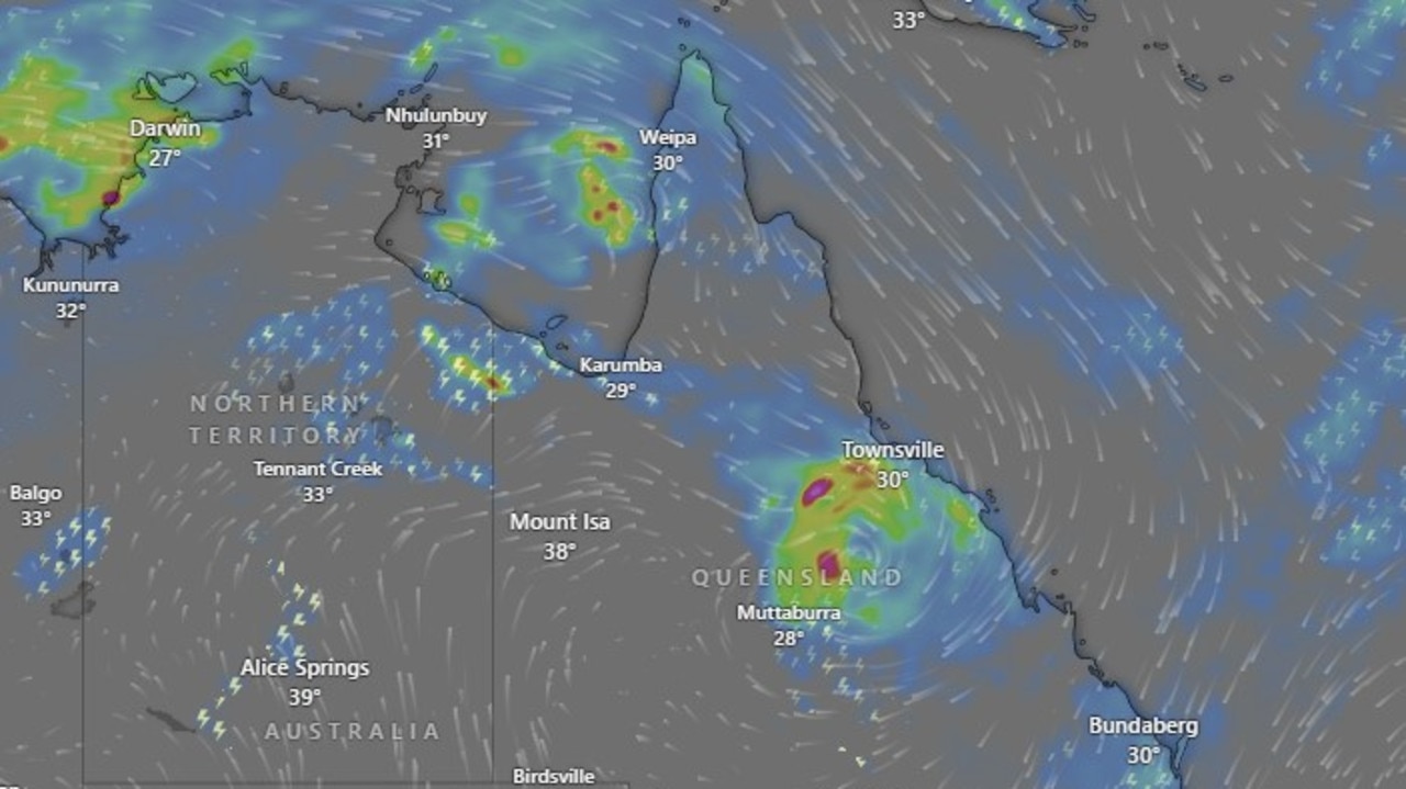
However that rainfall total could climb as high as 60mm on Saturday and 50mm on Sunday as a rain depression from impending Tropical Cyclone Kirrily makes its way inland.
Maximum temperatures will remain around 33C and 29C respectively.
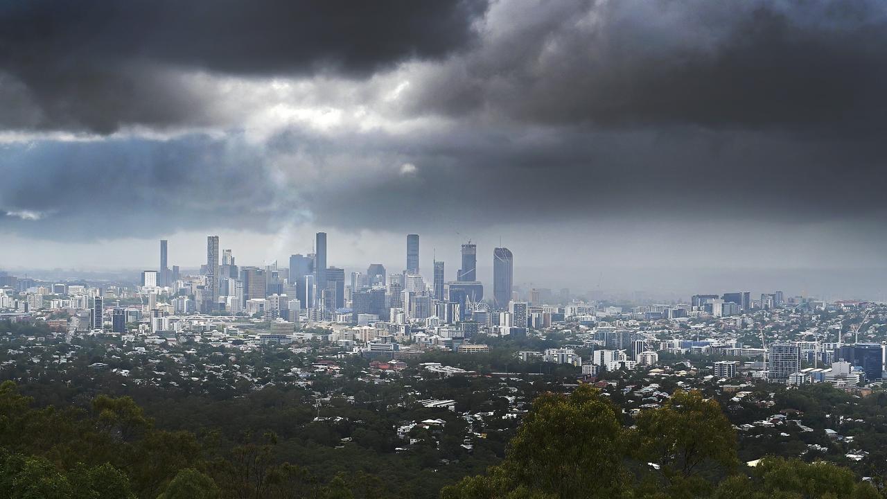
It spells a different story in the central and northern regions of the state, which will be enduring wind gusts of up to 150kmh, along with heavy falls that could lead to flash flooding.
Storm tides have also been forecast for coastal communities between Townsville and Mackay.
Victoria, Tasmania, South Australia, ACT
The chaotic conditions in the north are a stark contrast to what is being forecast for the south and southeast states.
Adelaide, Melbourne and Hobart are all set to experience the most comfortable weather, avoiding any major chance of storms, according to bureau forecasts.
“(They can) all expect top temperatures in the low-to-mid 20s and partly cloudy skies,” Mr Sharpe said.
“There is only a small chance of seeing wet weather in these capitals.”
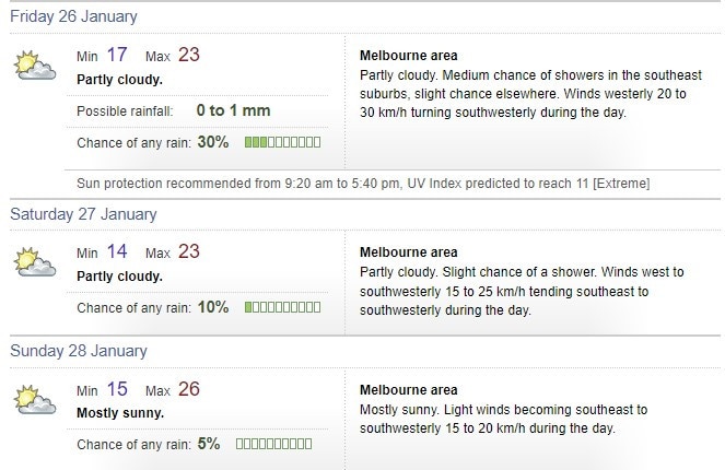
Melbourne is set for a comfortable long weekend as temperatures remain around the mid to low 20s, with a minimal chance of showers over Friday, Saturday and Sunday.
Adelaide will have similar cloudy conditions – the hottest temperature only going to 29C on Sunday.
Canberra will be partly cloudy with a medium chance of showers and a chance of a thunderstorm on January 26.
There is a medium chance of showers for Hobart on Australia Day but less than 1mm is forecast to fall.
The heat will be cranked up for all of these cities by next Monday however, with some pushing into the mid-30s.
Darwin
Stormy monsoonal weather shows no sign of letting up in the Northern Territory, with thunderstorms forecast for the Darwin City and Outer Darwin areas.
Up to 25mm could fall on Australia Day alone, then up to 15mm over the weekend.
Maximum temperatures will hover around 31-32 degrees from Friday through to Monday.
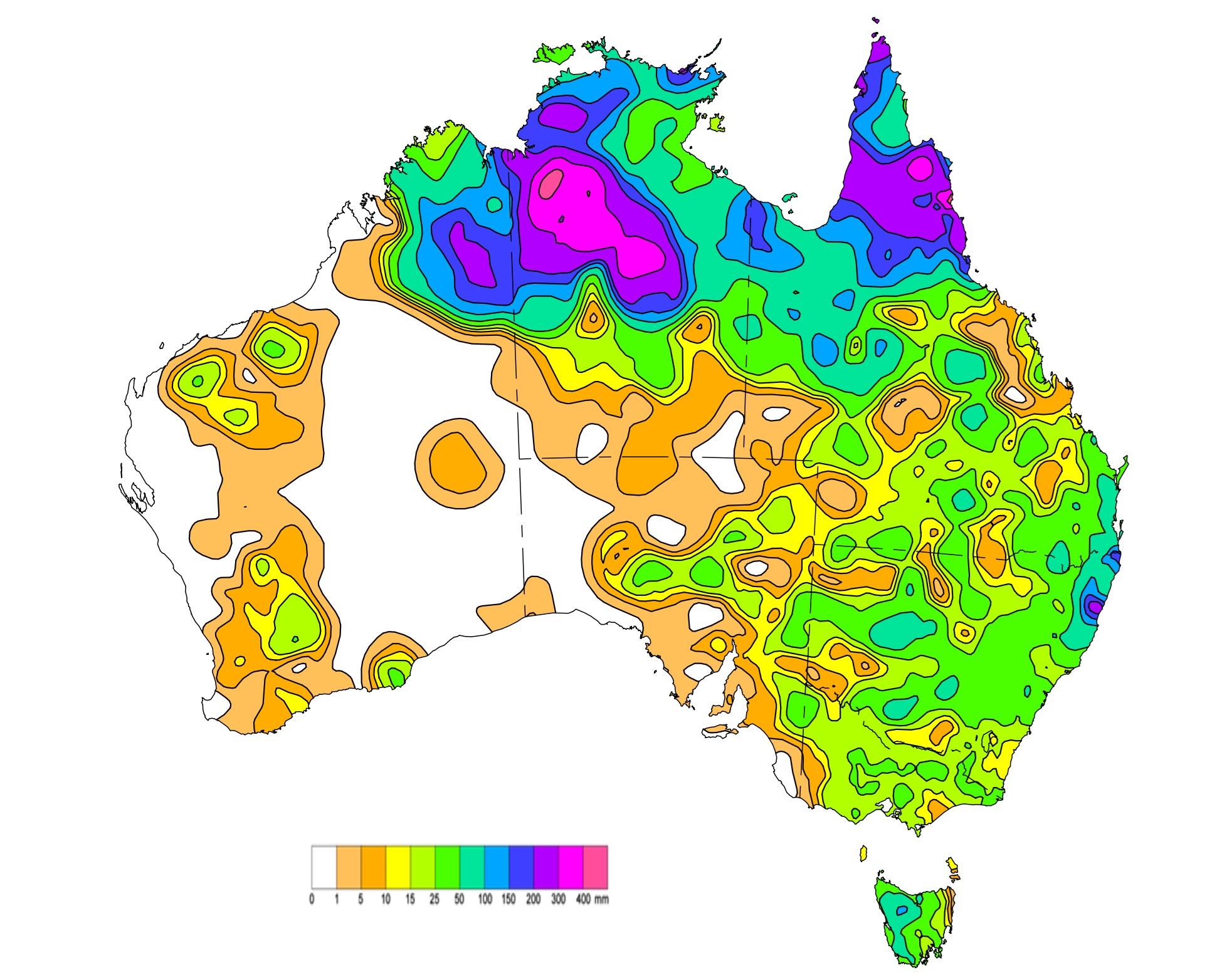
The stormy outlook is due to an active monsoon trough and tropical low hanging around the Top End since January 10.
“These systems brought widespread heavy rainfall, thunderstorms with areas of heavy to locally intense rainfall and flooding to large parts of the Northern Territory and northern Queensland,” the bureau’s weekly rainfall update states.
Some areas of central and western Northern Territory and northern Queensland received more than 300mm of rainfall, according to the bureau’s update.
Western Australia
Mr Sharpe said Perth is set to be the sunniest capital this Australia Day, with temperatures heading to the low-to-mid 30s.
These will ease to cloudier conditions over Sunday and Monday as the mercury’s high point drops to 27-28C.
It follows a lengthy heatwave across the state where maximum temperatures generally reached into the mid-forties.
Some areas were higher, particularly over parts of the western Pilbara and adjacent northern Gascoyne.
Overnight minimum temperatures hovered around the high twenties, reaching the low thirties for the first half of the week.


