
Heatwave for some, storms for others as weather set to turn wild
HOT, humid weather is creating conditions perfect for supercell storms. In some parts of Victoria, it’s already creating chaos.

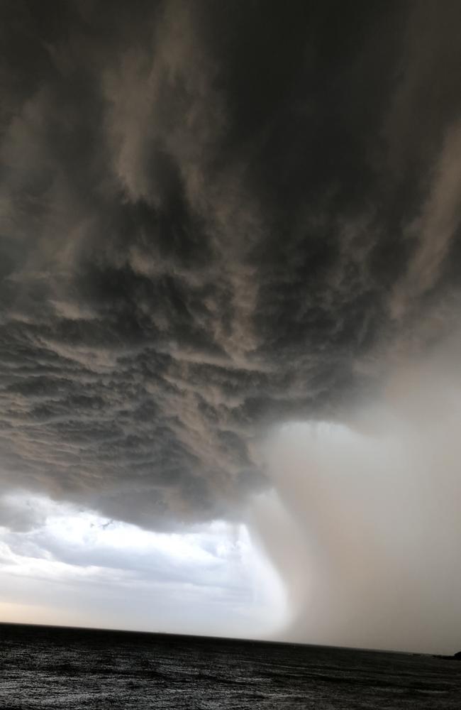
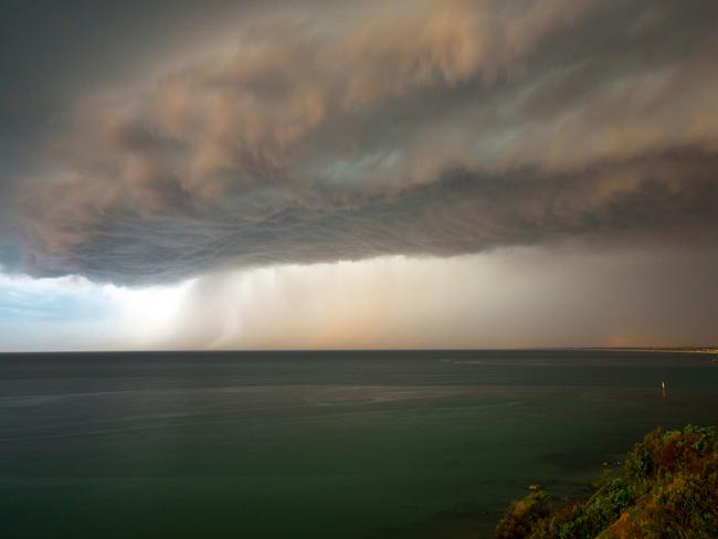
DANGEROUS supercell thunderstorms predicted for Victoria have arrived, bringing with them hail and lightning.
Mildura, in the north-west of the state, copped a battering earlier on Tuesday before the large hailstones fell across the state’s south-east.
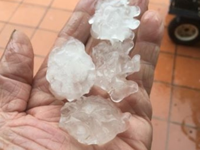
In Narre Warren, hail the “size of golf balls” damaged homes and cars in the area. Resident Terry Poulton told the Herald Sun a vehicle parked in the street was “a total write-off”.
“That’s gone,” he said.
Mildura recorded 10mm of rain in a short period and winds upwards of 90km/h. As the cold front moved east, Laverton recorded a wind gust of 98km/h and strong winds also hit Bendigo shortly after 6.30pm.
Large swathes of the state have also been hit by power outages.
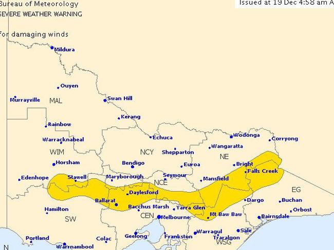
The Bureau of Meteorology earlier warned storms were possible for areas including Falls Creek, Daylesford, Ballarat and Stawell. This afternoon they added severe thunderstorms were detected near Craigieburn, Greensborough and Preston, as well as Dandenong and Glen Waverley.
Warnings are also in place for Shepparton, Seymour, Melbourne, Wodonga, Wangaratta, Traralgon and Bairnsdale.
As the storm hit on Tuesday, Melburnians took to social media to share pictures and videos.
The storm brought with it a cool change and much-needed relief after parts of the state’s north-east sweltered through temperatures over 40C.
Hot air streams over #Victoria from the north, with maximum temps above 40 in northeast. A cool change is set to move across the State today, but may bring #storms in the afternoon and evening.
— Bureau of Meteorology, Victoria (@BOM_Vic) December 18, 2017
Use BoM MetEye to track conditions: https://t.co/ea3T4FJl7d pic.twitter.com/dwXd9d8Tgh
Sky News Weather chief meteorologist Tom Saunders told news.com.au hot air had swept across Victoria creating stifling conditions.
However, he said a cool change associated with a front — which is currently moving east over South Australia — was expected to follow in the afternoon. When it hit, it brought with it a fast-moving storm.
“The front will trigger thunderstorms which could be severe across Victoria, particularly central parts of the state including Melbourne,” Mr Saunders said.
“Supercell thunderstorms, the most dangerous type of storm, are possible which can produce destructive winds, large hail and flash flooding.”
Thunderstorms likely to develop on Tuesday as a trough moves across #V during the day. Large hail, strong wind gusts and local heavy rain are all a risk. Check latest warnings at https://t.co/HLs2UYFQyQ pic.twitter.com/ZgMPV8dd9x
— Bureau of Meteorology, Victoria (@BOM_Vic) December 18, 2017
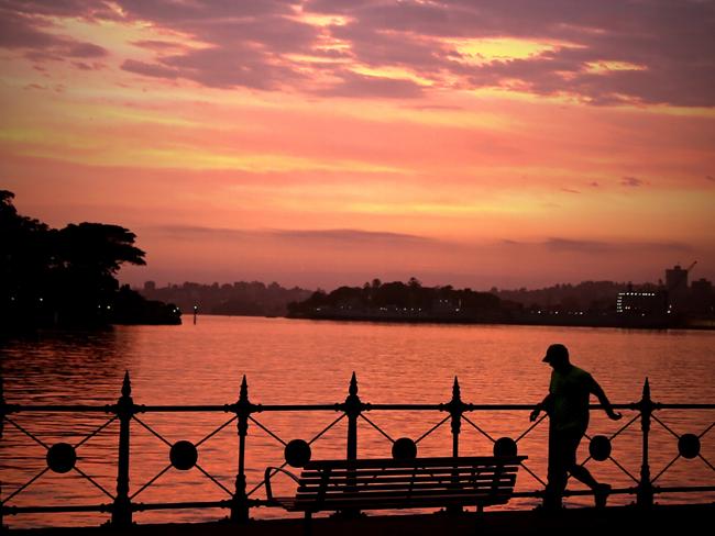
Victorians can look forward to a more mild Christmas Day after record-breaking heat spoiled barbecues in 2016.
Christmas Day will be a mostly sunny 24C, according to Bureau of Meteorology senior forecaster Stephen King, with a comfortable low of 13C on Christmas Eve.
“It will be much more comfortable this year, a better opportunity to crack open the barbecue,” he told AAP.
Christmas Day reached a sweltering 36C in Victoria in 2016, leading to fire bans in some parts of the state.
While Victorians are experiencing some relief from the heat, those living in NSW will have to wait a bit longer for a cool change.
“A very hot north to north-westerly airstream will lead to extreme heat across NSW today,” Mr Saunders said.
“This marks day seven of a heatwave for some inland parts of the state, for example Tamworth has sweltered through maximum temperatures of at least 5C above average for a week.”
Mr Saunders said the good news is the heatwave should be over by Thursday.
“The cool change will spread through western and southern NSW on Wednesday, reaching Sydney as a southerly buster on Wednesday afternoon,” Mr Saunders said.
“Sydney is forecast to hit 38C on Wednesday, the hottest day for the city in 11 months.”
Sydney is due to hit a warm 35C on Christmas Eve with a possible storm and cool change bringing the mercury down to 24C on Christmas Day.
Meanwhile in South Australia, the Bureau of Meteorology cancelled its severe thunderstorm warning after gusts of more than 90km/hr lashed parts of the state yesterday.
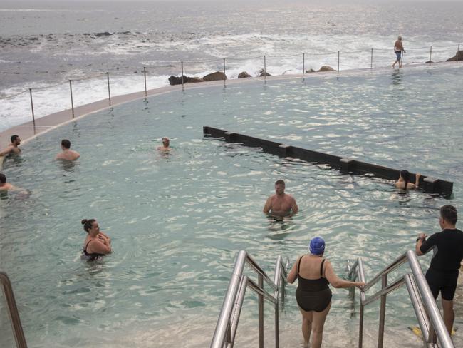
Adelaide experienced milder conditions on Tuesday and can expect 27C and sunny conditions on Christmas Day.
Brisbane was mostly warm and mostly dry and temperatures will stay in the 30s all week with a slight chance of storms on Christmas Day.
Here’s how the weather is looking for the rest of the country’s capitals this week
Tomorrow 23C with showers, Thursday 26C, Friday 28C, Saturday 29C, Christmas Eve 24C, Christmas Day 25C.
Tomorrow 33C, Thursday 32C, Friday 31C with possible light showers, Saturday 31C with possible showers, Christmas Eve 32C, Christmas Day 33C with slight chance of showers.
Tomorrow 31C and showers, Thursday 26C with showers, Friday 31C, Saturday 33C, Christmas Eve 36C, Christmas Day 25C possible showers and storms.
Tops of 33C and 34C all week with possible storms and showers every day.
Tomorrow 36C with showers and possible storms, tomorrow 25C, Thursday 25C, Friday 28C, Saturday 29C, Christmas Eve 23C and showers clearing, Christmas Day 24C and sunny.
Tomorrow 29C, Thursday 33C, Friday 31C, Saturday 30C, Christmas Eve 31, Christmas Day 34C and sunny.
Tomorrow 38C, Thursday 23C with showers, Friday 25C with early showers, Saturday 29C, Christmas Eve 34C with showers and possible storms, Christmas Day 24C and possible showers.
Tomorrow 21C with showers, Thursday 23C, Friday 25C and cloudy, Saturday 25C and showers, Christmas Eve 19C with a shower or two, Christmas Day 20C and cloudy.
— Additional reporting by AAP

Man feared dead in croc-infested waters
There’s been a major update on a man missing more than a week in crocodile-infested waters, as the region is lashed by flooding.
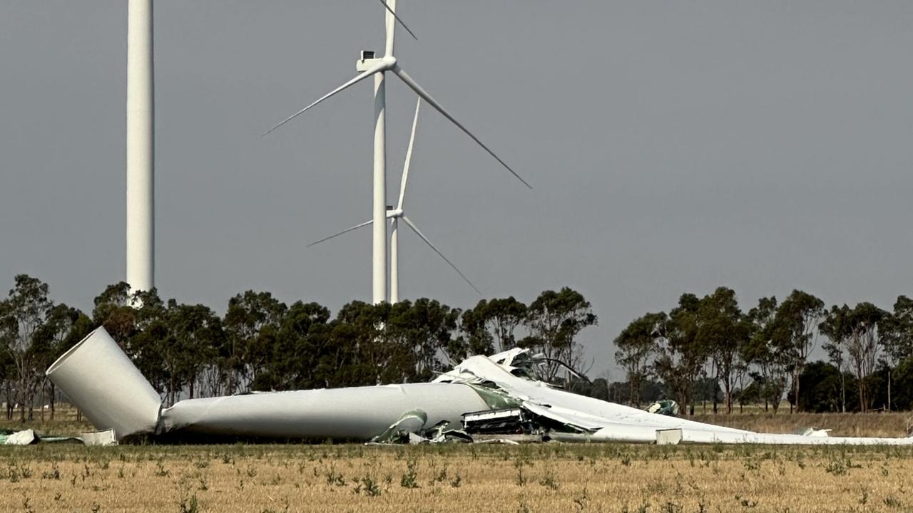
112m turbine collapses on wind farm
A 112m wind turbine has collapsed after severe thunderstorms wreaked havoc in one state, prompting this call.
Albo activates flood payments for victims
Residents in Far North Queensland rocked by surging floods will be able to access emergency disaster relief, Anthony Albanese has confirmed.