
Flood warnings Victoria: New monster deluge on the way
THE biggest September rainfall in a century has hit. Here’s the worse news: a heck of a lot more is on the way.
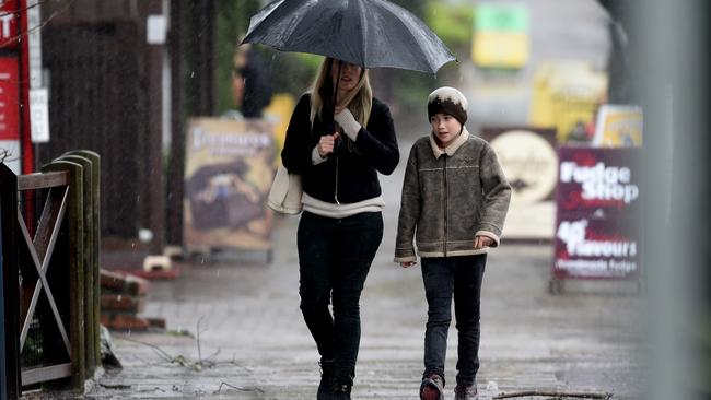
THE biggest September rainfall in a century has drowned Victoria while South Australia has copped a monster drenching as wild weather lashes Australia.
A series of cold fronts combined with warmer than average ocean conditions have produced higher than normal falls across the soaked states.
And forecasters say while the worst may be over for now, another big deluge is expected to hit southeastern Australia next week.
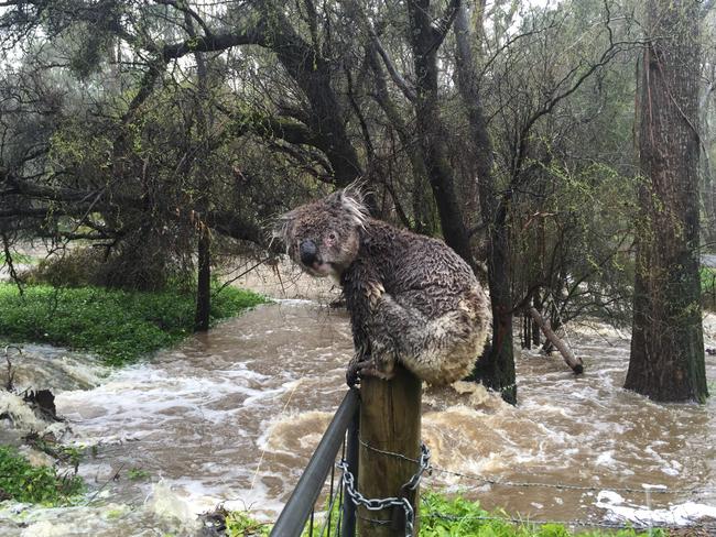
Authorities are also repeating warnings for people to take extra care after 11 flood rescues in the past two days in Victoria.
Ballarat has been hit with its heaviest rainfalls since 1921 in three just three days. The town of Beaufort also had its heaviest rainfalls in a 72-hour period since 1911, and Wedderburn its wettest three days since 1916, the Bureau of Meteorology reveals.
Weatherzone meteorologist Ben Domensino told news.com.au the rains were easing for now, but warned more was certainly on the way.
Mr Domensino said while Victoria would have a slight reprieve today and tomorrow, the state is expected to cop another drenching as two different systems move across eastern Australia.
“The current rains are tapering off as a high pressure system moving across eastern Australia produces drier conditions,” he said.
But he said the next systems were a cause for concern.
“A cold front moving across The Bight will hit western Victoria on Saturday,” he said.
While modelling predicts up to 10mm-20mm of rain, Mr Domensino said this would be enough to cause widespread flooding, with northeastern Victoria already waterlogged from its wettest winter in 20 years.
“Looking further ahead a low pressure trough will move through Queensland and NSW on Tuesday,” he said.
“This is expected to bring heavy falls to those areas as moisture from the tropics feeds that system.”
Northeast Victoria was could receive even more rain again then.
“A prediction of 20mm of rain doesn’t sound like much, but the concern is these two systems will add to the waterlogged conditions,” he said.
“While this is good news for soil moisture levels it, certainly has the potential to be dangerous in the short term due to catchments being so full.”
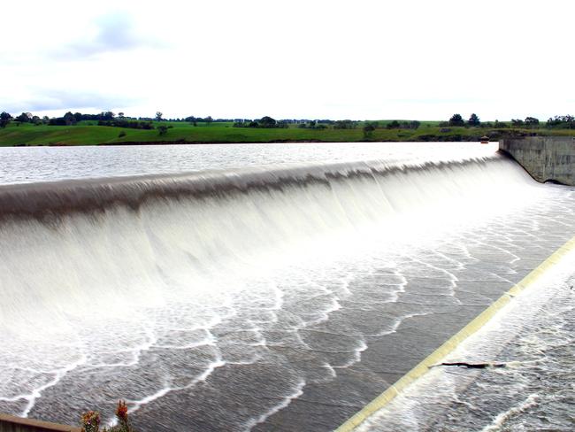
The BoM also warned a low pressure system developing across western Victoria and was likely to produce more rain across already saturated catchments.
Senior forecaster at the BoM national operations centre Dean Narramore said we could expect a series of widespread and heavy falls by mid next week.
“South Australia has had some heavy falls this week with areas such as the Mt Lofty Rangers getting as much as 100mm since 9am yesterday,” he said.
“Victoria has had between 50-88mm, but a break is ahead.”
Conditions are expected to ease today as the rain heads into Queensland before clearing across most of the country by Friday.
Rain is expected to develop across northern Queensland, the NT, South Australia and Victoria by Saturday before easing again.
But the dry break won’t last long as Mr Narramore said it was a case of weather systems “lining up one after another”.
While the wild weather produced a whole heap of wet across Victoria, it was a godsend for snow bunnies. The Victorian Alpine resort of Falls Creek was cheering thanks to a fresh dump.
Dumping #snow at #FallsCreek. The table-o-meter tells the story. Still #snowing temp -2.5°C. #HappyDays @Melbourne pic.twitter.com/JKVVkNUn9z
— Falls Creek Official (@fallsaustralia) September 14, 2016
Wild weather in spring is not unsual in spring as this video shows of a storm rolling over the canola fields in Ocean Grove.
VICTORIA
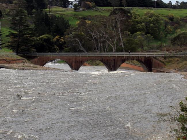
Victoria now has 12 local government areas affected by floods while more than 100 roads remain closed, the Herald Sun reported.
Warnings remain in place for the west and south coast regions, with landslides already forcing the closure of the Great Ocean Road yesterday.
Multiple Flood Watches and Warnings across most of #Victoria, major flooding in North West https://t.co/HLs2UYofag pic.twitter.com/t1FV6ZWf9F
— BOM Victoria (@BOM_Vic) September 14, 2016
Northwestern Victoria, particularly around Bendigo, Swan Hill and Horsham and Melbourne are expected to be hit with more rain in coming days.
Farmers remain on alert with fears the deluge will wipe out crops while 45 homeowners have already been evacuated in the town of Hamilton, which received more than double the average rainfall in September.
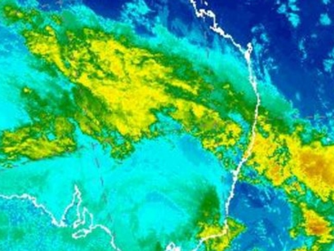
SEVERE WEATHER UPDATE: Rain & flooding in eastern Aus. Current at 11am AEST 14/9. Info: https://t.co/qm1nYhUSO4 pic.twitter.com/e25jPMun8i
— BOM Australia (@BOM_au) September 14, 2016
Crop and livestock farmer Luke Milgate, whose property is on the Loddon River, told the Herald Sun, the deluge threatened to ruin his best crop in years.
“The wheat crop looked sensational a week ago, but now at least a third of it has fallen over ... it is disheartening,” he said.
The towns of Maryborough, Clunes, Carisbrook, Castlemaine and Charlton are among the hardest hit by the recent deluge.
Victoria State Emergency Service (VICSES) is urging Victorians to remain vigilant and warned the flood message wasn’t getting through.
It comes as police hold grave concerns for a driver who remains missing after his ute was swept up in floodwaters in Wallacedale.
The man entered the waters on Wallacedale Byaduk Road yesterday afternoon, however authorities were unable to find any trace of the man, the ABC reported.
Conditions are expected to improve today but with more wet weather on the way authorities have repeated warnings for people to take extra care.
Warnings remain in place for the Loddon, Avoca, Wimmera, Glenelg, and Hopkins rivers.
VICSES chief officer operations Trevor White said it was vital that people remained vigilant especially as the grounds are already saturated from so much rain in recent weeks.
“We remind people to never drive through floodwater — it only takes about 15cm of water to lose control of your vehicle,” he said.
SOUTH AUSTRALIA
Meanwhile the worst of the weather seems to be over for flood-hit South Australia, which has been battered by heavy rain and wild weather.
Authorities are now facing a massive clean up operation while flood warnings remain in place for several areas.
Authorities remain concerned that swollen catchments will spill over with fears even the smallest amount of extra rain could be potentially devastating.
Flood warnings remain in place for a number of rivers across the southeast of the state including the North Para, Onkaparinga as well as the Angas and Bremer rivers, The Advertiser reported.
Thousands of people were affected by the wild weather yesterday while the SES continues to answer calls for help.


