
‘Extreme’ heatwave to hit Victoria, NSW and South Australia on New Year’s Eve
Soaring temperatures and dry winds are tipped to hit Australia, massively increasing the risk of bushfires and smoke haze for New Year’s Eve.


An “extreme” heatwave is slowly building over Australia’s south, bringing soaring temperatures and dry winds in the coming days.
The warm front is forecast to elevate bushfire danger in parts of the nation’s south as “severe” conditions build.
Monday and Tuesday are tipped to be the worst days for bushfires and smoke haze, just as we’re welcoming in the new year.
Sky News Meteorologist Rob Sharpe said the “extreme” heatwave is currently lingering over northwestern parts of the country, where the mercury is breaking 45C today.
“As we move through the week though, that heat is going to build through southern parts of Australia,” he said.
Severe to Extreme #heatwave conditions are set to develop over a large part of #NSW from the weekend into early next week. Plan ahead now - monitor the weather forecast: https://t.co/UdBoGyM9Kc and know how to look after yourself and others in the heat: https://t.co/oHq1GI87zW pic.twitter.com/YrRbv6m5gK
— Bureau of Meteorology, New South Wales (@BOM_NSW) December 24, 2019
“Initially, winds are not going to be that strong so we’re going to see a few regions with severe fire danger on Friday, Saturday and Sunday.
“It’s not going to be that dangerous, but it really ramps up at the end of heatwave on Monday.”
He said that, on Monday, strong winds will “suddenly” pick up and severe heat will hit Victoria, South Australia, NSW and even Tasmania.
Temperatures are set to hit the 40s on the mainland and the mid-30s in Tasmania.
Mr Sharpe said “dangerous” fire conditions are expected to peak on that day and it’s likely there will be smoke haze in Sydney on New Year’s Eve.
Two firefighters were killed and as many as 100 houses destroyed when bushfires ripped through NSW on Thursday and Saturday last week.
Firefighters have used milder conditions in recent days to strengthen containment lines.
The hot air mass over Australia has contracted to central parts but is expected affect SE states again after Christmas. Happily, the monsoon may be showing signs of life. pic.twitter.com/jrsbqRYiAI
— Andrew Miskelly (@andrewmiskelly) December 23, 2019
More than 1700 firefighters were in the field on Christmas Day, slogging away to strengthen containment lines before the dangerous weather arrives.
Fire danger ratings are very high today for the ACT, the greater Hunter, the central and southern ranges, the northern and southern slopes and northwestern NSW.
There is a high fire danger rating from the far South Coast up to Sydney, with a low-moderate danger rating in western parts of the state.
In South Australia, firefighters are working tirelessly today to control the 25,000-hectare blaze burning in Adelaide Hills before temperatures rise to about 40C on Friday.

A heatwave bringing severe to extreme conditions will start moving towards the Australian east coast today, affecting the northern parts of the state.
Adelaide will be untouched by the heatwave today with maximum temperatures forecast at 33C.
Conditions will then be very hot on Friday, with the mercury hitting 39C. The fires have destroyed 84 homes and hundreds of other buildings as well as claiming one life.
A watch and act alert remained on Wednesday evening for the Hollands Creek road and Cudlee Creek area.
— with AAP
Wild weather leaves passengers stranded
Passengers hoping to get a flight out of a popular holiday spot have been turned away after a regional airport closed its doors amid wild weather.

Man feared dead in croc-infested waters
There’s been a major update on a man missing more than a week in crocodile-infested waters, as the region is lashed by flooding.
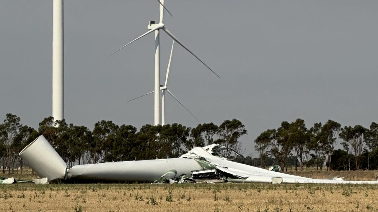
112m turbine collapses on wind farm
A 112m wind turbine has collapsed after severe thunderstorms wreaked havoc in one state, prompting this call.