
Expect a drenching this week as multiple troughs plough across country
WANT to know when the rain will end? Well, forecasters have promised a “massive week of weather” across the country.

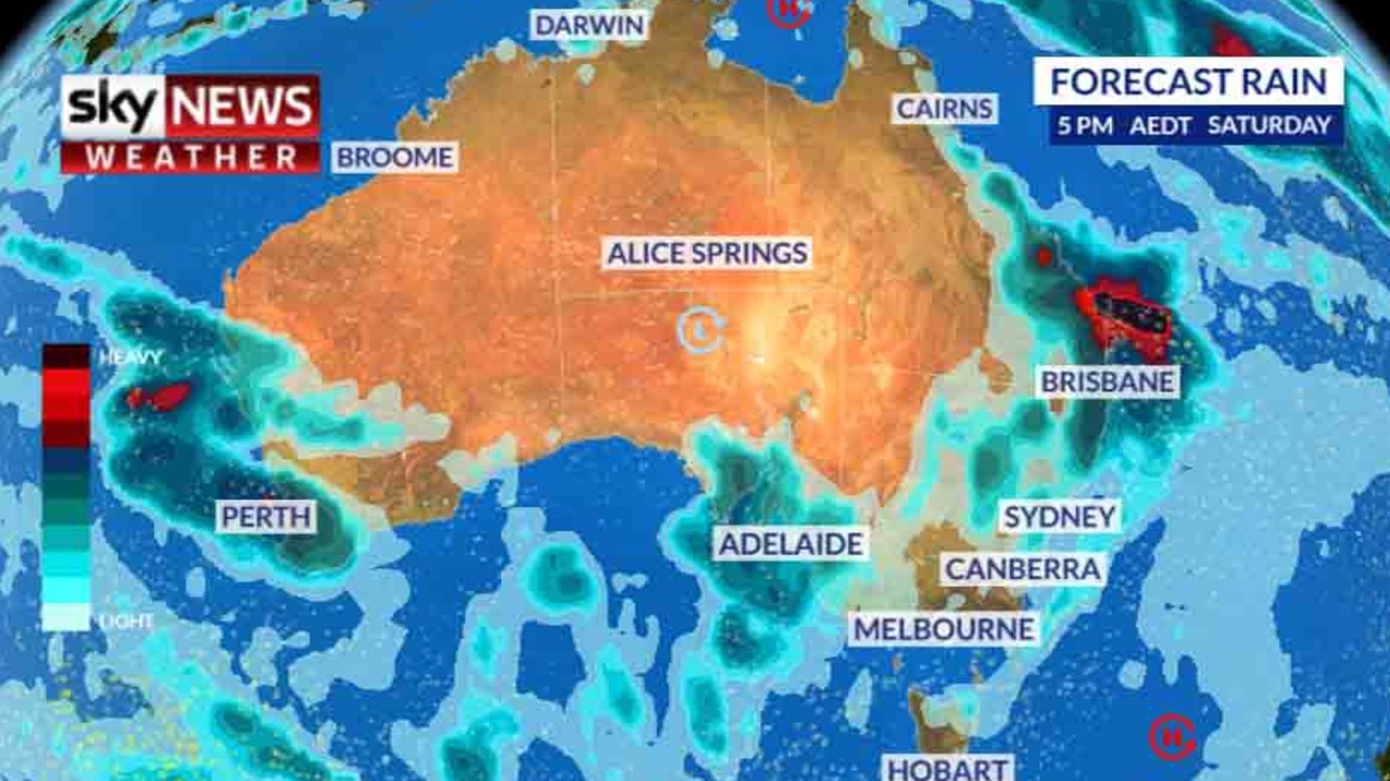
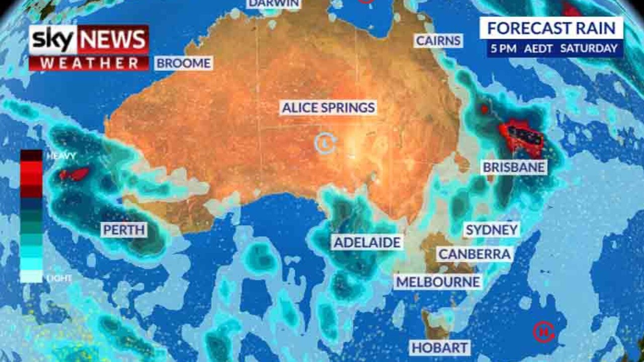
IF YOU’RE hoping for some respite from the rain, we have bad news. Not only are the soggy conditions here to stay, particularly on the east coast, forecasters have said up to half the country could see not only rain this week but storms as well.
“It’s going to be a massive week of weather — a lot of rain and thunderstorms,” Sky News Weather channel meteorologist Rob Sharpe said on Monday.
He warned of a “severe storm outbreak” with hail in places. And, right on cue, severe storm warnings were issued on Monday for damaging winds, hail and rain all the way from the Sunshine Coast to Coffs Coast, taking in Brisbane’s western suburbs and Byron Bay.
But despite the drizzle and the chilly temperatures, experts say it’s just a temporary blip and summer will be hotter and drier than average. We could enter “uncharted territory” nationwide with an extension of the extreme drought and a higher likelihood of severe thunderstorms.
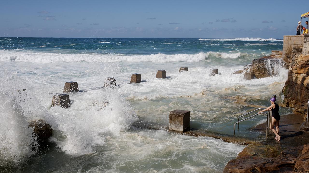
It didn’t look like that this weekend, however. Sydney’s CBD has now recorded 92mm of rain this month, its wettest October in nine years. Dubbo’s 63mm was its heaviest rain in 19 months.
And it’s sticking around. Rain is possible at some point just about every day across the east coast including Sydney, Brisbane and the Gold Coast.
“More than half the country is going to see some rain this week. In terms of thunderstorms, some will be severe today in northern NSW and Queensland but that will be just a drop in the ocean compared to the number of thunderstorms later this week,” Mr Sharpe said.
WHY THE CHANGE FROM SUN TO RAIN?
The storms as well as heavy rain and damaging hail were all a threat due to an upper level trough moving through and enhancing the uplift in thunderstorms.
But the underlying cause for all this moisture is because high pressure systems, which have lingered over central parts of Australia most of winter, have shifted south towards Tasmania. These had been blocking the rain bands but now the high pressure has gone for a holiday, the rain has had a chance to make a reappearance, especially in NSW and southern Queensland. This is a fairly typical occurrence in spring but the strength of it this year has been surprising.
From sunset to sunrise, this dry, mild weather is no surprise. Showers which on the morrow come, will be a source of joy for some. Settled Spring weather in #Melbourne today - tomorrow: Not so much. Details: https://t.co/3BfKHLIQCd pic.twitter.com/h0QXOlcuBr
— Bureau of Meteorology, Victoria (@BOM_Vic) October 7, 2018
Severe thunderstorm warning issued for a storm near #Esk. For latest warnings go to https://t.co/YKZOMipt9z pic.twitter.com/JaJakg7mlI
— Bureau of Meteorology, Queensland (@BOM_Qld) October 8, 2018
AROUND THE CAPITALS
After a few showers today, tomorrow may see some relief on the east coast but then it’s back to the rain.
“Friday is when the system really ramps up. We’re going to see areas of rain in central and southern Queensland and spreading down into NSW and Victoria,” Mr Sharpe said.
In Brisbane, there are warnings of storms on Monday and up to 20mm of rain could fall on Wednesday with the chance of showers on most other days. Up to 50mm could fall in some inland areas of the state’s south east.
Temperatures could peak at 31C on Wednesday but will then drop back to the low-20s.
Expect rain just about every day this week in Sydney as a series of troughs rolls through NSW. It shouldn’t be as heavy as on Friday, when 44mm fell, but it’s still worth packing an umbrella with up to 25mm in the gauge by the end of the week.
Melbourne managed to escape the rain last week but about 8mm could fall on Tuesday. Savour the high of 26C on Monday as it will only reach 16C on Wednesday before climbing into the 20s later in the week.
Adelaide could see showers earlier in the week and on the weekend with temperatures rising to 26-27C on Monday and also between and Friday and Sunday.
Rain in Hobart will be concentrated at the beginning of the week with temperatures in the mid to high teens.
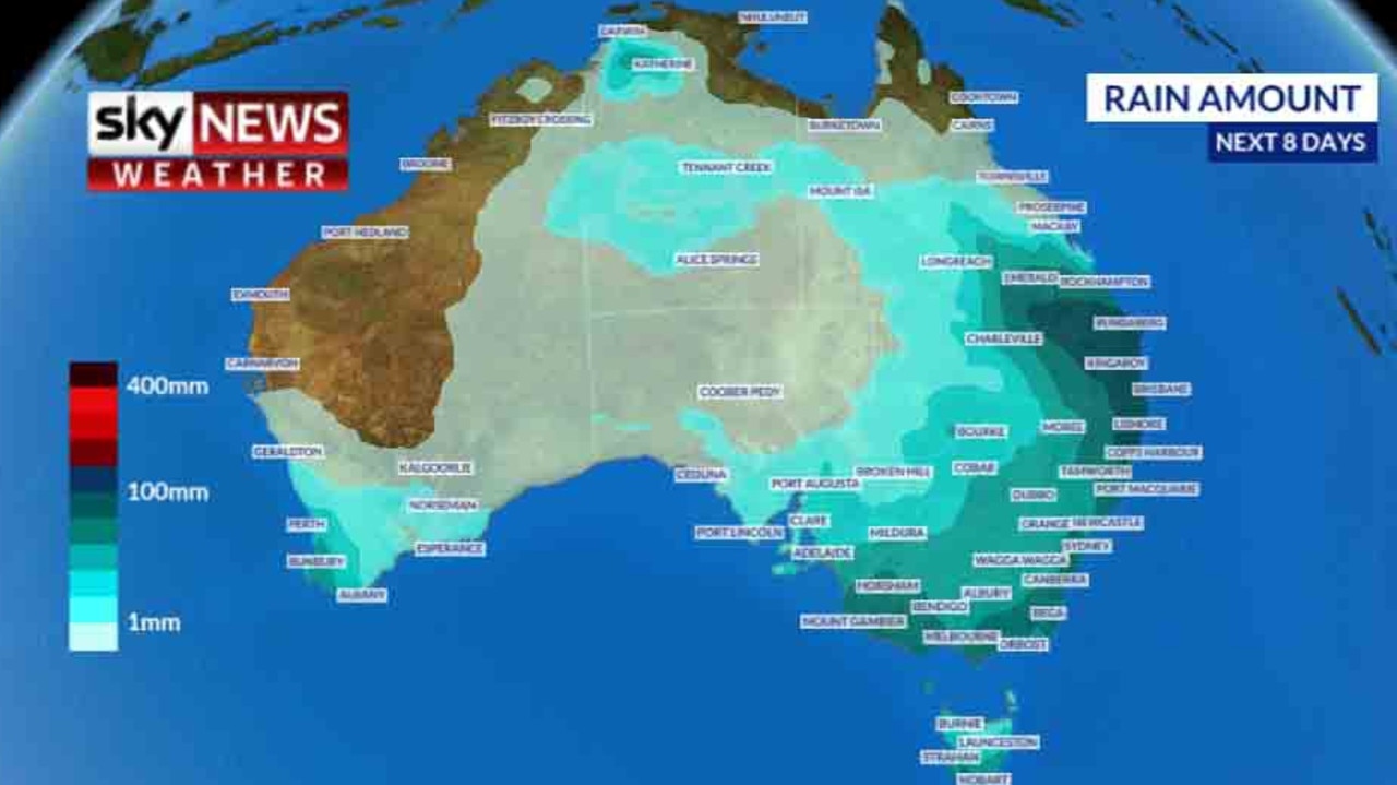
In Western Australia, 25mm of rain for the week is on the cards. A storm could pass through Perth on Tuesday while Saturday could be a washout with 15mm falling. Highs of about 27C earlier in the week will give way to 21C on the weekend. Head towards the southwest and the chance of wet weather only increases. Darwin will be 33C and sunny.
Mr Sharpe had a note of caution, however.
“Multiple weather systems are moving through but there is still a bit of uncertainty where exactly the storms will be, but there will be a fair bit of it,” he said.

SUMMER CLIMATE OUTLOOK
Wet it may be right now, but dry is the forecast looking forward towards the coming months.
Sky News Weather has released its climate outlook for the rest of 2018 and early 2019 with hotter and drier conditions expected.
“Australia enters the severe weather season in uncharted territory as an unprecedented drought cripples central and eastern parts of the country,” fellow Sky News Weather channel meteorologist Tom Saunders said.
Indications are there will be a continuation of hot and dry weather into early 2019.
“El Nino is slowly emerging and combined with a dry signal from the Indian Ocean and global warming, reduced rainfall and positive heat anomalies will almost certainly continue through at least the first half of our severe weather season,” he said.
“The ongoing hot, dry trend should worsen the already record drought and increase the risk of bushfires and heatwaves in some parts of Australia.”
There is a decreased risk of tropical cyclones and rain but thunderstorm activity is likely to be above average over parts of Queensland and northern NSW.
Drought relief is more likely towards the end of summer as the monsoon becomes the dominant driver of the nation’s weather.
An analysis of every capital city has suggested that overall they will be hotter than average this summer.
The long term daily average temperature in Sydney is 24.2C but in 2017-18 the average has been 26.2C. In Melbourne, average temperatures are 1.5C above long term levels.

Millions facing long weekend washout
Long weekend plans could be under threat across swathes of the country as millions brace for heavy rain and thunderstorms.
Major city rocked by earthquake
People have rushed onto the streets after the city was hit by a 6.2 magnitude earthquake on Wednesday.
Easter weekend drownings deadliest ever
A fateful combination of weather conditions has created the deadliest Easter long weekend in Australia’s recorded history.