Evacuation warnings for residents in NSW as flood waters rise
Thousands of residents across NSW are being forced to leave their homes as an area in one part of the state is about to hit a scary new record.
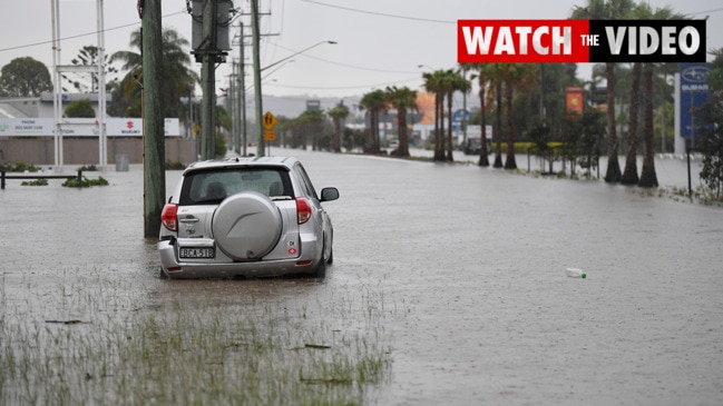
Flood levels in parts of Sydney are expected to reach new highs not seen since March 1978.
Thousands of residents across NSW were forced to leave their homes overnight and thousands more are preparing for the worst as dangerous flooding impacts a large area of the state.
More heavy rain has fallen across the Hunter, Central Coast, Sydney, Illawarra and South Coast in mere hours. Authorities say homes, businesses and roads have been flooded while some rivers are still rising. More than 60 evacuation areas were in place overnight.
NSW Premier Dominic Perrottet urged residents: “Please don’t drive through floodwaters, we cannot say that more than enough”.
Circulation forming off the coast continues to bring rain and thunderstorms to #Sydney and the east coast. Strong and gusty winds also along the coast, damaging at times with 95km/hr recorded at #Kiama. This will move south tonight. Monitor warnings: https://t.co/HPKvzoKfSGpic.twitter.com/2R1rbKtZtS
— Bureau of Meteorology, New South Wales (@BOM_NSW) March 8, 2022
An east coast low continued to deepen off the Hunter Coast and tracked to the south-southeast overnight, expected to continue into Wednesday.
Strong, gusty southerly winds of up to 90km/hr developed with a severe weather warning for damaging winds in place for people in Illawarra and parts of Hunter, Metropolitan, South Coast, Southern Tablelands and Snowy Mountains Forecast Districts. Residents have been urged not to travel.
Large and powerful seas are also expected until Thursday with “very heavy surf” causing “likely” coastal erosion for southerly facing beaches within the South Coast, Illawarra and Sydney Metropolitan districts.

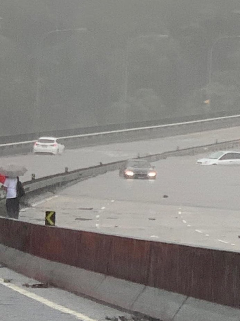
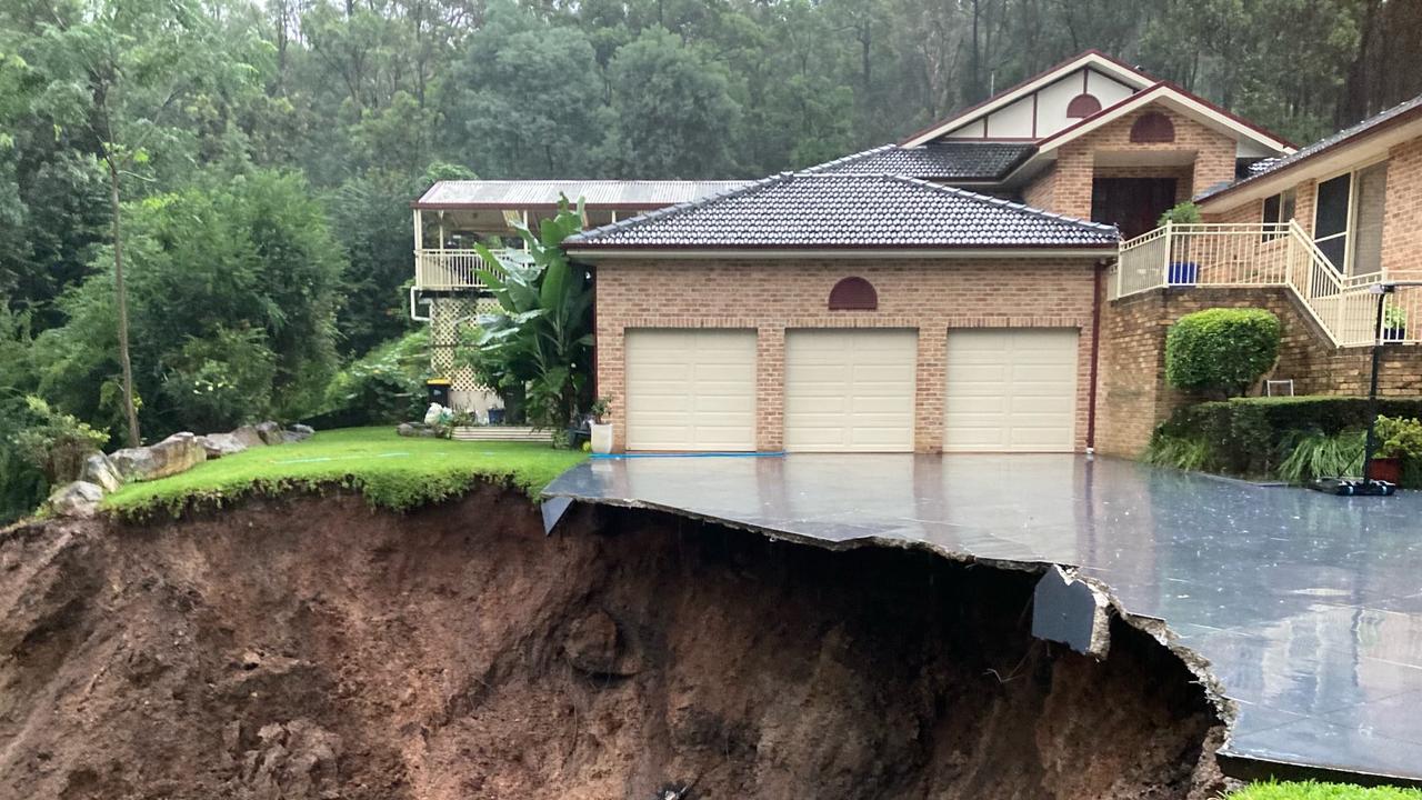
Rapid rises have been observed at Windsor where the river level has exceeded the March 2021 event and is likely to reach 14.30 metres around midday Wednesday, which is just below the March 1978 event (14.46 metres).
Major flooding above the March 2021 event is occurring along the along the Hawkesbury River at North Richmond, Windsor, Sackville, Lower Portland and Wisemans Ferry.
Forecast rainfall for Wednesday morning may cause further rises in the Hawkesbury Nepean Valley.
The Bureau of Meteorology (BOM) listed the warning for the Hawkesbury Nepean Valley and Colo Riverat Menangle, Camden, Wallacia, Penrith, North Richmond, Windsor, Sackville, Lower Portland, Wisemans Ferry and Putty Road as “top priority”.
Major flooding above the March 2021 event is already occurring along the Upper Nepean River at Menangle and along the Hawkesbury River at Lower Portland and Wisemans Ferry.
Heavy rainfall last week had already caused major flooding in the Hawkesbury Nepean Valley.
“Further heavy rainfall over the weekend and into Tuesday has caused renewed river level rises and higher flooding along the Nepean, Hawkesbury and Colo Rivers,” the BOM said.
âš ï¸ #Flood Warning issued for #HawkesburyNepeanValley. Major flooding possible at #Windsor on Wednesday just below March 1978 flood event. See https://t.co/AdztI2rqg1 for details and updates; follow advice from @NSWSES. #NSWFloodspic.twitter.com/fuMAiTg9p3
— Bureau of Meteorology, New South Wales (@BOM_NSW) March 8, 2022
Meanwhile the Hunter River and Wollombi Brook at Wollombi, Bulga, Singleton, Maitland and Raymond Terrace face major flooding with some areas already seeing flooding levels worse than last year.
Residents in Singleton are bracing for major flooding in those areas on Wednesday.
Manly Dam has reached Amber Alert and has commenced “overtopping”. Intense localised rainfall is occurring in the area.
âš ï¸Minor to Major #Flood Warning issued for #Hunter River and #Wollombi Brook at #Wollombi, #Bulga, #Singleton, #Maitland and #RaymondTerrace. See https://t.co/AdztI2rqg1 for details and updates; follow advice from @NSWSES#NSWFloodspic.twitter.com/E0hBRTxmDm
— Bureau of Meteorology, New South Wales (@BOM_NSW) March 8, 2022
Close to 100,000 claims have been made in South-East Queensland and New South Wales floods since the flood crisis, the Insurance Council of Australia said.
The claims are estimated to total $1.45bn and are expected to rise.
Sixty-nine per cent of claims are from Queensland and 31 per cent are from New South Wales.
Across both states, 80 per cent of claims are for domestic property, 17 per cent of claims are for motor vehicle, with the remainder commercial property claims.
#Insurers have received 96,844 #claims related to the #SEQ & #NSW’s #floods, a 12% increase on yesterday’s figs. 69% of these claims are from #Qld, with 31% from NSW. Based on previous #flood events the estimated current cost of #claims is now $1.45bn. https://t.co/33MysUKAUKpic.twitter.com/XGjm2cJ7Jw
— Insurance Council of Australia (@ICAUS) March 8, 2022
Evacuation alerts
In the latest evacuation order, resident in parts of the the Upper Hunter Valley are to evacuate by 10pm.
NSW SES is directing people along the Hunter River within Glenridding and Dunolly, Whittingham and Scotts Flat,McGraths Hill and Combo to evacuate the high danger area.
The areas affected are:
Low lying areas of Glenridding and Dunolly include the following streets;
- South of Victoria Street
- Army camp Road to the rail line
- West to Putty Road
- Including Hueston lane
The SES has warned residents and businesses within McGraths Hill and Mulgrave in Sydney’s north west to evacuate the following area by 8.30pm:
– All properties east of Windsor Road from South Creek to Brennan Dam Road, north of Killarney Chain of Ponds, west of McKenzies Creek.
– Includes the whole of McGraths Hill suburb. Includes the whole of Mulgrave suburb.
The SES has warned residents that once floodwater reaches 13.5 metres at Windsor, they risk being “trapped without power, water and other essential services and it may be too dangerous to rescue you”.
Earlier evacuation alerts
Low lying properties in Kempsey CBD have been told to evacuate now.
NSW SES is directing people within Kempsey CBD, Eden Street and areas east of the railway line north up to Frederickton to evacuate the high danger area.
NSW SES is directing people within low lying properties on the Lower Macleay to evacuate now.
These areas include:
- South West Rocks Road
- Smithtown Road
- Plummer’s Lane
- South West Rocks
- Crescent Head
- Hat Head
Residents and businesses within Narrabeen at Narrabeen Lagoon who were told to evacuate the following area by 7.00pm can now return with caution.
– The affected area is all properties surrounding Narrabeen Lagoon: from Wakehurst Parkway, Narrabeen bordered by The Esplanade, west of Pittwater Road from Goodwin Street to Albert Street then along Lagoon Street to Octavia Street, properties west of Lisle St, including low-lying properties of Emerald St and Malcom St, Walsh Street west of Pittwater Rd towards Warriewood Rd along Macpherson St down Garden St to Pittwater Rd including low-lying properties of Nareen Pde, Gondola Rd, Rickard Rd, Windsor Pde and Bristol Lane.
NSW SES is directing residents and businesses within parts of Camden to evacuate by 12.30pm. These areas include:
- Exeter Street west of John Street
- Milford Road Camden West
Prepare to evacuate
NSW SES is directing residents and businesses within low lying parts down stream of Manly Dam to prepare to evacuate.
These include parts of Manly Vale and North Manly downstream of Manly Dam along Manly Creek, Brookvale Creek and Burnt Bridge Creek. Area bounded by Allambie Road, Pittwater Road, Balgowlah Street, Burnt Bridge Deviation and King Street.
For the latest flooding alerts and updates, visit the NSW SES website.


