
East coast Aussies warned to rug up as a cold front sets in
Freezing temperatures, chilly winds, thunderstorms and heavy snowfall are forecast to hit Australia’s east coast this week.

Aussies are being warned to prepare for a fierce cold front this week, as freezing temperatures, rainfall, storms and snow settle in across the country.
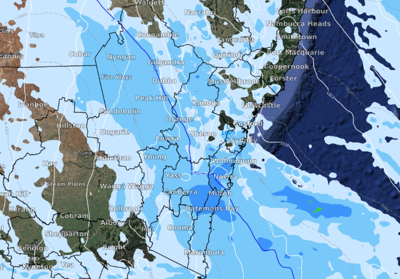
South Australia, Victoria and Tasmania will be the first hit by plunging temperatures on Monday, before the gloomy trend moves up into central and eastern NSW on Tuesday.
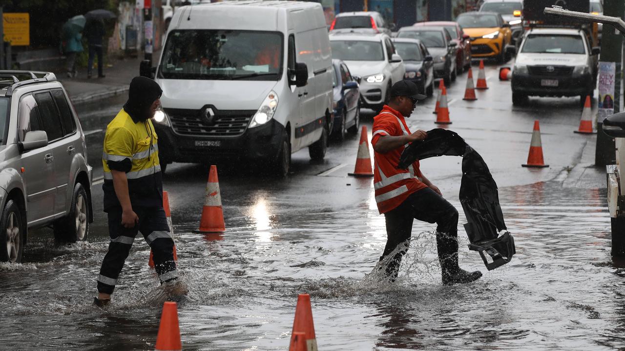
Subzero temperatures are being forecast in some parts of the country, with showers and even thunderstorms expected in NSW.
The freezing temperatures will be matched with chilly winds, making conditions seem up to 4C cooler.

For those hitting the Snowy Mountains this week, the Bureau of Meteorology is predicting a very high chance of snow across the area and into the Southern Tablelands on Tuesday morning.
Snow will also fall over the Central Tablelands and the Northern Tablelands overnight on Tuesday.
“This may produce a delightful snowy landscape for some, but also pose some risk on the roads,” Weatherzone meteorologist James Rout said.
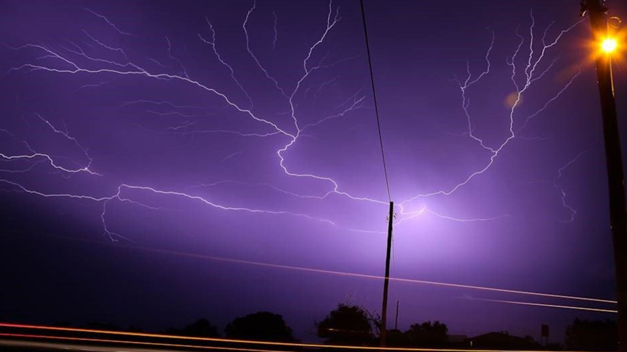
Flashes of lightning, rumbles of thunder and potentially damaging wind gusts will sweep across Greater Sydney, the Hunter and further north around the ranges on Tuesday afternoon.
The Hunter will also face heavy showers as a low-pressure system develops off the east coast, which is set to smash the Illawarra on Tuesday.
Temperatures will remain chilly across the lower half of the country throughout the week, with Sydneysiders facing a minimum of 7C and a maximum of 20C this week.
Jumper weather will also remain in Melbourne, with a minimum of 5C and a maximum of 15C throughout the week.
The Bureau of Meteorology issued a new severe weather warning for Victoria on Monday morning.
Damaging winds are expected to hit parts of Gippsland, while a gale warning has been sounded in Port Phillip in Melbourne.
People hitting the slopes in Mount Hotham felt temperatures drop to -3.9C, while those at Falls Creek shivered through -3.3C overnight on Sunday.
Latrobe Valley recorded a low of -0.1C and Sale 1.6C.
Adelaide temperatures will be slightly warmer, sitting between 7C and 16C, while Canberra will be the coldest city, with temperatures dropping to -4C.
Queenslanders are in for a mostly sunny work week, with rain sweeping through Brisbane over the weekend.
Wednesday will be the city’s coldest day with a minimum of 9C, while Tuesday will be the warmest with a top of 25C.
Perth will enjoy sunny and cloudy conditions all week, with a maximum of 22C forecast for the region.
People up in Darwin will also be loaded with plenty of sunshine throughout the week, with temperatures rising to 35C.
The wet weather comes as forecasters warn of another La Nina this summer, with above average rainfall to batter many parts of the country.
The Bureau of Meteorology (BOM) increased the La Nina outlook from “watch” to “alert” last Tuesday, meaning wet conditions are likely to stretch into the summer months.
“La Niña refers to changes in sea surface temperatures in the tropical Pacific Ocean, with waters in the eastern Pacific being cooler than normal, and waters in the western tropical Pacific being warmer than normal,” the bureau said.
“With wet soils, high rivers and full dams, and the outlook for above average rainfall, elevated flood risk remains for eastern Australia.”
Five day forecast across Australia
Sydney:
Monday: Max 23C (mostly sunny)
Tuesday: Min 12C, Max 20C (rain)
Wednesday: Min 7C, Max 18C (mostly sunny)
Thursday: Min 7C, Max 19C (late shower)
Friday: Min 9C, Max 18C (showers)
Melbourne:
Monday: Max 16C (rain/strong winds)
Tuesday: Min 5C, Max 12C (showers easing)
Wednesday: Min 7C, Max 13C (late showers)
Thursday: Min 9C, Max 15C (showers easing)
Friday: Min 8C, Max 15C (partly cloudy)
Perth:
Monday: Max 17C (mostly sunny)
Tuesday: Min 6C, Max 18C (mostly sunny)
Wednesday: Min 8C, Max 20C (partly cloudy)
Thursday: Min 10C, Max 22C (partly cloudy)
Friday: Min 8C, Max 22C (sunny)
Brisbane:
Monday: Max 21C (partly cloudy)
Tuesday: Min 12C, Max 25C (late shower or two)
Wednesday: Min 9C, Max 21C (sunny)
Thursday: Min 8C, Max 22C (sunny)
Friday: Min 10C, Max 21C (mostly sunny)
Adelaide:
Monday: Max 15C (rain developing)
Tuesday: Min 7C, Max 14C (shower or two)
Wednesday: Min 9C, Max 15C (showers increasing)
Thursday: Min 9C, Max 16C (showers)
Friday: Min 8C, Max 16C (cloudy)
Canberra:
Monday: Max 15C (shower or two)
Tuesday: Min 3C, Max 11C (showers)
Wednesday: Min -4C, Max 13C (morning frost)
Thursday: Min -1C, Max 15C (morning frost)
Friday: Min 1C, Max 16C (partly cloudy)
Hobart:
Monday: Max 13C (showers easing)
Tuesday: Min 3C, Max 11C (possible morning shower)
Wednesday: Min 5C, Max 14C (possible shower)
Thursday: Min 7C, Max 15C (cloudy)
Friday: Min 5C, Max 15C (partly cloudy)
Darwin:
Monday: Max 33C (sunny)
Tuesday: Min 19C, Max 35C (sunny)
Wednesday: Min 20, Max 33C (sunny)
Thursday: Min 19C, Max 33C (sunny)
Friday: Min 19, Max 33C (sunny)

‘Doomsday glacier’ could swallow cities
The collapse of this one glacier could raise sea levels enough to swallow cities all over the world.

Brutal winter blast sparks warnings
A savage winter blast is sweeping across the country, bringing gale-force winds, icy temperatures and widespread weather alerts.

States told to brace for weekend cold front
Windy weather has finally subsided across Australia’s southern regions, but a cold front is bearing down on these states for the weekend.