Dust storms, rains lash southern states as cyclone hits the north
Severe thunderstorms have lashed New South Wales, with warnings of flash flooding, while drivers needed rescuing from flood waters in Victoria.
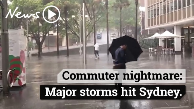
Severe thunderstorms have lashed the eastern half of New South Wales, bringing torrential rain, damaging winds and causing power outages.
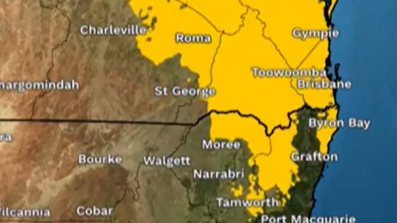
The destructive weather system made its way southeast across Sydney, as the Bureau of Meteorology warned of “giant hail” and ferocious winds for much of the state west of the Great Dividing Range.
There were warnings of flash flooding, with 41mm of rain falling in the 30min to 8.05pm at Auburn and 37mm at Guildford during the same period.
Thunderstorms hit the city about 8.15pm and tracked towards Fairfield, Horsley Park and Liverpool, then Badgerys Creek, Leppington and Minto. Wind gusts topped 105km/h.
Our poor local Chinese restaurant Narellan Court copped a hammering from the storm. Can't be good for business 😔... #blackout #sydneyweather #sydneystorm pic.twitter.com/3M3i3y7QqQ
— Peter Elder (@pelder90) December 13, 2018
If you’re waiting to takeoff from #Sydney airport it’s 6 aircraft deep on the main runway. Or if your that poor flight from Darwin, you’re probably on your eighth orbit in the holding pattern. #sydneystorm #rain #weather #avgeek #sydneyapproach pic.twitter.com/iwklsH46Xd
— itstagle (@ChrisTagle) December 13, 2018
Loco weather in Sydney. Within few minutes the streets of Marrickville became a river #SydneyStorm pic.twitter.com/33oOTqWRUo
— Digital Media Educator (@DigMedEd) December 13, 2018
The destructive system formed as warm humid air fed into a trough that lies about the western plains, combined with an upper low pressure system entering the far southwest.
There were reports of train delays across Sydney because of the severe weather conditions.
Parramatta Road at Homebush and the Princes Highway at Blakehurst have been impacted by flooding.
Thousands of homes are out of power as crews work to restore services across the state.
A severe thunderstorm warning is also in place for several parts of Queensland as Tropical Cyclone Owen starts tracking east towards the state.
@chrishemsworth When other Australians pretend to be Thor.#SydneyStorm #FAIL #Thor pic.twitter.com/XWPo5BZQLQ
— Mathew Gordon (@huckgee43) December 13, 2018
Just saw some poor Deliveroo rider attempting to ride down my street in this shitshow of a storm. Don’t be assholes people - don’t order food in this weather. It’s cruel. #MakeSomeToast and let’s keep those riders safe #SydneyStorm
— yellow bird (@zzippidydoodaa) December 13, 2018
Forgot to shut the kitchen window... I guess I always wanted an indoor water feature 🤔 #sydneystorm
— Jai (@jaiangeloni) December 13, 2018
INCOMING! ⛈ #SydneyStorm @GoProANZ pic.twitter.com/vbpXrRwwZ1
— Tj 📷👨ðŸ½â€ðŸ’» (@Tj__Edwards) December 13, 2018
A very large storm rolled in over Sydney tonight bringing torrential rain & enough lightning to make me run for cover! 🙀⚡ï¸â˜”ï¸#ilovesydney #seeaustralia #sydneyweather #sydneystorm pic.twitter.com/JdUtSo87sy
— Ruth Collins (@DrRLC) December 13, 2018
There’s a wild storm rolling into #Sydney right now. #SydneyStorm pic.twitter.com/3Uu2LBA8Hf
— Taraustralis (@Taraustralis) December 13, 2018
#sydneystorm what colour do I call this? pic.twitter.com/4LB6esbL4H
— misa Sim (@misasim83) December 13, 2018
âš ï¸Initial Minor #Flood Warning issued for #Tumut, Areas along the Tumut River may experience minor flooding around 06:00 am Friday. See https://t.co/yeard6YOw6 for details and updates; follow advice from @NSWSES. #NSWFloods pic.twitter.com/mvmfhH2PDn
— Bureau of Meteorology, New South Wales (@BOM_NSW) December 13, 2018
One of the current loops of the #NSW storms from #Sydney radar. Because of how far the system stretches active #storms appears on many of the #NSW radars. For those who want to have a look the link is: https://t.co/joGHpQeD2Z pic.twitter.com/OTcEV0jluf
— Bureau of Meteorology, New South Wales (@BOM_NSW) December 13, 2018
Further west, dust storms have engulfed whole towns.
Cuttabri wine shanty about to be swallowed by a dust storm just now. Amazing display of natural power. https://t.co/PHecTTZl1k @ABCRural @BOM_NSW @CanonAustralia @dwinningWSJ @bencubby @Joe_Hildebrand #weather @NatGeo @ausgeo @natgeoau @outsidemagazine @chrishemsworth #Australia pic.twitter.com/SoZPRpAeGv
— Josh Smith (@joshuajsmith) 13 December 2018
Two bushwalkers who have spent the past five nights in the Morton National Park near Nowra will be stuck another night because of the bad weather.
Police said it was believed a 59-year-old man and 60-year-old woman went bushwalking in the Ettrema Gorge west of Nowra on Saturday.
The man was expected to return home to Canberra by Tuesday but did not return and about 1.30pm on Wednesday police were notified.
A search was launched and shortly before 2pm today the walkers made contact with searchers by mobile phone.
Their location has been confirmed but because of the weather and an estimated two-hour walk into the gorge, a decision was made to suspend the retrieval operation until first light today.
Searchers confirmed the walkers were uninjured and have shelter.
A decision will be made this morning whether they will be walked out or flown.
AUTHORITIES SLAM ‘DUMB, FOOLISH’ MOTORISTS
Frustrated emergency workers slammed “dumb” choices by motorists after hundreds of cars became stranded and scores of rescues had to take place when drivers drove into flood waters.
There has been record-breaking levels of rain and flash flooding in parts of Victoria with authorities warning “it’s not over yet”.
Seventeen people have had to be rescued from the roofs of their cars. One hundred people travelling in 50 cars are stranded close to the M31 Hume Freeway at Wangaratta while the State Emergency Service has received 400 calls for help.
Police pleaded with people not to drive across flooded roads.
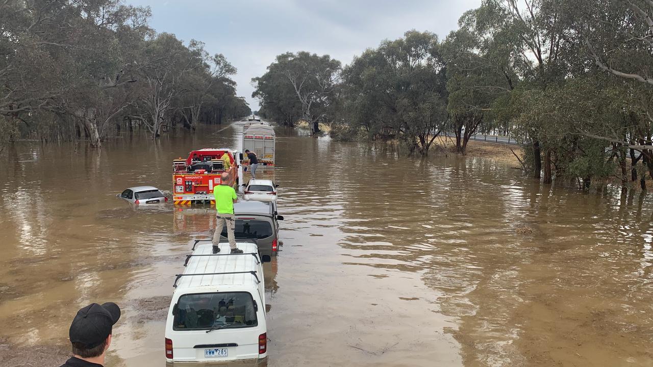
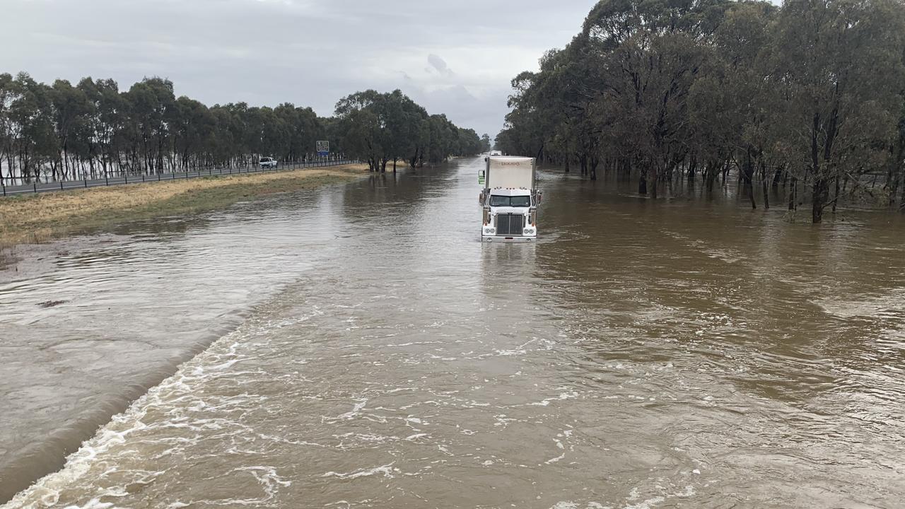
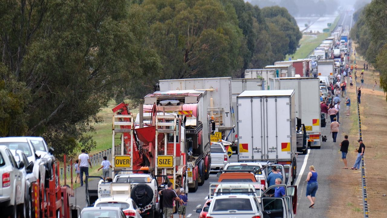
Northeast Victoria has copped the biggest beating from the rain with 160mm falling at Everton, close to Wangaratta. That’s more than three months’ rain in a single day.
There’s been persistent rain in Melbourne too, with over 30mm falling since early this morning.
The SES opened relief centres in Wangaratta, Chiltern and Wodonga to help these impacted by the flooding.
Police said “hundreds of thousands of dollars” have now had to be spent rescuing stranded motorists.
“There’s a certain degree of frustration, where people, after many, many warnings continue to make poor, foolish decisions to drive into flood waters,” said emergency management commissioner Andrews Crisp.
“They’re putting themselves at risk, they’re tying up emergency services unnecessarily. It’s just a dumb thing to do.”
The SES has received 400 calls for assistance and has dealt with 300 of them.
“But 100 of those still remain, in various parts of the state, particularly in the areas of Beechworth and Wangaratta, where we’ve seen the most calls for assistance today, as a result of the extreme rainfall,” Mr Crisp added.
He said the worst of the rainfall was probably over for residents of Melbourne, but not elsewhere.
“There will still be showers and some rainfall activity in metropolitan Melbourne over the next few hours. But in the northeast of the state, it’s certainly not over yet.”
VicSES volunteers have responded to more than 20 requests for assistance requiring rescue from flood water, including a number of vehicles impacted by flood water on the Hume Highway. Flash flooding can occur quickly - never walk, ride or drive through floodwater. #vicstorms pic.twitter.com/kMQAhmiwtt
— VICSES News (@vicsesnews) December 13, 2018
TROPICAL CYCLONE OWEN
Destructive “zombie cyclone” Owen is bearing down on the north of Australia with coastal residents being told to brace for the worst if the system reaches category four today.
The “very destructive and severe” cyclone, now up to category three, continues to increase in strength as it heads back towards Queensland promising to deliver a deluge in its wake.
Owen has been meandering in the Gulf of Carpentaria, between Port Roper and Port McArthur with sustained winds near the centre of 140 kilometres per hour and wind gusts to 195km/h.
It was upgraded to a category three storm yesterday afternoon and the BOM said it may reach Category 4 intensity early today.
“The system remains a category 3 system and is likely to continue to develop further over the next 12 to 24 hours as it moves east over open waters,” stated the weather service.
“A coastal crossing along the southeast Gulf of Carpentaria coast between Gilbert River Mouth to Pormpuraaw later Friday or early Saturday is likely, and there is a chance it crosses the coast as a category 4 system.”
The BOM said flash flooding was likely to develop around islands and coastal areas near the NT’s Gulf of Carpentaria, with a storm tide, damaging waves and flooding possible in the region.

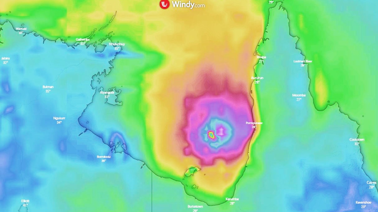
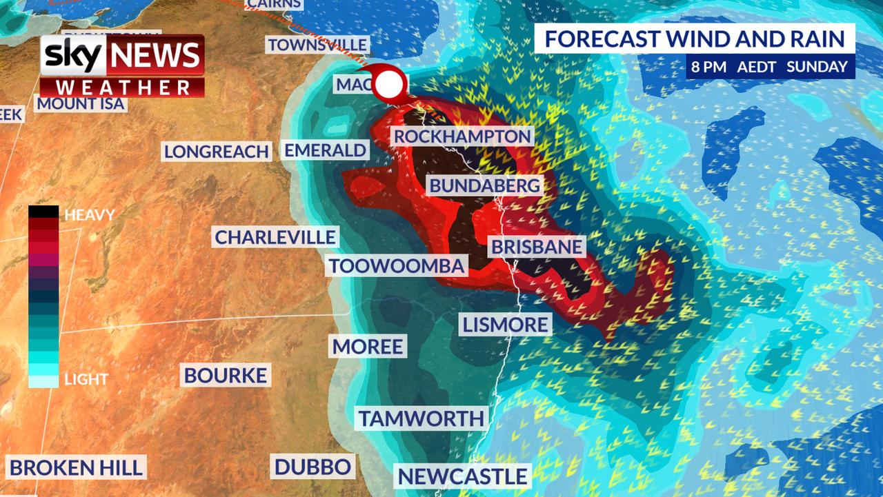
The Territory Controller said shelters had been opened and warned residents to move into them as conditions deteriorate.
Brisbane could see almost 200mm of rain over four days, with 20-60mm expected today and heavy downpours and storms in the following days.
Townsville will have up to 45mm today and a possible 200mm tomorrow.
Storm surge 🌊 can be one of the most destructive impacts of a tropical #cyclone 🌀 on landfall, especially on the high tide. As #CycloneOwen approaches the coast tides will be higher than usual between Cape Shield and Gilbert River Mouth. See Warnings: https://t.co/oxdI2Gc5uS pic.twitter.com/72oU1v0zbh
— Bureau of Meteorology, Queensland (@BOM_Qld) December 12, 2018
People across #NSW need to stay alert to the risk of #thunderstorms today. This guidance map indicates where conditions are best for severe #storms to form. If they do, they can spin up fast & move quickly, so watch for #warnings https://t.co/6PDG419J55 Rainfall will vary greatly pic.twitter.com/U88FNloXaG
— Bureau of Meteorology, New South Wales (@BOM_NSW) December 12, 2018
MONTH’S WORTH OF RAIN IN EAST
Owen is one of two weather systems that are causing havoc across the country with worries a low-pressure system in the south could combine with the cyclone to bring rain to just about anywhere on the east coast.
Victoria has been a particular concern for forecasters. The BOM reported that in a single hour, between 7am and 8am yesterday, 18mm fell on Coldstream, while Hopetoun has had its heaviest falls for seven years.
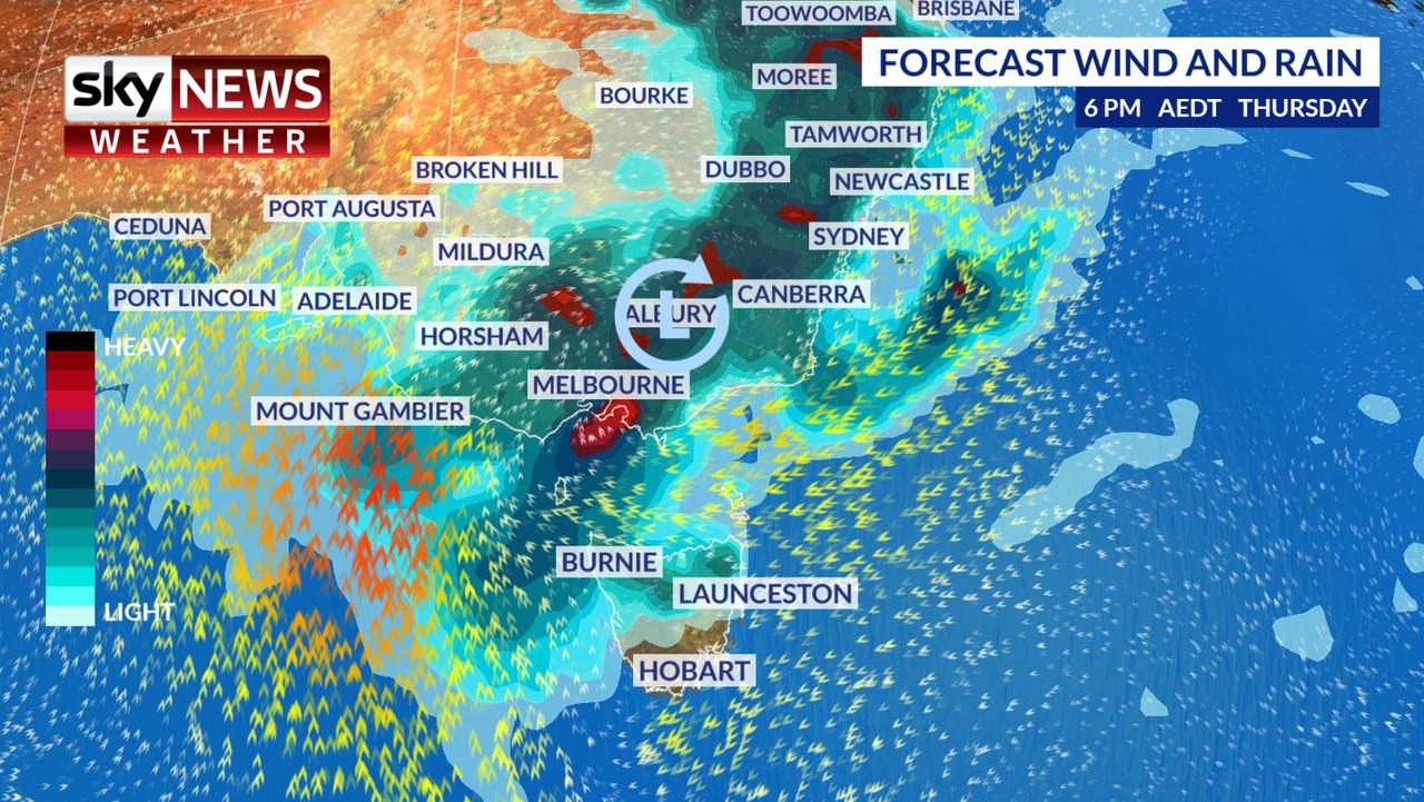
The rain has well and truly arrived in #Melbourne. Between 6am and 7am Coldstream recorded 18mm, Keilor 12mm and both Laverton and Altona 11mm. Expect this to continue and deteriorate throughout the morning. Keep an eye on the latest warnings https://t.co/zalVqkM8eX pic.twitter.com/xHynHqDpiI
— Bureau of Meteorology, Victoria (@BOM_Vic) December 12, 2018
A severe weather warning for heavy rainfall, storms and possible flash flooding is in place for much of the state.
Adelaide may not get quite so wet but a severe weather warning is in place for strong wind and rain over the next few days.
Tasmania could get very soggy this weekend. There is a possibility of around 65mm of rain from today in Launceston with highs of around 25C. Hobart will probably see less, but the weekend could still be a washout.
Severe downpours are due in Canberra with up to 10mm of rainfall expected in Sydney.
Perth, on the other hand, is parched. A sunny end to the week with highs peaking at 38C today.
Darwin will get to 35C and storms are possibility.
Additional reporting by AAP

