
’Conveyor belt’ of rain set to smash parts of central and eastern Australia
Huge amounts of moisture is being sucked across Australia towards the east just in time for Christmas. But in the west, it’s set to be bone dry.

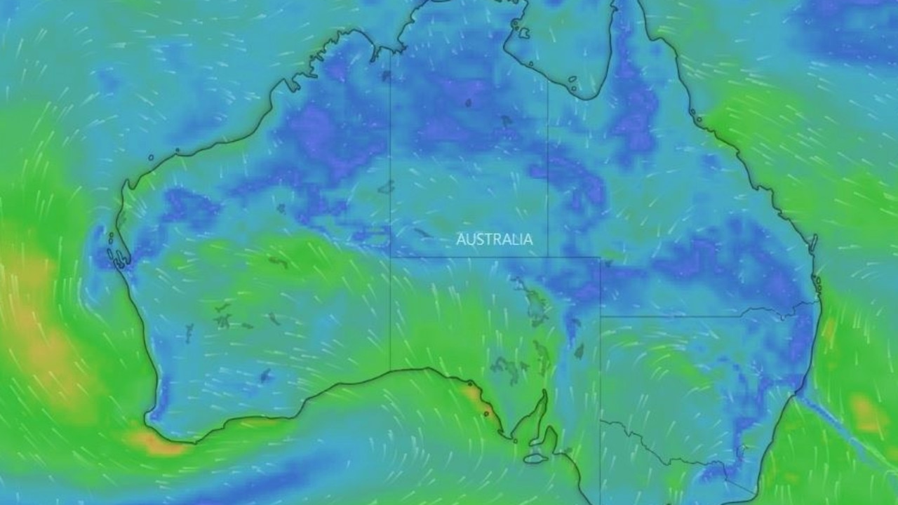
Parts of Central Australia and the east could be hit by large dumpings of rain in the run up to Christmas and beyond as wet weather from the tropical monsoon is sucked from the west and north of the continent.
The Bureau of Meteorology has labelled it a “conveyor belt of moisture”.
Queensland, the Northern Territory and the north of Western Australia are expected to be the most soggy over the coming days, but umbrellas may needed further south too.
In the southern states its all about the cold with below average temperatures and perhaps even a snowflake or two on higher ground delivering a midsummer white Christmas.
Around Perth, however, a low intensity heatwave is delivering consecutive days in the mid to high thirties.
“A Tasman low has moved away from the east and that’s why the rain eased overnight but a front will still bring some showers to south east Australia,” Sky News Weather senior meteorologist Tom Saunders said.
“There will be some wet weather for New South Wales on Christmas Day and Queensland can expect widespread heavy falls.”
RELATED: Wettest summer for a decade on cards
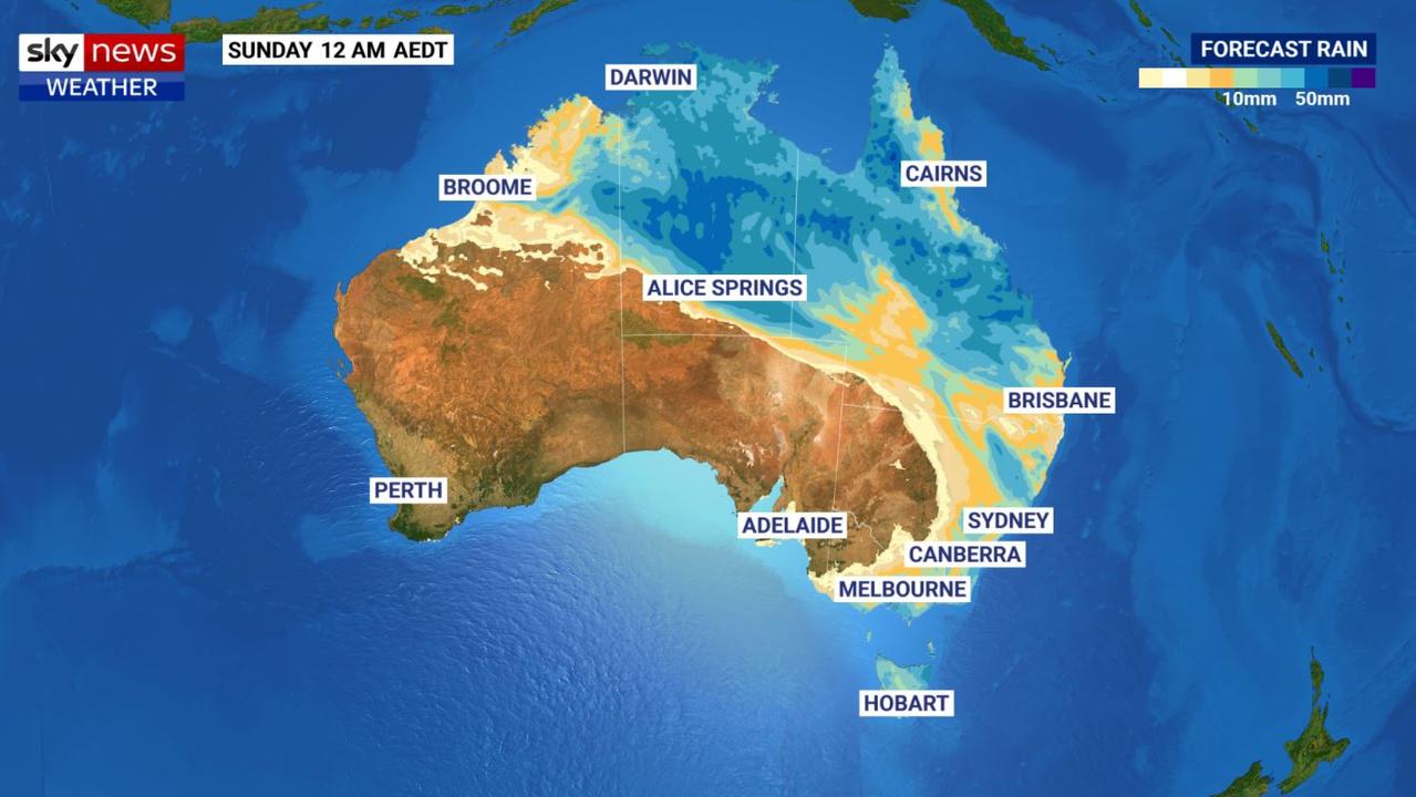
The biggest risk is across central Queensland where flash flooding and localised river flooding are possible.
“Queensland, unfortunately, won’t see dry weather on Christmas Day for much of the state,” Mr Saunders said.
Some areas could see up to 100mm of moisture over the coming days. A warm and muggy Townsville could see well over 70mm in the four days from Boxing Day. Longreach could bit hit will 40mm on Christmas Day alone.
The south east will largely avoid the rain with just a few spots on Christmas Day. Temperatures in Brisbane could hit 28C on Christmas Eve setting the tone for much of the rest of the week.
Tropical moisture continues to flow into NSW as we head towards Christmas. A stable weather pattern is forecast to develop, with a ridge of high pressure across the south. By the weekend a trough will form with showers & storms in the east. For warnings: https://t.co/I4g1Z7zPpY pic.twitter.com/bTU0iRqJzB
— Bureau of Meteorology, New South Wales (@BOM_NSW) December 23, 2020
Into Sydney and a maximum of 27C on Thursday dropping down to 23C on Christmas Day with some showers. Expect some heavier downfalls going into early next week.
On the Ranges there could be more rain – maybe even some storms – after Christmas Day.
Canberra will see most days peaking around the mid-twenties but it could hit 30C on the 27th. The moisture is likely to be pushed into next week.
VERY HOT IN THE WEST
It’s set to be a very wet Christmas across the Top End with possibly up to 15mm of rain in Darwin during the week due to that monsoonal low. Storms are almost a given and highs will be about 32C.
A low over northern Western Australia could bring storms and some rain to places cush as Kununurra on a hot Christmas Day that will be well into the mid thirties.
It will be even hotter further south with Perth likely to hit 40C on Christmas Eve and 35C on Christmas Day. The highs will then settle into the mid thirties with not a drop of rain in sight. Indeed, it’s been above 30C in the WA capital for days and days on end.
A low to severe intensity heatwave is affecting #Perth, the south west and the Gascoyne coast, with inland parts expected to be a few degrees hotter than places closer to the coast.
— Bureau of Meteorology, Western Australia (@BOM_WA) December 23, 2020
See which areas are affected here https://t.co/k3FHyAXxYB pic.twitter.com/bspDsvZXue
Across the Nullarbor, it will be mostly dry in Adelaide in keeping with much of the rest of southern Australia. Temperatures will steadily rise with 27C on Christmas Eve, almost 30C on Christmas Day and 34C on Boxing Day before dropping into the mid-20s.
CHRISTMAS SNOW HOPES
Temperatures will be much chillier in Victoria. Christmas Eve might only get to a maximum of 19C in Melbourne with a low of 13C, more than cold enough for a mulled wine and to pull on that festive jumper. The average for a usual December is more like 24C. Christmas Day may only scrape into the twenties with a low of just 12C on Christmas morning.
But just in time for the Boxing Day test, the mercury will roar back up again to 30C on the 26th. It’ll hover there on a possibly wet Sunday and then drop right back down again to just 19C on Monday.
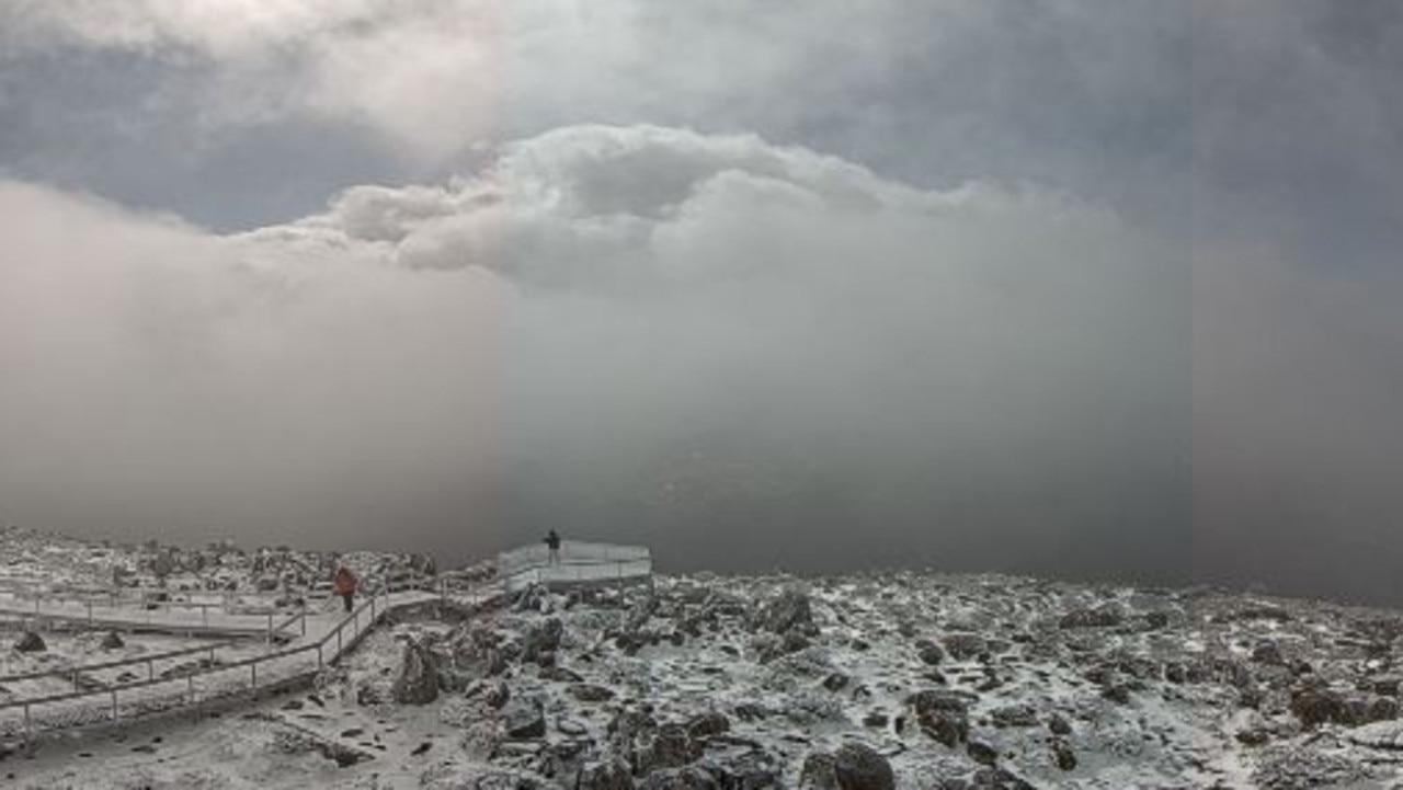
And how about that Christmas snow then?
“On Christmas Day, it will be easily below 20C for Tasmania,” said Mr Saunders.
“There may be one or two snowflakes very early in the morning on the highest peaks; so if you feel like climbing a mountain you could see a white Christmas in Australia.”
Indeed Kunanyi/Mount Wellington, overlooking Hobart, could be just the spot. On Christmas morning it may drop down to 0C on the peak with some possible snow flurries overnight.
In Hobart itself, it will be a little warmer this week. There will be a high of 18C on Thursday; a similar high on Christmas Day but with a low of 9C. But it should warm up to 27C by Sunday. Possible showers throughout the week.


