Australia warned it’s about to be locked in by relentless stormy weather throughout next week
Wild weather is expected to hit much of the country, after a major concert was thrown into chaos after storm forced thousands to evacuate.

Millions of Australians are about to be “locked in by relentless stormy weather” as thunderstorms are expected every day over large parts of the nation.
Weatherzone meteorologist Ben Domensino said thunderstorms would likely continue next week due to an abundance of moisture in the atmosphere that was unstable and a lifting mechanism that caused air to rise away from the surface.
He said these factors would lead to lots of lightening and thunder.
“Abnormally warm seas surrounding Australia will help to pump warm and humid air into the atmosphere, while numerous low pressure troughs, cold fronts and mountain ranges will act as triggers for storms,” he said.
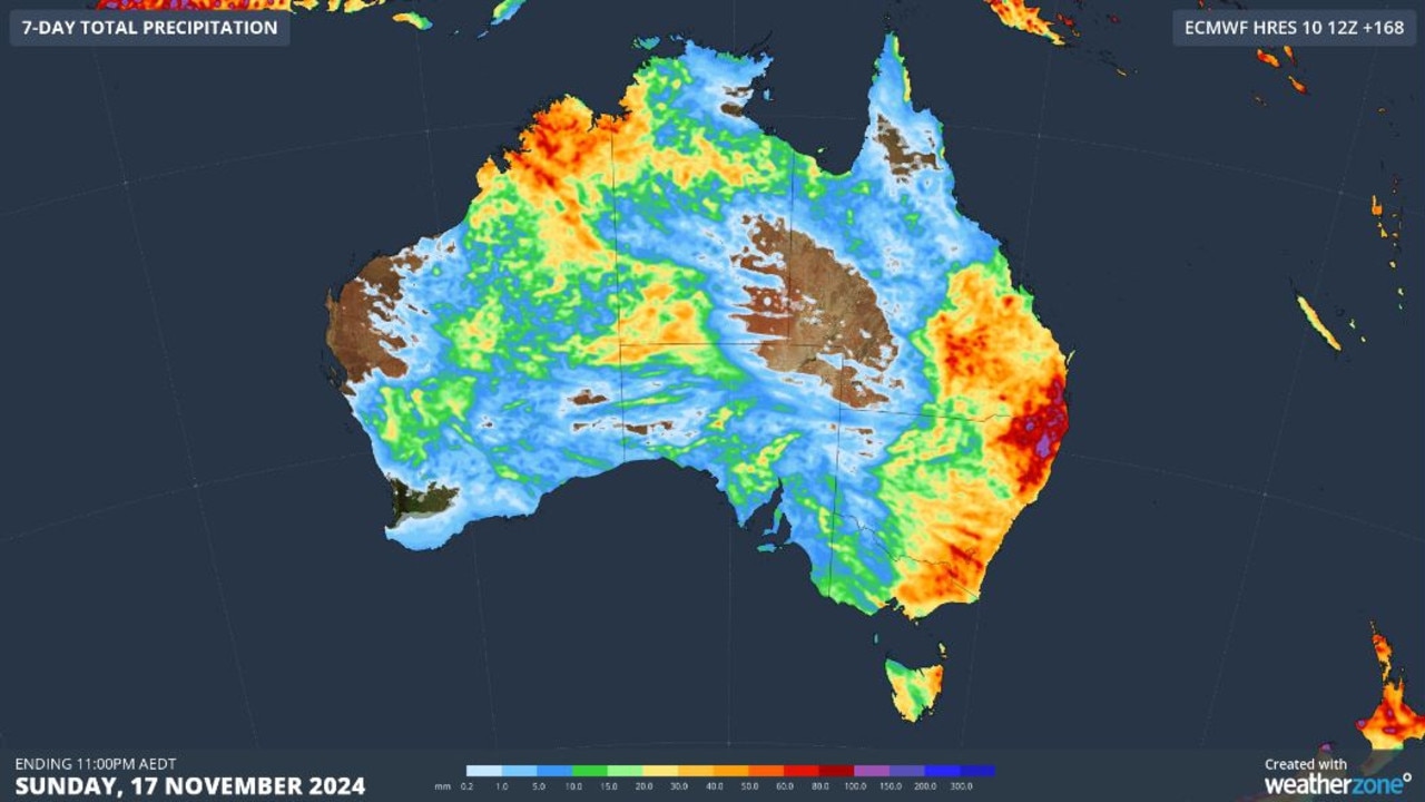
According to weatherzone, showers and thunderstorms would hit central, eastern, southern and southeastern Australia with severe thunderstorms expected in parts of NSW and Queensland on Monday and Tuesday.
Storms would stretch across Australia’s eastern and northern states and down into WA’s interior through the middle of the week.
Severe thunderstorms were expected to hit Sydney, Brisbane and Canberra on Wednesday.
Showers and thunderstorm should continue over Australia’s east and north, while extending towards WA’s south due to a cold front on Thursday and Friday.
“This frontal system, combined with deepening low pressure troughs over Australia, will lead to further widespread thunderstorm activity over Australia from this weekend into early next week,” Mr Domensino said.
On Sunday, a Brisbane concert was thrown into chaos after a wild storm erupted, forcing thousands of concertgoers to evacuate the venue and take shelter in an underground carpark.
Canadian singer Tate McRae was due to perform at the outdoor entertainment venue Riverstage in Brisbane’s CBD on Sunday evening when revellers were told they would have to evacuate about 7pm.
The Bureau of Meteorology issued a severe weather warning cautioning residents of heavy rain, damaging winds and hail expected to hit the city on Sunday night.
People were allowed back into the venue one the storm passed, with the concert resuming about 8.30pm, but some punters were left disappointed after being told the concert had been cancelled.
Sunshine Coast resident Peta Trigg shared on social media that she was halfway home when they were informed the concert was back on.
Ms Trigg said security “screamed” at her and a friend to leave the venue because the show had been cancelled.
“This was handled so badly. Surely we get refunds,” she said.
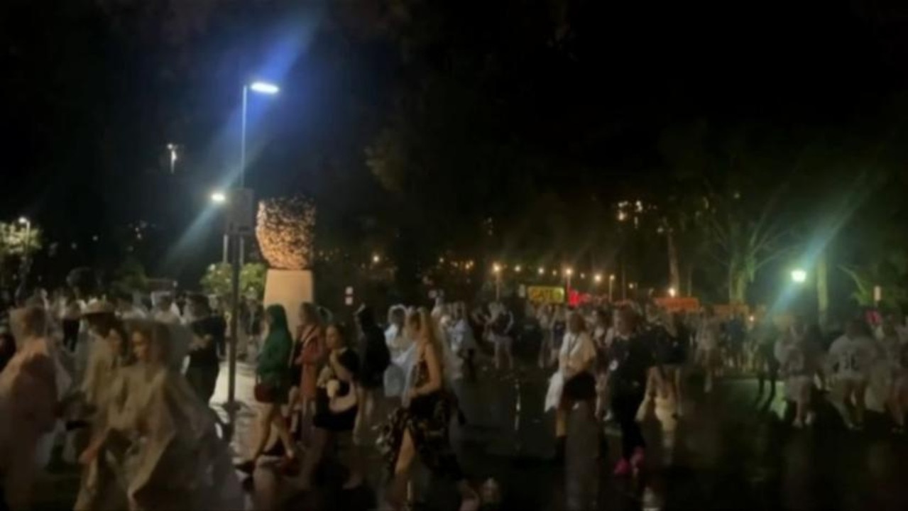
Other concertgoers said they were “heartbroken” after paying a premium for tickets only to lose their spot when people were allowed back inside the venue.
Courtney shared on social media that she had lined up for more than 24 hours and paid for a VIP ticket, but during a stampede to get back inside the venue, people with general admission tickets were allowed inside the VIP area.
Emergency services were also called out to assist with cars that were trapped in floodwater in Beenleigh in Brisbane’s south.
Drivers managed to escape after two cars were caught in floodwater near the corner of City Road and George Street about 8.40pm.
Another car was also stuck in floodwater at Knapp Creek about 100kms southeast of the city shortly before 7pm.

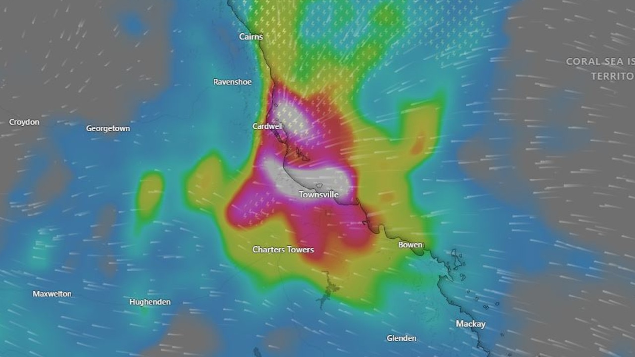
BOM senior meteorologist Miriam Bradbury said storms the redeveloped across southeast Queensland and northeast NSW on Sunday brought lightening, heavy downpours and flash flooding.
“The widespread rainfall totals across southeast Queensland was about 25 to 50mm, but we did see some isolated falls from 60 to 80mm, there was a lot of rain that came down in a short space of time,” she said.
“That’s when we start to see our waterways and drainage systems get overwhelmed, we get water over the roads and flash flooding occurs.”
More wild weather is predicted for the Sunshine State, with parts of Central Australia expected to be hit with showers and thunderstorms, as well as the possibility of daily thunderstorms in southeast Queensland and northeast NSW.
Ms Bradbury told Today there would be a concentration of showers and thunderstorm through central parts of Australia, impacting South Australia and southern parts of the Northern Territory.
Ms Bradbury said southeast Queensland and northeast NSW would see an almost daily thunderstorm risk which could bring heavy rainfall, flash flooding, large hail and damaging winds until Thursday.
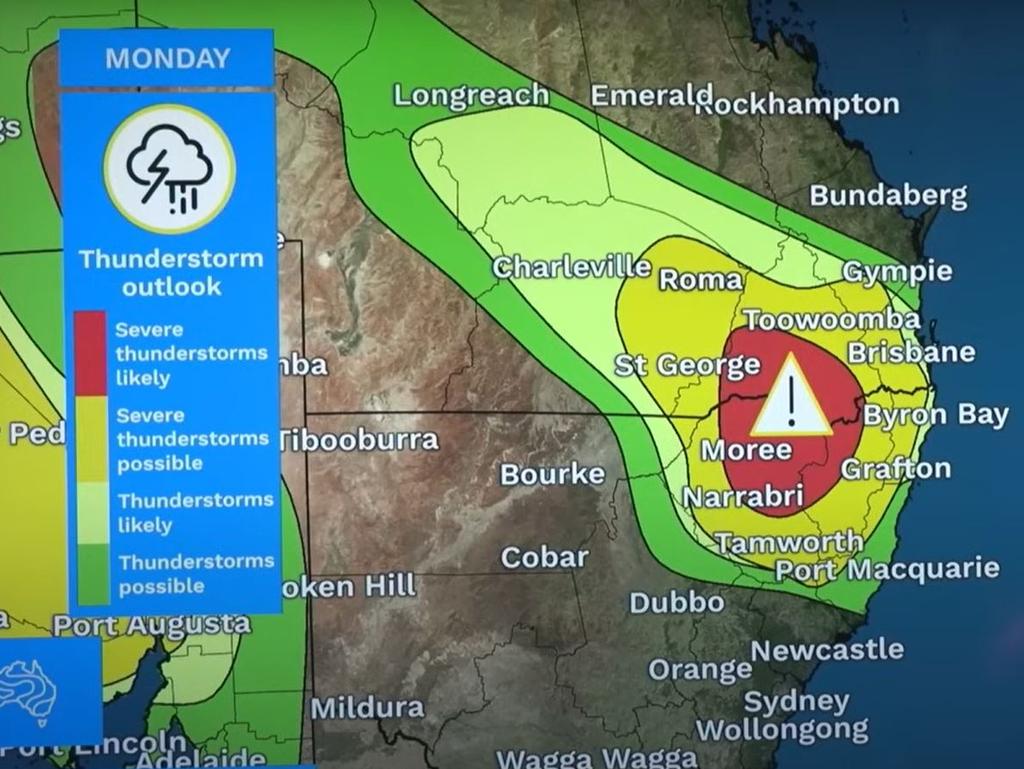
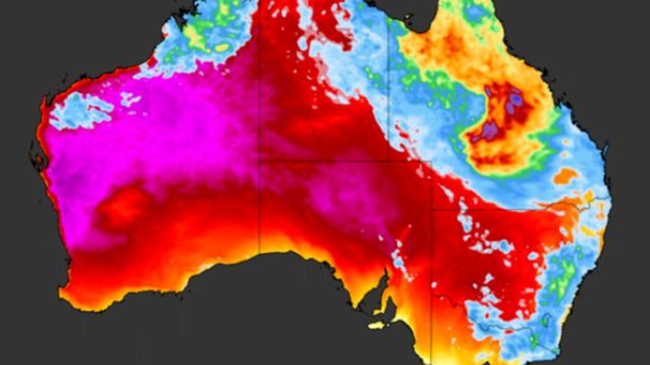
She said in recent days, heatwave conditions had been contracting away from southern Queensland and would be less extensive than it was over the weekend.
“Even where we don’t have those heatwave warnings, we’re continuing to see very hot weather across the northern parts of Australia, with temperatures 2 to 5 degrees above average,” she said.
“For many areas, particularly inland, (this) equates to temperatures in the high 30s at least, if not the low to mid 40s.”
Heatwave warnings have been issued for northern parts of Western Australia, the Northern Territory and Queensland with extreme to severe conditions expected to last until Wednesday.
Ms Bradbury said the heatwave would ease through Western Australia and contract to the Northern Territory and Cape York Peninsula later this week.

There is also a severe storm risk for southern parts of the Northern Territory, northern parts of South Australia and inland parts of Western Australia over the coming days.
Ms Bradbury said while communities were parse in those areas, heavy rainfall could impact roads and access routes causing disruptions.
“We should stormy conditions ease through central parts of Australia by Wednesday, but we are going to see the chance of some storms remaining across parts of the north and parts of Western Australia from Wednesday onwards,” she said.
“For the next few days the focus is southeast Queensland, northeast NSW and those central parts of the continent.
“From Wednesday, it’ll ease through central, southern and eastern parts, but start to pick up in the north and west again.”

