
‘Very strong’: Cold front set to sweep through several states
Several states are expected to shiver through a “very strong” cold snap in coming days, with severe weather warnings in place.

Large parts of Australia face a cold week ahead as a high pressure system intensifies across the south east.
Parts of Victoria, NSW, Tasmania and South Australia are due to experience morning temperatures 4 to 8 degrees below average, the Bureau of Meteorology warned.
Daytime maximum temperatures are also expected to remain several degrees below average for most of the week.
“Essentially we’ve seen a very strong cold front moving across the south east parts of Australia over the weekend,” senior meteorologist Miriam Bradbury said.
Melbourne was set to experience its coldest day since 2019 on Monday, with temperatures in the CBD forecast to reach a top of just 10 degrees.
Strong south-westerly winds made it feel much colder than it actually was, however afternoon sunshine brought some relief and a chance to defrost ahead of more cold weather overnight.

A severe frost warning was in place for Victoria’s north and northeast on Tuesday morning.
“It will be the first in a run of very cold mornings across the state, with minimums typically between -4 and 1 degree C across Tuesday, Wednesday and Thursday mornings,” the BOM said.
“Afternoons are likely to be crisp, with light winds and lots of sunshine.”
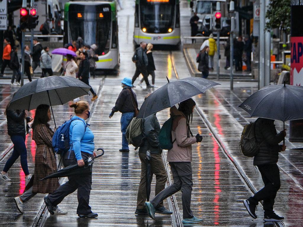
Some parts of far southern Tasmania recorded snow flurries at sea level early Monday, while the snowline reached as low as 300m around Hobart.
The low-level snow prompted both a Bushwalkers Alert and a Road Weather Alert for large parts of Tasmania, warning of snowy and potentially icy roads and adverse conditions.
“Conditions are forecast to ease on Tuesday as the next ridge of high pressure moves in, with settled conditions expected on Wednesday through to Friday,” Ms Bradbury said.

‘Extreme’ danger warning as temps soar
Millions of Aussies bracing for blistering temperatures this weekend, with the extreme conditions sparking several warnings.

PM’s $500m pledge for local jobs
The Prime Minister has announced a crucial investment package during a pre-election speech, but not before he took a few healthy swipes at the opposition.
‘Flesh, fat’: Vile Aussie beach scenes
Locals claim pristine Tasmanian beaches are being overrun by a disgusting “biohazard”, sparking outrage and urgent calls for action.