
‘Cold outbreak’ in southeast to bring snow, freezing temperatures
Temperatures will drop this week from Tasmania all the way to Queensland as southeast Australia shivers through the first cold snap of the season.
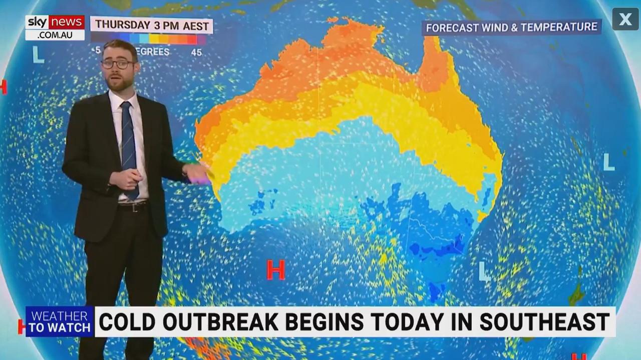
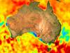
A “significant cold outbreak” is set to hit Tasmania and Victoria today, before moving north through NSW and into Queensland by Friday.
It is the first cold snap of the season in southeast Australia, with the Bureau of Meteorology (BOM) warning of a “significant drop” in temperatures.
Sky Weather meteorologist Rob Sharpe said the peak of the cold weather event would be in the southeast on Thursday.
“Temperatures are pretty close to the long-term winter average for many locations – even below that for quite a few pockets,” he said.
“Then into Friday the cold weather will creep slightly further north and into Queensland as well.”
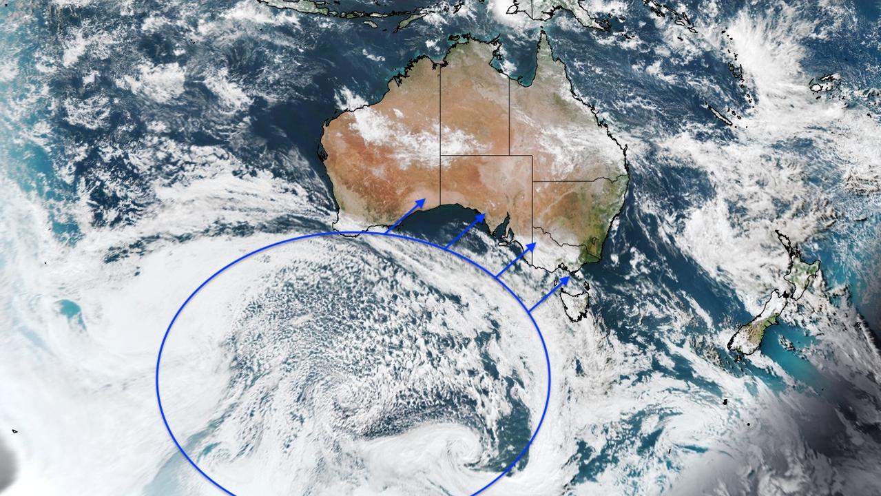
A strong cold front will approach #SA, western #Vic and western #Tas on Tuesday night, sweeping across the south-east on Wednesday. This system will bring rain, possible thunderstorms and a significant drop in temperature of 4-8°C. Forecasts: https://t.co/4W35o8iFmhpic.twitter.com/mrdCBTtmlu
— Bureau of Meteorology, Australia (@BOM_au) May 3, 2022
Cold snap temperatures
Melbourne and Hobart are forecast to reach 16C on Wednesday, before dropping to 7C (max 13C) and 8C (max 14C) respectively on Friday.
In others areas temperatures will be even colder, with Victoria’s Falls Creek in for a low of -4C and not expected to get any higher than 0C on Friday.
Canberra is expected to reach 18C on Wednesday but is only forecast to get up to 13C on Friday, with a low of 0C.
And Sydney is in for a sunny day on Wednesday with a top of 25C, a low of 9C and high of 20C is forecast for Friday.
Brisbane’s mostly sunny 27C day on Wednesday will become showers and possible thunderstorms by Friday, with a low of 18C and high of 25C forecast.
But in southern Queensland, regional areas will be feeling the cold more than those in the state capital.
Goondiwindi, which will also reach 27C on Wednesday, is expected to have temperatures drop to 5C over the weekend. The maximum temperature on Saturday is forecast to be 20C.
Stanthorpe is also likely to see temperatures drop, with 6C forecast for Sunday (max 18C). And Ipswich will see temperatures go down to 11C (max 24C).
Snow in Victoria and Tasmania
BOM senior meteorologist Miriam Bradbury said in Victoria a significant rain event was not expected, however there was a “significant cold outbreak” with “very low maximum temperatures” and snow.
“The coldest area associated with this front will start to move into the state late on Wednesday and impact us through Thursday and Friday,” she said.
“On Wednesday night we’re going to see the snow level dropping down to around 1200m across western parts of the state … but on Thursday as the coldest air moves over us we’re going to see that snow level dropping to around 900m, so snow flurries down to that level are possible with showers through Thursday. We could also see areas with small hail.”
In Tasmania, Mr Sharpe said heavy rain would become a threat on Thursday night into Friday, with potentially damaging winds.
“[The low-pressure system] will then move off and away through Sunday but until then we’re going to be seeing a fair bit of rain and snow for the elevated terrain in Tasmania,” he said.
“Some pockets could see more than half a metre of snow and blizzard conditions at times.”
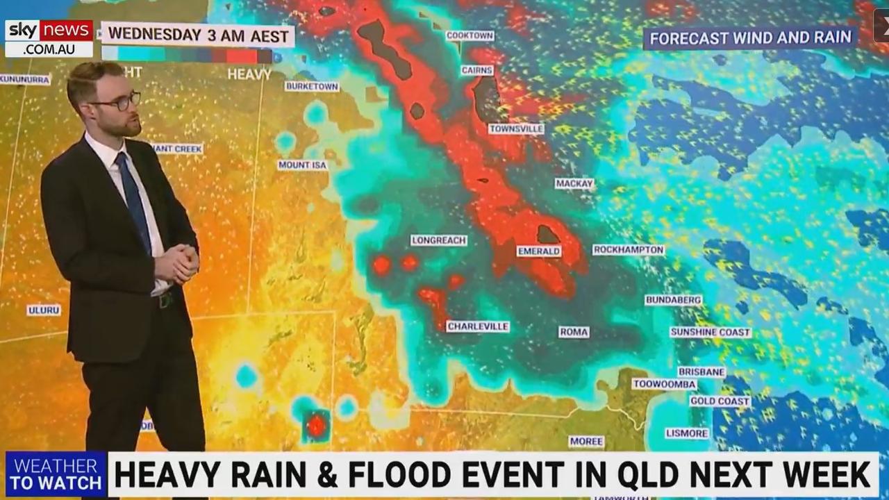
Heavy rain and floods for Queensland
Mr Sharpe said there would be “quite a few storms” around the NSW and Queensland border on Thursday and Friday, but more importantly next week a “major weather event” was on the cards.
Just when we thought #LaNina forgot about #Queensland the state could receive record May rain next week. It's still a week away but latest ECMWF data shows up to 200mm through the west - nearly 10 times the monthly average. @SkyWeatherAUS@SkyNewsAustpic.twitter.com/9OHo9MuNcP
— Thomas Saunders (@TomSaundersSNW) May 3, 2022
More Coverage
Initially heavy rain is expected in southeast Queensland on Sunday and Monday before it becomes a statewide event.
“Heavy falls are a threat across multiple areas from the tropics through the centre of the state and then probably drifting further south into northern NSW as well,” Mr Sharpe said.
“Through that whole period of time the NSW coastline will be seeing daily showers from Monday onward.”

Albo reconnects with Aussie icon in China
Anthony Albanese has gotten a big dose of panda diplomacy in China, reconnecting with an Aussie favourite as he winds down his state visit.

Greens demand PM act on toxic bloom
As one Aussie state continues to suffer from a “disaster” algae bloom that is putting the future of the fisheries industry in crisis, the Greens have made a simple demand from Albo.

‘Mind boggles’: Big call to bring back old tax
A former Treasury boss says the axing of a controversial tax “still boggles the mind” amid calls for stronger action to protect the environment.